


The Plan & The…Run!?
A couple months earlier I had met a fellow Marine living in Taiwan named Richard. We had talked about hiking together sometime and I pitched this hike. Now mind you, I didn’t know this was going to be a thick bushwhacking trip. It was difficult for me to tell what the hike would be like from my maps. I told Richard it could go both ways. He was cool with it, so we set a date and time to meet.
Fast forward to the morning of the hike.
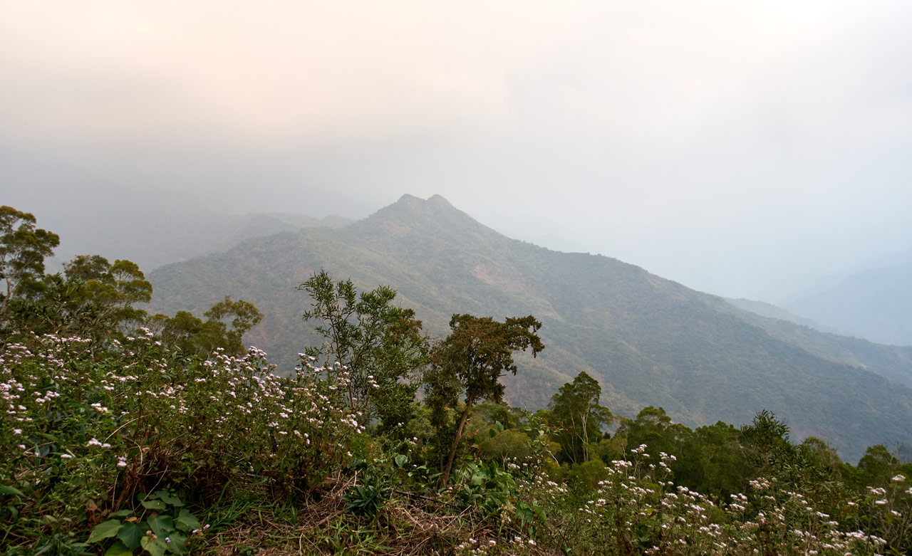
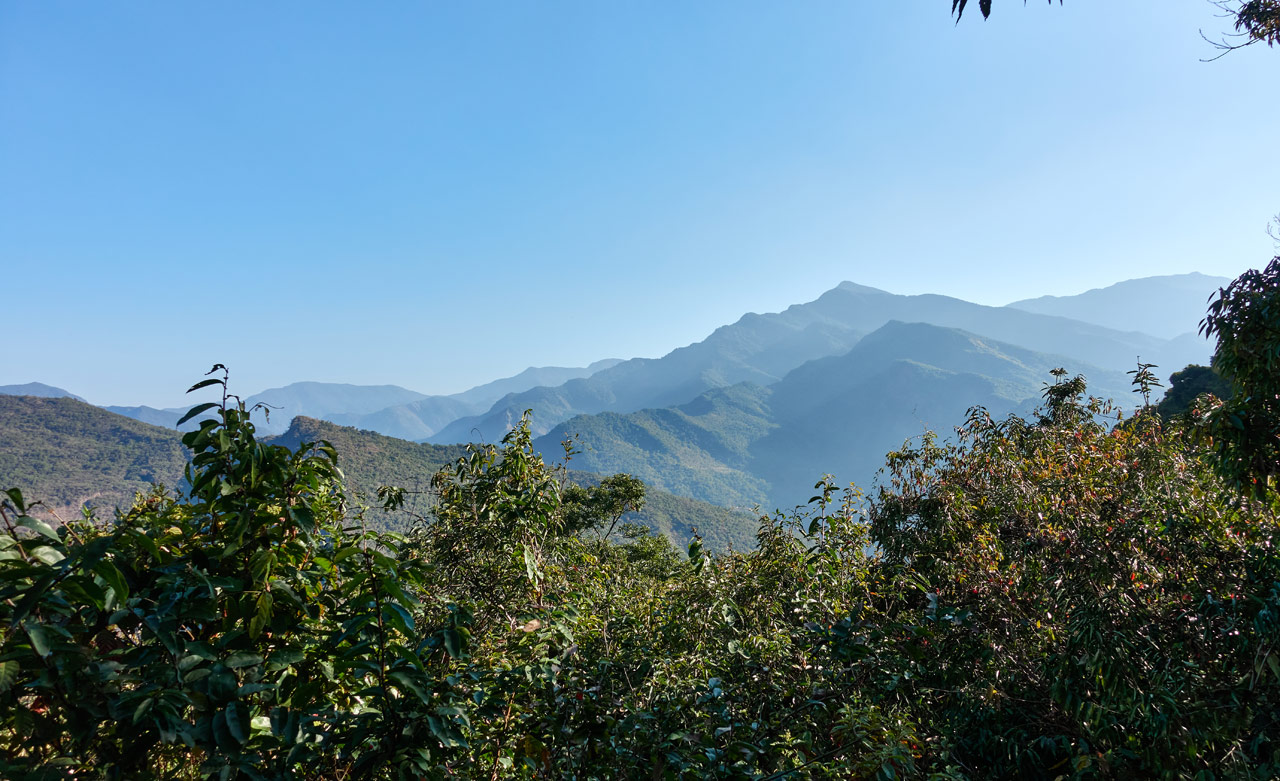
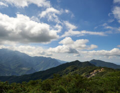
This was actually a shot from after the hike, but it can be seen on the drive to the trail head. HuYaLuoShan – 戶亞羅山 (托庫棚山) is the right peak.
Richard and I met and drove as far as his car could safely make it along the mountain road. He told me to keep driving to the trail head and he’d meet me there. He said he’d run it. Yeah…run it. This is probably a good time to mention that Richard is an accomplished runner/trail runner. For example, he did a 100k run a month prior. So the approximate 3k he had to run–mostly downhill–was barely a warm up for him. When I arrived at the trail head, I figured he’d take a while to run to me so I took my time unpacking my bike. I had barely started before he showed up!
A Short Detour First
The GPX track I found had a short hike of about 150 meters up to a little peak next to where I had parked. I wasn’t sure if this was a named peak or something else of other interest, but figured those people I downloaded the GPX track from must have had a good reason for going up there, so why not?
We hiked for about 8 minutes to the top to find that there was nothing up there…

I’m not sure why those folks wanted to come up here. Perhaps for the view?
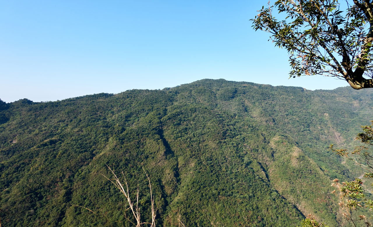
That’s SanDiShan – 三地山 there near the middle.
There were no ribbons or signs or stones proclaiming this little peak being of any importance, but just in case I took triumphant picture.

Less triumphant for Richard though.

The Real Start of the Hike
With that curiosity out of the way, we hiked over to the actual trail head.

There was an old chain and cable on either side which was likely used as a simple gate back when someone used to farm this land.


The first ten minutes of the hike was a nice and easy walk along the ridge.


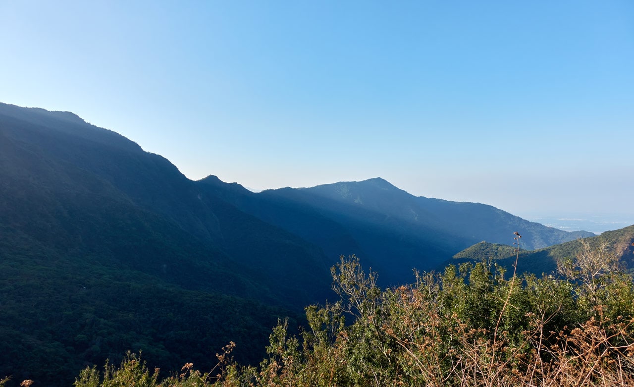
And in a couple places it had a great view of the mountains to the west.
The road you can see near the top of those mountains is the Shaxi Lindau – 沙溪林道. I highly recommend you take it for a ride if you have a suitable high chassis vehicle or motorcycle. There are several peaks you can access from that dirt road.
The Real REAL Start of the Hike
Ok, so we’ve started the hike, what? Two times now? First up to that fake peak and then the walk along a pleasant old ridge road? Right…so this is where the hike really begins in my book.

I think this was the first trail ribbon I saw. Who can argue with that? This must be the trail head, right?

As bad as this looks, the good news is there was a trail to follow. It wasn’t so bad…especially since we were going downhill!
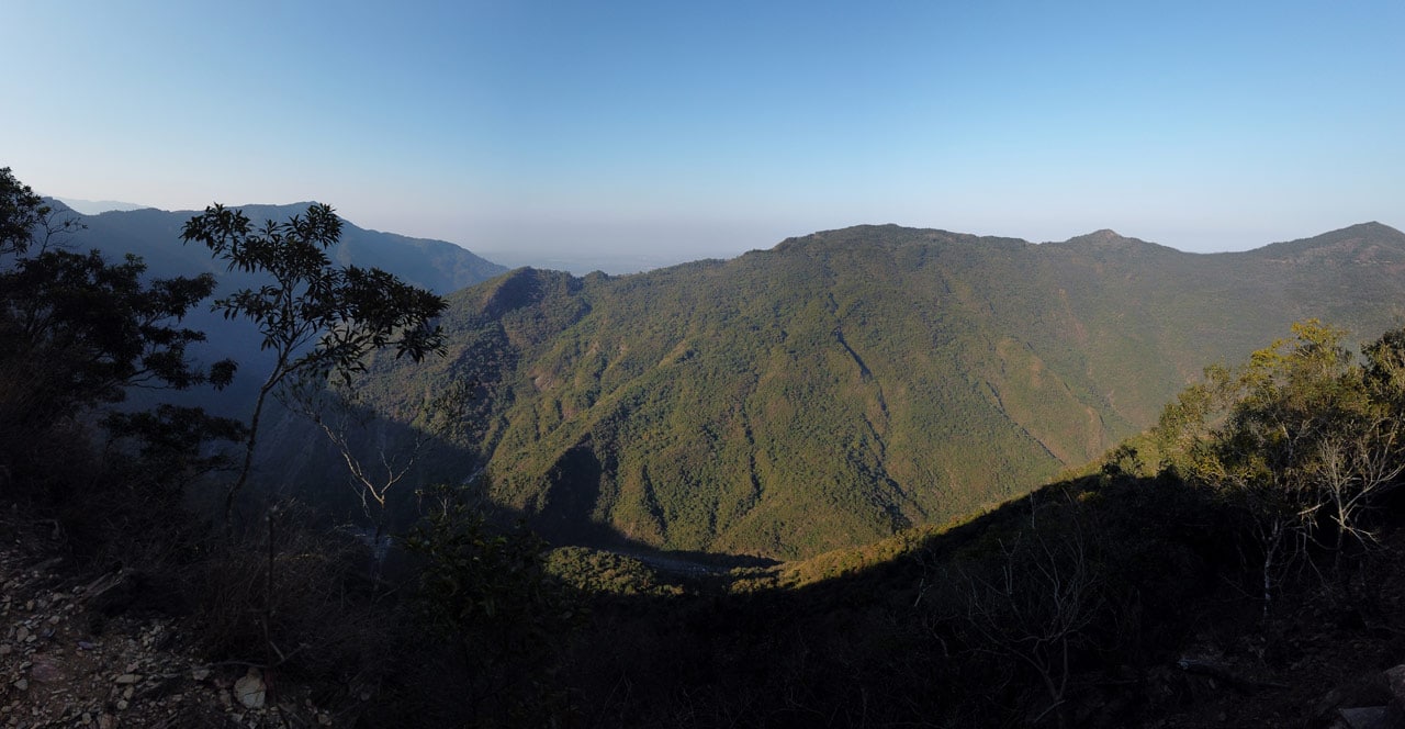
We continued along the ridge for about forty-five minutes. The first part looked much the same.


But eventually it opened up nicely.
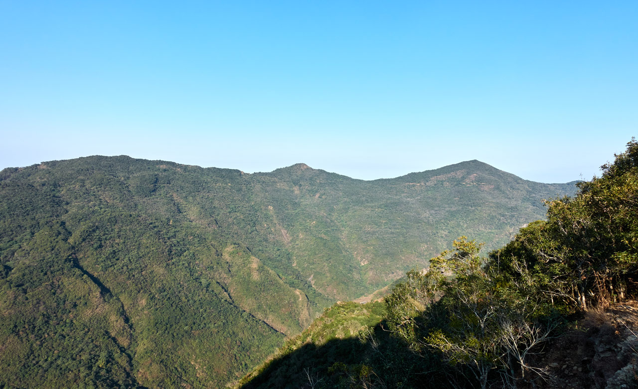
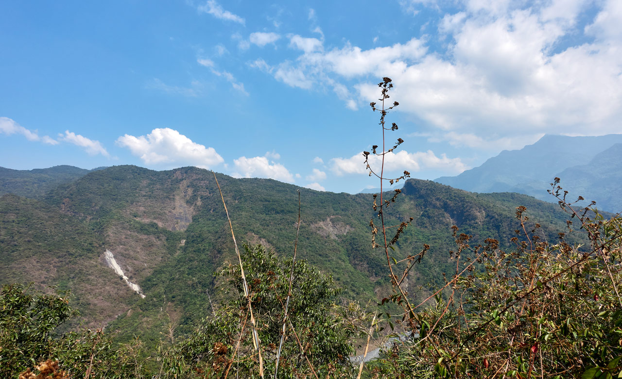
You could see both sides of the ridge…though not at the same time. And in case you were wondering, that’s DaMuMuShan – 大母母山 above.
Most of the ridge looked more or less like this along this section…


…but eventually it switched to bamboo.

Somewhere around here is where we decided to stop following the ridge trail. It appeared to be veering off to the wrong direction. Also, we found a “tree marker” of sorts.

With that, we chose to leave the ridge and head down the mountain to the east.
Into the Thick of It
It wasn’t long before we realized we weren’t on any kind of trail. The GPX track I had showed them cutting down a lot earlier than we did. But if we continued down, we would link up with their track. The only problem was how messy and steep it got along the way.


But we did eventually make it down.

And would ya believe that we linked up with an old road?

Well, not that you can tell this was a road…but believe me, we hiked down on an old road for five or six minutes. 🙂
The place where we left the road looked bad, but wasn’t. It was nothing a machete couldn’t take care of.


Bushwhacking
Things took a turn though. For the next two hours, Richard and I fought through old abandoned farmland that had become ridiculously overgrown. The total distance was just over one kilometer. I took all of three pictures over those two hours; there was just no time to think of pictures with all the ducking, crawling, and bushwhacking we had ahead of us.
Here’s the three pictures I took.


Notice the stacked rocks in the last picture? Those should be part of the old farmland that used to be here. We saw quite a lot of these stacked rock “walls”.
To make up for the lack of pictures (I know, you don’t care…let’s just get to the peak, right!?) I have a video! Unfortunately there was a problem with my DJI Osmo Pocket and the sound came out barely audible. That’s probably for the best though – I doubt I had anything interesting to say.
And that’s about it. There’s not much else to say about this section. It didn’t change at all over those two hours. I did have fun with it though. And it was nice having someone along who could take the lead from time to time to save my chopping arm some work.
And just like that, we looked up and there was our final destination…

DeSheShan – 德社山
In total, it took about three and a half hours for us to hike to DeSheShan. I wasn’t expecting much and was surprised to find that there was a view at the peak.
Ok, it wasn’t great. But at least it wasn’t covered by a canopy and overgrowth. It was a nice day and a pretty nice little spot for a break.
But first, we needed to find the triangulation stone. We searched around the general area but couldn’t find it.

I think it was Richard who found it. It was nearly buried off to the side under all those vines. You’ll see it near his feet in the picture below.
After finding it, the next item on the agenda was…to…take…a…break!


After a healthy rest, we got to digging out the triangulation stone.


It was in there pretty good. We did the best we could.
And of course I got to my peak picture as usual.

Right after that I took a couple pictures of the area and we headed back.


The Trip Back and…
I should be wrapping this one up, right? But no! You probably noticed that the title of this post had not one, but THREE peaks named. So where are the other two??
The next peak we already passed. Do you remember at the very beginning, that really easy ridge section? I believe I called it the second start of the hike. Well, it’s along that section. But why Glenn didn’t you go to it first, you say? I simply forgot about it.
Getting back to that part of the hike took exactly three hours and twenty-five minutes. Remember, we were hiking UP this time around. I think we made pretty good time truth be told.
I’ll make this next part short. Going back up was just as bad as the trip down. That’s it. Hahaha…


Can you spot Richard in all that?
Somewhere along the way I lost the bottom half of my trekking pole. Probably in a section that looked like this:

If you find it, do let me know. Its other half really misses it! (and Richard is hiding in that picture too…)
Somewhere on the way up we by chance found a trail that took us up to the ridge. It appeared to be a hunter’s trail if I was forced to guess.
We took one little break on our final push to the ridge trail.

And before we knew it…
North DeWenShan West Peak – 北德文山西峰
We had arrived at North DeWenShan West Peak!

There wasn’t anything special about this peak and no reason to stay. We were close to our transportation (well, I was anyway) and we were both eager to get back. So I took my peak picture and we got out of there.


Are we finished yet? No!
It wasn’t long before we arrived back at my motorcycle. Now this is where I have to give props and mad respect to Richard. Remember, he had another three kilometers uphill to get to his car. Once again, he said, “I’ll run it”. (insert surprised Pikachu here)
And yeah, he did it. Not as fast as he did it in the morning, but pretty damn fast by my judgement. I probably would have been crawling it. hahaha
Oh, and here he comes now!

I waited for him here because this is where a side road splits off to the third peak, North DeWenShan – 北德文山. Did you forget about that one?

Richard wasn’t keen on hiking to this last peak, and I don’t blame him. Though he did miss something a bit cool.
Anyway, we said our goodbye’s and went our separate ways.
The Final Peak
The road was in pretty bad shape, but I didn’t have far to drive. It ended at a sort of shack.

A couple souvenirs hung on a support beam.

And a half burnt pile of garbage was off to the side.

The trail was off to the left side of the shack, so I located it and got going.

The peak was less than a hundred meters away and it took me all of eight minutes to find it. It got a little dense here and there, but wasn’t that difficult to get through. It appeared to be old farmland – lots of coffee trees.

North DeWenShan – 北德文山
This was by far the worst of the three peaks. I have nothing to say about it other than “it’s there”.

I hung around a bit longer than I thought I would, took my pictures, and left.


To Conclude…
All in all this was a pretty nice hike for me. Even if you haven’t followed any of my other hikes, you’ve probably guessed that I enjoy bushwhacking my way through hikes. If you also enjoy that, then this hike is for you! But for the other 99.99999% of you, I’d probably skip DeSheShan and North DeWenShan.
North DeWenShan West Peak might be worth it if you’re in the area and looking for a quick hike. There are some views along that ridge and goats! Yes, GOATS! A lot of them. I didn’t mention it before (or take pictures of them for some reason) but there’s a goat pen, or house or whatever you call the place where goats live. They’re allowed to roam the whole area, so you can see them periodically at the beginning of the hike.
Date hiked: 2021 Feb 04
GPX Track Download Instructions: Click the track on the map to see the download link
DeSheShan GPX Track – 德社山
Please use these at your own risk. After you leave the ridge trail it’s pretty much “every man for himself”. You could easily get lost if you don’t know what you’re doing.
BeiDeWenShanXiFeng GPX Track – 北德文山西峰
This is the whole track from DeSheShan to North DeWenShan West Peak. I thought it might be useful because we came back a slightly different way.
BeiDeWenShan GPX Track – 北德文山


![[Valid RSS]](https://outrecording.b-cdn.net/wp-content/uploads/2020/03/valid-rss-rogers.png.webp)
Leave a Reply