

As 2019 was coming to a close, I wanted to end the year with an “epic” hike. Knowing that wasn’t possible, I opted for a hike that would be less than epic but still offer up a bit of fun and adventure. With that in mind, I set my sights on the QiYueZongZuo ridge trail (旗月縱走).
Unfortunately I knew very little about the hike. What I eventually learned gave me pause. The full trail is a little over 11 kilometers of (sometimes steep) ups and downs, with a backtrack to a parking lot that would add several more kilometers unless you arrange pickup.
People typically hike the trail in sections. However, there were plenty accounts of folks hiking the entire thing in one go. That’s what I wanted to do, but I was worried about the pain I had been having in my leg(s) on previous hikes. At best, I was looking at 9 hours of hiking; at worst, over 12 hours. That’s a lot to ask of my legs given the pain they might be in. So my plan was to play it by ear. If I don’t make it all the way, so be it. At the very least I wanted to make it to the halfway point, RenTouShan – 人頭山.
Trail Head
I started my adventure at 6:45am. The weather was nice and it was shaping up to be a perfect day to hike. I secured my bike (hidden behind that scooter)…

Surveyed the area…


And started up the trail!

It’s steep from the get go.


But with all the ropes and “tree root steps” it’s all pretty easy.

One of the many things I didn’t know about with this trail were the number of peaks I would pass. I saw several prominent peaks listed on maps, such as QiWeiShan, FuMeiShan, RenTouShan, and YueGuangShan (旗尾山, 福美山, 人頭山 & 月光山), but it appeared there would be several more. And one of those I reached rather quickly.

It’s the survey stone for BeiQiWeiNanShan – 北旗尾南山.


It’s listed as a triangulation point dealing with water (水資會三角點). I took a picture with it for the heck of it.

AND…five minutes after that picture I arrived at BeiQiWeiShan – 北旗尾山.


If you’re a peak bagger, this might be the perfect hike for you! 
Trail to QiWeiShan 旗尾山 – First Half
From the northern peak it took about an hour to reach QiWeiShan. Along the way the views started to show up.
The trail was safe for the most part.

But with the jagged-style peaks of this hike, there were plenty of these steep sections that could easily cause a fall.

This old water storage container has probably seen more hikers than I every will.


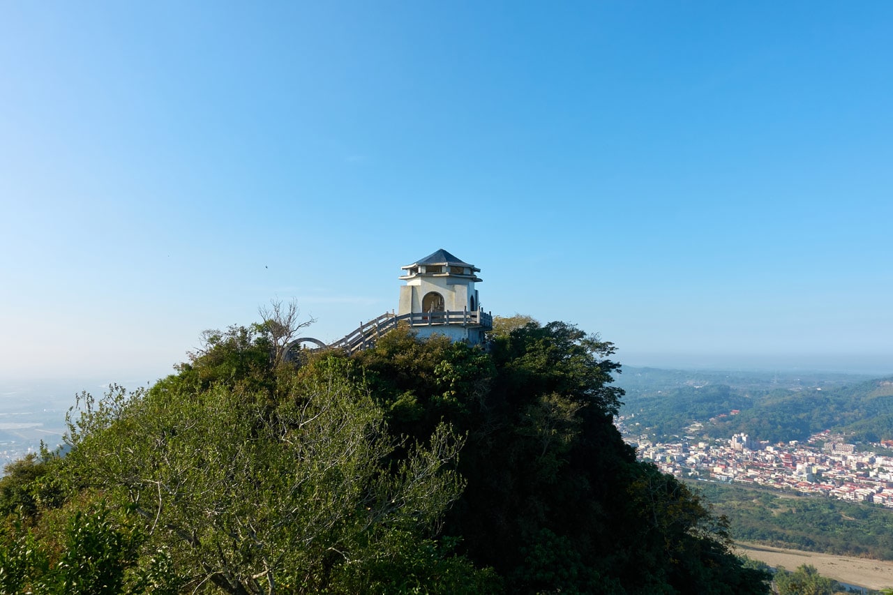
Not quite halfway to QiWeiShan I got my first clear view of the peak and the “Chiang Kai-Shek Memorial Hall” lookalike built on top.
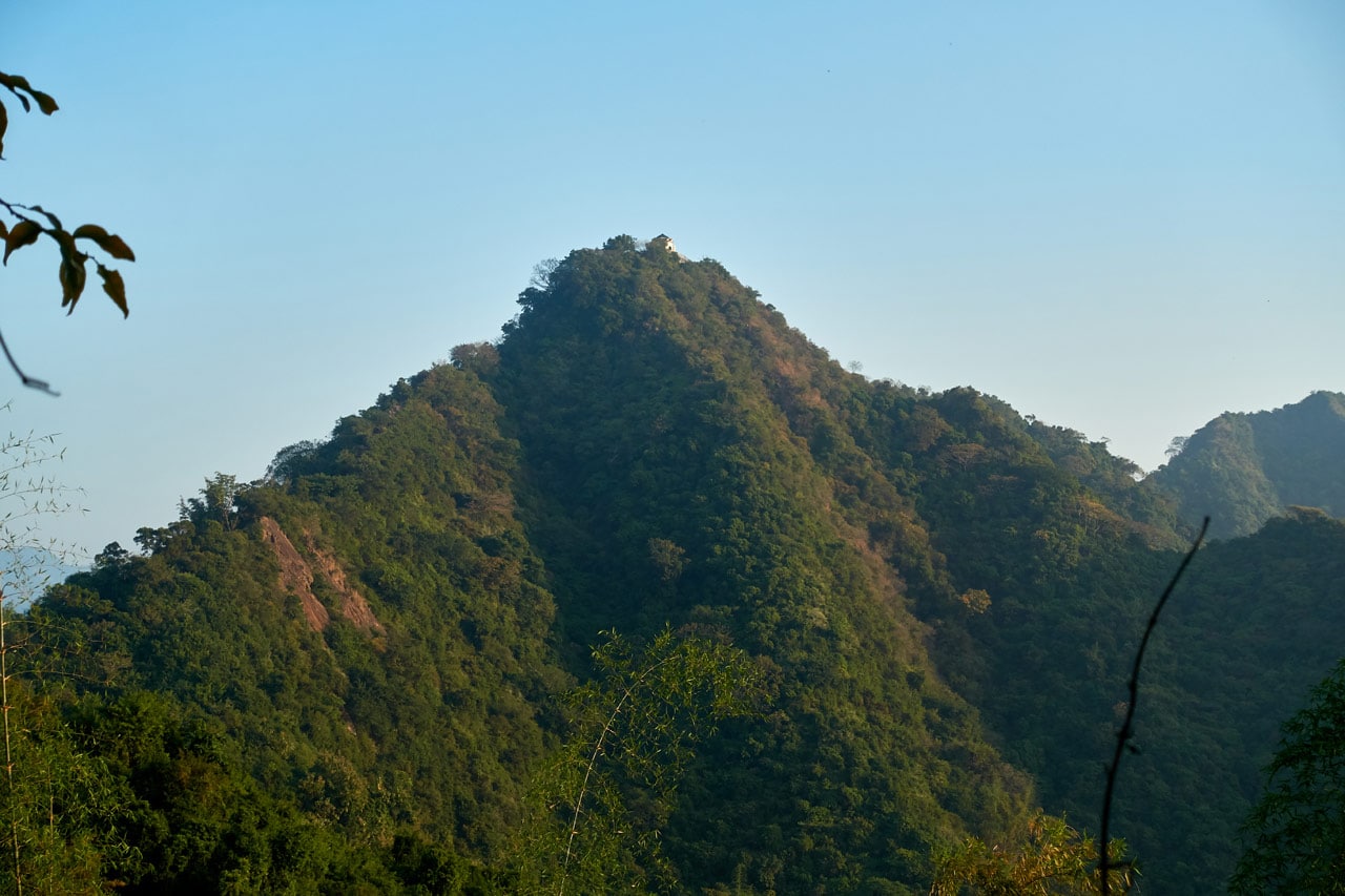
I still had a ways to go (that pic was zoomed to the max) but the views were improving.

Trail to QiWeiShan 旗尾山 – Second Half
I passed a couple of old markers along the way, but I couldn’t tell you their purpose.


One thing I did figure out rather early, was that the trail would quickly go from nice and easy sections like this:

…to more technical sections like these:


Not that these were terribly technical or anything (especially with all the ropes and whatnot)…but you certainly needed to pay attention while navigating through them.
Being that this is a ridge trail, there are PLENTY of opportunities for great photos. Hiking alone, I did the best I could do. 😆

This particular location offered a great visual of my progress.
I saw plenty of this particular sign throughout most of the hike.

As I neared the final climb up to QiWeiShan, I was surprised to find…

STAIRS!!!
One set going up and one going down.

As mentioned, I didn’t research this hike in detail. But now I have. There is a MUCH easier route to get to QiWeiShan. You can park on the main road about a kilometer or so from where I parked and walk up an old road until you reach these stairs. They’ll take you all the way to the top. I later came back with my family and it took us about 75 minutes to reach the top.
At this juncture there’s a “famous” tree, judging by the amount of pictures I’ve seen of it when researching this hike.
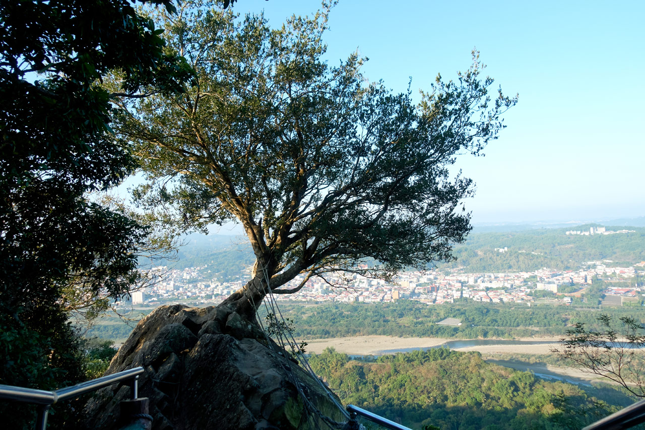
I came up from the other side of the tree.

I was happy to see the stairs, but they were really darn steep at times. However, it was only a few minutes before I got to the top.

QiWeiShan – 旗尾山
The first thing you see when entering QiWeiShan from this side is the peak marker and this stone.

And behind it the QiWeiShan triangulation stone.

The layout of the structure is a bit strange – probably due to the land features up here. I won’t to describe it; I’ll let you see for yourself.
Inside the structure are several tables, a bunch of chairs, and a cork board with various odds and ends around it.

There was also a box of cheap rain coats in case you’re caught off guard.
Since there were several people inside (one old man doing pull-ups) I decided to walk up the spiral staircase leading to the second floor to see what was up there.

There wasn’t anything special up there but 360 degrees of open windows. I’m sure there were windows in them at one point, but I can’t imagine they would have an easy time surviving up here in a typhoon.
There was also graffiti all over the wall – including this gem.

Spectacular Views!
The views from up here were by far the best of the whole place.
But the views most anywhere up here were stunning. Just wish I had a better camera to capture it all.
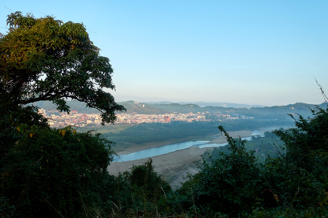
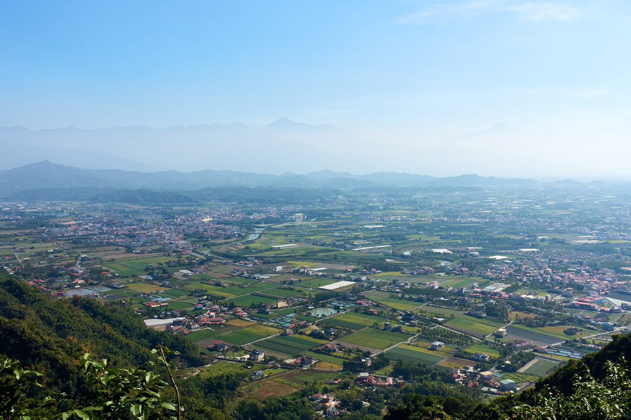
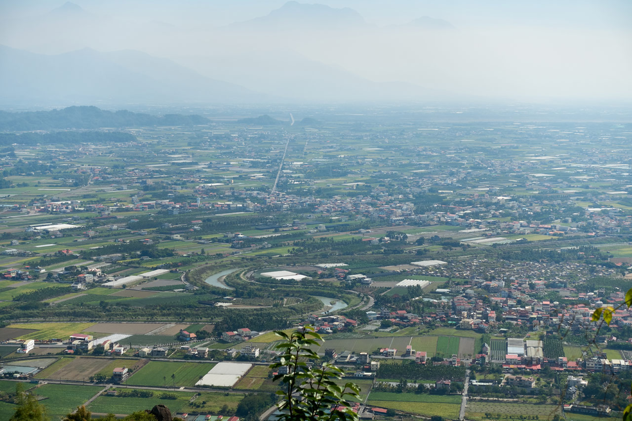
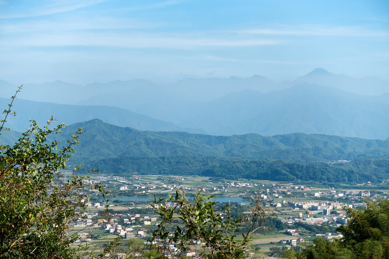
One of the best views was looking down at all the farms of Meinong – 美濃 and the mountains in the distance. But it was early and the sun was on that side of the mountains, so I didn’t try to get a picture. You’ll see that view later in the post.
I wasn’t sure what the rest of the trail would be like so I didn’t want to stay here long. I might have rested for five minutes before exiting out the other end.

Oh! And one last thing to mention. QiWeiShan is a 小百岳 XiaoBaiYue! (Taiwan’s top 100 lower peaks) I didn’t know it at the time. All I can say is, it’s worth your time to visit.
The Journey Continues
Stepping off this side of the peak was much different from the other side. There were no stairs or anything to help you down. You need to unceremoniously plop yourself off the ledge and hope for the best.

I looked back to say goodbye to this “last vestige of trail humanity”. There wouldn’t be stairs, benches or other creature comforts down the line. However, one unwanted olfactible trace of humanity permeated the air here: the pungent odor of human urine and feces. Needless to say, I didn’t linger long. (See what I did there? 😆 )
There were signs to guide my way out of this stink bomb, but honestly I don’t see how they are needed. I just followed the trail down…


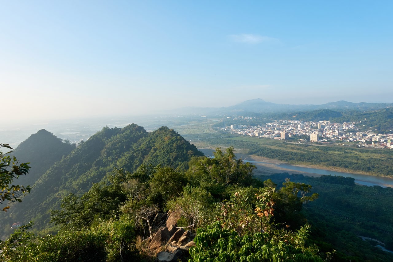
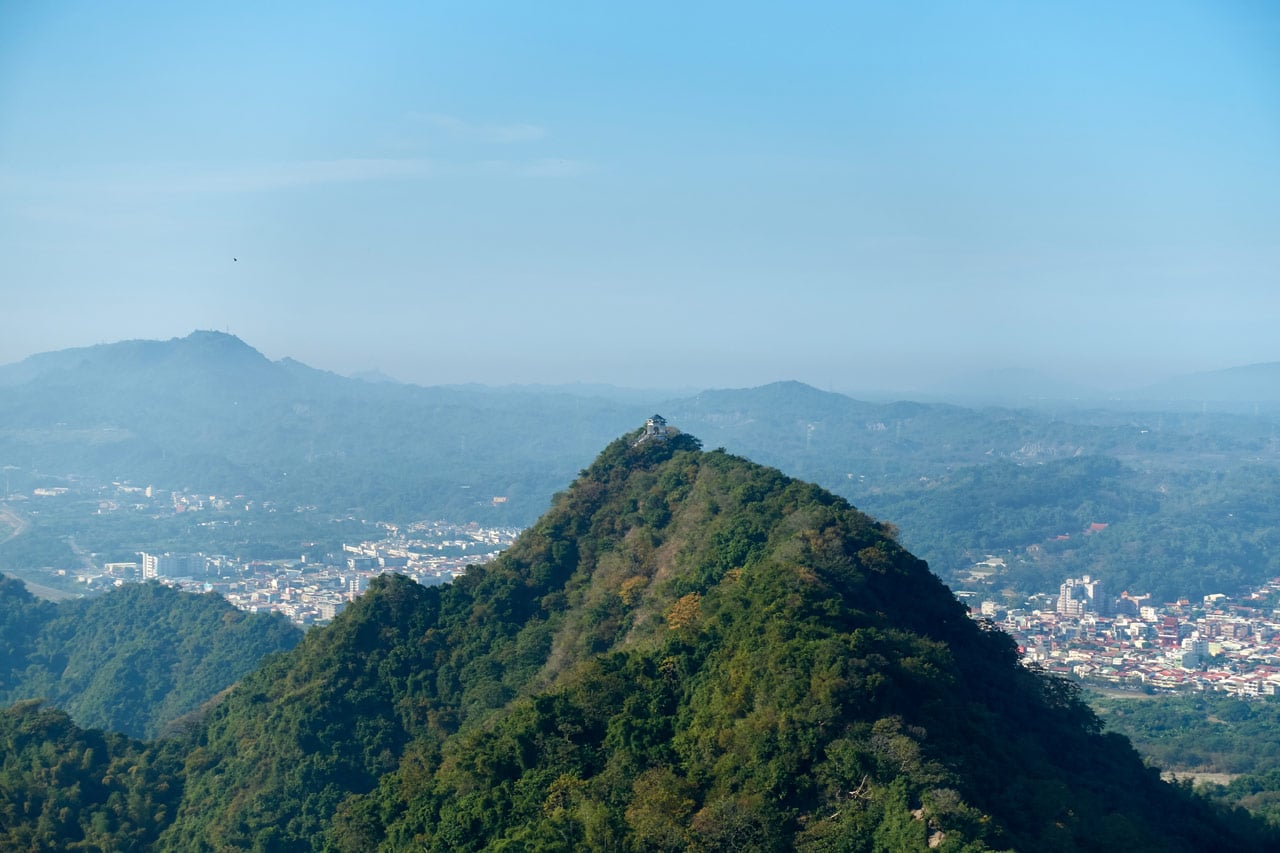
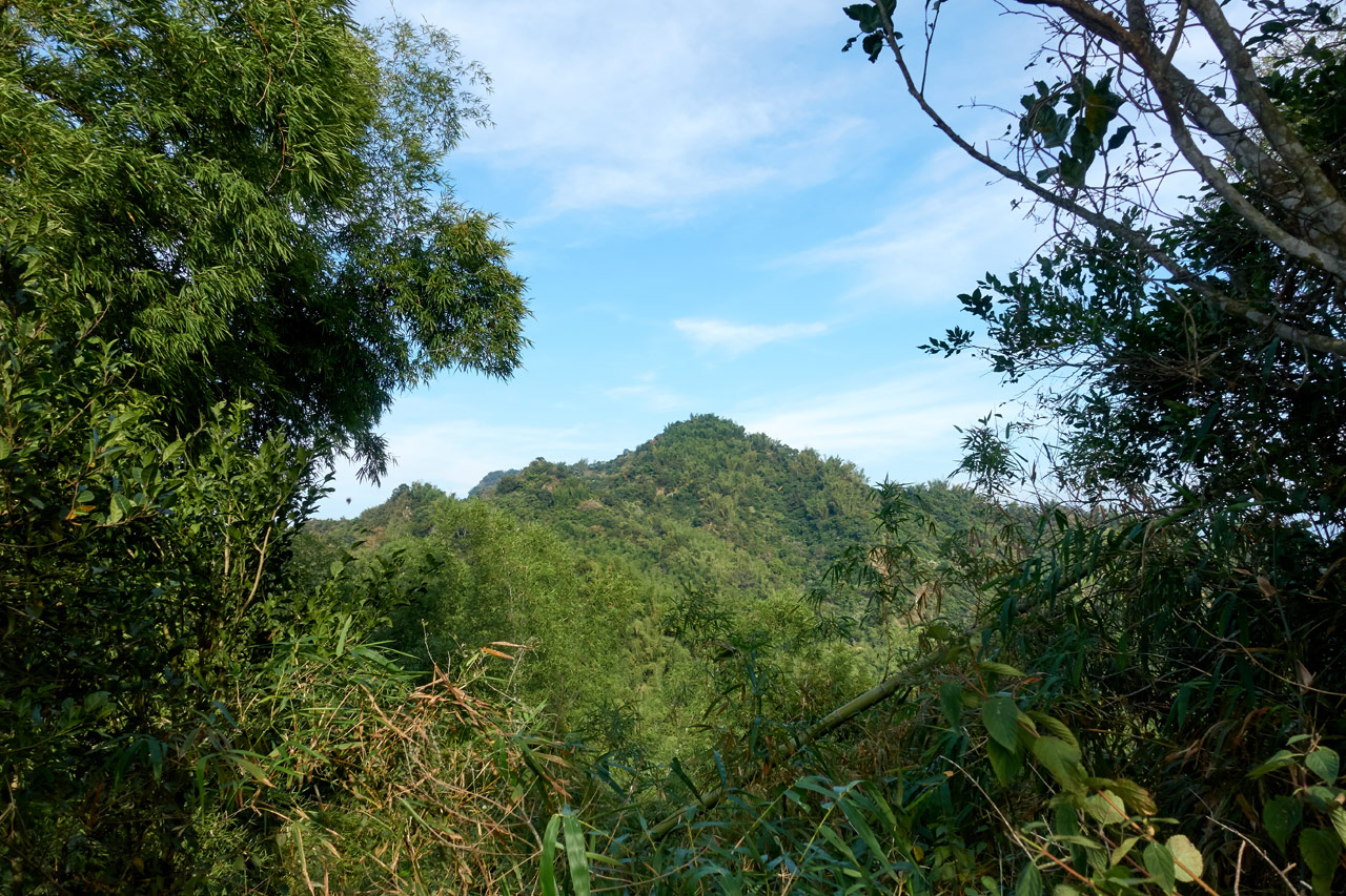
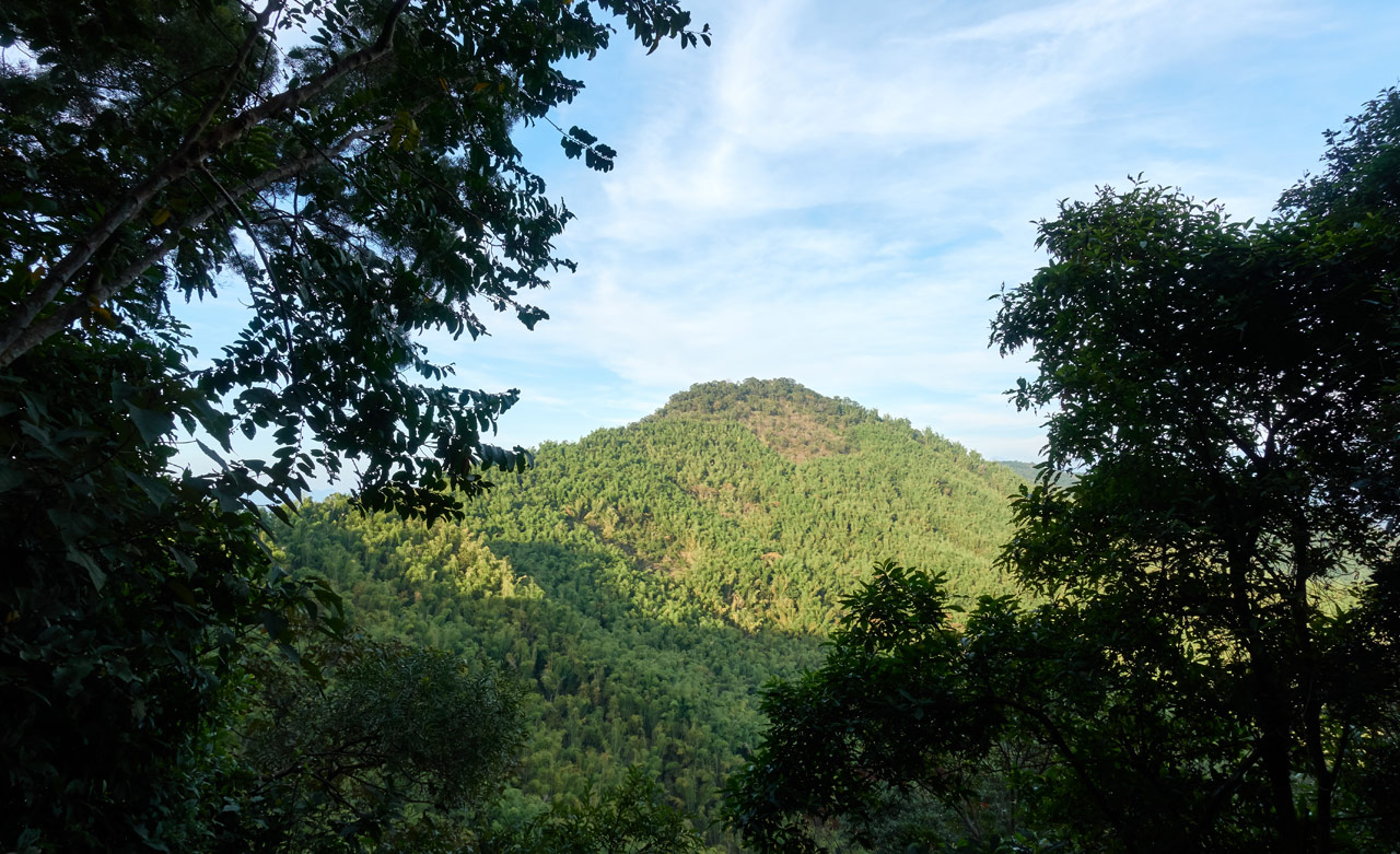
Coming up to the other side to the top of the next peak offered a nice view of the previous peak.
This stepped concrete base of something now gone stood at the top of this little peak. I can’t begin to guess what might have stood on top of it. But it must have been important enough to go through all the trouble.

To the Next Peak!
From here my goal was to reach FuMeiShan – 福美山. It didn’t look far, and it wasn’t. But it took a bit of effort in places.

But again, the rocky rope areas were always followed by easy sections…

…which were followed by steep sections…

This pretty much sums up the entirety of the hike until the section at the end. As annoying as I thought all these ups and downs would be, I’m happy to report that I didn’t really notice. In fact, they were a welcome respite from the usual grueling never-ending steep mountain hikes that I usually find myself doing.
About halfway to FuMeiShan there were some signs.


Just beyond the signs I saw my first of a few monkey sightings.

This one was yelling at me. I’m assuming it was the protector of the group, as I saw several running past it to disappear off somewhere.
Not long before reaching the peak I got some great shots of the trail looking back.
FuMeiShan – 福美山
Roughly 45 minutes after leaving QiWeiShan I arrived at FuMeiShan!

There’s nothing to see at this peak – not even a triangulation stone. It looks much like any other part of the trail.

The only thing setting it apart are these signs nailed to a tree and a red sign lying on the ground.


With nothing else to do, I rested here a bit and continued forward.
Trail to RenTouShan – 人頭山
From what I thought I knew, my next stop was RenTouShan which was a couple kilometers away. This part of the hike was more interesting for me as it offered up plenty of rocky rope sections.
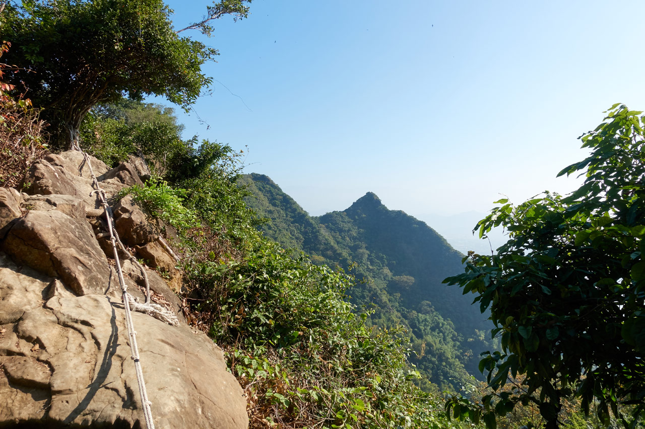


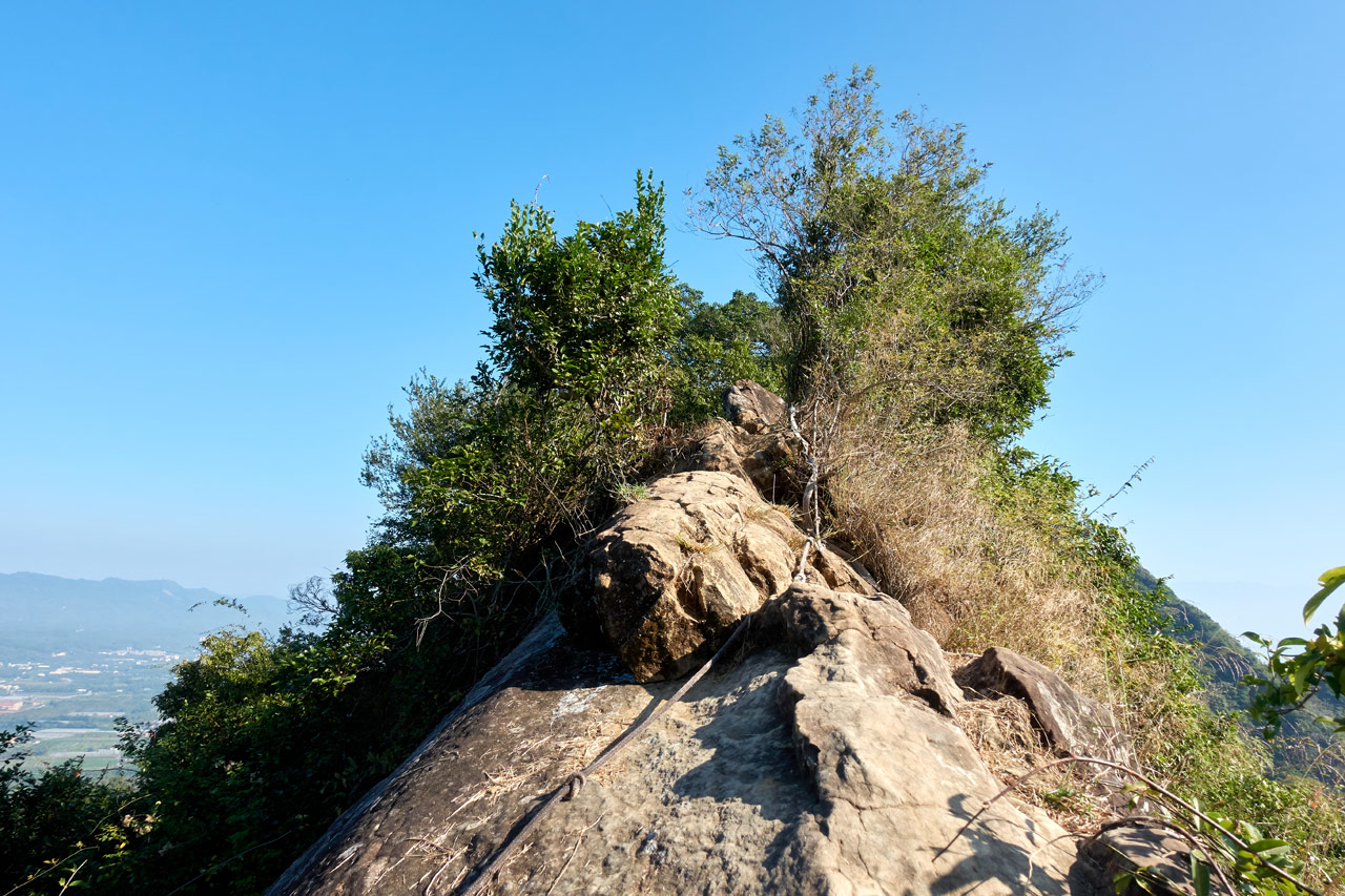
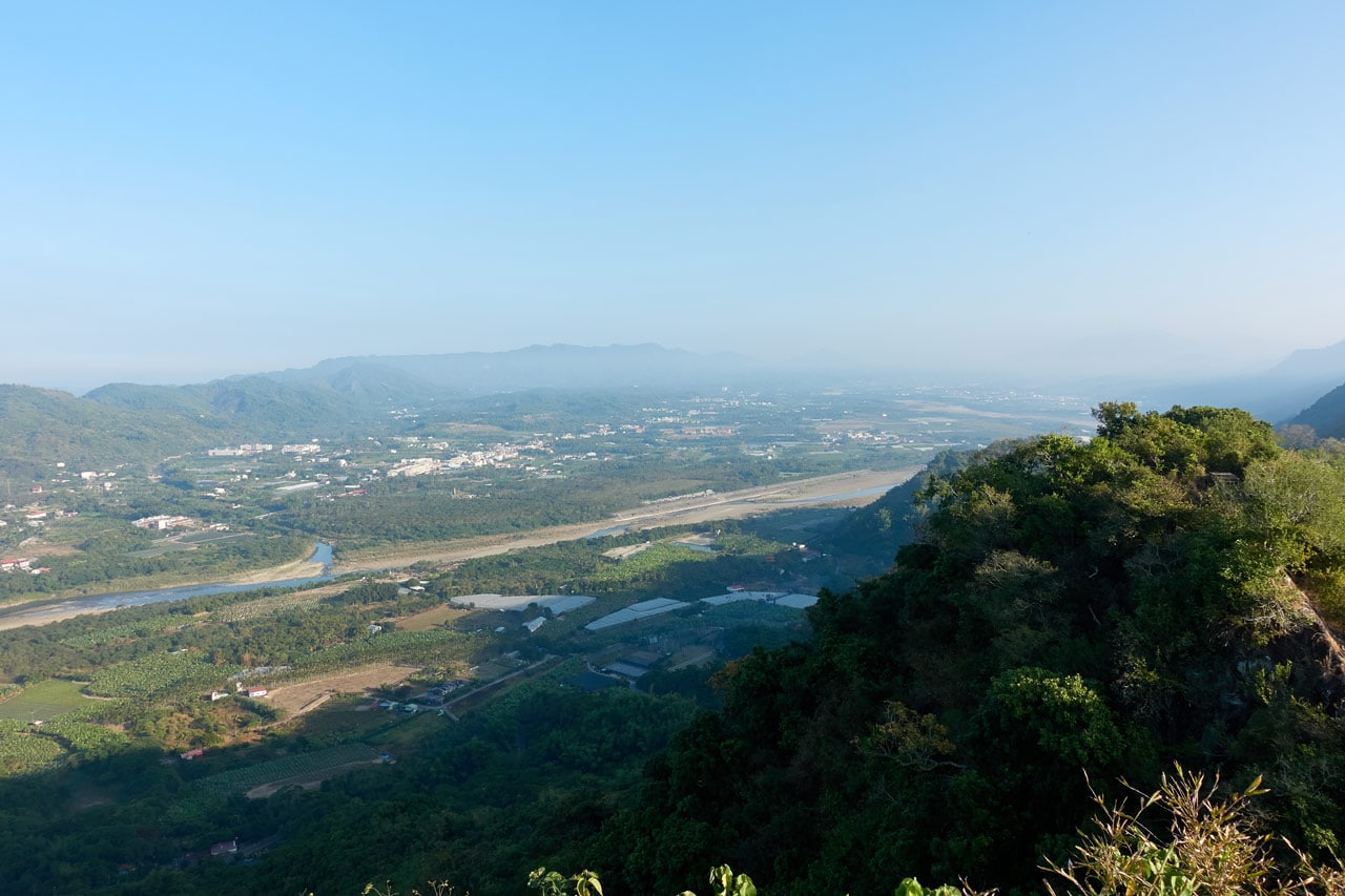
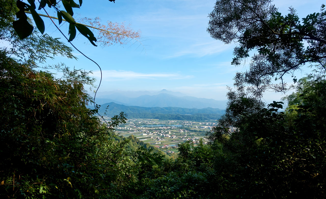
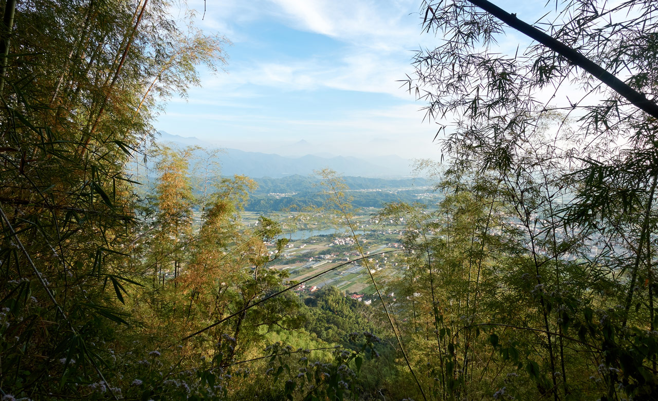
And with all those rocks came a lot of great views at every turn.
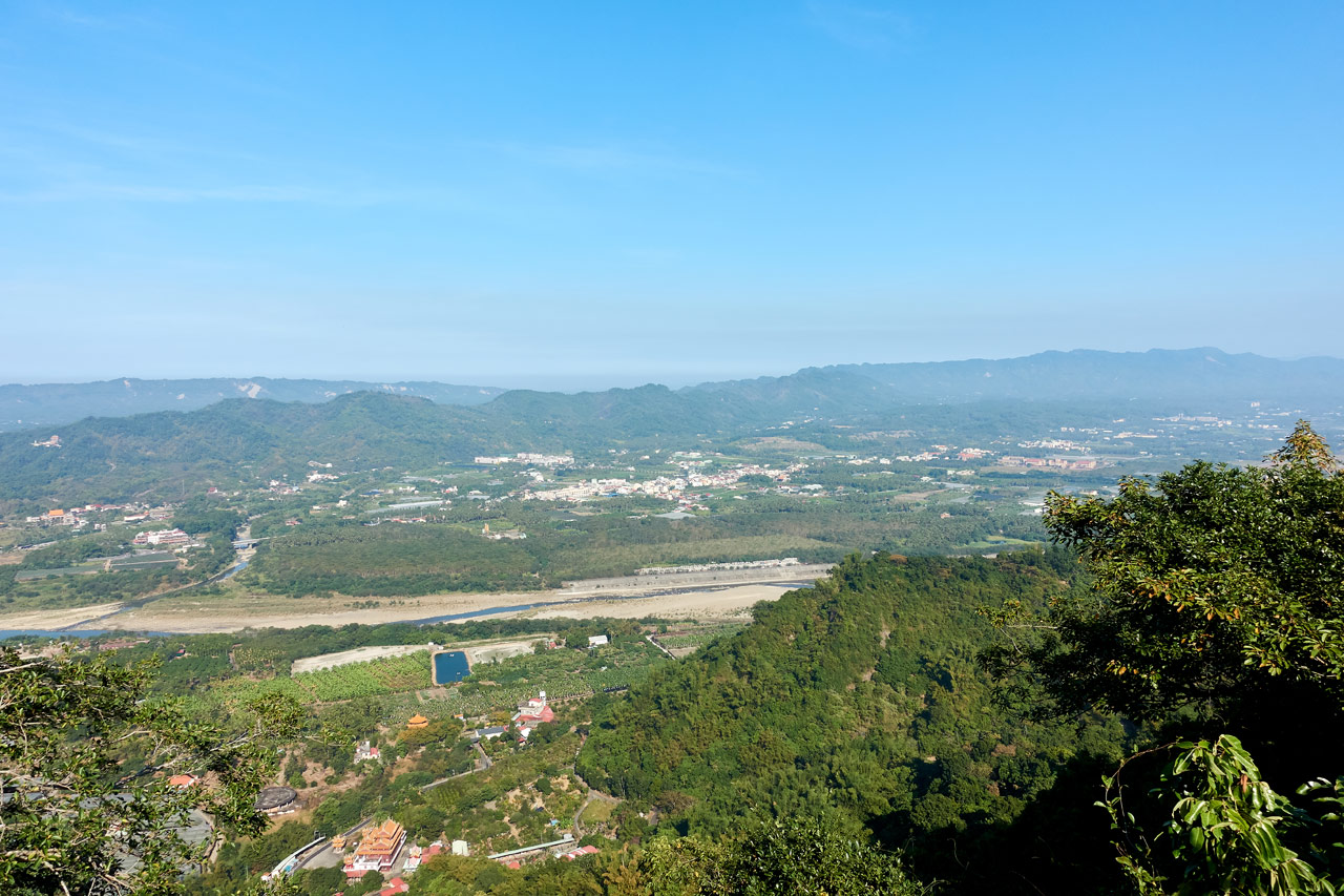

I still couldn’t get a decent shot of the Meinong side of the mountains, but things were starting to clear up over there.
I’ll admit, this section took a LOT longer than it needed to because I kept stopping for pictures. I’ve never taken so many pictures in all of my hiking. Keep that in mind if you decide to try this hike. It will probably take longer than you expect!
I soldiered on, thinking it would be at least another hour til RenTouShan.


Until I found a side trail headed up the mountain.

And wouldn’t you know it…
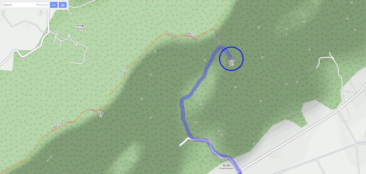
Mystery Peak! JinZiYuanShan – 金字圓山
I was beginning to think that I should have researched this hike a bit more. But to be fair, I still can’t find this peak on any maps – probably because, like the last peak, there’s no triangulation stone.


Being right before Christmas, I couldn’t resist.

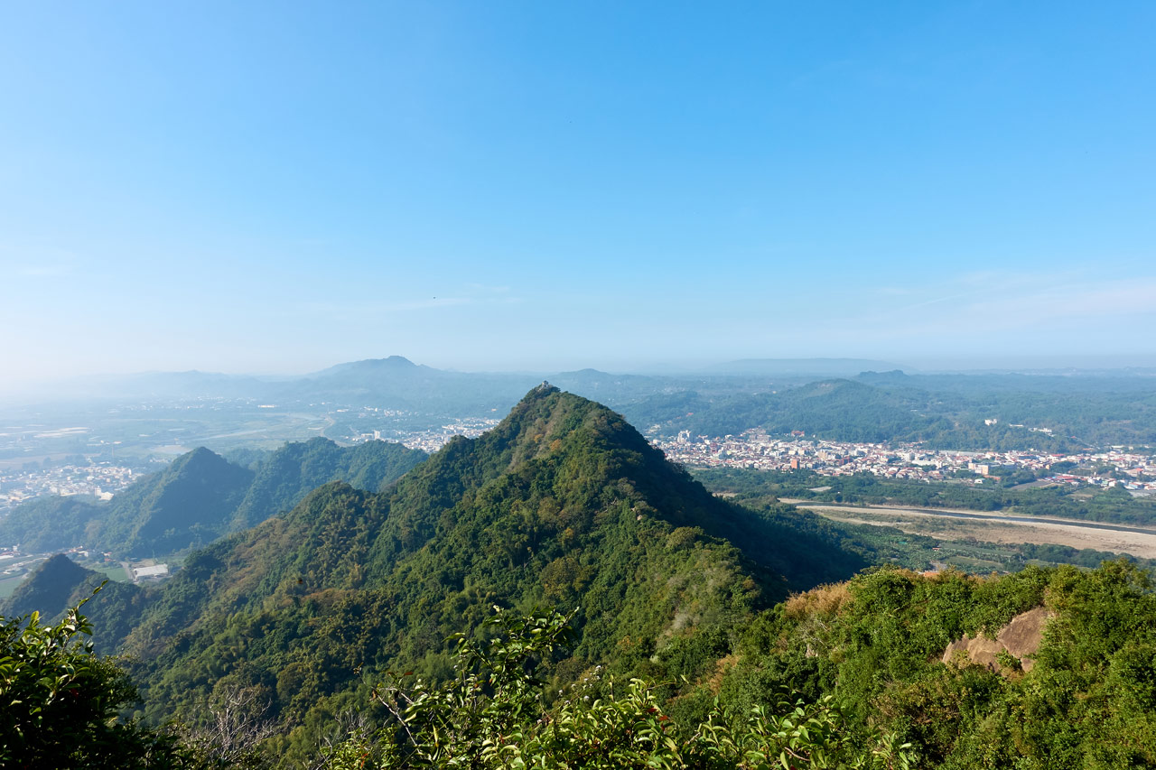
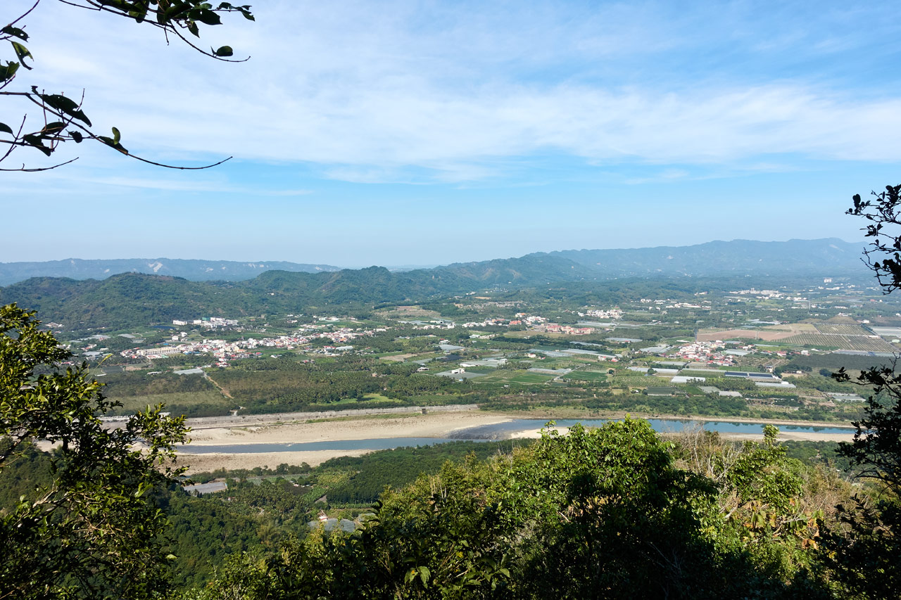
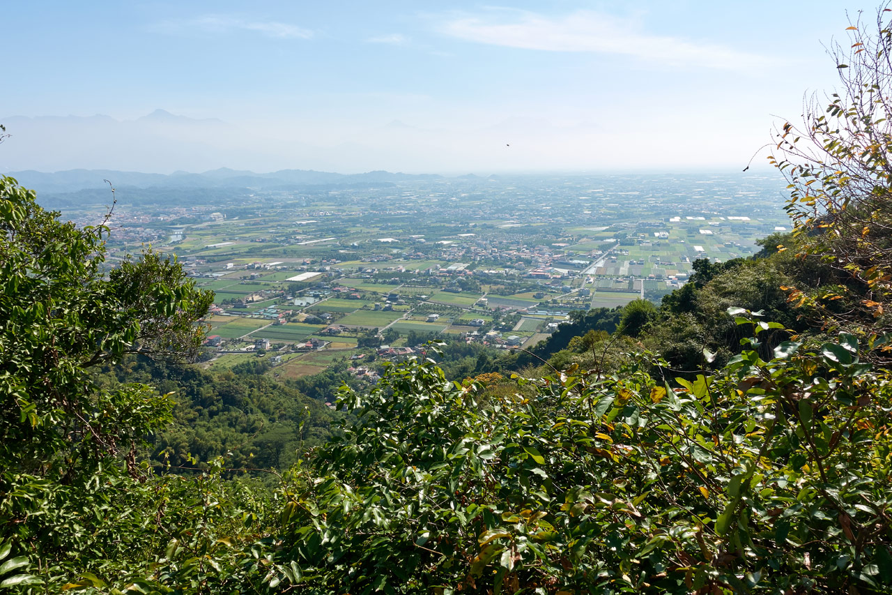
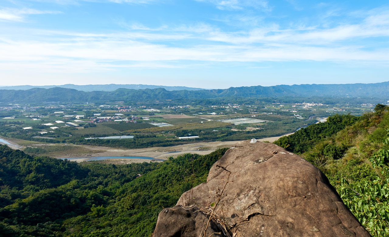
Now, unlike the last peak, the views from JinZiYuanShan were GREAT!
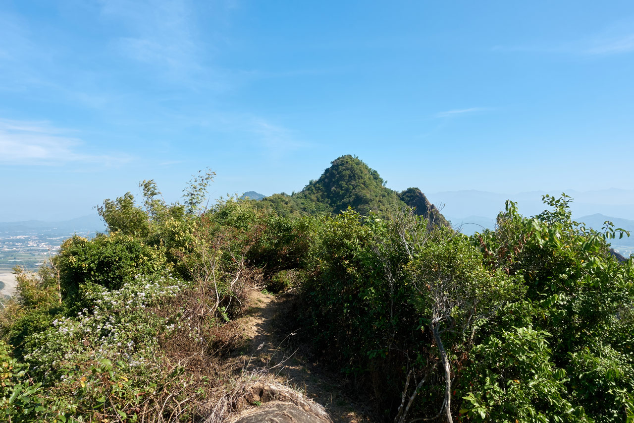
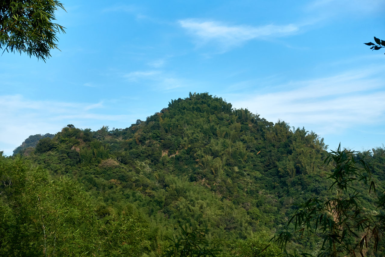
The trail up didn’t stop at the peak. It continued on to what I believed would be a lonely nearby peak.
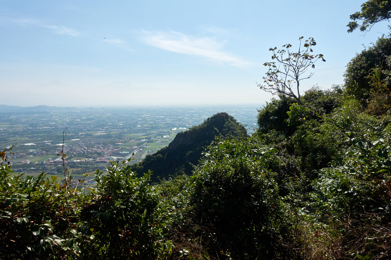
Here it is from a view earlier on the trail. The peak on the right.
I never considered making the journey over to that peak, though I really wanted to. I just felt I didn’t have the spare time to invest in a side adventure. Later I would learn it’s named JinZiMianShan – 金字面山 and that there’s another trail starting just below it that I can try in the future. It’s likely steep going, but should be a lot faster than the way I came.
The Final Leg to RenTouShan – 人頭山
I didn’t know it, but I had 45 minutes before I would reach RenTouShan. Leaving JinZiYuanShan, it was the typical rocky ridge-line I had been hiking the past hour or so.

Which again came complete with all the views you’d expect.
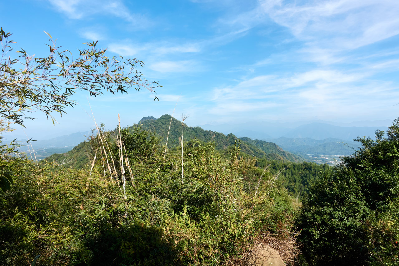
But then things took a turn – quite literally. Instead of following the ridge-line, the trail veered off to the northern side of the mountains.

The trail more or less stayed on this side of the mountain, weaving through the the bamboo trees and rocks.


Toward the end it started getting steeper; the final climb to RenTouShan!

After several longer, steep climbs I emerged from this drop-off.

I had arrived!
RenTouShan – 人頭山
I didn’t know what to expect before arriving, but I was pleasantly surprised by what I saw.

The place looked “civilized”! I figured there must be an easier route to this peak or all these chairs wouldn’t be here. (And there is. I brought my family back here a month later. Definitely a hike you can do with even young children.)
I was the only one there, so I made myself comfortable and decided I would take an extended break. With the sun now nearly directly above me, the Meinong side was looking much better. And RenTouShan is perfectly located to get some great shots if the weather is cooperating – and that day it was for the most part.
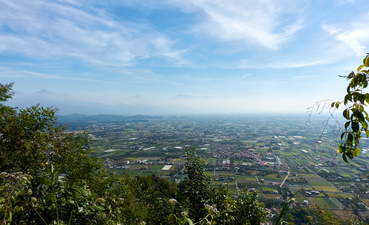
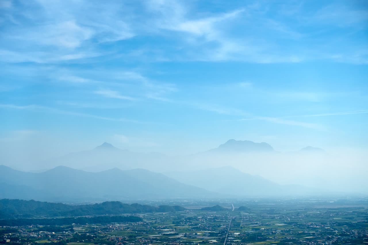
OK, the weather wasn’t PERFECT, but it wasn’t bad.
Picture Frenzy
After about 15 minutes another hiker emerged from the side I had entered. Then another, and another. In total, 7 or 8 people now joined me. They seemed like nice people, but I wasn’t in the mood for talking. Unfortunately, you have to put aside those fantasies of being left alone when you’re a foreigner in Taiwan. 😆 I’m not complaining though.
They were all excited to be at RenTouShan and took a barrage of photos in different positions and different locations.

I was even included in their “boot picture” (all of us making a circle with our feet) and hands picture (same as the boot picture but with our hands) but I don’t have a copy to share. 😀
They also encouraged me to take a sign picture.

They took a break but didn’t stay long. After they left I took the opportunity to grab my usual style peak picture.


Decision Time
You might have noticed the knee sock on my right knee in the above picture. The shin problem I had been having in previous hikes had been slowly coming back over the length of the hike. As high up as the pain was (and I had yet to see a doctor) I still wasn’t sure if it was my knee or shin. The brace seemed to help a bit. (I later found out it’s Pes Anserine Tendonitis)
The problem I faced now was should I keep going or should stay here and wait for my friend to show up and finish the hike now?
Friend!? What friend, you say!?
I had originally planned to hike this with a facebook friend. I had arrived earlier than he, so I started up on my own. He said he would catch up. It turns out that either I’m a fast hiker or he’s a slow hiker. I think it’s a little of both. Anyway, he was still quite a ways away. I would need to wait here at least another hour for him to arrive. So I figured I’d hike a bit more to see how I’m feeling.
According to this sign, it was only 1.26 kilometers to the trail head of this mountain.

At the very least I could hike to the trail head. If my leg was getting worse, I could hang out there until he arrived – I was certain there would be benches or something.
So off I went.
Down the LingShan Trail – 靈山步道
This side of the trail is far more hospitable than the end I came up on.

There were stairs, a neat trail, and plenty of markings along the way.


At the bottom of the stairs there was a fork in the trail. When I came back with my family I took the trail to the left (on my way down – there’s a somewhat hidden trail off to the side towards the top).

It must have been the original trail. It’s flat for the most part, but gets steep with ropes at the end. The route with the stairs must be relatively new; it’s a great addition.
Not long after the stairs ended I caught a glimpse of movement off to the left. It was a muntjac!
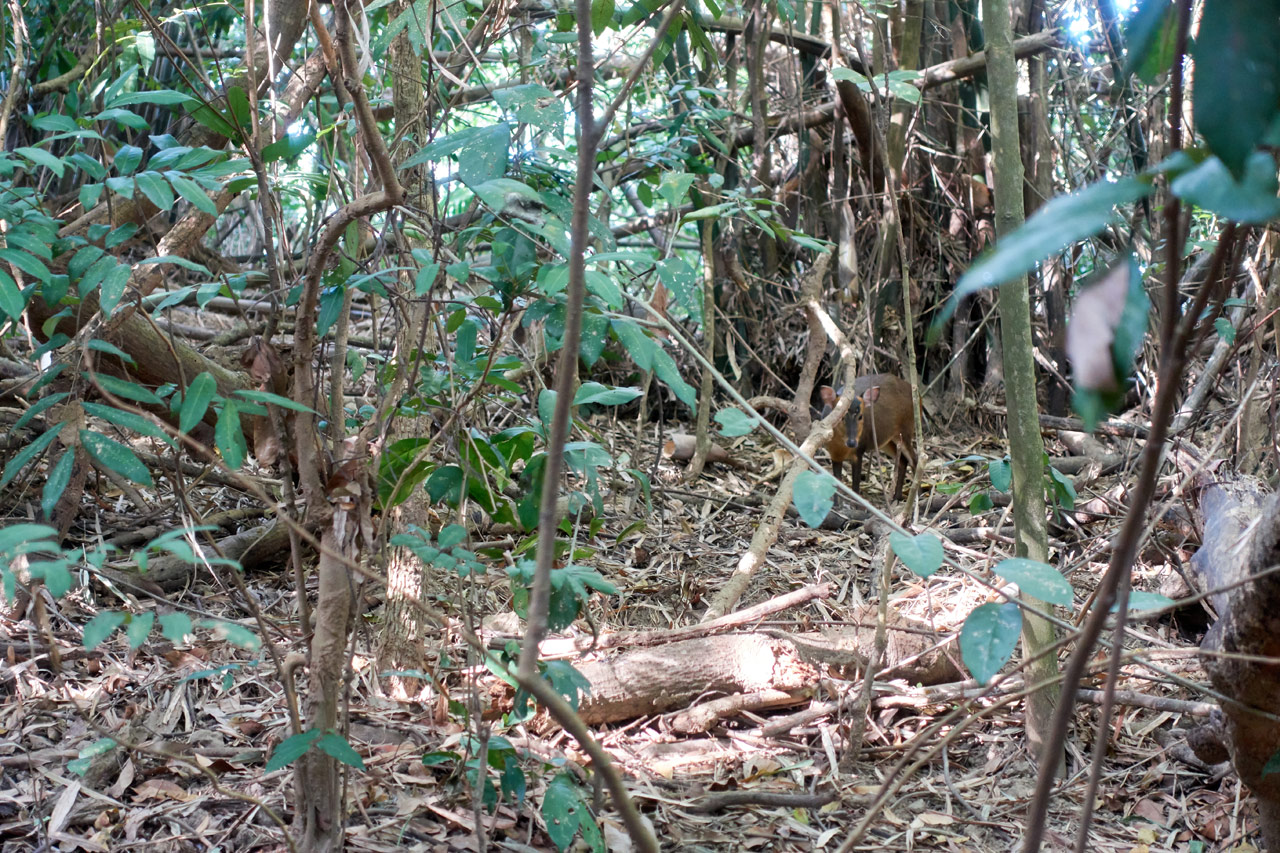
I had my bluetooth speaker on, but the music didn’t scare it off – nor did I. We stood there staring at each other for about 10 minutes. I took a bunch of pictures and this video.
After we parted ways I continued down the trail and later could hear talking and laughter.

There was a little temple to the right and a large open area with seating and tables.

The hikers from the previous peak where making lunch and relaxing here.

They invited me to sit with them, but I didn’t have the time. I shared a quick glass of tea and accepted a hard boiled egg offered to me and said goodbye.
This area is a crossroads.

A paved road goes down to a temple and parking lot.

The other end has this open area flanked by these two structures. I’m assuming this is another place hikers can sit down while resting; though I feel they may have had another purpose at one time. They look like covered bus stops to me!

Whatever their purpose, I had no time to stay here.
Second Mystery Peak! – LingShan – 靈山
I left comforts of the LingShan trail and surveyed my leg. It wasn’t feeling bad; in fact, it was feeling better than it had before RenTouShan. My plan at that moment was to keep going a bit, reassess my leg, and go from there. Thankfully, the trail wasn’t steep.

Along the way I noticed a rounded stone in the distance. As round and as smooth as it looked, I didn’t think it to be natural, so I walked over to investigate. When I came around the other side…

A gravestone! I later found out it has some pretty good age to it. This would date back to when the Japanese were here. Here’s a closer look:

It wasn’t but a few minutes after leaving the gravesite before arriving at the namesake of the trail I was just on, LingShan – 靈山!


And my proof of arrival… 😆

Just off to the side was a Taiwan flag hoisted up for…well, hikers I guess…to see!

My leg was still feeling OK. From this vantage point I could see most of what I needed to traverse.
It didn’t look so bad, so I decided to keep hiking.
Possible Exit
I remembered a map I had come across that showed a side trail leading down the mountain someplace between RenTouShan and the next peak, ShuangFengShan – 雙峰山. My plan was to hike as far as that trail and then decide if I wanted to keep going or not.
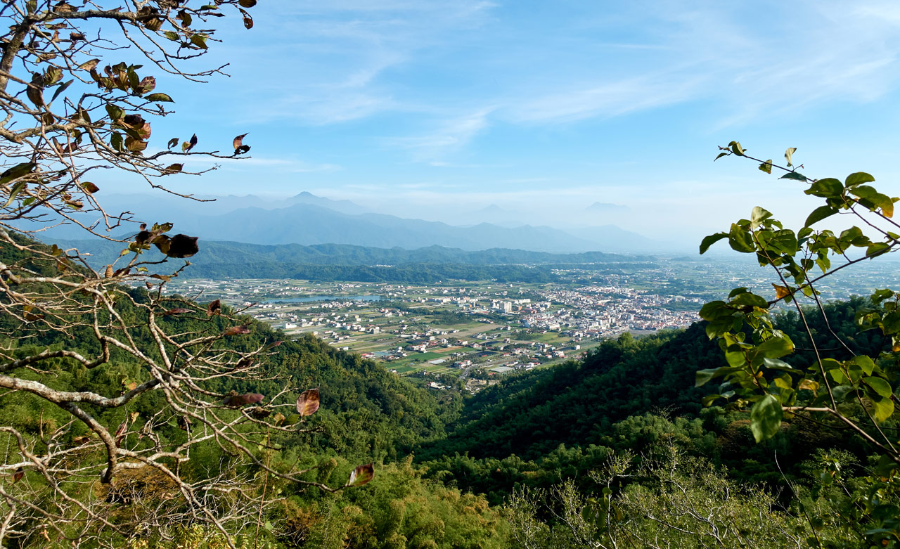
Once again, the views up there were spectacular.
This section of the hike wasn’t so bad, but it still had it’s “fun” spots.

And more signs to help point the direction.

Before I knew it, I arrived at an exit.

My leg was feeling fine–though not great–so I chose to continue hiking. My thought was, if it starts hurting more I can always turn around.
With that settled, I pointed myself toward ShuangFengShan and the radio tower on top of it.
Trail to ShuangFengShan 雙峰山
The trail started off great.

This old stone marker was on the side of the trail. It once must have had a purpose. Now it’s just trail decoration.

I came across this “perfect Instagram picture site” as I’ll call it. There was this stone sticking out over a steep drop-off. The view beyond was awesome. The stone was just the right size to sit or stand on while taking that picture that will get you thousands of likes.
I’ll be honest, I wasn’t about to go out there – even if I had someone to take the picture.
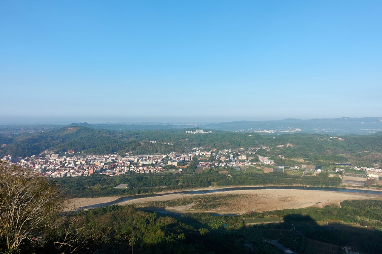
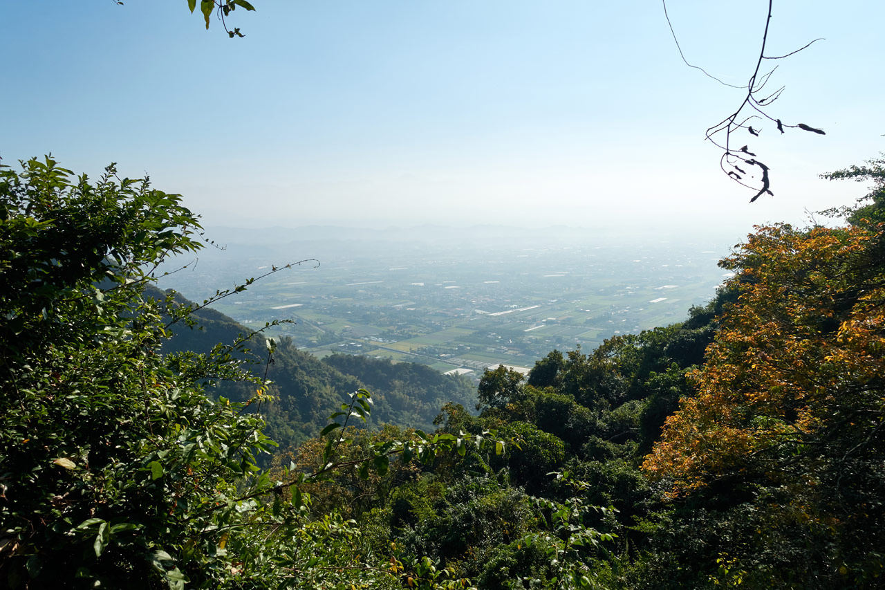
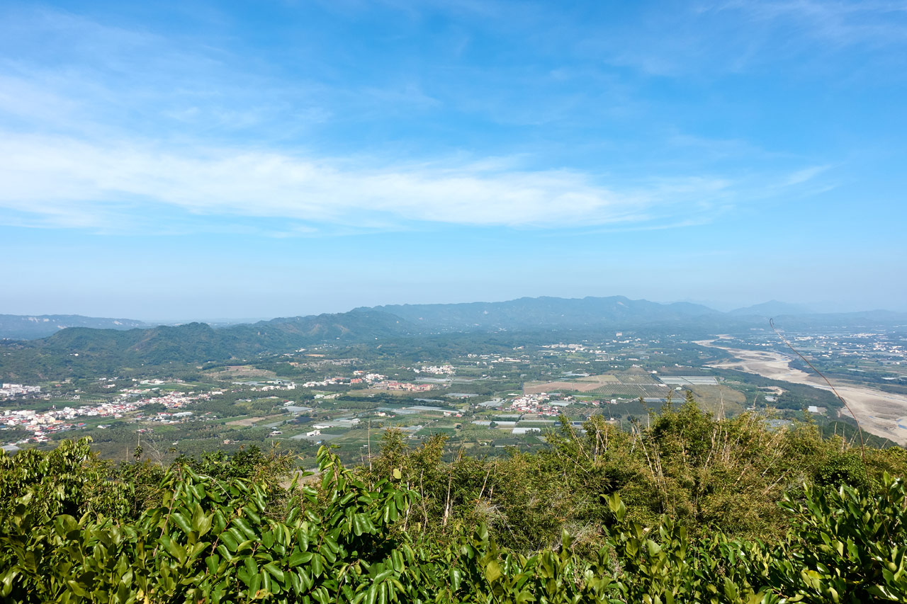
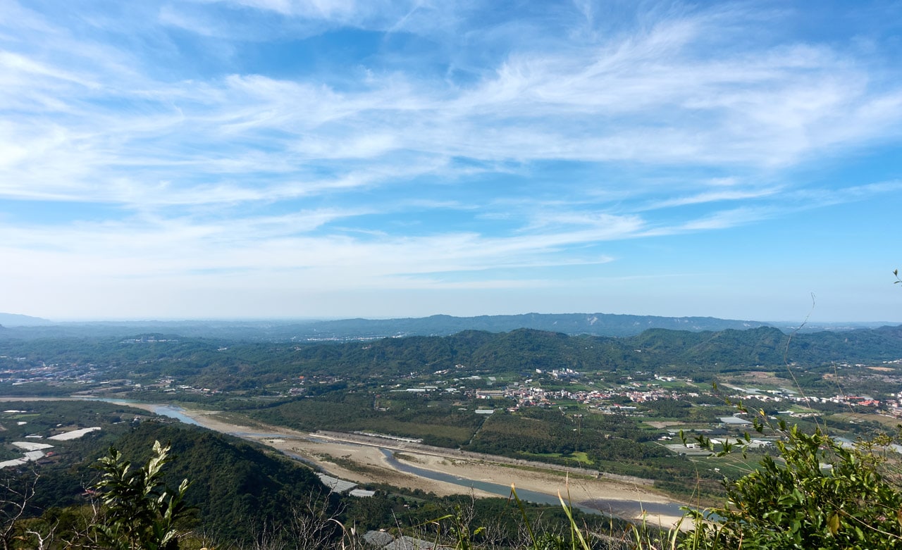
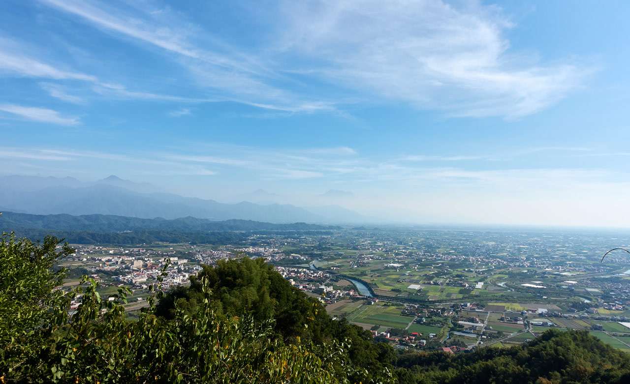
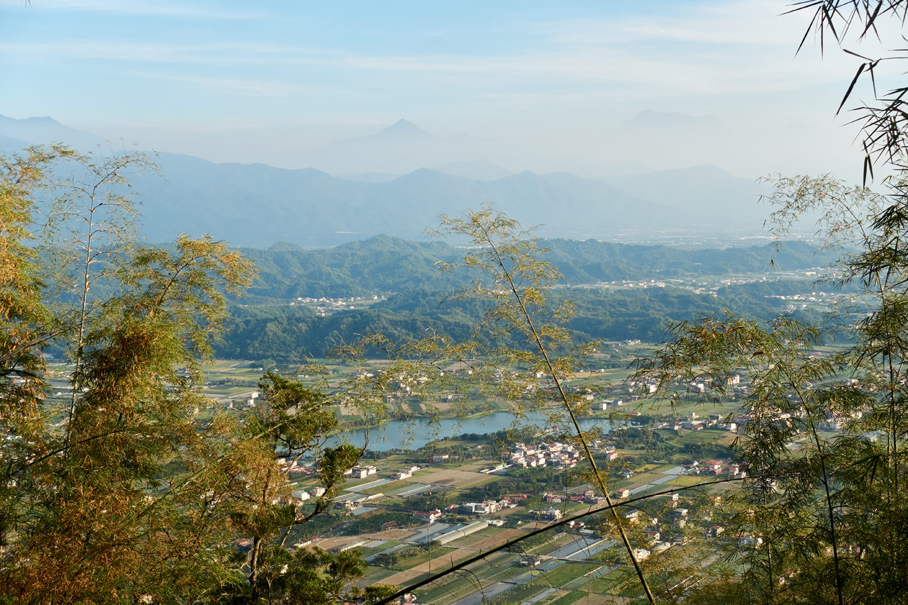
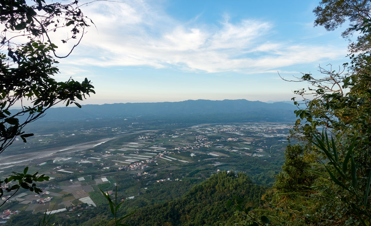
Along this section there are several places to get a good look at the other half of Meinong below and the mountains beyond.
I’d love to say that my leg never bothered me again for the rest of the hike. But I’d be lying. By the time my leg started hurting to the point of wanting to stop, I was past the point of no return. All I could do was keep going.
I made more frequent stops to give my leg a rest. Pretty much any reason for me to stop and I would take it. Like for this little lizard playing hide-and-seek with me.

To be honest, I probably could have turned around and exited the trail and it would have been easier than continuing forward. But I knew this would be my last hike for at least a month. So I wanted to make every bit of it count. I wanted to FINISH it.
So I kept going until I could see my next objective.
ShuangFengShan – 雙峰山
That’s ShuangFengShan 雙峰山 in the distance. You can see the radio tower on top in the next picture.
Everything seemed to be going well, all things considered. Until…two things that happened.
The first was this sign.

And this sign.

They’re warning of bee nests ahead. The first sign was bent at the bottom. I grabbed the sign to unfold it. Now, normally I wear gloves when I hike. But this hike I forgot them. As I was holding the sign to take a picture, I suddenly felt pain in several places on my hand. I looked down and large ants were crawling all over me! And BITING!
Damn it! Where was the sign warning me of biting ants on the bee warning sign??? (Probably on a bee’s nest) 😆
Ok, so I’m on the last leg of my hike to ShuangFengShan and all is looking good, both figuratively and literally.

That’s when the second difficulty arose: steep climbs….


Two things here. It’s not always easy to show depth in trail pictures. These don’t really look steep to me, but I certainly remember them as being steep.
Second, I don’t take many pictures when I’m struggling. It’s the last thing on my mind. And I WAS struggling. My leg was acting up and I had already been hiking for around nine hours. I was running out of steam. All I could do was try to mentally push through this section. Singing Marine Corps running cadences I learned over twenty years ago helped…a lot. It’s something I do when I feel like I can’t go any further. And it worked this time around.
I came to this last steep DOWNHILL (Oh thank God it was downhill!)…

…and shortly thereafter arrived at…
…A ROAD!!!

Second Decision Time
I can’t even begin to tell you how happy I was. I pushed and pushed myself and was rewarded with a friggen road!
Looking at my map, it appeared it would take me all the way down the mountain if I chose to follow it. I just needed to decide if I would take the easy way out or try to finish the hike by first hiking up to YueGuangShan – 月光山 and then turning around and backtracking to the YueGuangShan parking lot. That would add another FIVE kilometers to the hike – plus the steepest uphill of the entire day.
I decided…that I would decide later when I reached the crossroads. 😆
So I followed the road…

And what about ShuangFengShan you ask? Well, I really wanted to hike up there, but I just didn’t have the energy for it. Plus my time was getting short. As I passed the trail going up to it, I thought, nah, I’ll come back one day. It’ll be an easy hike.
There was a small side trail near this sign. Apparently I could also take that to exit. The road seemed to be easier, so I stuck with it.

The sun was getting low on the other side of the mountains, which offered some nice views on this side.
And a zoomed-in shot that I thought looked good.
I also got my first look at my (possible) final objective.
The hike to the turnoff point was relatively flat and easy and worked as kind of a short rest. I guess that’s what happened, because when I arrived at the crossroads…

I said “fuck it” I’m finishing this hike!
Trail to YueGuangShan – 月光山
The elevation gain from the crossroads to the peak was only about 170 meters over 1.2 kilometers. That doesn’t really sound like much–and normally it wouldn’t be for me–but it was hell for me that day.
I started off fine and with a full head of steam. But it quickly wore off.
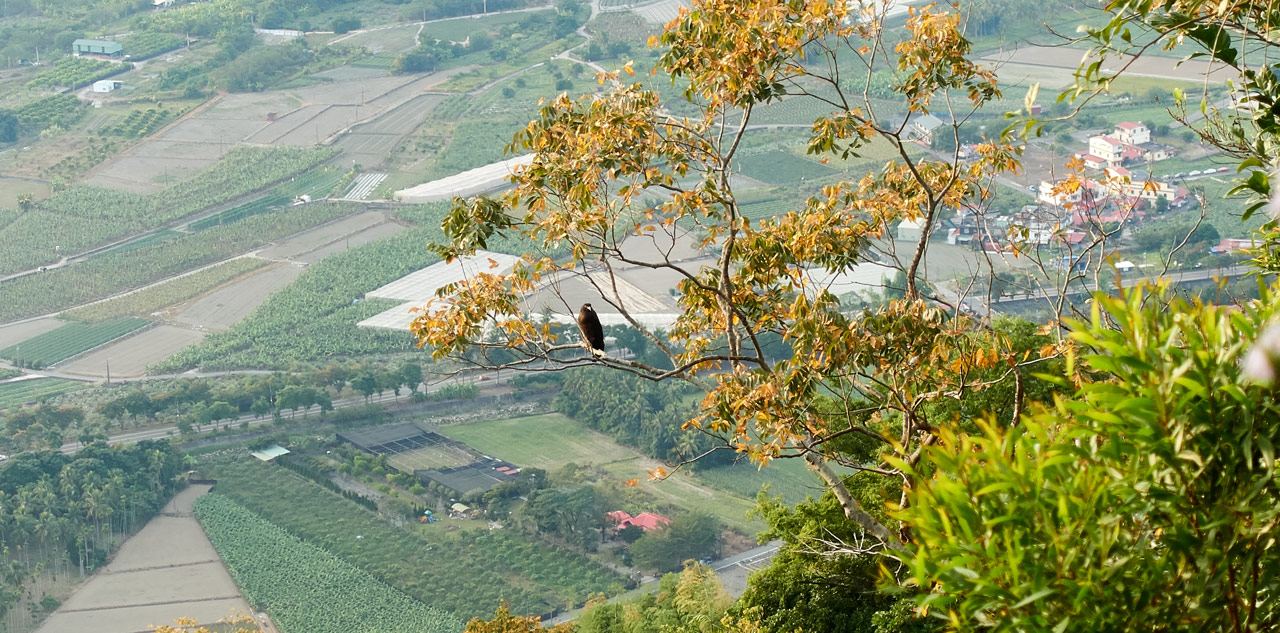
I stopped where I could – like to take pictures of this Crested Serpent Eagle I noticed.
Again, I didn’t take many pictures of the trail. These two are all I got.


The other side of the mountain was looking pretty, but I was running short on light.
As I have no more pictures of the trail up, I’m just going to end this part by saying that it kicked my ass big time. By the time I made it to the peak I had been hiking over ten hours and was walking at a snail’s pace. But….I made it!
YueGuangShan – 月光山
Normally I would have been sorely disappointed of having zero views after putting in that much effort, but I hardly cared. All I wanted to do was rest and eat. I badly needed to replenish my energy. So I sat on one of these benches and spaced out for twenty minutes.

And then took pictures of whatever I saw hanging on whatever tree…


And then quickly took my peak picture. (I wasn’t in the mood to set it up for the perfect angle.)

That’s it. It was time to leave.
The End
I’m going to try and wrap this up quickly. If you’re read this far you must want it to be over as much as I did that day! That and I have very few pictures left to help break up my words. And I know I need them! Haha…
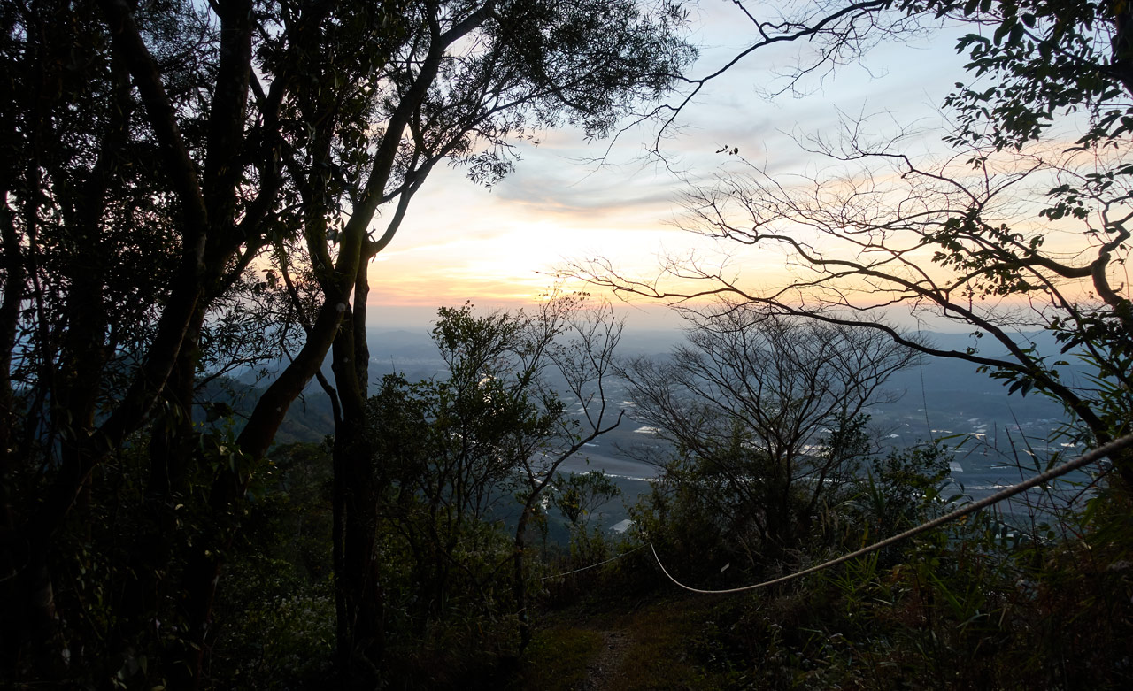
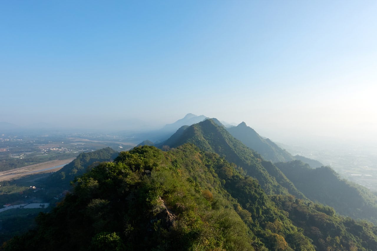
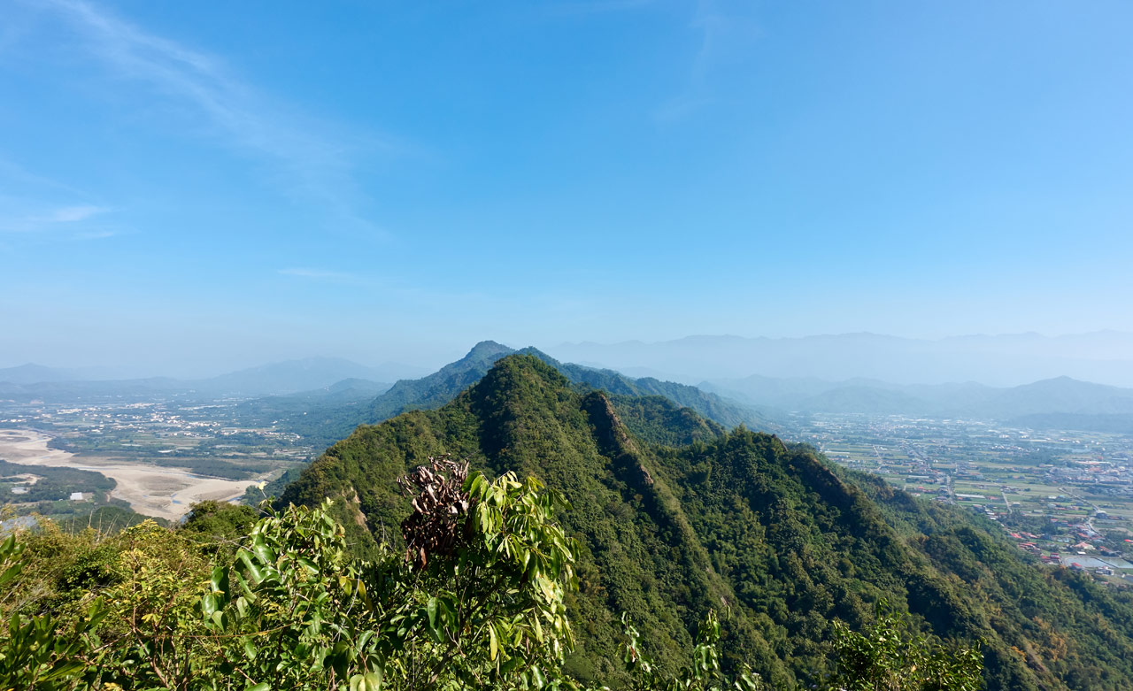
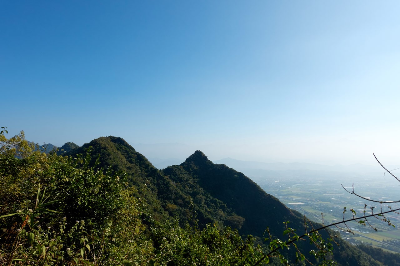
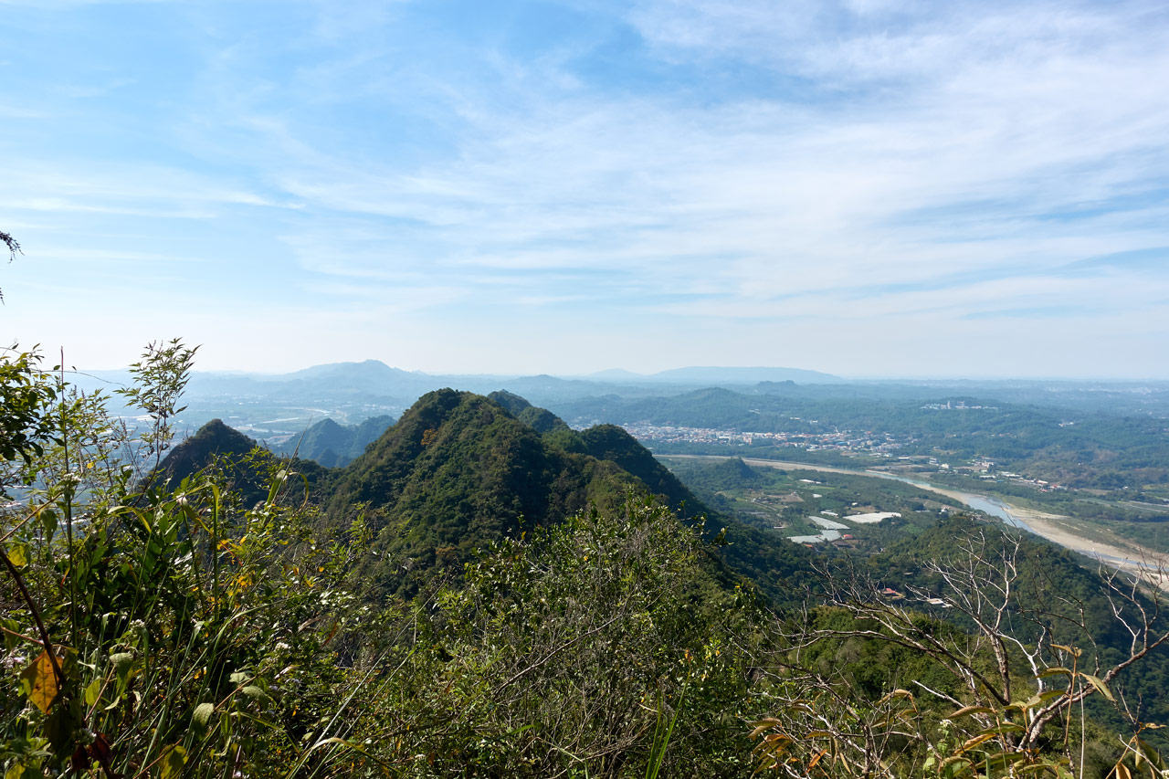
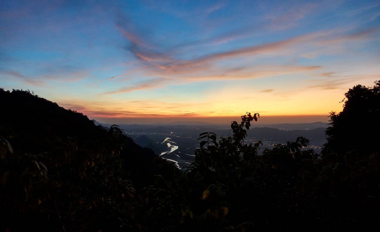
I headed down as darkness slowly set in. This next shot might very well be the picture that best encompasses what I had just hiked: That jagged spine in the middle and a bit beyond that you can’t see. All of that.
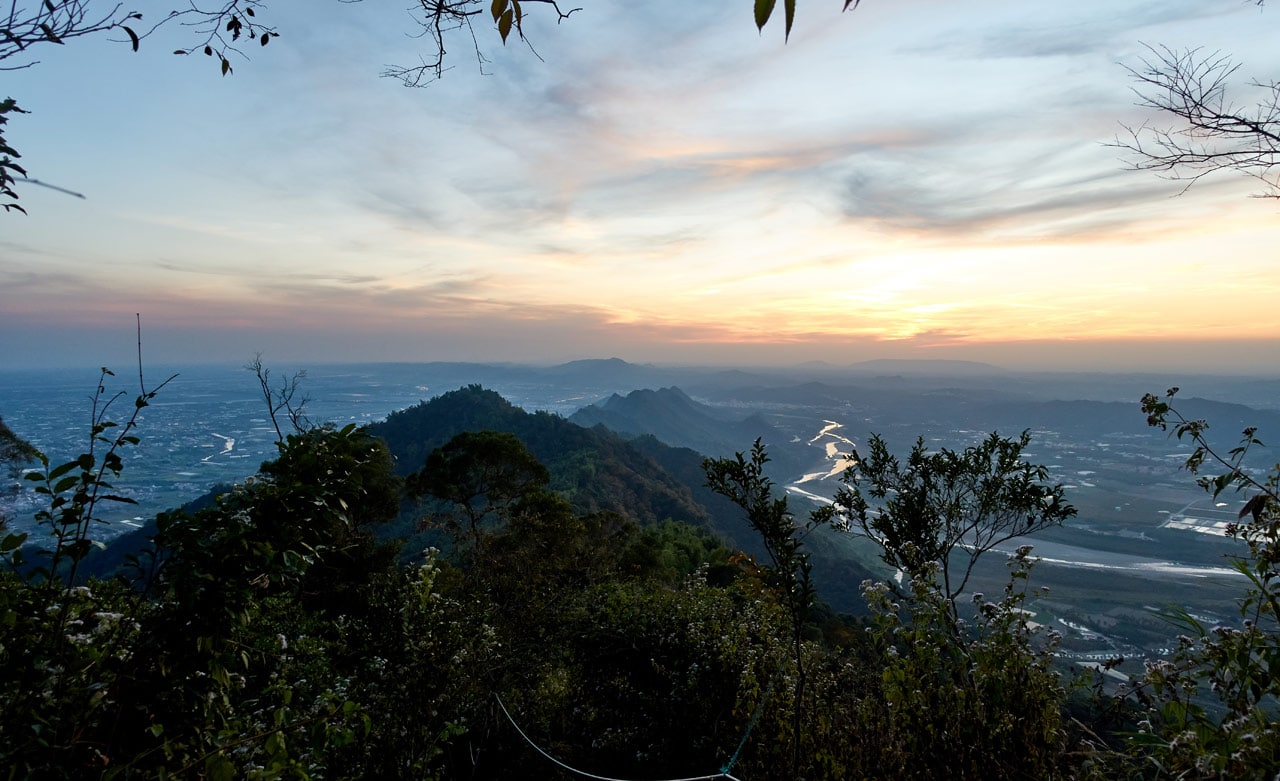
This was my last decent picture of the day. After this spot I was stuck in the trees with no light by my headlamp.
I spent the next hour and a half in the dark, mostly hiking down an extremely broken up mountain concrete road. My leg had completely stopped hurting – perhaps adrenaline or whatever chemical was kicking in to numb the pain. That was good.
The friend I mentioned earlier went above and beyond the call of duty and walked…yes, WALKED from the exit at RenTouShan, through the farms, to the trail head back near CiShan! He said it took him about two hours. Wow!
He then drove back to where I was to pick me up. I had thought he could drive up the concrete road to meet me somewhere towards the top, but that plan didn’t work out. Turns out you can only go so far on the road before vehicles are blocked. That meant me hiking down to him.
We eventually linked up and he drove me on the back of his scooter to where I started. But first we stopped for something to eat – his treat! Thanks so much!

And that’s it! Wow! What a hike!
Conclusion
This was one of the few hikes where I had a smile on my face toward the end. I know it sounded like I was being tortured, but really, I had a great time! I plan to hike it again. But not the whole thing in one go. Just sections.
If you plan to try this hike, go for it! Or if the whole thing sounds to be a bit much, just do the first or second half. You won’t be disappointed no matter which route you choose. However, DON’T choose to go only to YueGuangShan. That would be a disappointing hike in my opinion. Perhaps adding ShuangFengShan to it would make for a better hike.
Date hiked: 2019 December 17
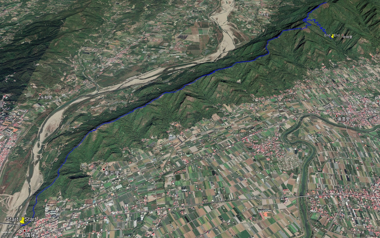
GPX Track Download Instructions: Click the track on the map to see the download link


![[Valid RSS]](https://outrecording.b-cdn.net/wp-content/uploads/2020/03/valid-rss-rogers.png.webp)
Hi Mr Glen.
What a thorough breakdown of the peaks. Thank you for posting so many pictures and details. I’m planning to go there with my lady tomorrow but as she is a little wet behind the ears with hiking I plan to limit it to qiweishan. But now I’m inspired to do the whole thing soon.
Great work on the post and thanks again.
Thanks, much appreciated! I went back sometime after that hike with my family. Neither my wife or young son hike, so we did Qiweishan and then drove over and hiked up to Rentoushan with a lunch stop in between. It’s a perfect easy combo with the best views. Good luck!