

Last year on exactly this date I attempted to hike to XinZhiShan – 新置山 and failed. I ran into a nightmare of the entangled sort. Overgrowth prevented me from reaching my goal…three times! But this year would prove to be much different. This year I would make it, easily!
Rather than rehashing the specifics of XinZhiShan, let me point you to my write up from last year: https://outrecording.com/hike-to-xinzhishan-and-toulunshan-新置山–頭崙山-near-laiyi/
And if that page doesn’t interest you, then here’s a map showing the three routes to the XinZhiShan peak. (The peak is located at the yellow pin that says “Start”)
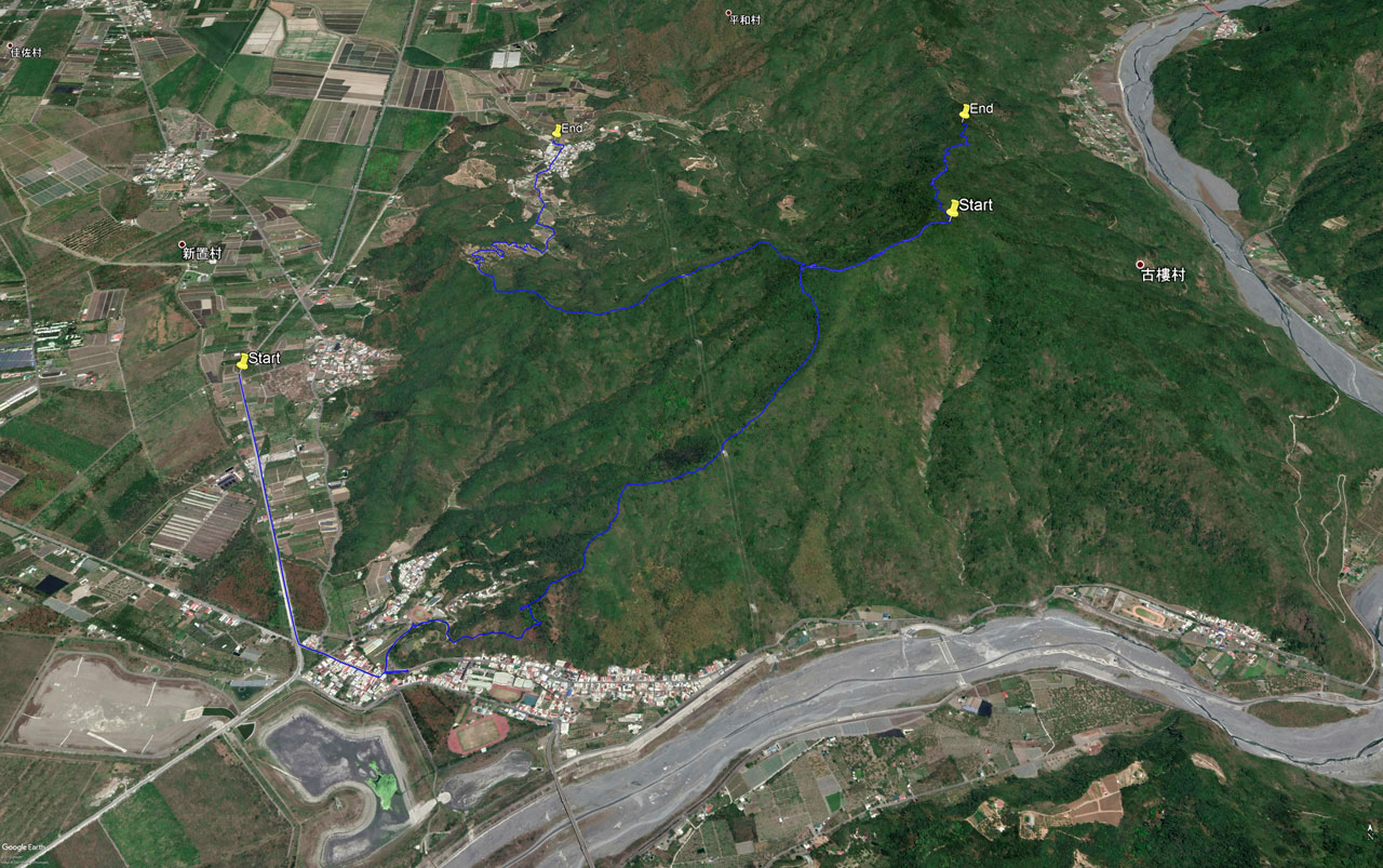
For this hike I chose the northeast route as it seemed the easiest of the three. Despite the short length of roughly 1,100 meters (in a straight line at least), I was sure it would take me a few hours with all the bushwhacking I thought I would need to do. I brought along my cheap Cold Steel Kukri machete instead of my usual Vietnam War US Army style machete because of all the thicker branches I would encounter. The Army machete is a nice all-around workhorse, but takes a lot more energy to cut through the thicker stuff. I’ve had good results with this Kukri.
Trail Head
Getting to the trail head is pretty easy if you have a motorcycle or decent car/truck. It’s a dirt road most of the way, but you shouldn’t have a problem if you go slow enough. There’s also another route to the trail head from the north that might be easier.
When I arrived at the trail head it was a nice sunny day and the area looked much as it did one year ago.

I set off into the tangled mess after securing my bike. The beginning would be easy I knew, because I had already cleared a path for a few hundred meters.


I followed the trail markers but noticed I was slowly deviating from the path I had carved last year. However, there WAS a trail to follow. Did I miss this other trail last time? Whatever the case, I kept following this new trail.


The Never Changing Story…I mean, Scenery
It was obvious to me by now that either I’m getting better at trail finding or this trail had been created within the last year. I’m thinking the former is more likely.
Last year I was following a GPX track that was somewhat old. The trail markers from that route are still around, but the trail is overgrown. I feel dumb for rigidly sticking to that route. Had I opened my eyes more I might have noticed that the current trail veered off in a different direction. Live and learn…
The good thing about this “new” route is that I had yet to even contemplate unsheathing my machete. Granted, it wasn’t smooth going, but it wasn’t bad.


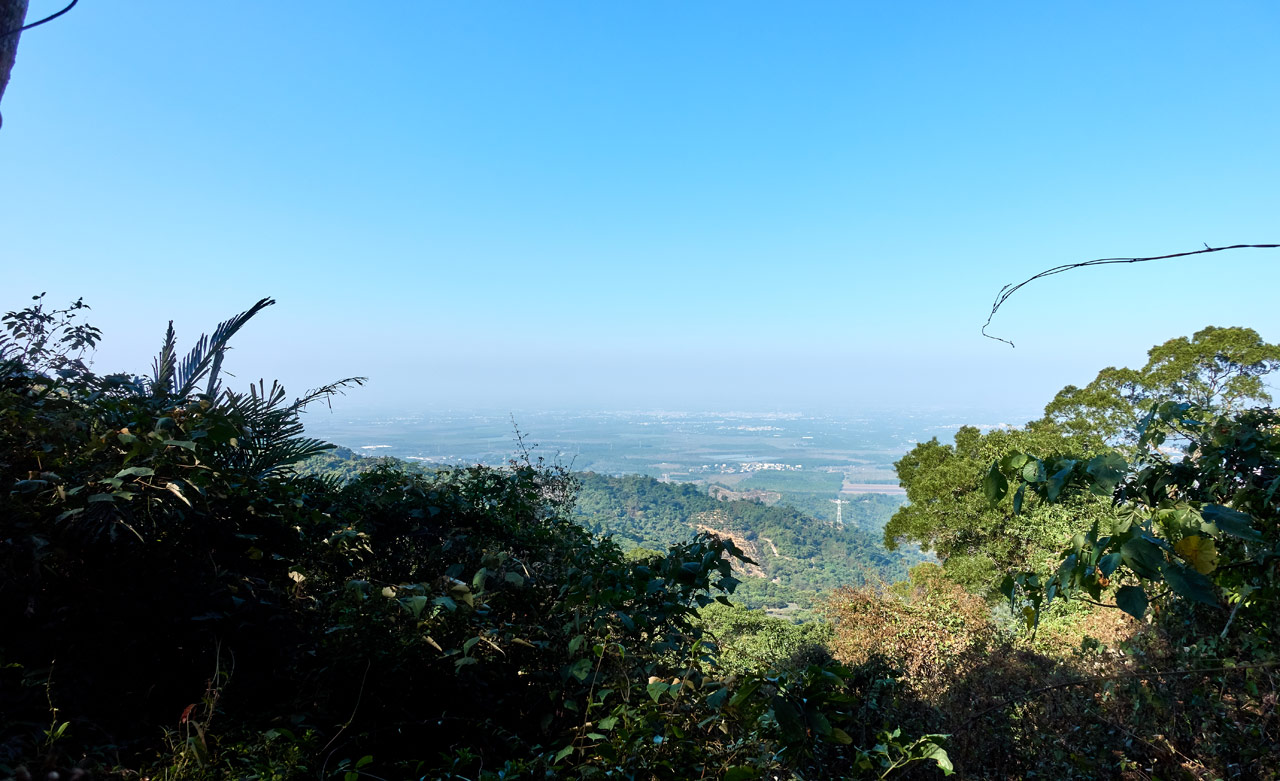
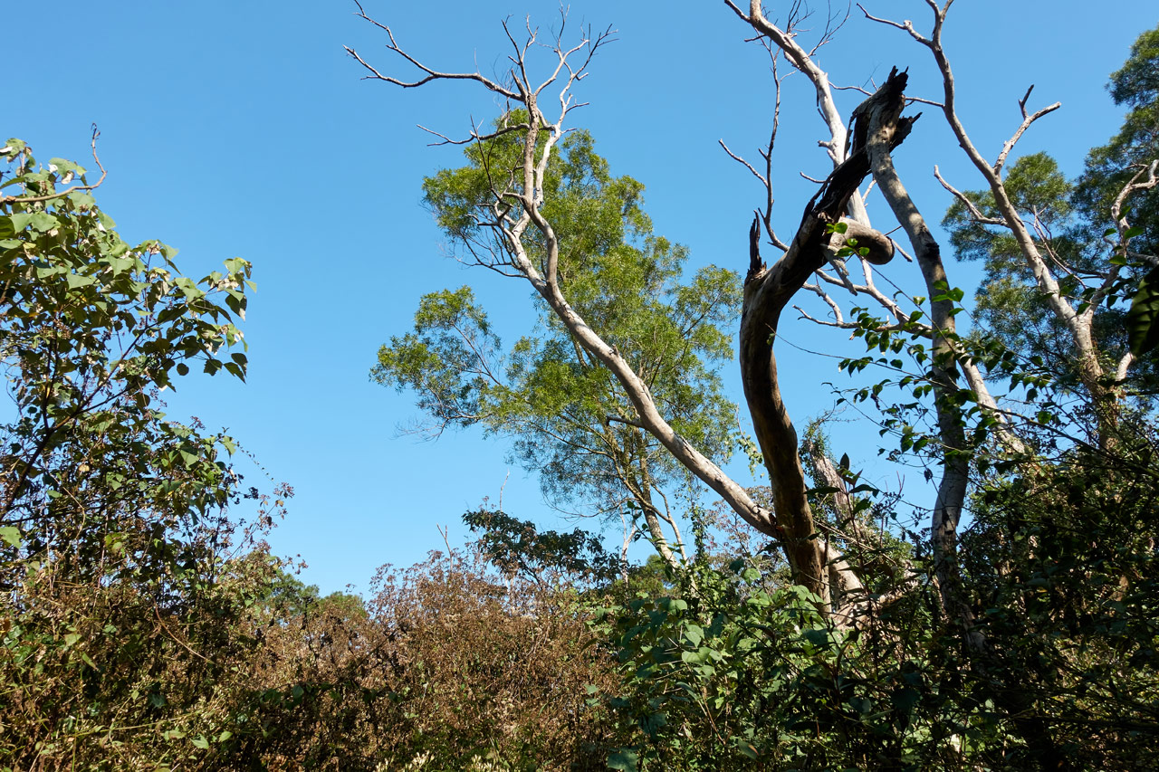
The downside was the scenery. There was no scenery. Everything looked the same for the entire hike. I’m afraid that most of the following pictures will look the same to you. Sorry, but that’s all I’ve got.
There WAS this randomly placed bottom of a can nailed to a tree. That was different I guess. 😆

…and this open area with dense vegetation…

…and even a break in the canopy with a blue sky…
Oh, and I heard something growling at me. That’s it.
The rest of it just looked like the beginning of the hike.


Towards the top I DID find something interesting…to me at least. Two roads!


Sure, they don’t LOOK like roads, but they definitely were at one point in time. It would have been fun to follow them and map them out, but I didn’t really feel like it. I just crossed them and continued the hike up…with more of the same scenery.


I got poked a lot and scraped up pretty good, but I can’t complain because it was relatively easy. And before I knew it…I had arrived!
XinZhiShan – 新置山
It took me a little over two hours to reach XinZhiShan.

There wasn’t a view, but I knew to expect that. One thing I wasn’t expecting though was to see remnants of what I bet used to be at least an occasionally visited peak.


If I had to guess, I’d say the trail that starts in Laiyi village (來義) used to be in much better shape – possibly used as a local exercise route. I’m not sure why it fell into disrepair. But it makes it all the more fun to hike here and a lot more relaxing for me knowing that I probably won’t be sharing the peak with anyone.
I didn’t really feel like staying here long, but there wasn’t any urgent reason for me to leave. I had plenty of time to get down and there was a second nearby peak I had planned to visit if I had time – and it was going to be an easy one. (or so I thought…) So I took an extended break here.
Peak Exploration
And for your viewing pleasure, here is all there was to see at the top of XinZhiShan.
The triangulation stone and sign…


A couple signs attached to trees…


A flag from the recent Taiwan presidential election…

And a “water boundary” stone marker…

Either they painted it in a typhoon or lying on its side. You’d think they would have been a little more careful, eh? (No, not really.)


On the other side of the peak was the trail that goes down to the other two trails.

That’s all there was to see.
After my longer-than-wanted rest I took my proof picture peak picture…

You probably can’t tell, but my face is redder than usual. Part sunburn and part…something else.
My neck had been itchy for half the hike, and later my nose and face. I think I rubbed up against something on my neck. When I later rubbed it with my towel, I must have transferred it to my face when wiping off the sweat with the towel. It wasn’t terribly itchy, but still a nuisance. That night I had bumps all over my neck. It took three or four days for it to go away. Luckily I had some leftover medicine from a hike where I got bit up bad by some little bugs. That cream apparently worked.
The Hike Down
I’m going to make this part quick. It took me an hour and a half. I got off trail at one point. I believe I accidentally followed the original trail a bit before realizing my error. A quick course correction and I made my way back to the correct trail.
Only two interesting things happened on my way down. The first was THIS thing…


As I’m hiking down I plant my hand on this tree and as I walk by it I look over and HOLY SHIT! I think I said something to that effect and quickly backed away cuz I thought it was a bee hive. 😆
Thanks to Twitter, I now know this is Hoof fungus.
Imagine coming down the mountain, hand firmly grabbing this tree for support…you turn your head and your face is within inches of THIS. I thought for sure it was a bee hive and acted accordingly. 😳First time I’ve seen a (mushroom??) like this. #Outhiking #hiking #Taiwan pic.twitter.com/smWwzQXreq
— OutRecording (@OutRecording) February 4, 2020
I’ve seen it before many times but never this large. An interesting fact about Hoof fungus: it can be used as fire tinder. Some of it was found on the 5000+ year old Iceman found in the Ötztal Alps. Hence, its nickname “Ice man fungus”. I kind of like that name. 🙂
The second interesting thing on the way down was this cluster of five snare traps.


They look similar to some of the snares I found on the other side of the mountain a year ago. I must have gotten off trail on my way up because I didn’t run into these. They’ve been placed directly on the trail, and I surely would have gotten tripped up by them. I really hate these things after a bad encounter with one that pulled me and motorcycle down hard. You can read about that here: https://outrecording.com/hike-to-huyayushan-戶亞宇山-in-taiwan/
And that was it for XinZhiShan. I hiked down without incident, jumped on my bike, and made my way over to the WuTanShan – 武潭山 trail head.
WuTanShan – 武潭山 Trail Head
It was looking like I would be having an easy day of hiking. XinZhiShan turned out to be easy and WuTanShan should be even easier! In total it’s about 500 meters of hiking, most of which follows an old dirt road.
But of course I was wrong…terribly wrong.
As I exited the main road onto the old dirt road everything was just as I had remembered it.

About six years ago I had driven up here on my old Hartford VR motorcycle. In fact, this was part of our maiden voyage.

I saw this side road and followed it up. After it leveled off I wasn’t sure which way to go. I stupidly followed Google Maps’ directions. There was an open grass area that I barrelled through. It looked something like this.

I didn’t find anything interesting on the other side so I turned around and drove back through. I picked back up with the dirt road and about 20 seconds later looked down at my left hand. There was a HUGE Golden Orb Weaver spider standing on it! It was larger than this one:

I knew next to nothing about these spiders and well, I panicked. 😳
I took my hand off the throttle to try and knock it off. It might have worked, but I’m not really sure because my bike stalled and we both went down. I rolled off to the side and down the mountain! Thankfully I caught myself before doing any damage. This was the exact spot right after it had happened.

Good times!
Current Conditions
Six years ago this dirt road wasn’t so bad. But now…

I was forced to stop here and heal toe it the rest of the way. It’s too bad because I had hoped to follow the road to wherever it went. After the spider incident six year ago, I had lost interest. 😆
When I arrived at the grassy area I mentioned before, things had changed. The grass was still there but the rest looked really messy.

This was another dirt road I was supposed to follow. Huh…it looked like this wasn’t going to be an easy one. This made me happy.
I busted out the machete and got to work! And boy did I ever!
I cut through this…

And hacked through that…

And made my way through this…

It never really let up until I arrived at the actual trail head that led away from the “road”.

Along the way I ran into this old bee hive.

The way it was positioned, there was no way to walk around it without disturbing the occupants. Lucky for me it was abandoned. Whew!
The Hike Up
From here the trail was well marked.

Though marked rather unconventionally throughout most of it.

But whatever, it worked.
Despite being well marked, it still wasn’t easy.

This next section took me the longest to cut through.

Here’s the “after” picture looking back.

About an hour after I started, I arrived at…
WuTanShan – 武潭山
Well, this was supposed to be the peak.

But where was the stone marker???
After a quick search I found it.

And spent the next several minutes cleaning up.

Mission accomplished!

Once again I wasn’t in much of a mood to stay long. There was nothing to see up here at all. So I took my usual set of pics…


And quickly left.
A Hasty Retreat
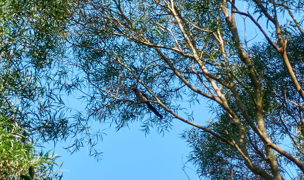
It took less than thirty minutes to get back to my bike. Absolutely nothing of interest happened. Though I did stop for a few minutes to try my luck at attracting some birds with a Collared Owlet call.
I managed to attract this little fellow. I cropped the picture quite a bit.
And that’s it! My hike ended.
The End
This was one of those combo peak hikes that I enjoy. My expectations of both peaks were completely wrong. The hard one was easy and the easy one was hard. This kind of thing keeps you on your toes, you know? The Taiwan mountains are always changing and rarely disappoint.
Now for the average hiker…I don’t think you’ll like either of these peaks.  Don’t yell at me if you find yourself on one of these trails.
Date hiked: 2020 January 31
GPX Track Download Instructions: Click the track on the map to see the download link
XinZhiShan – 新置山
WuTanShan – 武潭山


![[Valid RSS]](https://outrecording.b-cdn.net/wp-content/uploads/2020/03/valid-rss-rogers.png.webp)
Leave a Reply