

If you’re looking for a somewhat challenging day hike, but one that offers a trail the entire way, then XueYeGenShan 鱈葉根山 might be worth considering.
I hiked to XueYeGenShan two weeks after hiking to BaiBinShan and ZhenLiShan Northeast Peak – 白賓山, 真笠山東北峰, which are located on the same ridge. My original plan had been to hike all of these in one go, but as usual I started too late and had to break it up into two hikes.
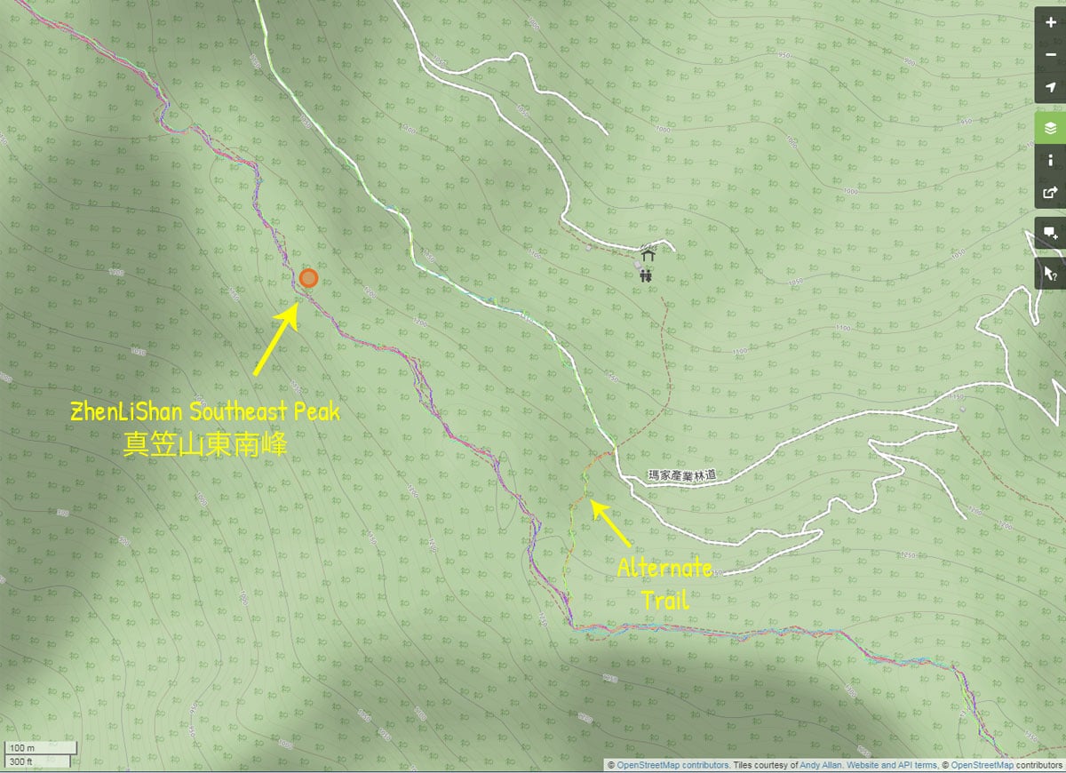
Here’s the map of both routes.

The blue route is the trail to XueYeGenShan.
Getting to the Trailhead
As you can see, there’s a road that takes you nearly all the way up to ZhenLiShan Northeast Peak. Google Maps does a fine job plotting the route, but there is one turn that could be confusing. When you get to this intersection, take the road on the right.

Continue up until you reach this dirt road: 22.674099, 120.670856

If you’re in a car, park and head up. If you have a scooter or motorcycle you could drive a little ways up the dirt road if you want. It won’t save you much time though.
Getting to ZhenLiShan Northeast Peak
I apologize, but I’m going to be lazy and direct you to my write-up from the last hike. Scroll down near the bottom and you’ll find it. It’s super easy to get to ZhenLiShan Northeast Peak from here. It’s so easy in fact, that it makes for a good family mountain-top picnic area with no hiking involved. (Weekends are probably busy. Be warned.)
As for me, I drove up as far as I could go and parked off to the side of the road.

It was quite foggy that morning. I feared the whole day would be like this, killing any chance of seeing the beautiful views of the surrounding mountains like I had the last hike.
ZhenLiShan Northeast Peak – 真笠山東北峰
Once again I had arrived at ZhenLiShan Northeast Peak. Since this was my third time here, I didn’t plan to stay long…just a few minutes in fact. Again, if you’d like to know more about this peak, check out my last post.
According to a thermometer that hangs off a tree, it was around 18 degrees Celsius that morning. I highly doubt that was accurate.

Somewhere up there attached to a tree is the sign you’re looking for. Follow it to XueYeGenShan!

As I mentioned, I only stayed a few minutes. This was largely due to hearing people coming up from another trail. It sounded like this loud auntie who was there two weeks ago. She was nice, but I didn’t feel like getting into a conversation, so I grabbed my stuff and fled like someone had thrown a hand grenade.
BTW, if you arrived early enough and want to bag another peak, head on over to ZhenLiShan – 真笠山. It doesn’t take long. Though there’s nothing special about it really – no views at all.
Let’s Begin!
The hike technically started back where I parked, but this felt more like the real start of it.

It was damp and foggy, but otherwise felt pleasant. The first ten minutes or so is mostly flat and looks much the same.


I shouldn’t have been surprised to see a “claimed area” but I was. I figured this whole stretch would be nothing but a trail. Looks like I was wrong.

After the “claimed area” things start to change a bit.

There was a bit of a downhill…


…followed by a bit of uphill…

…which is then followed by a bunch of messiness.

It wasn’t really that bad. But the bit of moisture on everything didn’t make for ideal climbing conditions.
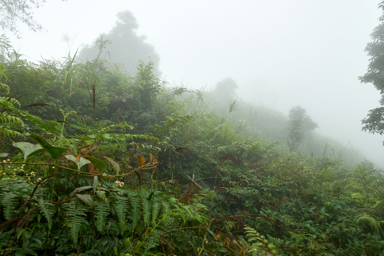
And conditions didn’t improve.


I’m assuming this would have been a decent view on a clear day.


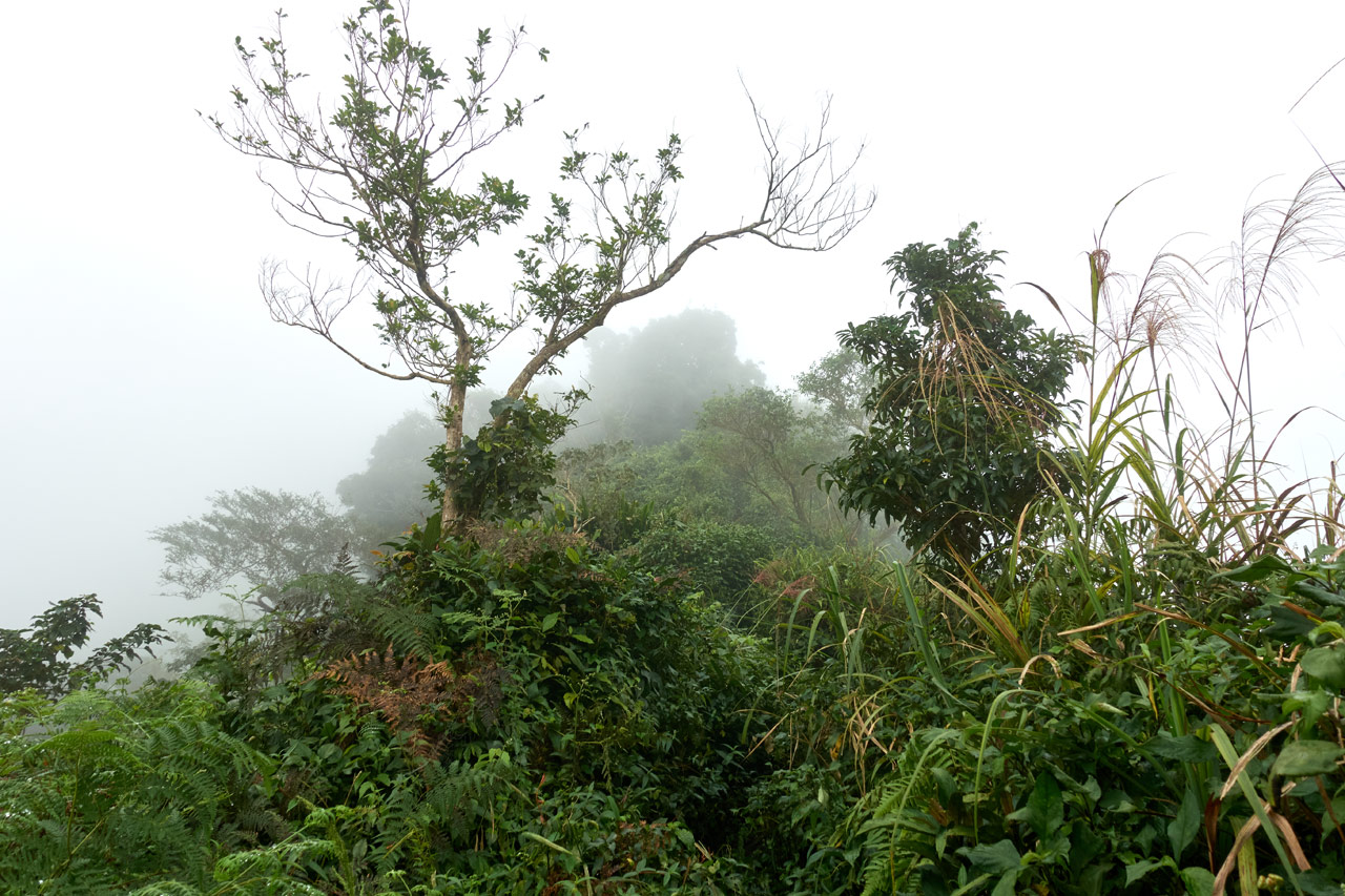
All that work wasn’t without reward however. To my surprise, up and to the left of the trail was…
ZhenLiShan Southeast Peak – 真笠山東南峰 !

This peak was not on my radar at all. I research all my hikes and generally know what’s to come–especially trig stones–but somehow I missed this one. At any rate, it was a welcome find. This would make a perfect (though not ideal) place to take a break.
And after said break I took my peak picture and photographed whatever was nearby of interest.


This tree has some directions on it.

One final note about ZhenLiShan Southeast Peak. It appears there should be a decent view from this peak as evidenced by THIS post. I wasn’t as lucky unfortunately.
Onward to XueYeGenShan
After leaving ZhenLiShan Southeast Peak, things got better. It was still quite foggy, but the hiking was relatively easy.


Yes, there was a rope section or two, but it wasn’t that bad.


When I saw this old blue oil-style drum on the side of the trail I knew there must be, or had been, an alternate trail nearby.

And there is! But I’ll get to that in a bit.

Picnic Site?
Less than twenty minutes after leaving the last peak I came to what OpenStreetMaps labels as a “picnic site”.


This is a much better place to stop for a rest, but there seemed no point in stopping again. So I pushed on.
There were a couple not-so-great spots like this…

…but for the most part it was easy hiking again.


Alternate Trail
I mentioned I thought there might be an alternate trail, right? When you see this gaggle of ribbons tied to all these trees, you’re there.

As you can see below, the trail goes down the mountain.

Coming up from this trail would save you a lot of time and effort. There’s a road not too far down that trail.
It appears to be about 100 meters elevation difference over roughly 250 meters distance. Taking this shortcut will cut more than half the distance off the entire hike. If your only goal is XueYeGenShan, I would highly consider this route.
From Easy to Less Than Easy
Standing at the intersection of the alternate trail you can clearly see how the trail is well worn going to ZhenLiShan Southeast Peak. But the opposite direction to XueYeGenShan? After about a minute it turns into this…


And the whole time climbing up…


I think you get the idea…*sigh*
Then the ropes came.


All of this only lasted for thirty or forty minutes before leveling off.

Another Picnic Area
Not long after it levels off I came to another “picnic area”.

I didn’t feel much like resting, so I took some pictures and moved along.


Part of the reason why I didn’t rest there was because I was about 80% of the way to the peak. Roughly 1 kilometer til I was there. So why rest, right? Just get your butt in gear and go, go, go!!!!
Except…I had no idea of what was ahead of me: one hour of steep and sketchy climbs.
But of course it doesn’t start out that way. No, it tries to lure you into a false sense of security.


It’s all nice and good until I got to this landslide.


While I was taking these pictures, I looked down and saw this little dude in a defensive posture.

Up, Up, and Away!!
This is where the hike takes a turn…or a lift…or..well, it’s just a lot of climbing and ropes!


The above climb looks innocent enough. But with the rocks being moist, it was a little bit of a challenge. If you look to where the ropes go, you’ll notice a bunch of metal tied up. I thought it was a ladder or some sort of “climbing aid” that collapsed. I was wrong.

Someone carried these railings up here and tied them together as crude stairs to help get up the rocks. I was dubious, but they were solid enough. Without them it would be difficult to get up there.
From here it just gets crazy with the rope climbs.


Here’s a video from the above picture. Good times!
Someone tied up this metal container to be used as a step. It’s perfectly placed and did a good job. It’s definitely needed.


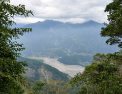
This should probably be a great view. Oh well.


From this spot I was really close to the peak. I thought (ok, I was praying) it would be a nice and easy walk to the peak. But as usual, I was dead wrong.


It’s like you’re SOOOOOOO close and every time you finish one rope climb there’s ANOTHER rope climb waiting for you. “OH COME ON!!!” come out of my mouth a lot.
Almost There
But the rope climbs did ease up at bit at the end. There were still a few but they weren’t nearly as steep.


Until everything finally leveled off and I got my “easy walk to the peak” which didn’t last that long.

XueYeGenShan – 鱈葉根山
At long last, I made it!

At this point I wasn’t expecting any kind of views. Maybe if this peak was up in the 3000+ meter height I could get above all that fog. But at 1556m, there was no chance. There were a lot of trees around, so I doubt the views would be spectacular anyhow. That’s my rationalization and I’m sticking with it!
I spent about fifty minutes resting and eating…

…took my peak picture…

…as well as pictures of everything in the area…


…and got the heck out of there.
The Return Trip
I would skip writing about the return trip if not for two things. The first…well, it rained.
I suppose the rain just rounded off the whole hike. It was wet the entire time, but it never rained until near the end. Why not, right? *sigh*
Thankfully it didn’t rain while I was climbing down that rope section. That would have sucked dearly. They were bad enough just being wet.
The second notable event on the way back happened as it was turning dark. For whatever reason I always wait as long as I can before putting my headlamp on. I think I just don’t like stopping. It’s silly and dangerous, I know. Anyway, I finally stopped to put it on and it wasn’t but a MINUTE later that I saw this on the trail:

That’s the infamous “100 Pacer”, or Deinagkistrodon Acutus – a type of pit viper. 百步蛇 in Chinese. It’s highly venomous. Had I not had my headlamp on, I might have thought it a tree root and (hopefully) stepped over it. I’m really not sure what the outcome would have been. It’s a bit scary to think of really.
I waited a bit for it to move off to the side. Since it was still slightly raining I didn’t want to take out my good camera for the picture. I regret that decision now. It’s not often you get the chance to see one up close.
In Conclusion
Despite the wet conditions, this was a really great hike. I’m sure I’ll pass through here again one day. I wouldn’t recommend this hike to a novice hiker. But anyone with some experience, and who doesn’t mind rope climbs, I would say go for it. The views must be great!
And if you try this hike, please report back on how the views were. Thanks!
Date hiked: 2020 Oct 30
GPX Track Download Instructions: Click the track on the map to see the download link


![[Valid RSS]](https://outrecording.b-cdn.net/wp-content/uploads/2020/03/valid-rss-rogers.png.webp)
Leave a Reply