

After stumbling upon the abandoned Paiwan village Vuri’ilj last week, I decided to look for another abandoned village to visit. My search led me to Kulalangau (sometimes written as Kulalangaw) in Chunri – 春日. It’s located very near BeiHuLuShan 北湖呂山. In fact, there are two alternate trail heads you can take to get to BeiHuLuShan that should be much quicker and easier than the route I took when I went in January. They’re located along the road to Kulalangau.
The road to Kulalangau used to be completely overgrown…

…and impassible.

Those shots were taken in 2016 when I was exploring the area.
But now, the exact same spot looks like this.
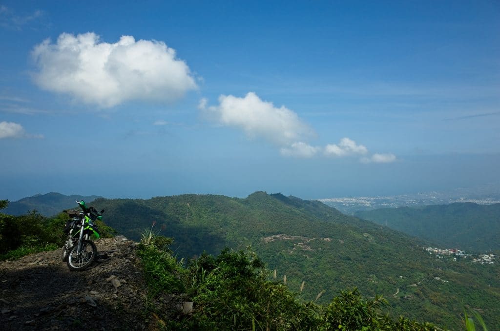
I didn’t think to take a picture of the rock slide. It’s to the left of my bike. But believe me, the trail is now clear and you can easily drive past it.
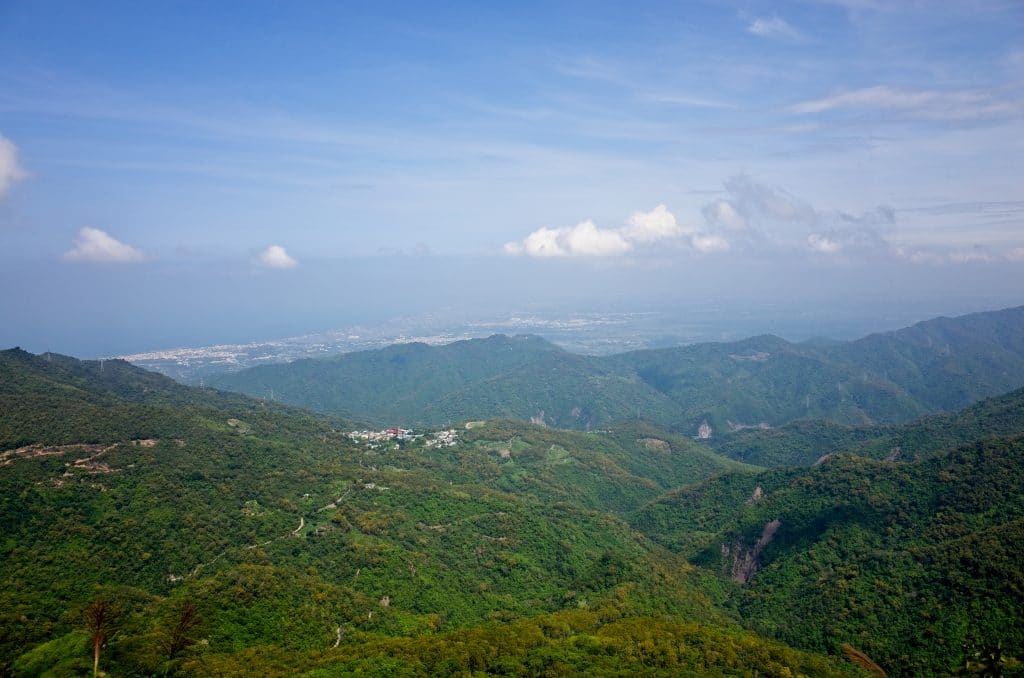
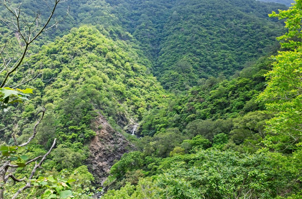
The views from this location are spectacular. You can see the ocean, mountains and all the little villages and farms below. If you want a nice spot to sit and eat lunch, this is the place! Unfortunately it was a bit hazy that day.
It’s roughly a 16 kilometer drive to the village when starting from the bridge at the base of the mountains – the first 7 kilometers are paved for the most part. Beyond that it’s dirt and a couple rock slides that are kind of dangerous. I met a farmer or hunter along the way who was trying to clear rocks from the landslides. He wanted me to follow him, so I didn’t stop to take pictures. I would be very careful if you plan to drive through those landslides.
I arrived at Kulalangau roughly an hour after starting at the bridge.

I parked and started exploring.

I noticed right away how well the village looked.


Well…how well it looked compared to some villages I have seen. This place has obviously been taken care of. I have never seen a village with a thatched roof intact like the picture above. Judging by the banner hung where I first arrived, there was some activity here recently.
I did a little research and found a couple of interesting Facebook posts. It looks like some of the villagers from the nearby Kasevengan village helped to clear the road last March.
And in April they went down as a group and visited the village and hiked to the riverbed below.
I also found that in 1938 the inhabitants of Kulalangau village were moved to the current Kasevengan village, or (I believe) 士文 in Chinese. It appears they’ve kept a connection to their old village. It must have taken a lot of effort to to clear 9 kilometers of overgrown trail and keep the old village from becoming completely swallowed by the jungle. If you want to know how bad a truly abandoned village can look, wait for my next post about my visit to Tjuqemadris. That village was REALLY bad.
But let’s get back to Kulalangau. Here are some pictures from my walk around.


While researching this village, I found an archived picture of the village from an unknown date.

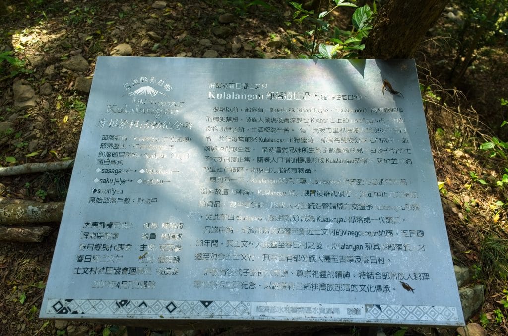
係由力里社姐弟二人因迷信可以結婚而被放逐
到另外部落 kulalangaw。後因有過路的族人送獵
物,因二人食不盡隨即棄之而損壞發臭被蒼蠅圍
繞,進而得名為 kulalangaw。
It roughly say something about a sister and a brother who got married because they were superstitious. The people where they lived kicked them out because of this and they went to this new place, Kulalangau. A hunter shared some food with them there. But they couldn’t finish the food and threw it away. Many flies came to eat the discarded food and that’s how the place got its name.
I’m a little confused by the story. I’m not sure if it means they were the first inhabitants of this new place and it got its name from the food that went bad (like, Kulalangau means something about bad smelling food?)…or if it was already an established village and renamed to Tjauruljivak after they arrived because of the incident. My Chinese isn’t good enough to understand the story and my wife had trouble figuring it out.
If you understand and want to help me with the translation, I’d be grateful! I’m sure I got it all wrong.
I only spent thirty minutes exploring the village. There was more to see spread around the area but I had seen what must have been the heart of the village and that was enough for me. I had other places I wanted to go, so I set off to explore some more.
Oh, and I didn’t find any traps like I’ve been finding a lot of recently…but I DID find this.

A bag of trap-making materials. From what I’ve seen before, those things are used to make a type of spring loaded snare – similar to these.


I found those “nearby” on the way to NanHuLuShan at the end of December.
Ok, back to my story…
The original plan was to drive to the village, explore, and then follow the trail that exited the village to see where it goes. After following that, I had planned to hike up to BeiHuLuShan if time permitted. I estimated it was only 800 meters to reach the peak; so totally doable.
I never made it to BeiHuLuShan, but got something equally as good. Here’s what happened.
I exited the village and followed the trail down towards the river at the bottom of the mountain.


You could tell this was recently cleared. They must have had an excavator and some chainsaws to clear it this well.

The last few switchbacks were REALLY steep. With the amount of work put in to open up the trail this far, I thought there HAD to be something good at the end. I continued down until it came to an end.

From what I could tell, the original road used to wind further down the mountain. But a large landslide ended it here. If you’ve made it this far by motorcycle, I highly recommend you take it easy coming down to this spot. If you continue down over the edge, here’s what awaits you.

Good luck with that…
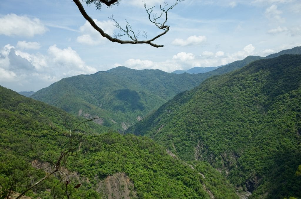
But if you did stop, take a moment and enjoy the views.
Off to the right is a trail heading down.

If you’re cold, maybe this jacket will still be there for you to wear on your way down.

The hike down is pretty easy – steep, but easy. Just keep in mind that you’ll need to hike back UP after you’re done exploring down below.
There are some markers and words of encouragement along the way.

This one says “大家加油 – Dajia Jiayou”.

This bit of encouragement is facing the downward part of the trip. It really needs to be written on the other side of the tree for when you’re climbing back up. Believe me, you’ll need it!
With the exception of one minor landslide and a loose-rocky rope descent…

…the trail was well groomed and even had small and large trees removed by chainsaw or machete.


This tree appears to have been recently cut judging by the sawdust. My excitement for what awesomeness must be at the end of this trail was growing. I couldn’t imagine anyone going through so much trouble clearing the trail to the village and then clearing a path all the way down to the river, only for there to be nothing special there. There HAD to be something cool. My guess was a waterfall.
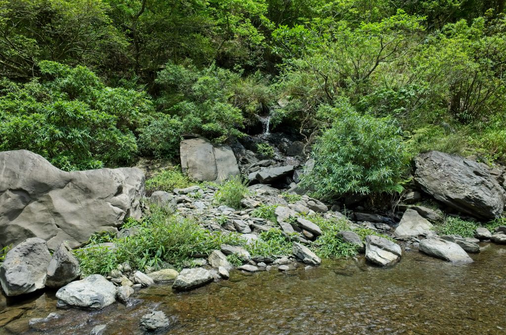
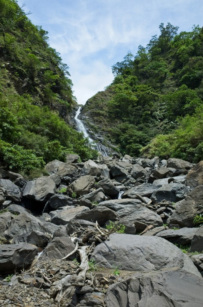
And I did see something promising as I neared the riverbed.
There’s a small waterfall and a nice large pool in the distance. It’s difficult to see in this shot, but from a different angle down the trail you can see the pool looks sizable.
On my way down near a landslide area I heard a medium sized rock falling from above. There are few things in the mountains that scare me more than hearing a rock falling from an unknown direction above. You have no idea if it will hit you or not. The only thing you can do is try to make yourself a smaller target. Crouch down, cover your head, and wait. Or if you’re lucky enough to be behind a decent size tree or boulder, you can use that for cover. In this case, it fell down about 15 meters in front of me. I waited a bit in case there were any stragglers.
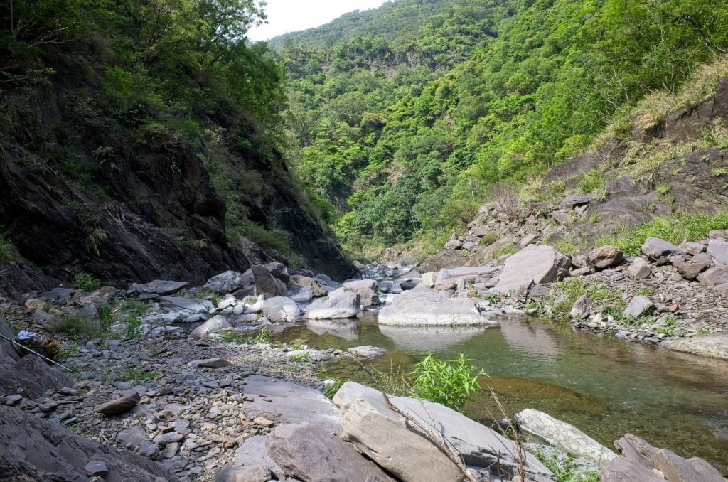
After all was clear, I continued down and quickly arrived at the riverbed.

I climbed down, and right before reaching the riverbed I found this little makeshift camp.


As expected, the Abandoned Cap Cult strikes again.

The river is just below this place.

There wasn’t an obvious path to the pool that I saw earlier from here. It looked like I would need to get my feet wet if I followed the river downstream to find it. I wasn’t quite ready for that so I chose to travel upstream instead. There was garbage all around the area. It was dispersed upstream, so I thought that was a sign that maybe people traced the river to reach the waterfall I had hoped to find.


I followed it upstream turn after turn for thirty minutes, and found nothing. I also stopped seeing garbage. This worried me. Would I find nothing?
Despite my worries, I pushed on.

This little pool of water doesn’t look deep, but I believe it would come up to my neck if I jumped in.

Forty-five minutes into the river-trace, the river ran dry.
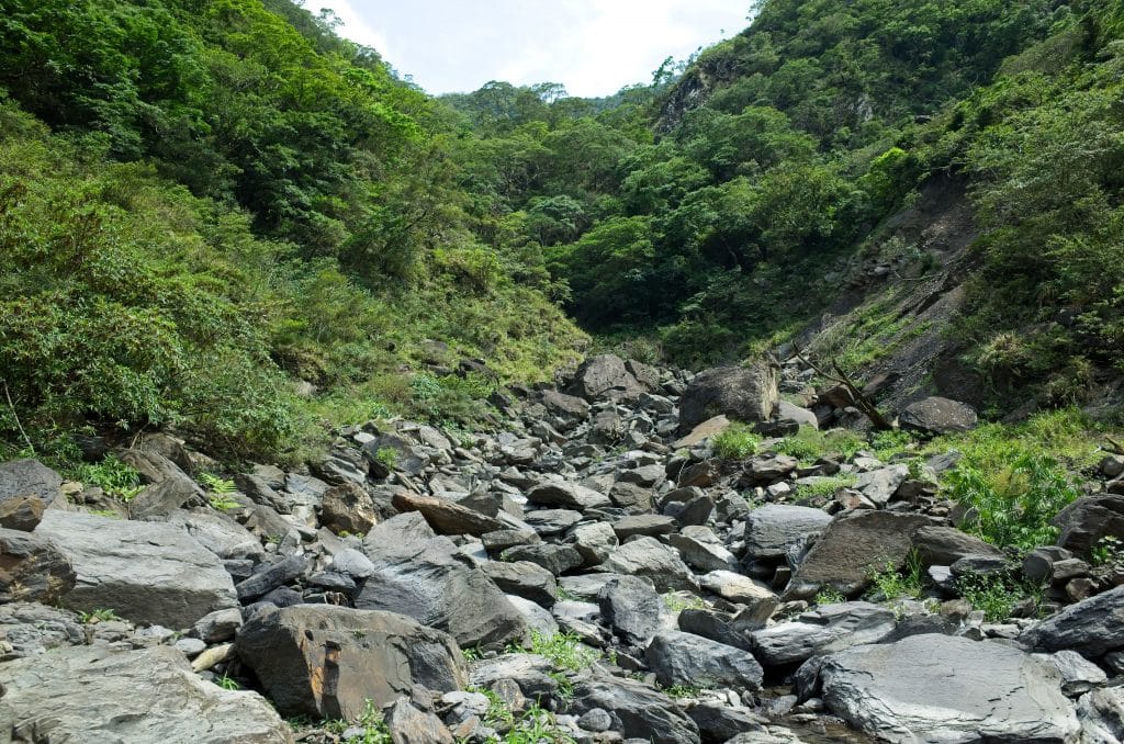
I thought for sure this was the end. But I’m stubborn. I’ve seen rivers go dry over a length of distance and then find water further upriver. Maybe that would happen here. It must be the case because I wasn’t about to turn back.
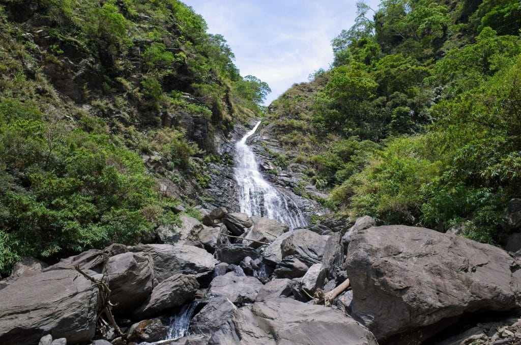
It was coming up on one hour of riverbed hiking and guess what? The water flow had returned AND…I was feeling a spray of mist on my face. That could only mean one thing.
WATERFALL!!!!!
I was excited and quickly jumped from boulder to boulder to reach the top.
But as I neared the waterfall I began to suspect something. Was there a pool at the bottom?
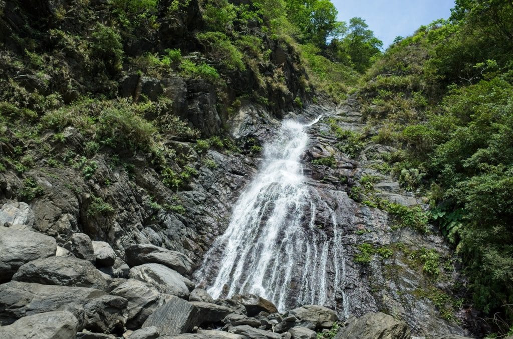

No, there wasn’t a pool. There were just boulders and smaller rocks. That was really unfortunate. I was hot and could have used a dip in the cool water.
But as things were, I found a spot under the nearby trees, used a flat rock as my seat, and ate lunch.
I stayed for a short while before heading back down river. But before leaving I had to test out the 10 second delay on my new camera.

My shins still hurt from that picture. Note to future self: take your time when scrambling up boulders. A picture is not worth getting hurt over.
The hike down was uneventful. I did find a skull from possibly a Serow.

By the time I reached riverbed exit, I was tired and it was getting late. I didn’t feel like searching for the route to that pool I saw earlier, if one even exists.
So I hiked back to my bike and drove the 16 kilometers back to civilization.
I plan to go back someday to search for that pool. If you go and find it, please let me know. It will save me a trip if it’s not worth it.
Date hiked: 2019 May 25
GPX Track Download Instructions: Apologies! For some reason this GPX track is not showing on the map for mobile devices. I’ve spent over an hour trying to figure out why. Until I solve it, just click the “GPX” or the globe icon to download either the GPX or KML version. Sorry for the inconvenience.


![[Valid RSS]](https://outrecording.b-cdn.net/wp-content/uploads/2020/03/valid-rss-rogers.png.webp)
2 Comments