

ZhuoDiLuoLiuShan – 著地螺留山 is a mountain people will usually hike together with ShiKeJianShan – 石可見山 if they have the extra time and energy. But it can make an excellent day hike if you want to do something more relaxing without worrying about the time. It offers nice views of the mountains beyond and river below, as well as a sneak-peak into a traditional aboriginal village. And the drive to the trail head ain’t too shabby either!
I thought this hike would be perfect as a ‘test hike’ to see how my injured knee was doing. This would be my first hike since I hurt it while hiking to DaWuCang and KaShan – 大武藏 & 卡山 five weeks earlier. It wasn’t completely healed, but felt good enough to take on the gradual incline at a relaxed pace to the peak.
Trail Head
Getting to the trail head takes a bit of time. You’ll need to drive along the Lili River (力里) and make your way up and then down the mountains to Laoqijia Suspension Bridge – 老七佳吊橋.

This is an excellent place to stop for pictures. All the cool kids are doing it.
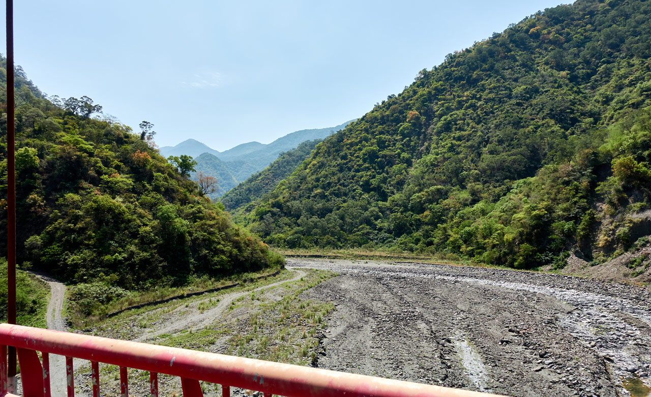
You also could take the riverbed road to reach this bridge. It will save you some time and should be a lot more fun. However, it’s not always there and you will likely need to cross the water once or twice. The water is usually pretty shallow, so it’s not a big deal. But still, be aware that there might not be a road.
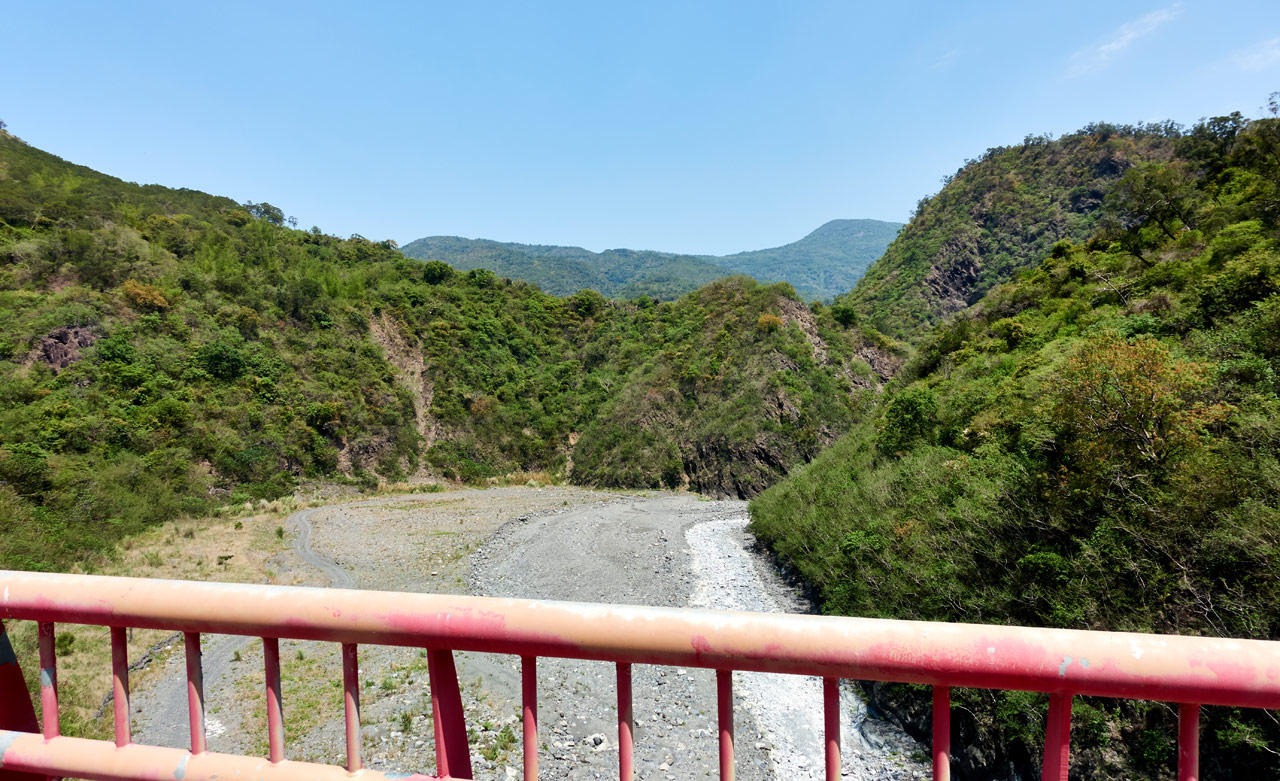
From the bridge it’s a relatively easy drive up to the trail head. There are a couple pretty steep sections, so please be careful.
The road will take you all the way to the gate of the LaoQiJia Tribe (Tjevucekadan). You cannot enter without permission, but you can get a decent look later while on the trail high above. There’s a large map of the village for you to look at nearby.

If you drove a car, this would be the place to park. Otherwise, a motorcycle or scooter can make the short drive up to the trail head to park there. That’s what I’ve done both times.
Let the Hike Begin!
A locked gate marks the beginning of the hike.

Were it not for this gate, you could drive a motorcycle or scooter all the way up to the saddle and save yourself a solid hour to hour and a half of hiking. But what would be the fun in that?
Instead, you get to hike a single-track trail that looks more or less like this the whole way up.

But you do get some nice views early on that continue the whole way up.
Now this is where I’m going to depart from my usual style of step by step storytelling. This trail is really simple and there isn’t a whole lot to write about. If you’d like to read a few more details about this section up until the saddle, have a look at my write-up from my trip to ShiKeJianShan. One point of interest in that post is about a survey marker I found by accident.

I couldn’t find it on this hike despite knowing exactly where it was located. There was a lot of overgrowth and I didn’t bring my machete to help look for it. Maybe you can find it..
Nice Views and Random Photos
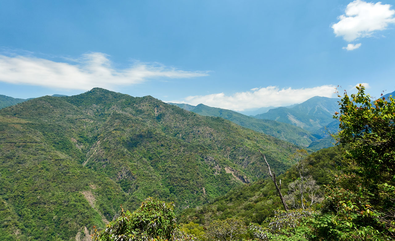
Over the next hour and a half expect views such as these.
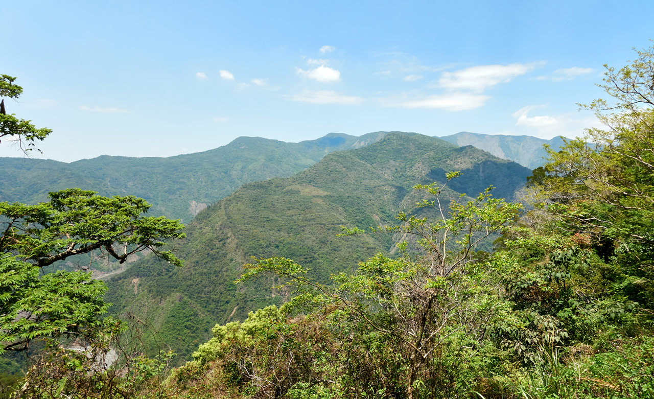
In the above picture you can see JiuBaoShan 久保山 in the middle. Just above that old farmland in the center is NanJiuBaoshan 南久保山 – both great hikes.


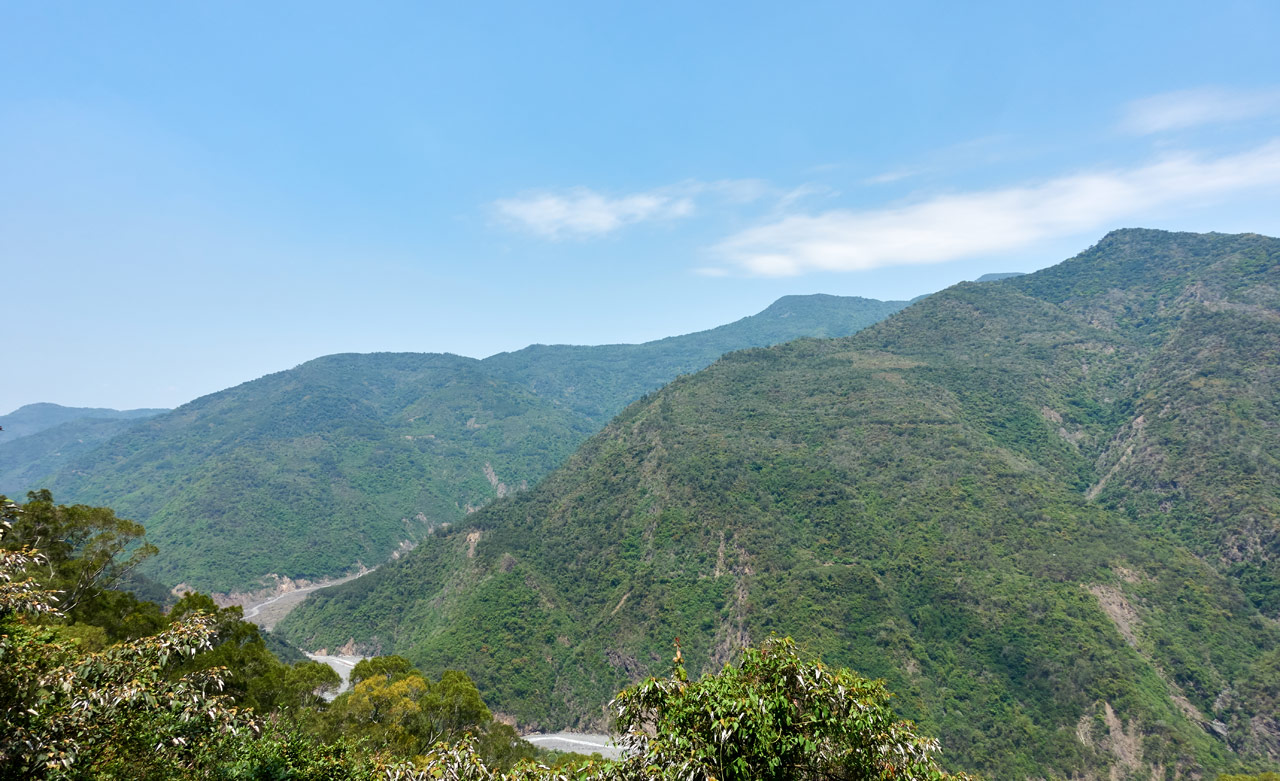
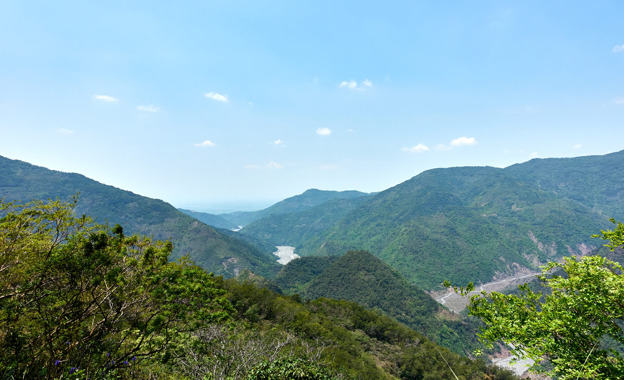
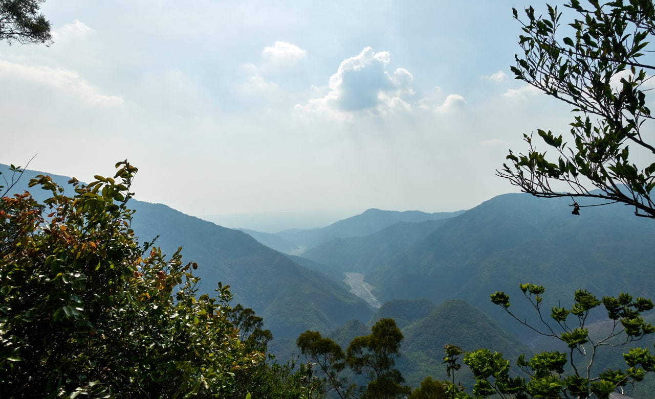
As you near the saddle you can get a spectacular view of several mountains and the riverbed below.


Dawucang 大武藏 is a decent day hike where you don’t have to push yourself too hard. Or if you want something a bit more challenging with more reward, keep going to Kashan 卡山 (You can’t see it from here. It’s behind that little peak the arrow is pointing at). And if you have a couple spare days, try for Yidingshan 衣丁山.
I’d also recommend Qijiaxishan 七佳溪山 riverbed hike. It’s awesome! Trust me!
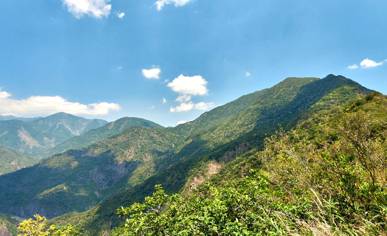
Once you near the saddle you’ll get a clear shot of ShiKeJianShan if you’re lucky.
The Saddle
The saddle is a great place to take a rest before your journey up to either peak. It has a nice open area suitable for camping if you wanted to do that for some reason.

There’s two directions you can go from the saddle, either up towards ShiKeJianShan or the opposite direction towards ZhuoDiLuoLiuShan. But don’t be fooled and follow the old road.

I don’t know where it leads (probably to old farmland) but I doubt it will take you to ZhuoDiLuoLiuShan. Instead, on your right side just as you start to follow that road, there’s a trail headed up the ridge. Do follow that trail.

Trail to ZhuoDiLuoLiuShan
There honestly isn’t much to say about this trail. It’s relatively easy to follow and heck, you’re on a ridge, so you can’t really go wrong. You can see where the old trail splits to a new trail here and there because of a fallen tree or major overgrowth, but it doesn’t hamper your progress.
Here are some random pictures of the trail.


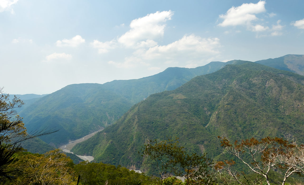
There were one or two places with an open view of the mountains and river on this side.
And the occasional obscured view of the other side of the mountain.

And as promised, a look down into LaoQiJia village. This is just one part of it. There’s more that’s covered by the trees.
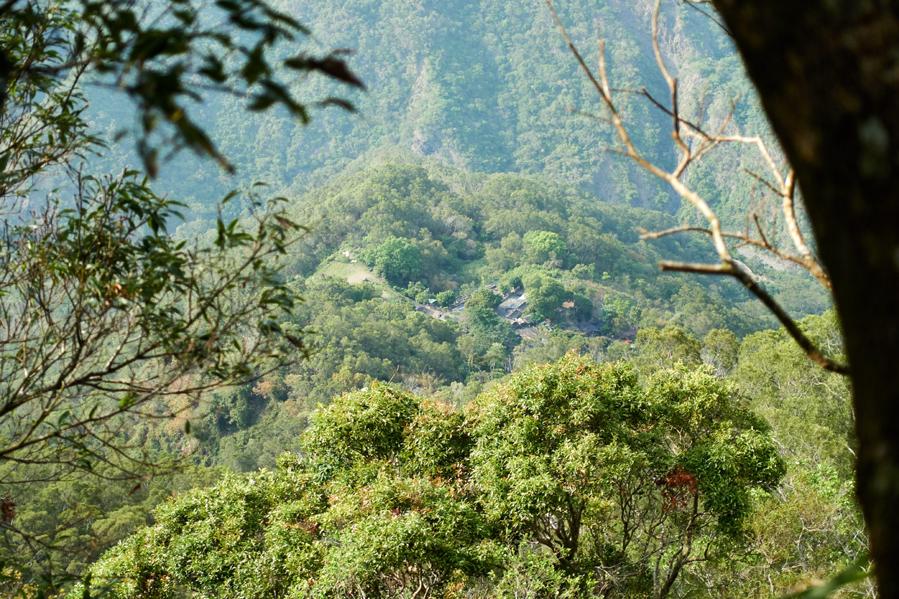
The only other thing of interest were these stacked stones.


Their purpose? You’re guess is as good as mine…
ZhuoDiLuoLiuShan – 著地螺留山
It took me an hour to reach ZhuoDiLuoLiuShan from the saddle – and that’s excessive. I was really taking it easy because of my knee. I’d bet a highly motivated individual could make it in half that time easily.

The peak was a lot better than I thought it would be. It’s not overgrown, there’s shade, wind, and if you walk past those trees, there’s a bit of a view.
Unfortunately it was pretty hazy that day.
But I’ll tell you what…this was the first time I’ve had what I’ll call a “perfect peak day” since my hike to BeiHuLuShan – 北湖呂山 over a year ago. The weather was just right and I had plenty of time (and a chair!) – it was SOOOOOOOOOO relaxing.


After that extended rest, I took some pics and headed back.


Oh yeah, and my peak picture.

New Boots
I’m wearing my new hiking boots, a pair of Altra Tushar in green. REI was having a free shipping to Taiwan deal. With their yearly member discount plus my dividend…I just had to buy SOMETHING. My old boots were almost needing new soles, so I figured I’d buy a backup pair.
These weren’t my first choice (or second or third); REI won’t ship a lot of their boots overseas. So I ended up with these. They did fine. They have a super wide footbox and a zero drop angle inside. I think they’ll take some getting used to, but for easier hikes I’ll probably choose these. They were definitely comfy!
Oh, and coincidentally…this is the same mountain I climbed with my old boots for the first time about a year ago when I went to ShiKeJianShan. It took me exactly one year to wear out my soles. 🙁
Possible Alternate Route
Along the way to the peak I noticed this old road headed in a different direction with a couple trail marker ribbons.


There’s nothing in that direction that I know of. My only guess is it’s an alternate route to ZhuoDiLuoLiuShan. I recall there being a path leading out the other end of the peak, so it’s possible that’s what it is.
Looking at the map below, it’s located at the yellow arrow. (click for a larger picture)
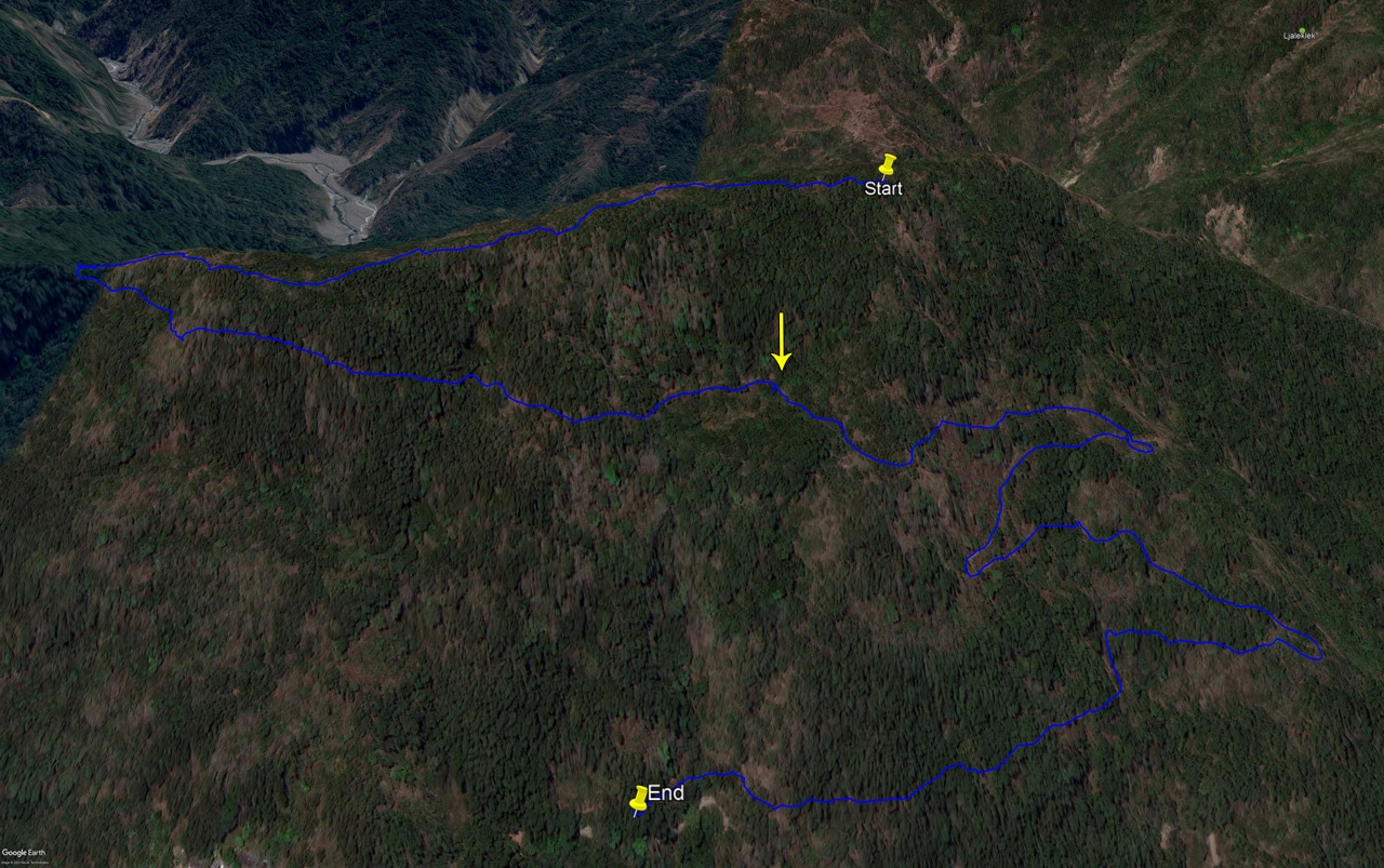
It heads off to the right of the arrow. If it truly IS an alternate route, it would probably be a much faster, albeit steeper route to the top. Normally I would be game to explore it, but there’s no way my knee could have handled that kind of steepness.
That’s It…
I don’t have anything else to add about the trip down. My knee was fine for the most part, though it gave me some soreness/pain towards the end. All in all the hike was relaxing and nice. It was the perfect hike to see if my knee was ready for something more challenging (definitely not).
Here are some random pictures I took on the way down.


This last one was a bit off-putting. 😆
Date hiked: 2020 April 15
GPX Track Download Instructions: Click the track on the map to see the download link


![[Valid RSS]](https://outrecording.b-cdn.net/wp-content/uploads/2020/03/valid-rss-rogers.png.webp)
Great report as always. Thank you for your hard work Mr Glenn. Lady and I made it up and back round three hours. The scooter ride up the mountain from the main rode almost stole the show. Quite a wild ride.
Thanks Tim! Glad you found the post useful. Yeah, the ride up to the trail head is an adventure all its own! Thanks for the comment!