

This was originally going to be a combo post of two hikes I did a couple weeks apart. But I realized halfway through writing this that it would be quite a long post; so now they get their own posts! The original plan had been to hike to BaiBinShan, ZhenLiShanDongBeiFeng, and XueYeGenShan – 白賓山, 真笠山東北峰, 鱈葉根山 but apparently that was too ambitious. The first hike was BaiBinShan and ZhenLiShanDongBeiFeng (Northeast peak) and the second hike was XueYeGenShan – that will be my next post. I do believe it’s possible to do all three in one go, but you’ll need to start mighty early and possibly arrange pickup somewhere around ZhenLiShanDongBeiFeng.
But I’m getting ahead of myself. Let me introduce this hike first.

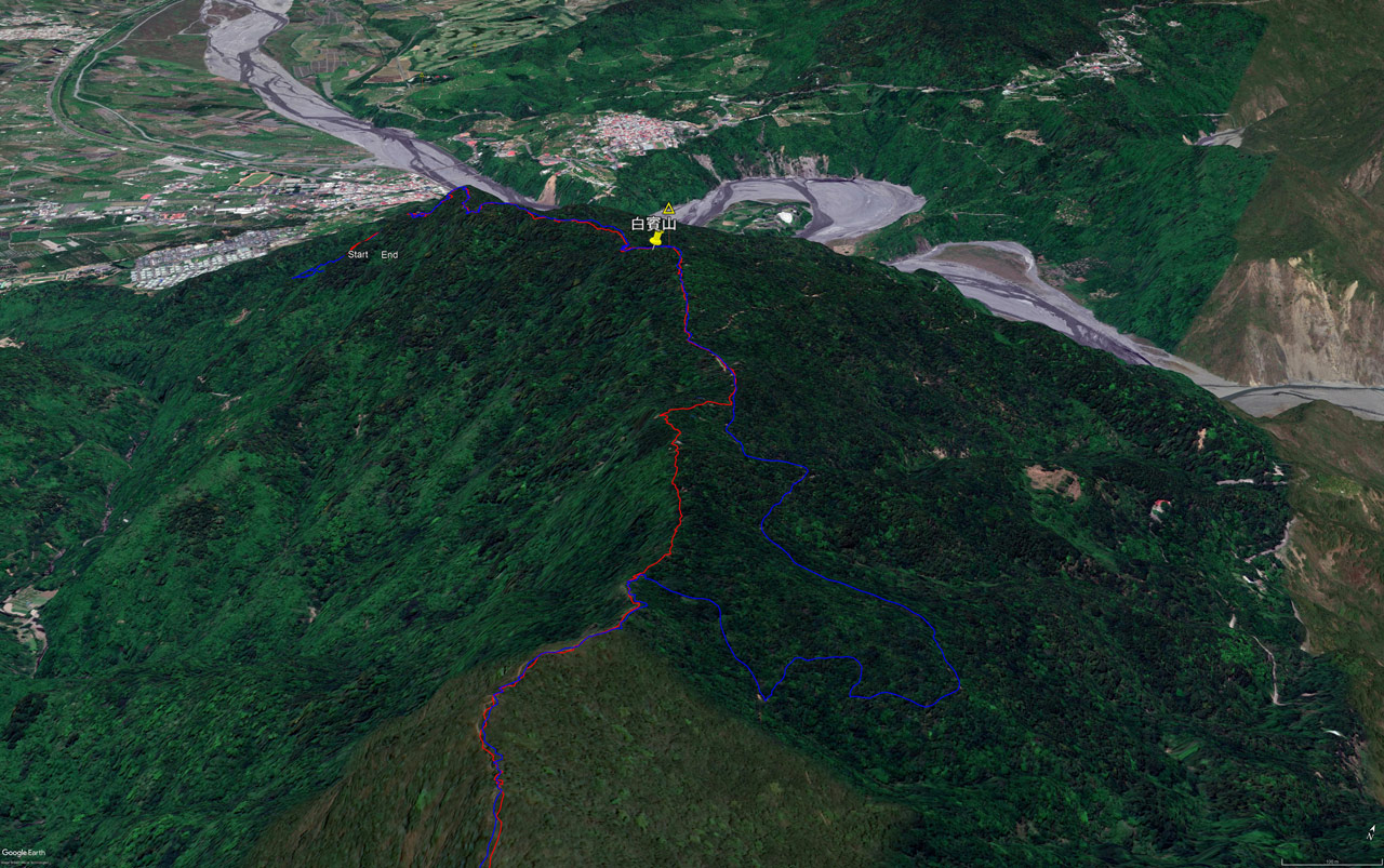
The red line is the hike to BaiBinShan and ZhenLiShanDongBeiFeng. The blue line is the hike to XueYeGenShan. As you can see, there’s a road that can take you to within a 15 min easy hike to ZhenLiShanDongBeiFeng. From there you could hike a short distance to ZhenLiShan 真笠山, indicated by that orange triangle on the map. I’ve hiked there before from a different route. But honestly, there’s nothing special about ZhenLiShan. There are no views. However, ZhenLiShanDongBeiFeng does have a view…and a nice covered area to eat.
The choice is yours.

BaiBinShan & ZhenLiShanDongBeiFeng – 白賓山 & 真笠山東北峰
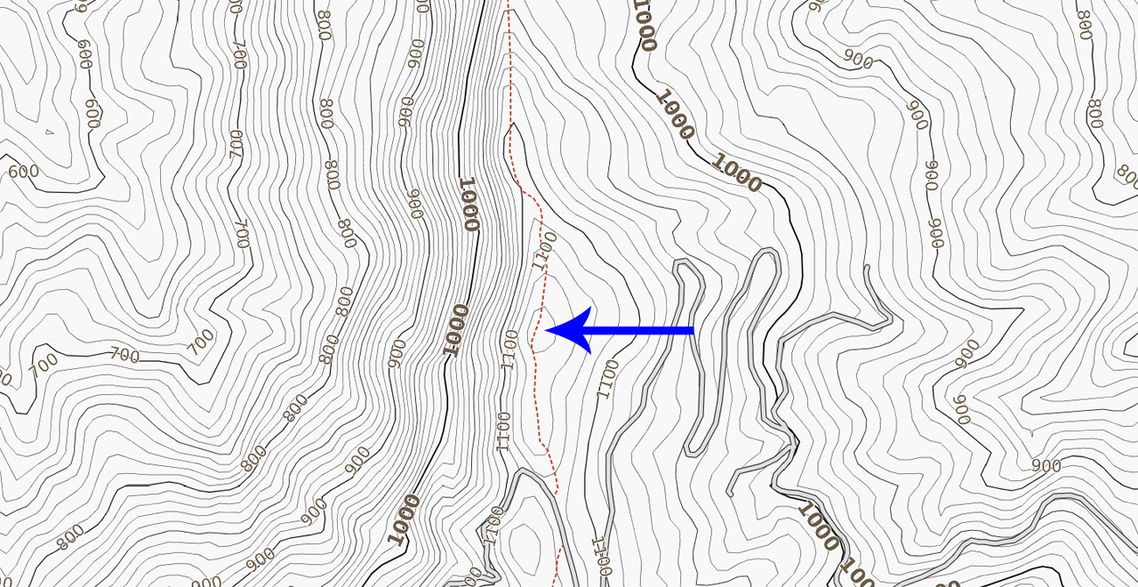
There are two ways to get to BaiBinShan. (technically a few more if you come in from the other side) The map below shows them marked with red arrows.
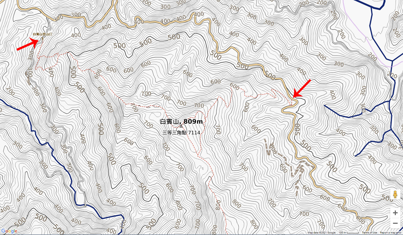
I took the trail coming in from the northwest. The eastern trail appears to be a good deal easier. There’s also a small parking lot there. From what I observed leaving BaiBinShan, the trail from the east is a dirt road…or the road and trail overlap in places. One day I may go back and try that trail and report back. Whatever the case, the route I took wasn’t really all that difficult.
Trail Head
The northwest trail head is easy to locate but you may have difficulty finding parking on a busy day if you’re driving a car. Scooters and motorcycles won’t have a problem though.


I would suggest giving your legs a good stretch before you begin because right off the bat you start with a nice climb.

There’s a sign to warn you about potential threats on the trail.

As well as another sign indicating where you’re about to hike to…in case you forgot.

After you start the climb your legs will get a short reprieve before the steepness begins again.

A short ways into the hike you’ll need to make a decision: left or right? They both end up at the same place, but the left trail is shorter and steeper, while the right trail is longer and somewhat less steep. I decided to go with the left trail. I took the other trail later that night on the way back down. It’s a better choice if it’s dark (it was for me). It’s steep-ish in some places, but not nearly as bad as the other trail. I’d estimate the distance is almost twice as long as the other trail.


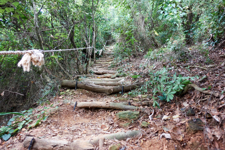
As mentioned, the left trail got steep but wasn’t really that bad because of steps and ropes.

I had two kinds of company on the way up: a couple homo sapiens (seen above) and a serpentes.
A green snake was crossing the trail as I hiked up. This was the best shot I could get of it. (middle of picture)

The entire trail in this section was exactly like the below pictures.


Mini Rest Area
At the top of the steep climb there was a small area with a fallen tree branch set up as a makeshift bench. This is roughly 25% of the way to the peak. (It’s a short hike)

I took a short break and continued on.


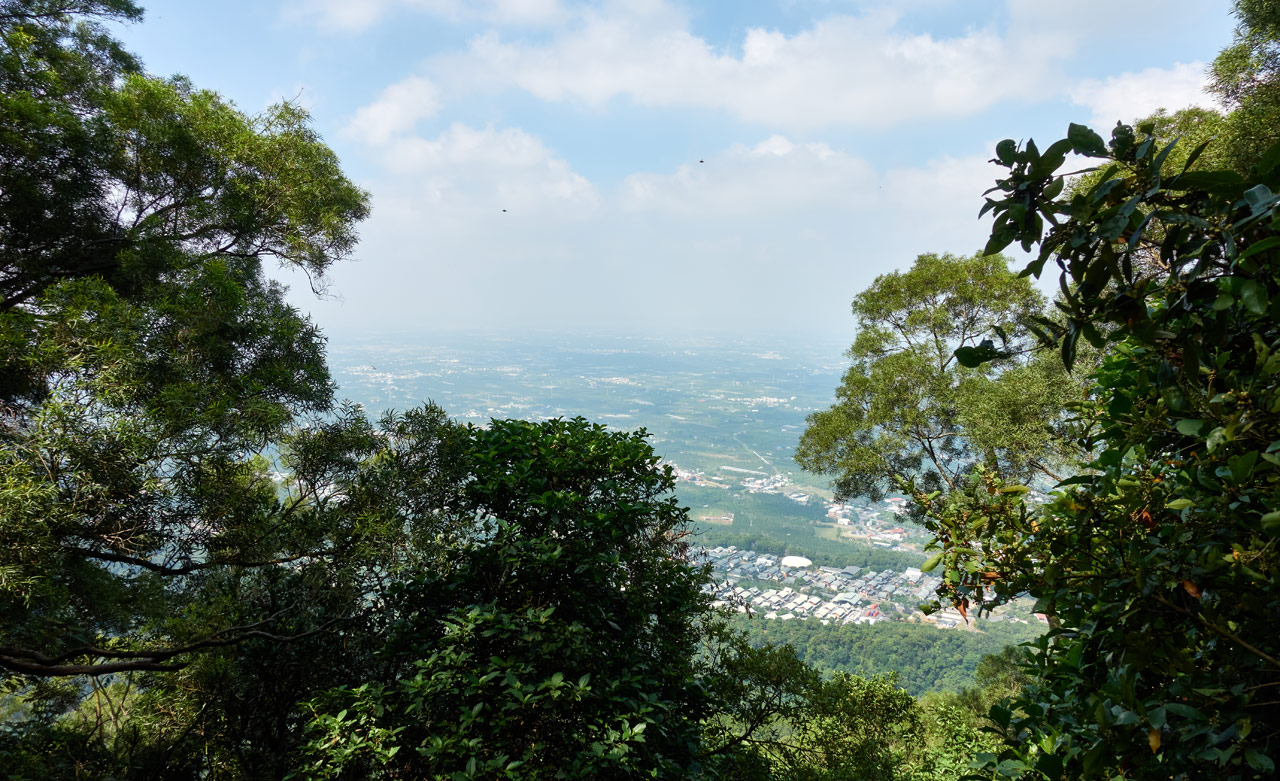
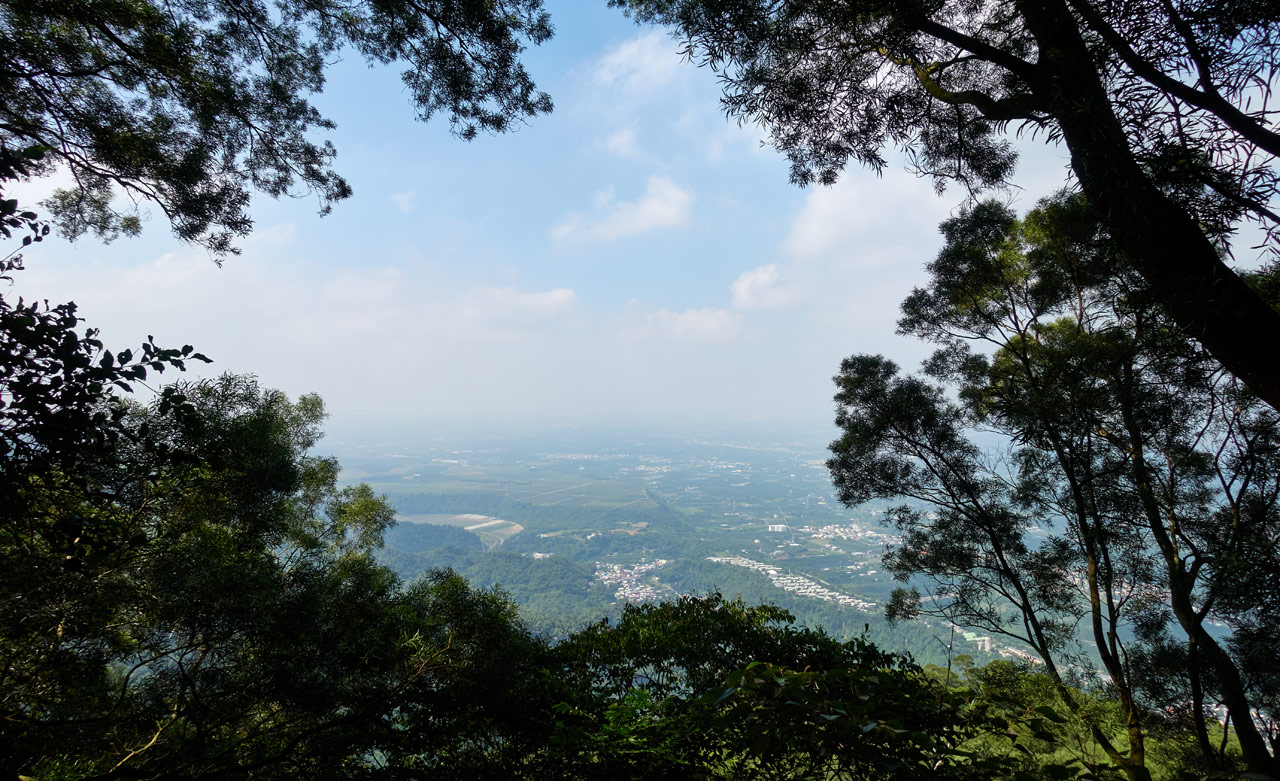
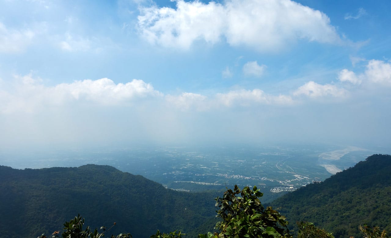
Somewhere along the way I got my first peak into the village and lands below.
There’s a small wooden table and chairs nearby if you chose not to rest earlier.

As well as a seating area just off to the left of the trail. I can imagine it being occupied by loud talking, tea-making uncles and aunties on the weekends. hahaha…

From Sorta Boring to Less Boring
I can’t lie, this hike felt somewhat pedestrian to me for the most part. But it DID get interesting around halfway up.


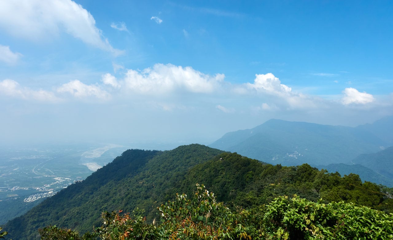
And one spot offered a better view of everything below.
Just ten minutes away was another rest area…or more likely a ‘claimed’ area. Though I see no reason not to take a short break here if nobody is around. Heck, even if people are there, there’s a good chance they’ll invite you to drink some tea at the very least.

From here you’re only about twenty-five minutes from BaiBinShan. Less if you don’t stop for a bunch of pictures like me.


This section of the hike was nice. It wasn’t as steep and you could catch some breezes and sunshine. You also got your first look at BaiBinShan. I could hear people laughing and talking loudly even from this distance.
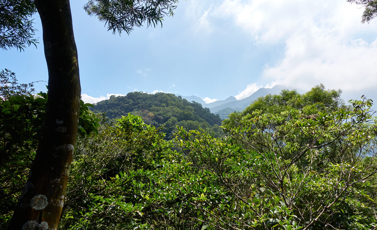
BaiBinShan – 白賓山
I was real close. For some reason there was another little sign attached to a tree that said to me, “Just in case if you really had no clue where you were going, well, this is it!”

There was also another one of those numbered signs I see on a lot of the more popular trails here.

As I hiked close to BaiBinShan I could hear the voices getting louder and louder until…I reached the peak!

There were two groups of people here. A group of students out for a little mountain adventure, and an older group of hikers enjoying the shade. When I walked up I heard someone announce my presence, “Hey! The foreigner is finally here.” hahaha…yeah, yeah, yeah, I took my time…I’m slow…whatever.

Everyone was nice. They offered me some water and tea and even some food. Of course I was happy to accept their drinks.
I knew I had a long hike ahead of me, so I didn’t want to stay long. I quickly ate, drank, and asked for help to take my peak picture…

And took a few pics of the trig stone and sign.


Before I left, the students asked if I could help them take a group picture. And then invited me to join in another group picture. I haven’t seen the final result of that. If you see me in a picture with a large group of students in a Facebook picture, please send it to me!
Onward to ZhenLiShan Northeast Peak – 真笠山東北峰
From BaiBinShan it’s a short and easy downhill section until you reach the road. Off to the sides of the trail were a few “claimed” areas.


Roughly ten minutes later I reached the dirt road.


This sign pointed me to my next destination, sorta. (To ZhenLiShan)

From here until ZhenLiShan northeast peak it’s almost entirely following the ridge. Over the next couple kilometers you’ll need to gradually climb a few hundred meters. It’s not really difficult, but still took me a couple hours. (remember, I stop to take a lot of pictures.)
So I continued up the dirt road as far as it went.

There was another “claimed” area along the way. This one was occupied by a few older men arguing about politics. (at the end of the road in the below picture)

A little ways down the road a trail splits off and up to the right. This is where another decision needs to be made.

They both lead to the same place. Like before, the trail is shorter, but more difficult…the road is flat and easy, but longer. I again chose the trail. But I took the road on the way back. I’ll get to that later.
Ridge Hike
The trail looked like most frequently traveled ridge trails that I’ve hiked before.

The good part of hiking on a ridge is the views. Only a few minutes after turning up the trail I got my first good look at everything to the west.
All along this section of ridge, until you reach the road at the other end, there are “claimed” areas and a few little makeshift spots to stop and take a rest. Rather than go one by one, I’ll just drop their pictures below.

This place had a lot of lovely flowers being grown on the trees.


All of this took twenty minutes. Then I reached the end of the road…quite literally.

The trail connects up with the end of that dirt road I mentioned earlier here in this open area.

The road goes down to the east.

The Road
Let me quickly talk about the road since I’m not going to write about my return trip. It’s roughly one kilometer and it took me twenty minutes, the same amount of time it took me to hike the trail going up. But remember, I was hiking the road going down. So you’ll be saving time if you take the trail. But for me that day, I felt like hiking the road down since it would be mindless and simple, albeit more steps.
It’s a road…so not much to talk about.


There were a few signs along the way. But I can’t see anyone getting lost here.


And for your information, here is a picture of the two routes. The red line being the trail and blue line the road.
Had I known it was that much longer, I would have opted for the trail again.
A Ridge with a View!
Going back to that little open area where the road ended…the trail starts up somewhat less…gradual…

There are a few spots like this, but as I remember, for the most part it’s more or less like that last ridge section.


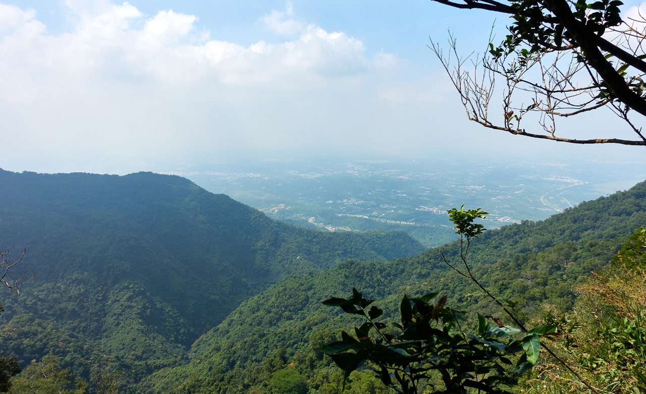
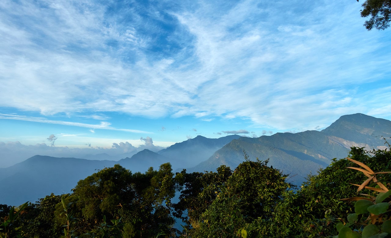
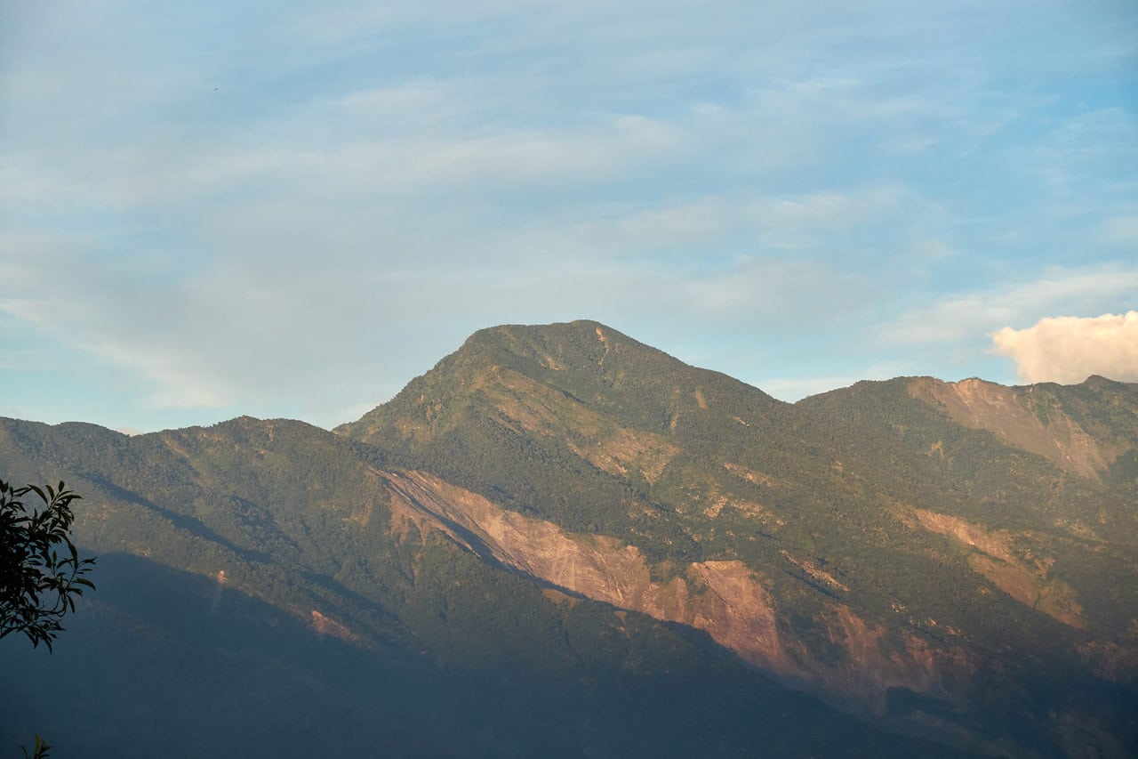
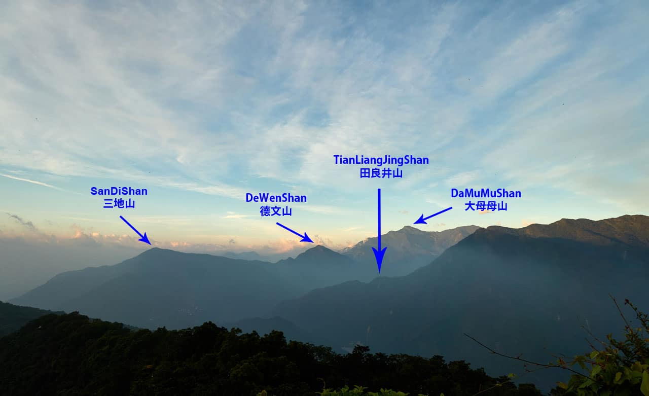
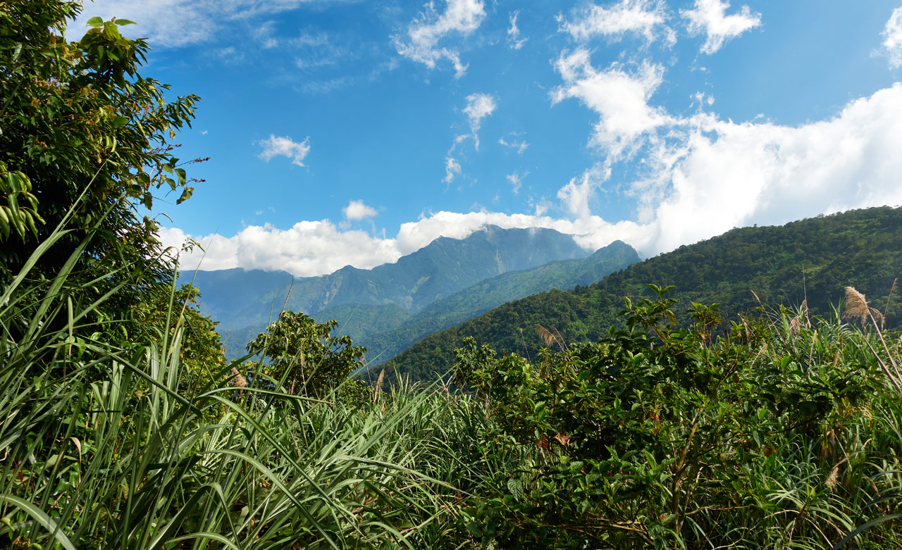
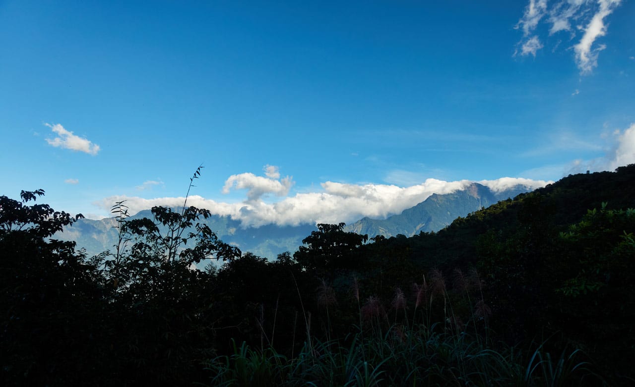
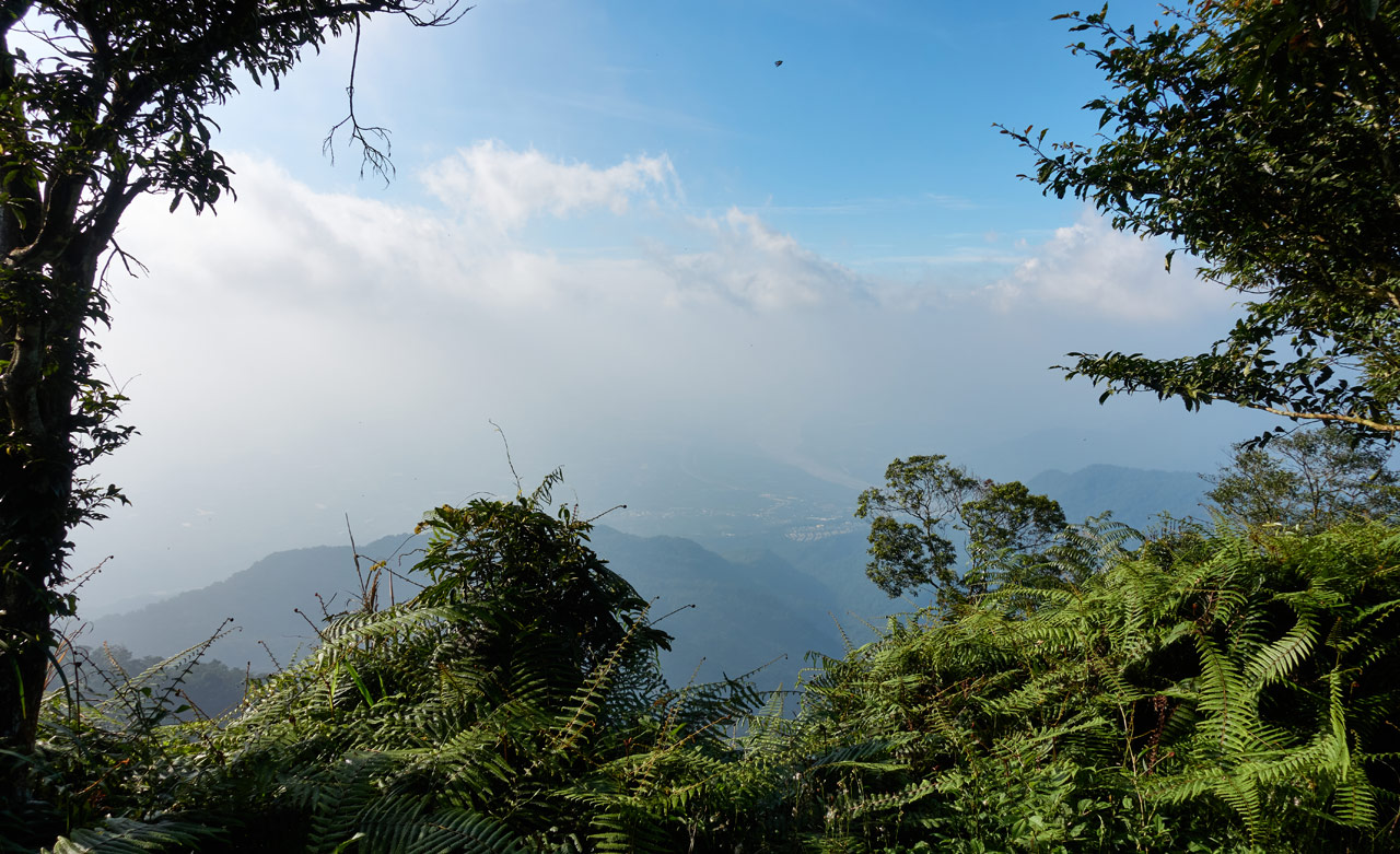
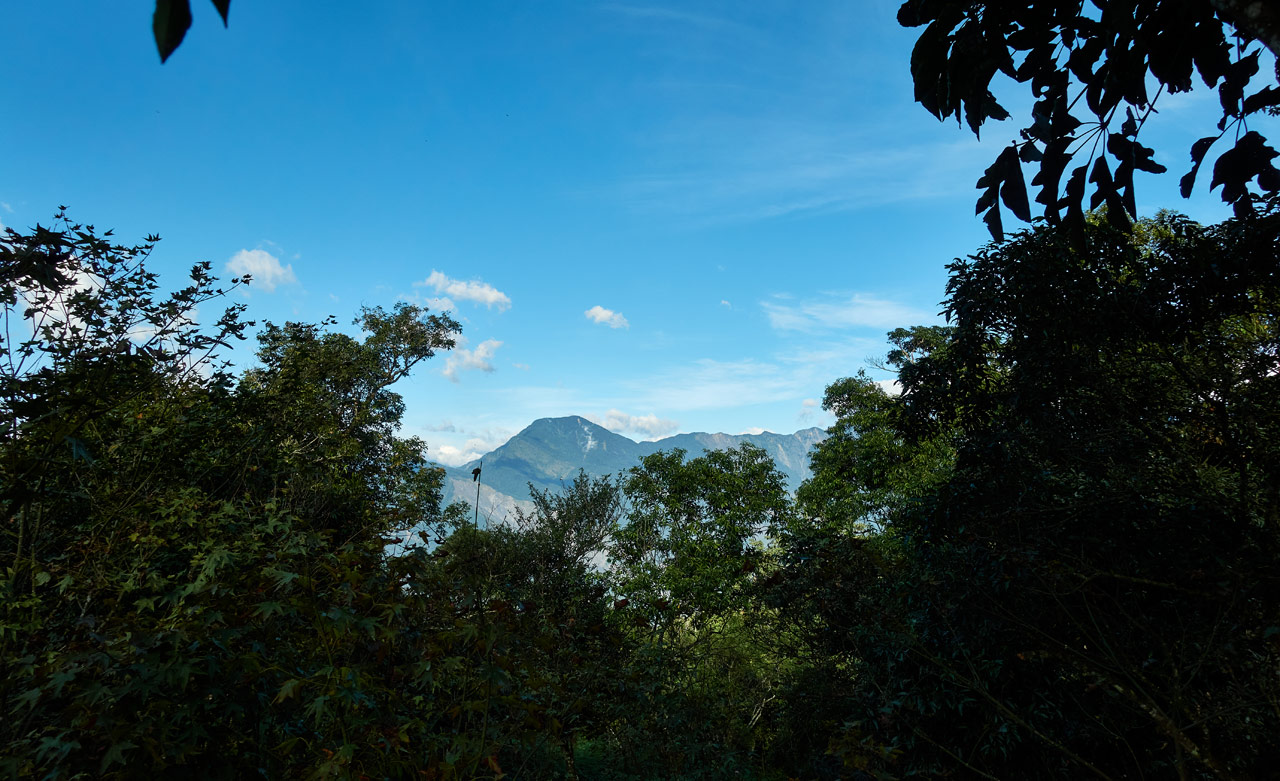
There are two interesting things to note about this section. The first…is the VIEWS! I highly, HIGHLY recommend that you wait for a day that you’re absolutely, positively, without a shadow of a doubt SURE that you’ll have clear skies to hike this. I was blown away by the views to the north and east.
The problem I have now is that I took far too many pictures. Posting them all here would be nothing but self gratifying. So I’ll try and choose only la crème de la crème.
Here goes! (all of these pictures you can click for a larger view)
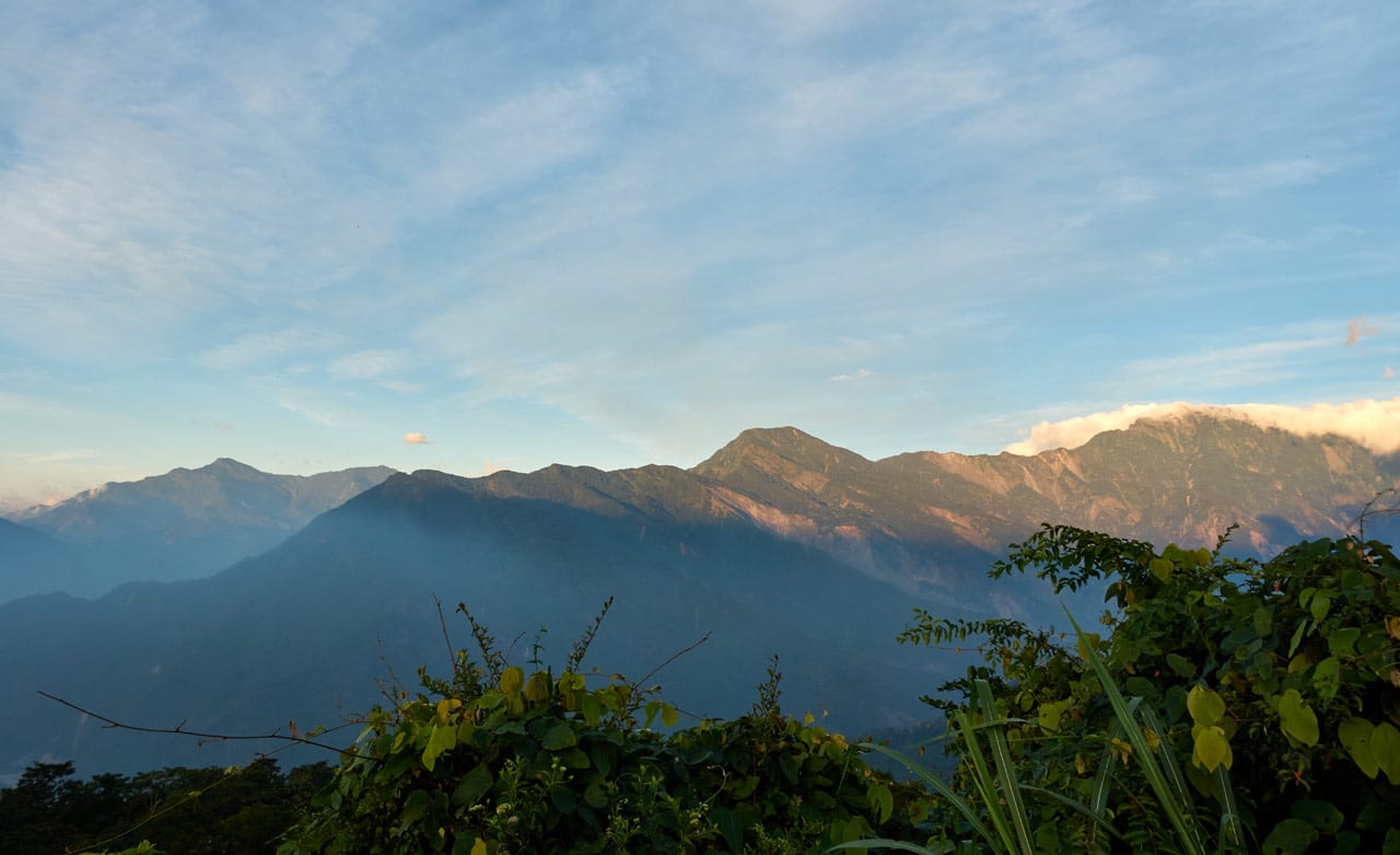
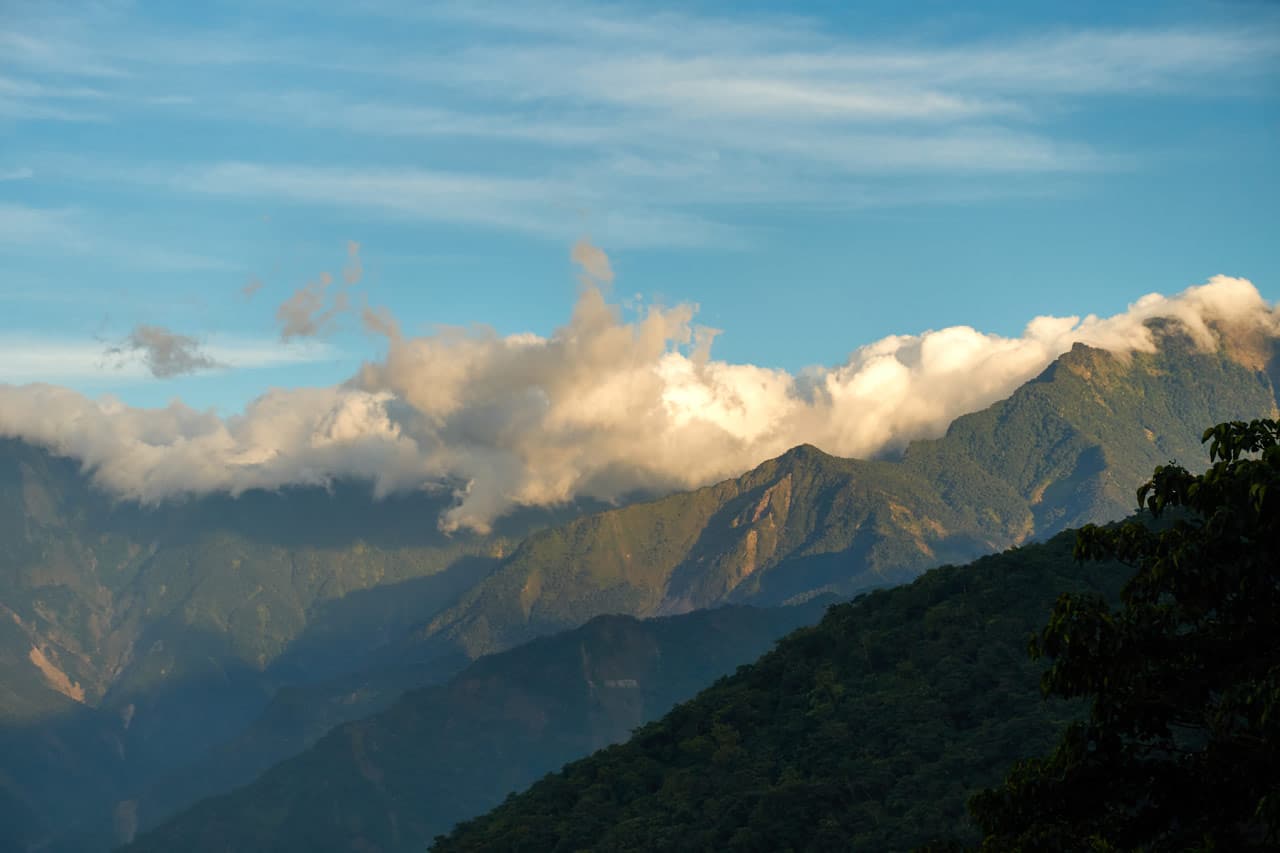

And in case you were curious, here are the names of some of the mountains in the above picture.
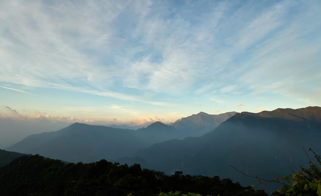
And this is your view from the road. You don’t even need to hike for this. Just drive your lazy ass on up!
The Other Interesting Thing
I mentioned there were two interesting things, right? The other one is not nearly as interesting as the views, but I’m slightly a nerd, so here it is. It’s this unnamed little peak right before arriving at another road.
It’s flat and somewhat cleared – a suitable place to take a break.

The interesting thing being this tree with the approximate altitude written on it.

Who wrote it and why? Does this little unremarkable peak have a name we don’t know about? I doubt it. But someone thought it important enough to note it’s height.
So I mentioned driving up earlier, right? Yep! A nice little stroll down this peak…

…and we link up with a proper road!

The Final Push to ZhenLiShan Northeast Peak
A very short distance down the road you’ll see a dirt road going up to the right.


Before hiking up the dirt road, I’d suggest turning around and looking behind you. There’s another dirt road that leads to some sort of radio tower or something.

Why go there? For a slightly better mountain view of course! (It’s not very far, don’t worry)
Or catch it on your way down. That’s actually what I did.
Ok, let’s get back to the final objective…ZhenLiShan Northeast Peak.
The dirt road takes you past this delivery truck graveyard.


Speaking of graveyards…

Ok, it’s not marking a grave. It just feels really out of place here. Anyway, take your picture and keep going.

The above trail continues going straight. But somewhere along the line a trail splits off to the right and goes up. Follow that trail.
It gets a bit dense and muddy, but it doesn’t last long, I promise you.


ZhenLiShan Northeast Peak – 真笠山東北峰
It only took me fifteen minutes to reach ZhenLiShan Northeast Peak from the concrete road. You could do it in ten minutes if you don’t stop for pictures.
Once you come out of the dense and muddy part of the trail, it opens up to a nice refreshing mountaintop!

I don’t have a lot of pictures of this area because I took a bunch the last time I was here. Follow that link for a more detailed look.
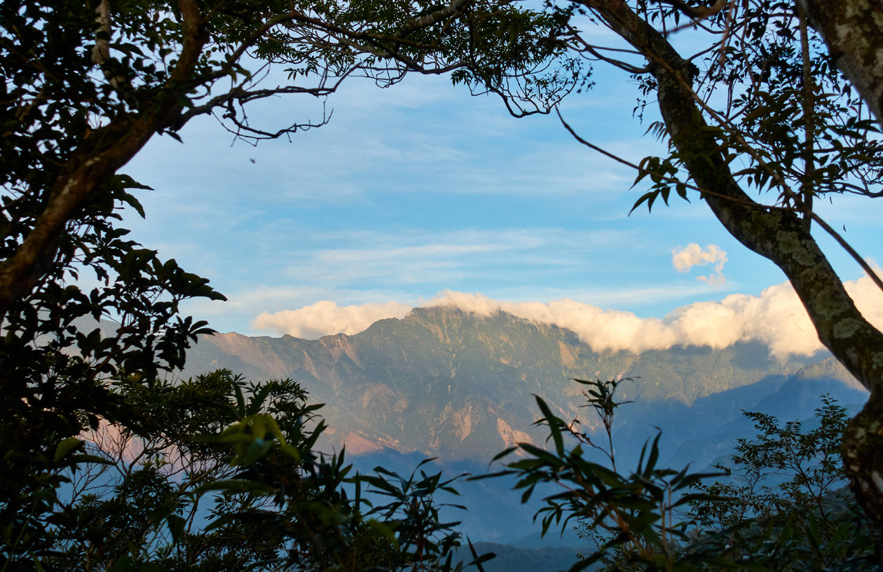
Just up near the top there is a covered area perfect for eating. If any other hikers are here, you’ll be sure to find them there. Also, there are some apparent locals who come up here to relax. There were a few, plus some other hikers, when I arrived. They offered me some food and tea.

From what I observed, there are gas stoves under the tables, as well as other odds and ends. They appear free to use. But I can’t be certain. There are also various containers (a LOT) around full of water. I have no idea if they’re safe to drink. But know that you’ll have water available if needed. Be sure to bring your water filter.
And lastly, just up the hill a little is the triangulation stone.

I didn’t take my peak picture this time around.
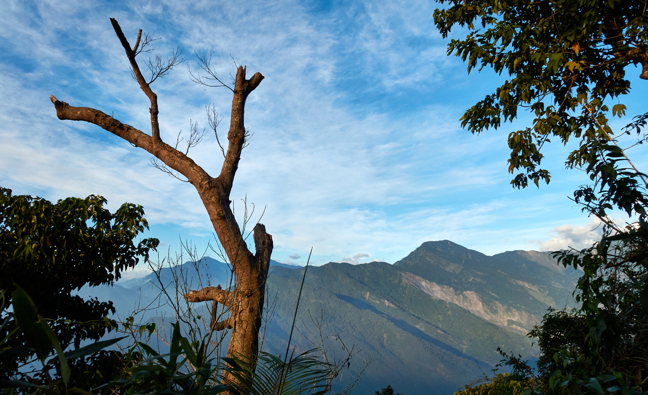
You can get some decent views of the surrounding mountains from here. The last time I only got a wall of fog. So I was happy to get lucky this time around.
To Conclude
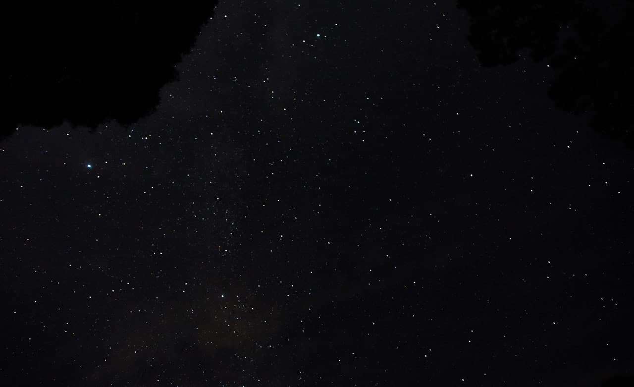
After a nice long rest, I hiked back to my bike. I didn’t see a single person the whole way. Around the time I made it back to BaiBinShan it was dark. I spent a solid forty minutes there in the dark taking pictures of the stars and city lights.

On the way down from BaiBinShan I snapped pictures of these two little dudes or dudettes.


That was pretty much the hike!
If you want a nice little half-day hike to burn some energy, then try BaiBinShan from the trail head I took. Or just do the whole thing like I did! Or for a (likely) easier hike than I did, start at the other trail head and do the whole thing to ZhenLiShan Northeast Peak. It shouldn’t take as long and you’ll have an easier hike back down to your vehicle.
As for what I hiked? It was fine. If not for the luck with the mountain views on the way back, I would have been disappointed in the hike. As it stands now…it was OK.
Date hiked: 2020 Oct 15
GPX Track Download Instructions: Click the track on the map to see the download link
GPX track for the hike down (includes alternate roads)


![[Valid RSS]](https://outrecording.b-cdn.net/wp-content/uploads/2020/03/valid-rss-rogers.png.webp)
Leave a Reply