

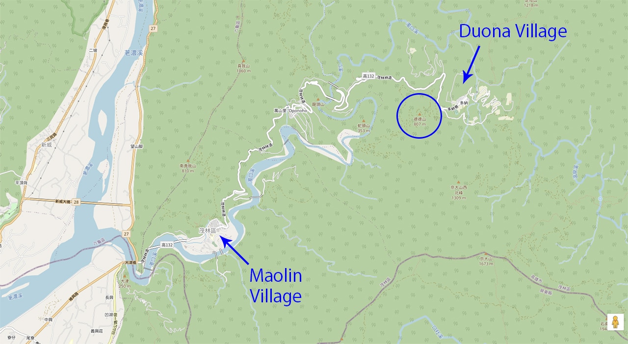
If you’re visiting Duona Village – 多納, Duona Suspension Bridge – 多納高吊橋, or just looking for a quick hike with great views, then head on up to DeDeShan – 德德山 in Maolin District –
茂林區.
A quick hike like this isn’t my usual type of thing. I’ll sometimes bundle a nearby little peak with another hike, but this peak is a one-shot deal. Up and down; nothing else. Or is there…?
*evil laugh* *evil laugh* *evil laugh* *evil laugh*

*end evil laugh*
Now that I got that out of my system and wasted a lot of time making it, let’s continue.
A Hopefully Brief Overview
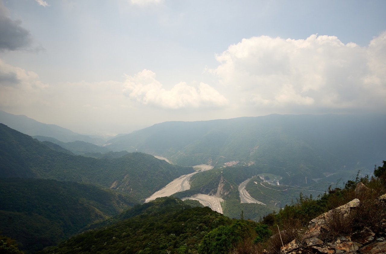
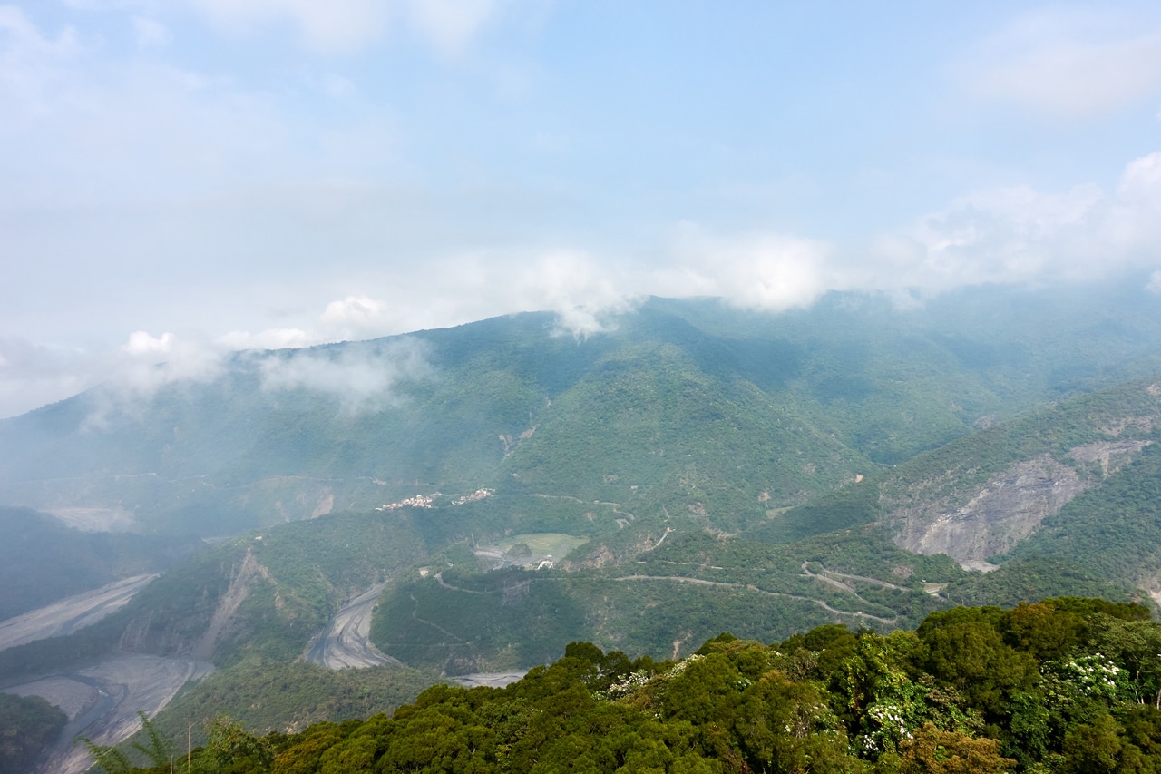
DeDeShan – 德德山 is at the top of the mountain ridge that separates Duona village from the rest of Maolin.
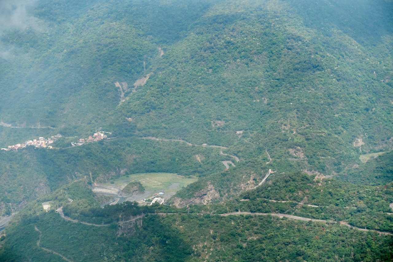
If you look at the picture above you might notice the suspension bridge and that famous eagle bridge. Yeah, you can see all that from DeDeShan as well as a great view of Duona village.
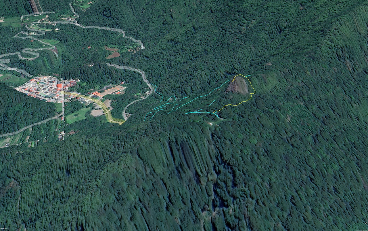
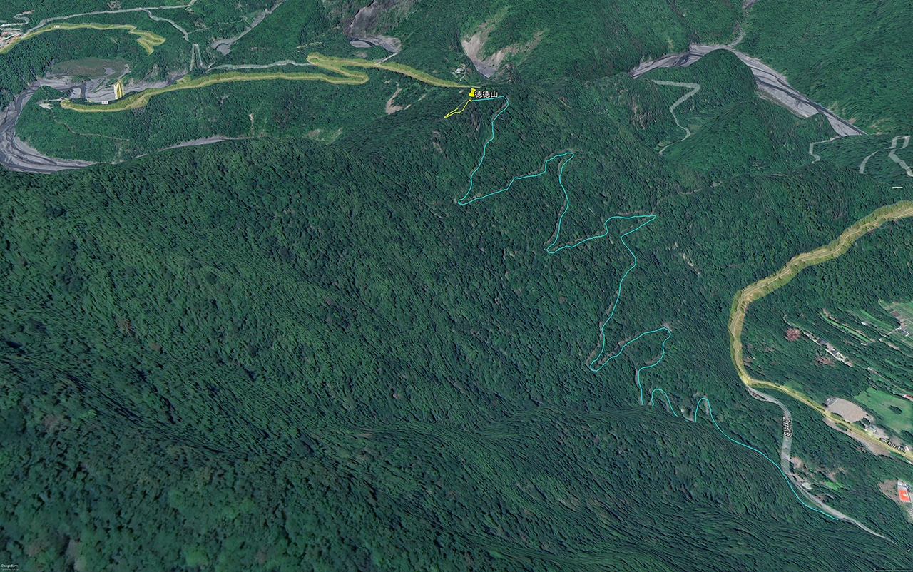
The blue line in the pictures are what I drove and the yellow line is the hiked portion. It looks very easy, right? And believe me, it is.
The Drive
You can drive up using pretty much any mode of transportation of your choosing: car, scooter, skateboard, rollerblades, hoverboard…the possibilities are endless. There’s nothing to stop you from reaching the top.
Why?
Well…because it’s paved and…there’s nothing to stop you.
All that is probably due to this little tower at the top.

Cell tower perhaps?
The whole way is paved and there’s even some sort of “parking lot” near the trail head.


Oh wait, I didn’t talk about the actual drive up. That’s cuz it’s totally uneventful. I’m sure you’ve picked up on that by now. There was the remains of an old old 4×4 that would look just at home in Chicago or Detroit as it does here.

But that was it.
Getting to this road is simple. Drive like you’re headed to Duona village. Drive slow; drive fast; drive backwards for all I care. But instead of turning left to enter the village, keep going for another three-hundred meters and look right. Can’t miss it.
One more thing to mention. The parking lot was basically the end of the line when I was there. A tree had fallen that prevented vehicles from continuing further. Plus the road beyond was quite overgrown – though there was a trail. There appears to be some old farms along the road that continue down the mountain.
The Hike
It’ll probably take me longer to type about the hike than the hike actually took. My GPS says it took me seventeen minutes and fifteen seconds. That included stopping to take pictures. An extremely motivated mofo could likely do it in under ten minutes is my guess.
Here’s the trailhead.

It’s right there next to the parking lot. Trail ribbons and a trail are clearly visible.
There are some old stacked-rock walls along the way. Probably connected to old farming.


It’s not long before you find yourself in the thick of things.

DeDeShan is essentially a big old open rock at the top. If you had spiderman-like climbing abilities, you could climb straight to the top from here and save yourself a lot of trouble. But for the rest of us, continue on!
It’s more or less the same view until you reach a wall of bamboo.

Only one way to go now…
UP!

Guess what? We’re almost there.

Just follow a little trail up a ways…

…and you can nearly see the top.
Another thirty seconds later and boom-shakalaka…
You’re there!

DeDeShan – 德德山
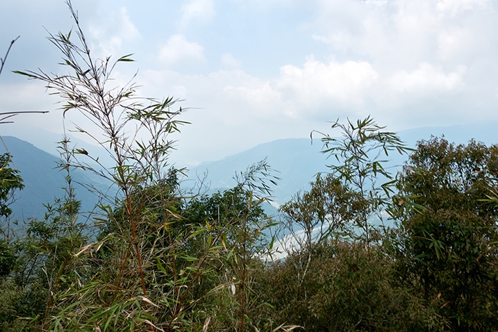
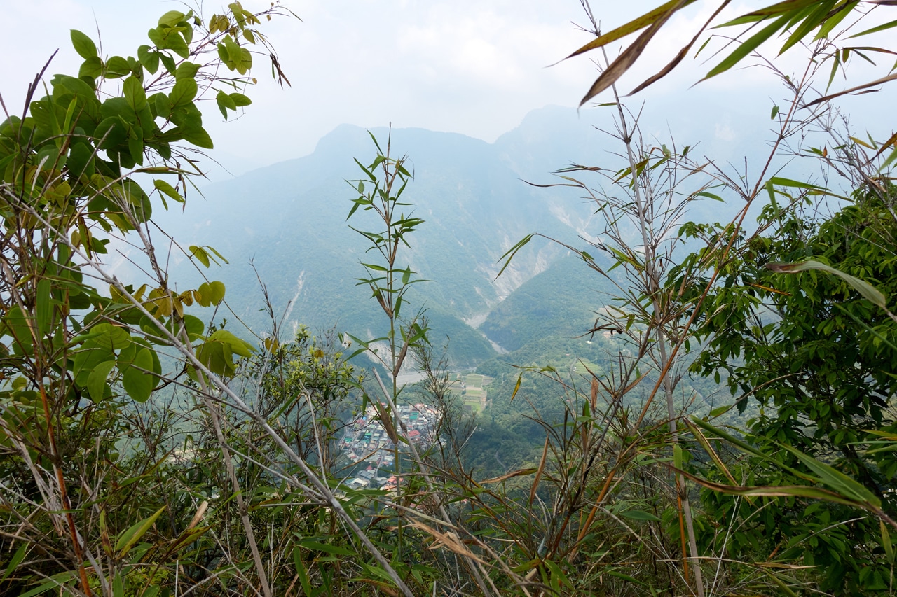
The good news is, for very little effort you get a great view.
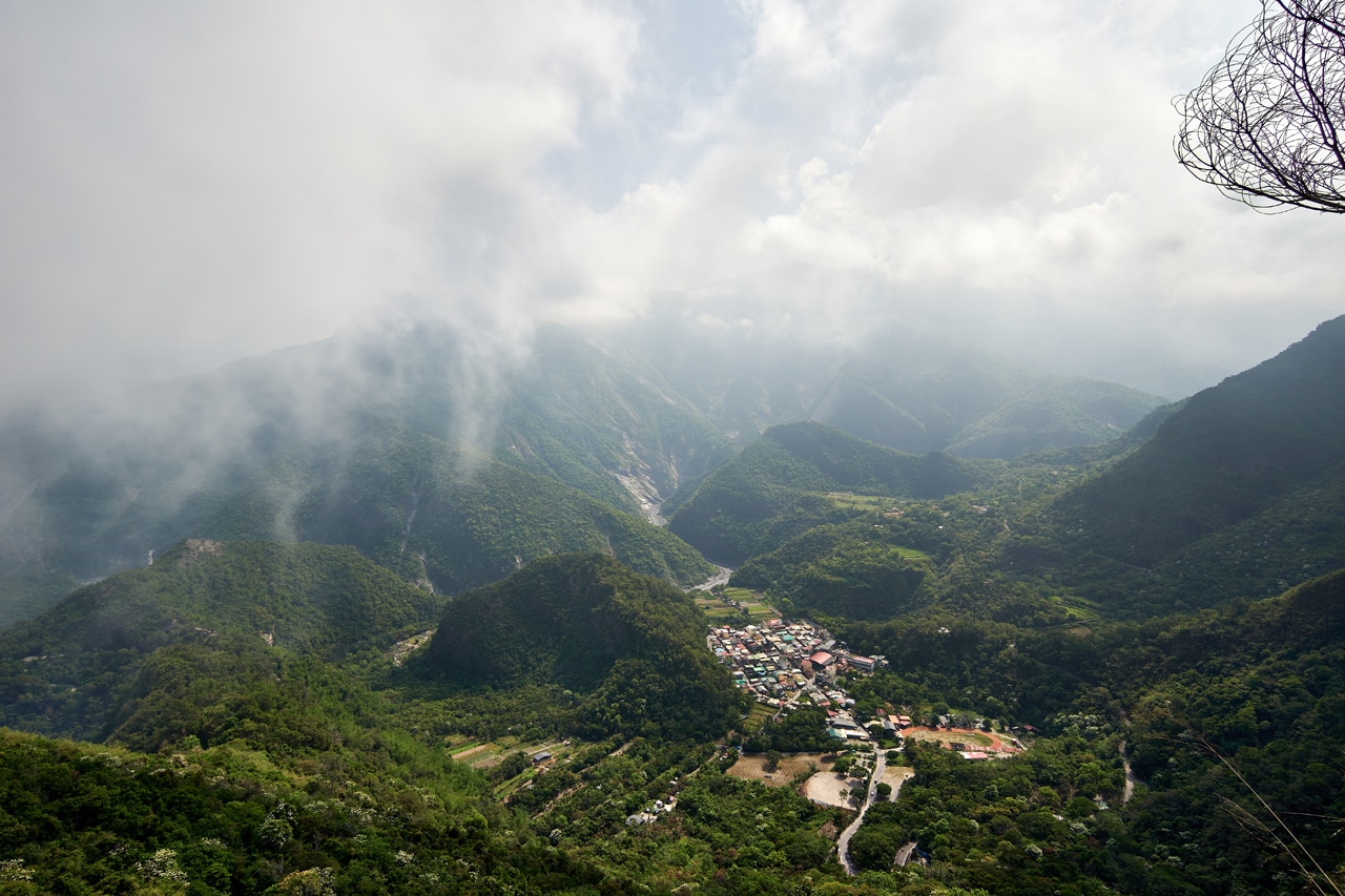
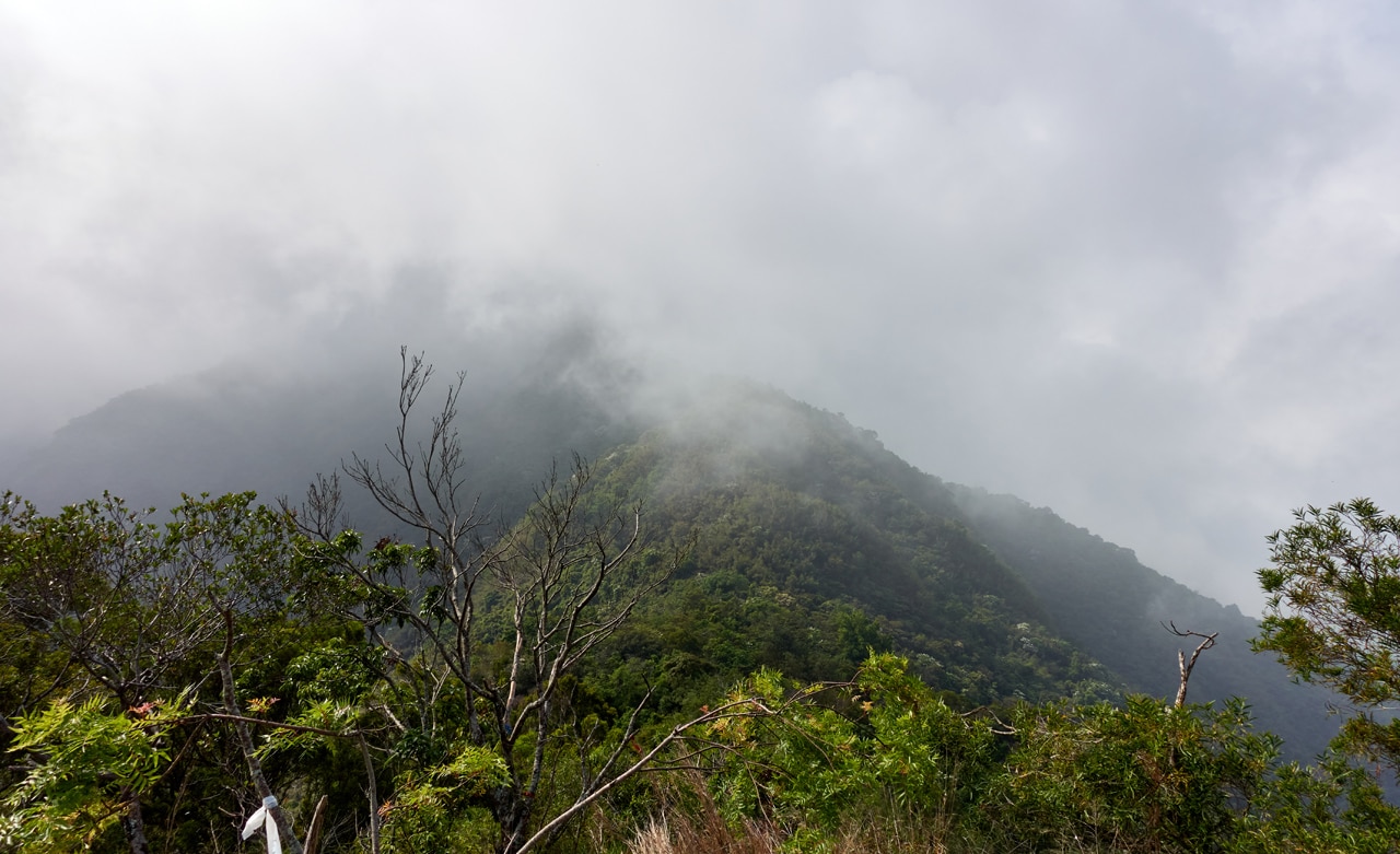
The bad news…for me that day…was that it was foggy.
But it did clear up ALMOST a little bit.
On a nice day this must be a great place to visit. But as it was that day, I could still see a lot. The suspension bridge and that eagle bridge are clearly visible.
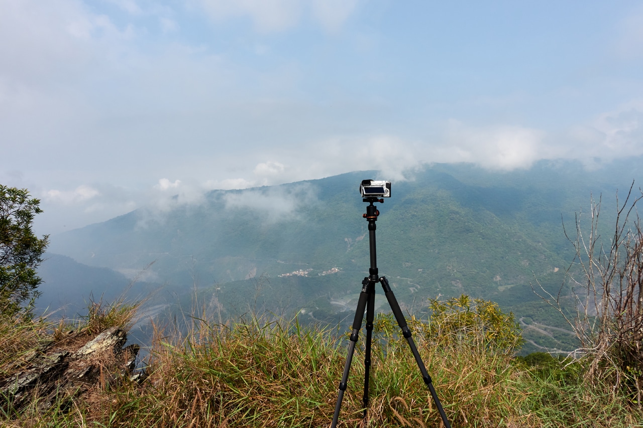
I took a rather long rest and shot some pictures…
This one looking up the mountain.

Some sort of old metal holder here.


Oh, and my proof of life picture.

Ok, Now What??
.
.
.
Sorry, I had to do it again.
Believe it or not, I had a plan!
The ridge I was on…if you followed it up, would take you directly to JingDaShan – 京大山. Yes! Another peak!
I had been there four years ago, but I was woefully out of shape. I have no desire to hike that same hike again, but why not hike it from a new and possibly unusual way? So yes, that was my plan: Hike to JingDaShan!
Start of Exploratory Hike to JingDaShan
I had already explored a bit along the ridge while waiting for my camera to finish a time-lapse.
Here’s the not-so-great-video of that time-lapse…
From what I saw on my little recon mission wasn’t promising. This part of the ridge hadn’t been crossed by anyone or anything limited by two or four legs.


It was a bit discouraging. From what little progress I was making, turning back had crossed my mind. But that day I had no “Plan B”, which is unusual for me. So what else could I do but keep going?
So imagine my happiness when I found some animal scat!

That was a sign that the ridge might become a bit easier. And it did!

It wasn’t long before I started seeing more stacked rocks.

Looking down I could see what appeared to be flat ground.

I made my way over and down to this flatter ground, and was greeted by a lot more stacked rocks.


The whole area was filled with these stacked rocks. I could have stayed and explored a bit more, but I had no idea what lay ahead, so I wanted to keep moving.
At one end there was also a decent amount of bamboo.

Some of them had been cut. That piqued my interest.

The cuts didn’t look fresh, but it did mean that someone had been up here at one time. Which meant…there must be another way up. There’s no way they would have came the way I had come. I filed away that info to investigate on my way back. An easier way back to my bike would be welcome.
As I made my way out of this flattish, rock-stacked area I found another hint of visitors.

Perhaps after loading up on bamboo they had no room to carry this bottle.
Into the Darkness
The going wasn’t too bad compared to how this section of the ridge was in the beginning.

I found another bottle along the way.

And this is where–despite the sun being out–it got dark.

I had hit every hiker’s nightmare: a wall of wild bamboo. 🙁
But to my surprise, there were small lanes here and there that allowed me to get by without having to hack at them with my machete.


And there were more remnants of the stacked rocks.


As well as another discarded water bottle. And this one looked…well, less older than the previous bottle.

At this point in the hike I started seeing a lot more signs of humans.


And the route I had been on slowly morphed into looking like this:

Now does that kind of look like a trail to you? Sure does to me!
This exploratory hike didn’t start so well, but with everything I had been seeing at this point told me that there just might be a trail all the way up the ridge!
So I soldiered on.
Follow the Trail
This part of the ridge looked more or less the same. Sometimes trees…

…sometimes bamboo…

…sometimes both!

Can you see the path in the middle of those pictures? Believe me, that was a huge relief.
No hiking ribbons were to be found, so I could only assume it was a hunter’s trail. But I also found no evidence of hunters…yet.
I was happy to have a trail to follow through this mess. Could it get any better? Well yeah! Have a look.

See it?
If you’re half blind, here’s a little help.

A friggen rope!!
And at the top…some friggen garbage!!


At this point I knew all of this was created and maintained by hunters. But what to do? Just keep going…
And things got…nicer?


I mean, no bamboo. That’s a major improvement in my opinion.
But then it really did become nicer.

I had wandered into some old farmland.


There was also more garbage.


AAAAAAAAAND…somewhere after this spot (where it switched to bamboo and darkness again) is where I found it.

A trap!


It had been sprung already. Not much to see, but at least it confirmed my suspicions.
Thin Ridge
I left the trap behind and made my way up nicer terrain.

Well, sorta nicer.
It was around here that I had my first peak of the mountains since DeDeShan.
It wasn’t a great view, but nice to be out of the “darkness” I had been hiking in earlier.
Now this is where the ridge started to get ‘thin’.


And the bamboo made its appearance again.

But I was still able to push my way up.
I was feeling pretty good about my chances of reaching JingDaShan. Damn good in fact. That is, until I reached this next place.
DeDeShan – 德德山 Ridge Collapse

Getting over those rocks wasn’t an issue. But…

I think it might be tough to decipher exactly what has happened here. Fortunately I have a video.
So yeah, there was a little landslide or land “topple” there that stopped me in my tracks. 🙁
If I knew about it ahead of time I could have planned an alternate route around the sides of it…maybe. But as things were, all I could do was stop and enjoy my time there.
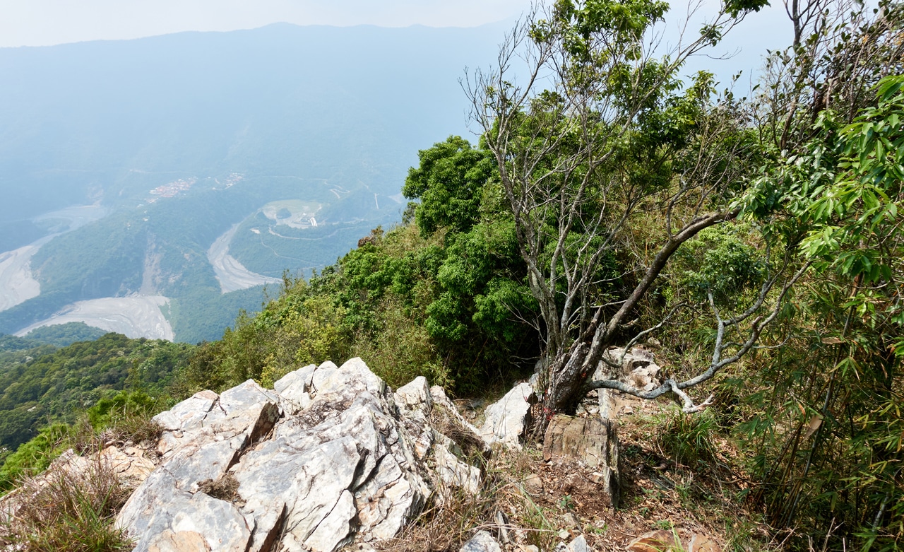
I picked out a spot and got to eating and relaxing. Honestly, I can’t complain. It was nice.

I think I spent a little over an hour on that ridge. I had a solid view of the two bridges below, but the haze was still an issue.
The End? Not Quite Yet!
Normally I would end it here. But there’s one important thing left to mention. Well two actually.
On my way back down, while in the bamboo, a bird suddenly flew out of nowhere merely inches from me! Something similar had happened at that very same spot on the way up…except it had flown off while I was several meters away. I hadn’t thought much of it the first time. But this time I knew something was up. A nest perhaps?
Yep!


I was quick to take a few pictures and zoomed in so I wouldn’t get too close. All my zoomed in pics were a little blurry. Oh well.
So what’s this important thing I feel the need to keep your time with?
Definitely not these.


Or these.


But THIS!


Would ya look at that!
Roughly 70% of the way back I noticed the hunter’s trail seemed to head down the mountain. I knew there was an old road down there–the one that was blocked by the tree–so whether the trail really went down or it was just my imagination, it didn’t really matter so long as I reached the road. So I headed down and at some point found that rope.
The trail down was easy enough to follow.

And yes, it took me straight to the road.

Try to imagine there’s a picture of an overgrown dirt road with a path right down the center of it. I didn’t think to take a picture of it. The above picture is me standing on the road looking down.
Is This Finally The End?
Yes. Yes it is.
This is the end, beautiful friend
This is the end, my only friend
The end.
– Jim Morrison
Ok, not quite the end. Like Jerry Springer, I need to give you my final thoughts.
The hike to DeDeShan is something anyone and everyone should do if you are in Maolin – especially if you find yourself in Duona village. By all means, hike up there and see the sights!
The rest of my hike…I’m sure nobody is interested in that. The view from the broken ridge IS nice and all, but I can’t imagine anyone wanting to go there. But if there are some crazy mofo’s out there, I’ll put the GPX tracks down below. The hike from DeDeShan to the broken ridge took me about two and a half hours. If you follow the hunter’s trail up instead of my direct, but shitty ridge hike, you’ll save yourself some time and trouble. Enjoy!
Date hiked: 2022 April 15
GPX Track Download Instructions: Click the track on the map to see the download link
Hike to DeDeShan – 德德山
This GPX is from my exploratory ridge hike. Use it at your own risk. Also best to download the next GPX track as it will be easier to follow (backwards)
This GPX is from my exploratory ridge hike, return trip. Use it at your own risk.
(Add link to this post in youtube videos)


![[Valid RSS]](https://outrecording.b-cdn.net/wp-content/uploads/2020/03/valid-rss-rogers.png.webp)
Leave a Reply