

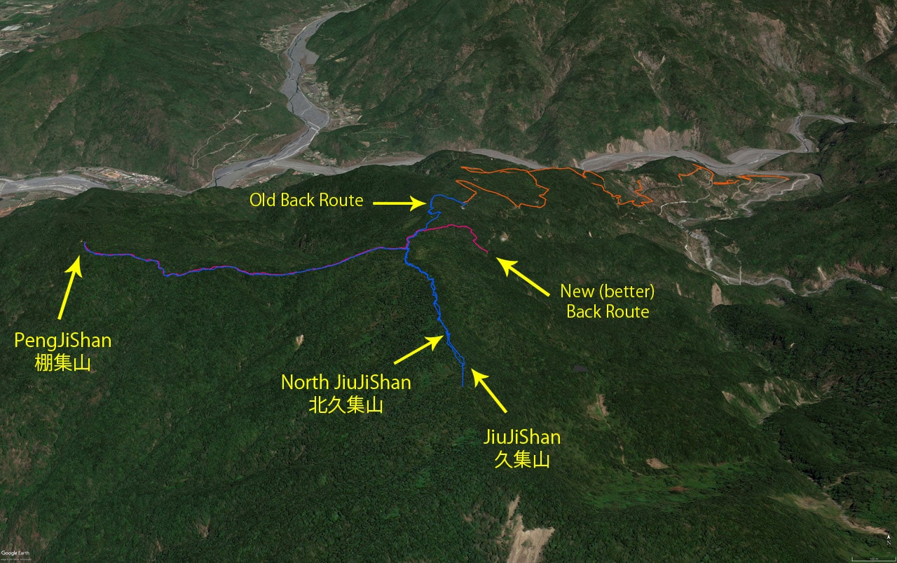
I was wanting do a short bushwhacking trip and found a promising looking back trail to PengJiShan 棚集山 on a map. My guess was that not many hikers would use that trail because the main trail up to PengJiShan is listed as #78 on the “Little BaiYue” 小百岳. After a quick search, I found nothing about this possible trail. So an adventure was born!
My plan was to (hopefully) bushwhack my way up this trail until I reached the main ridge trail that connects PengJiShan and JiuJiShan 久集山. Depending how long it took me to reach that trail, I would either hike to JiuJiShan and then backtrack to PengJiShan or only go to PengJiShan. As it happened, I had plenty of time.
Poor Decision
On the drive up I wanted to explore a road that possibly connected over to the other side of the mountain.

I drove up and got some halfway decent pictures of the surrounding mountains.
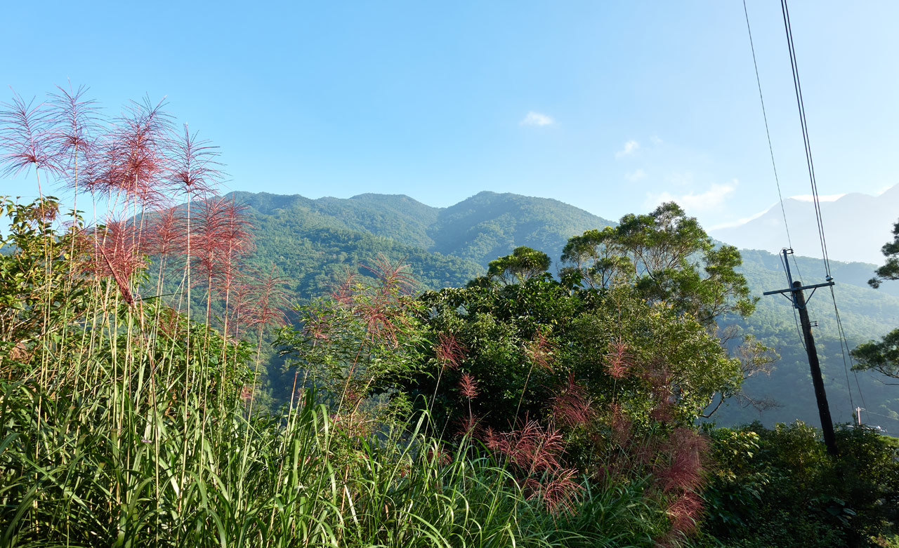
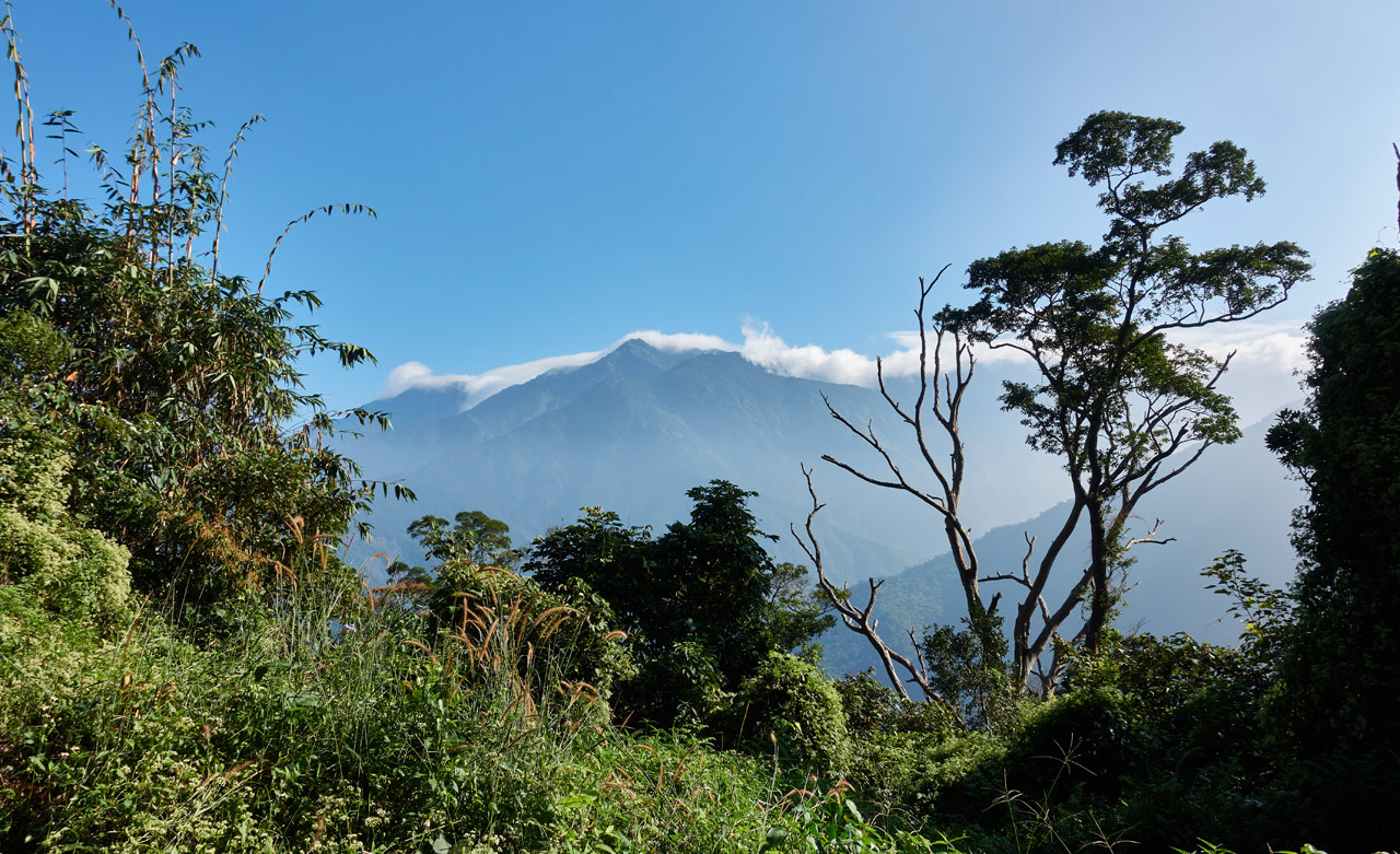
But as it turned out, that road DIDN’T connect. It “ended” at some farmland. It appears you could hike it over, but that wasn’t part of my plan, so I turned around…a bit pissed for the time I lost.
But as fate had it, on the way down I passed a sort of shack with a lot of dogs tied up in various places before and after it. There was a man nearby and he stopped me to say hello. He surprised me by speaking perfect English! We chatted about what I was doing out there and why he was there (building his shack for him and his dogs). He asked if I wanted to come inside for some tea. But I was in a hurry to leave so I declined and said goodbye. Next time I’m out in that area I’ll be sure to stop by and say hello. He seemed like a really nice man.
Another twenty minutes of driving and I had arrived at the trail head.

There’s a structure across the road from the trail head. I parked near there.

The trail head itself looked used enough. So there went my hope of bushwhacking.

The Beginning!
The hike looked to be a normal hike. There was a solid trail in the beginning, though it didn’t seem to be used as often as I had initially thought. Quite quickly I ran into this marker.


The more I hiked, the worse the trail became.


As you can see, I did get a bit of a workout with the machete. But it wasn’t that bad. I probably could have just bull-rushed my way through most of it. Better than nothing, right?
And then things started clearing up as I went along.


Well, it mostly cleared up.


And right at the end, before I reached the main trail, there was even a rope section. So yeah, some folks still come up here.

The Junction
A solid hour after setting off, I had arrived at the trail junction!


There were several signs giving directions and telling you where to go and not to go. (Don’t go the direction I had just come from. LOL)


This junction is nearly dead center between PengJiShan and JiuJiShan. I knew I had time to make it to both peaks, but since I hadn’t been to JiuJiShan yet, that was my first destination.
Surprise Peak
Now that I was on the main ridge trail, the going was rather easy.

Though there were a couple somewhat steeper sections with ropes.


I hiked a full fifteen minutes…


…before being surprised by a peak!

I mean, I GUESS it’s a peak. There’s no triangulation stone. But it has a name according to the sign nailed to a tree.

So this is North JiuJiShan. Ok, I’ll take it!
There isn’t much to see here other than this sign…

…and some old plastic chairs and a sorry excuse for a table. I was pretty close to JiuJiShan, so I didn’t want to rest. It seemed a better decision to rest at JiuJiShan. (Hint: it wasn’t) So I took a sorta peak picture and moved on.

500 Meters
That’s how far I was from the next peak, JiuJiShan. There is very little to say about that portion of the hike. It took me fifteen minutes. I’m pretty sure I was taking my time. There wasn’t much interesting to see, but here are some pictures for your information.


That’s all the pictures I took. Now you know everything I do…which is not much.
JiuJiShan – 久集山
JiuJiShan was quite…underwhelming to be honest. I mean, I wasn’t expecting anything great. But considering its little brother, North JiuJiShan had some chairs and a table, I kind of thought JiuJiShan would be a step up.


This is a step down for sure. I immediately regretted my decision not to rest at the last peak. But whatever, I was only fifteen minutes away. So I took my pictures and went back.

Back to the Junction and Beyond!
I quickly hiked back to North JiuJiShan and took a short break there. Then I made my way to the junction. When I arrived it wasn’t even noon yet. I had plenty of time to hike down to PengJiShan. I had been there once before. But that time I had taken a strange route to get there. (don’t I always…) At the time of this hike, I still hadn’t hiked up to PengJiShan via the usual trail. But my chance to do so would be coming very soon – in five days to be exact.
So after the junction it’s almost all downhill.

There were a couple spots where it opened up some.

The problem with the open areas are the taller vegetation. No trees to steal their sunlight, so they can grow unchecked.

It wasn’t terrible. The trail was still easy to follow in these sections.
Somewhere in this section I found this oddity screwed to a tree.

It appears to be some sort of high viz marker I’m guessing? At night that yellow piece likely reflects light pretty well. But I’m at a loss as to why it was put there. There wasn’t a turn or some difficult-to-get-lost section that I can remember. The trail was very clear and easy to follow. It’s just another “mountain mystery”.
So the trail continued down and down.


…until it started going up.


This is when things suddenly became interesting. But not the “Huh, that’s pretty cool!” interesting. But a different kind.
Holes in the Jungle
If you’ve watched any of the movies about the mafia in Las Vegas, then you’ve probably seen mention of “holes in the desert”. One line from Casino particularly comes to mind.
A lot of holes in the desert, and a lot of problems are buried in those holes. But you gotta do it right. I mean, you gotta have the hole already dug before you show up with a package in the trunk. Otherwise, you’re talking about a half-hour to forty-five minutes worth of digging. And who knows who’s gonna come along in that time? Pretty soon, you gotta dig a few more holes. You could be there all fuckin’ night.
That was exactly my thought when I walked up to this hole on the side of the trail.


Ok, I didn’t really think anything nefarious was going on, but it’s still kind of odd. Not too far away is one of those “claimed areas” I’m always going on about.

The hole most likely is connected to this place. But I’m not sure why they dug it? Definitely not a cathole. Maybe for burying/burning garbage?
As I alluded to earlier, I hiked this section again five days later and it looked the same. So I don’t know…
Final Leg
After that claimed area…(BTW, there’s another claimed area nearby on the other side of the trail. It’s kind of hidden and some distance away. They tried to camouflage the beginning of the path with vegetation and sticks, but did a poor job.) the trail immediately drops down to a muddy little ‘valley’ and then goes back up.


Here’s how it looks from the other side looking down.

After you pass this spot you’re almost to PengJiShan.
Just a little more hiking…

…and a stop to read a sign…


…and I arrived at my final destination!
PengJiShan – 棚集山
When I got there nobody was around. It was about 1:45pm, so I figured everyone had left for their trek down the mountain. All the better in my book. There’s nothing like having a peak to yourself.

I didn’t think it would take me much more than an hour or so to get back to my bike, so I stayed here a solid hour. Nobody showed up over that time.
Even though this was my second time here, I still took a peak picture.

Just not so serious this time around.


NOT the End…
There’s a little something I didn’t mention in the beginning. Before I reached the junction early in the hike, there was a trail that split off going down the mountain. My best guess was that it went down to the road where I had parked. This trail gave me some excitement. I love following trails that aren’t mentioned on maps or blogs and whatnot. Some of these have led me to some great finds! I wasn’t expecting much from this one, but it still piqued my interest.
So I hauled ass to get back to that trail. It only took me about forty-five minutes to get there. And then I started down.


It went pretty much straight down for the most part.

Until I reached a curve.

This is when I realized that this trail must have been a farm road at one time. Its width and the way it curved and followed the land downwards is exactly like all other mountain roads I’ve seen.
And to get an idea of how old the road might have been, this tree yields a clue.

Only twenty minutes after starting down this new (to me) trail and I reached the road.

Looking at the picture now, I can see how it’s easily missed. This is a much better place to start your hike. It will save you some time and effort no doubt.
From this spot I had a leisurely walk back to my bike. And that was it!
Final Thoughts
This hike was really just to satisfy my curiosity about a trail I found on a map one day. I couldn’t find reference to it anywhere else, so the need to solve that mystery was an itch in my head that I couldn’t let go. There’s really no reason for anyone to hike this unless a) you’ve been to PengJiShan many times and want to try another route, or b) you’re planning to hike to JiuBaoShan – 久保山. This would be a solid starting point for that hike.
And for your information, here is a little map showing the trails.
Date hiked: 2020 Nov 17
GPX Track Download Instructions: Click the track on the map to see the download link
This is my track leaving PengJiShan and later taking the “new” trail down to the road.


![[Valid RSS]](https://outrecording.b-cdn.net/wp-content/uploads/2020/03/valid-rss-rogers.png.webp)
Leave a Reply