

It has taken me a while to get around to writing about this hike. It’s not that QiLuZhiKeShan – 耆路知可山 was particularly difficult, but because I attempted it three times. Writing about it feels like I’m going back for a fourth try! Wouldn’t you feel the same way?
Ok, I’m lying. I went out there three times, but only attempted the hike twice. On my second trip I was blocked from accessing the trail head in two places. At the time, the government was working on the new number 9 tunnel. The trail head is very close to the west tunnel entrance.


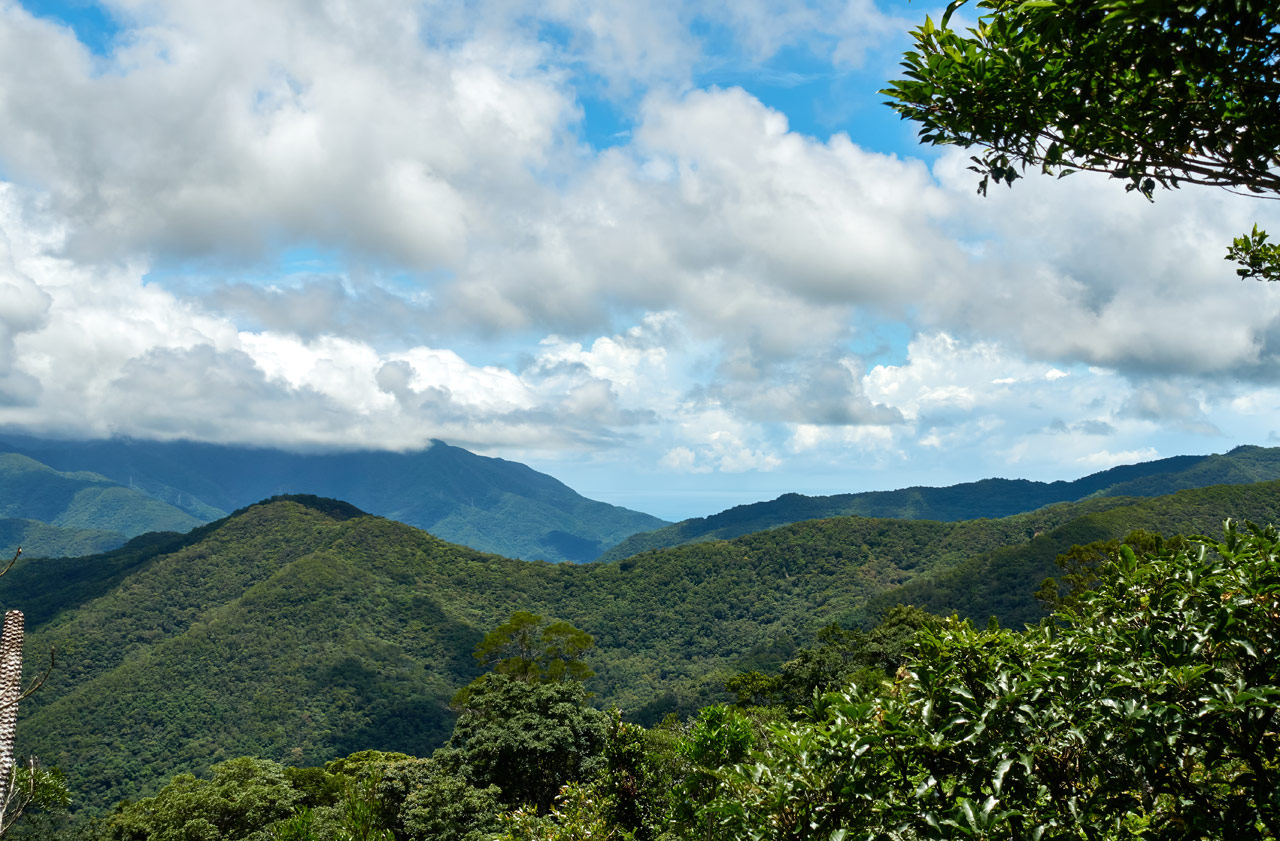
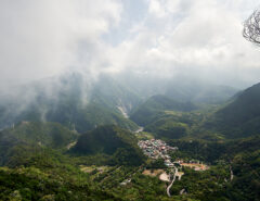
In the second picture (taken on my first trip) you can see a road going up in the middle of the picture. That’s the best way to get down to cross the river. However, on my second trip it was blocked by a large crane holding up the new section of bridge. But no need to fear! There’s another road just a little ways down…that was blocked by ANOTHER crane. Doh!
Well, so much for that. I axed my plans and instead hiked NuRengShan – 女仍山, one of the XiaoBaiYue 小百岳. It was a great hike. I can’t complain.
First Trail Head – Isn’t There Something Better!?
On my first attempt, I dutifully followed the GPX track I found on the Internet. But I was met with frustration and delay.


The gate wasn’t locked. But I didn’t feel much like “trespassing”. (maybe it was the barking dogs that made me think twice)
It seemed to me that this was a public road, but I wasn’t about to argue the point…with nobody. LOL So I asked my wife to call the number for me. That did not work at all. It accomplished nothing but pissing off my wife. The person answered, heard about five words from my wife, and hung up on her. She called back a few times. Then the person must have turned off their phone.
My only option was to park down by the road, walk up to this spot, and cut up to the next switchback. Yeah, I made my own trail.
It wasn’t pretty, but I made it up to the next road.

Following this old road will take you up past these coveted sightseeing relics.


There’s also some sort of little transmission tower or something along the way. Sorry, I didn’t get a picture. But it’s there. I’d have to bet that’s the reason why there was a number on the gate – in case a worker needed to access the tower.
Continuing on, the road will take you to this messy intersection.

Yeah, messy…


From here you can go up…

…or down.

Obviously you want to go up. The road going down comes from the other trail head.
A Better Route?
First, I must apologize. In order for me to get into this second trail head, I feel I must explain to you how I found it. Otherwise you might be asking, “Why in the hell didn’t you take that trail from the beginning you idiot!?” And I wouldn’t blame you. So here goes.
On my way down on my first failed attempt I came to the junction above. I knew I would have to go back the way I came and I didn’t much want to have to go through that “new” trail I made. And as decent as that road going down in the picture above looked, I thought that it must go SOMEWHERE…possibly (likely?) leading to the main road below.
I wasn’t wrong, but I made a series of wrong turns along the way that prolonged the whole trip. But whatever…I had time.
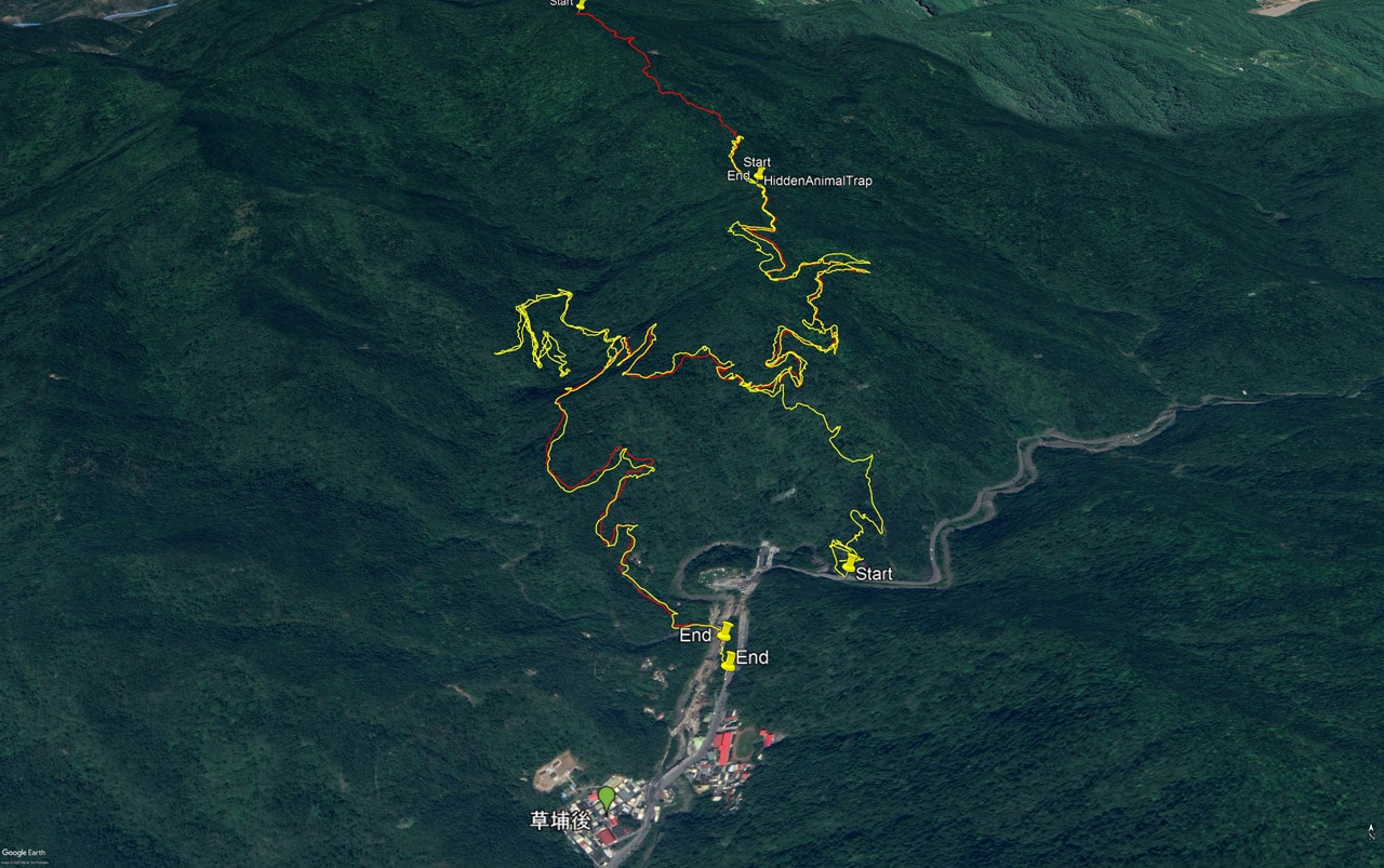
The yellow lines are the first trip. The red lines the last, successful trip.
As you can see, the road does go back down to the main road, but the distance is quite a bit longer. And see that little jumble of yellow at the top that goes nowhere? Yeah, that’s the result of all of my bad decisions. Jeesh!
Though they weren’t without reward. Here are some of the ‘cool’ stuff I saw along the way.
Traps!


A garbage heap!


A sketchy homemade bridge!


A random ladder!

A metal structure!

And a shitload (and I mean A LOT) of these plants, which appear to be 山蘇 –or Bird-Nest fern–a common vegetable here in Taiwan. Someone is definitely taking advantage of growing them up here.

Yeah, it was a heckuva detour no doubt!
But eventually I found the correct road down and made it out before dark.
Two Trail Heads – Choose Your Poison
Which route would I recommend? That’s entirely dependent on what mode of transportation you took to get there. If you’re on foot (you took a bus or begged someone for a ride) then you’re stuck with the first route. Maybe you can try your luck with crossing the gate and pray the dogs are chained and the owner isn’t around. Or do what I did and make your own path up the mountain to the next switchback.
Drove a car? Probably the first route, but possibly the second route. You can drive a good ways up the second route, but you’ll have to park somewhere along the way before the junction. It all depends on how adventurous you are.
Motorcycle or scooter? Definitely take the second route. It’ll save you lots of time and effort.
Honestly though, anyone can take the second route if you wanted to hike up from the main road. It took me just over an hour to hike DOWN from the junction (minus the ridiculous detour). So maybe an hour and a half or so to hike up? It’ll take half that time hiking up the first route though, so…
The Junction and Beyond
Have you chosen your poison? Great! Whichever route you choose, you’ll end up at the junction. Here it is again.
I chose to drive up this time around. It was mostly fine for my bike, but sketchy in some places. I eventually found a suitable place to park and began my hike.

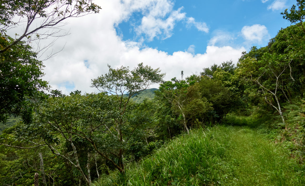
It’s an old farmer’s road twisting and turning its way up the mountain for the first hour.


Sometimes it didn’t look like a road at all.

I followed the road (for the second time) until it becomes so overgrown you can’t go any further. From there the trail cuts up the mountain to catch the road further up.

You’re pretty well covered by shade the entire time until you reach…the fun stuff!


This is the last section of the fun stuff. Let’s call it ‘the gauntlet’.

I remembered the best route to take through all this tall grass, so it didn’t take me all that long. But the first time around was a different story. I don’t think anyone had been through there in a while. Here’s how part of it looked then.

From Despair to Hope…or Something Like That
After exiting the tall grass, the road just opens up.

At this point you’re very near the ridge and everything just FEELS better. It’s more open, comfortable, and quite relaxing. This largely due to the perfect weather that day.
As I climbed I saw what I thought was QiLuZhiKeShan; it certainly appeared to be in the right place.
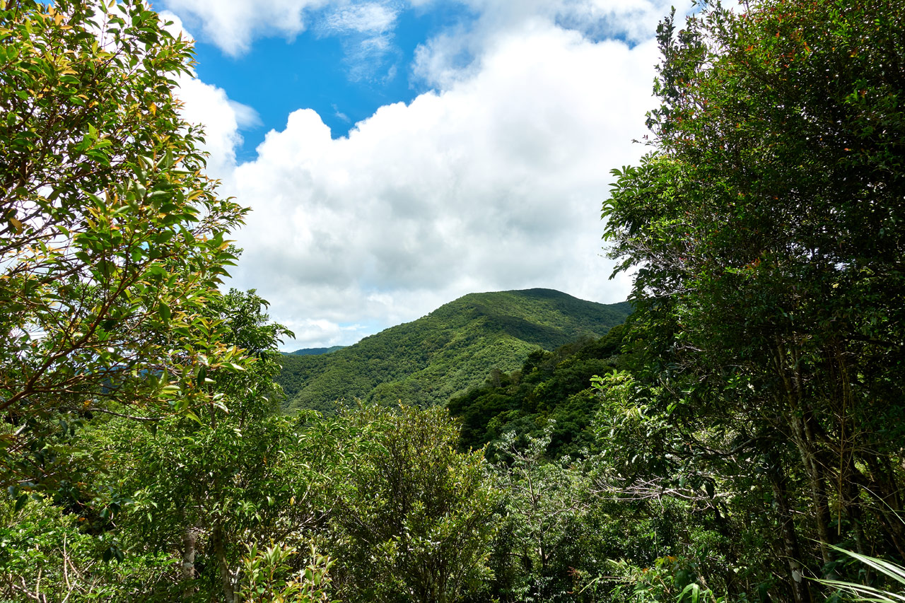
But I was wrong. QiLuZhiKeShan is further back and to the right. You can’t really see it most of the hike up.
However, as you climb up…

…what you CAN see as you near the ridge is…
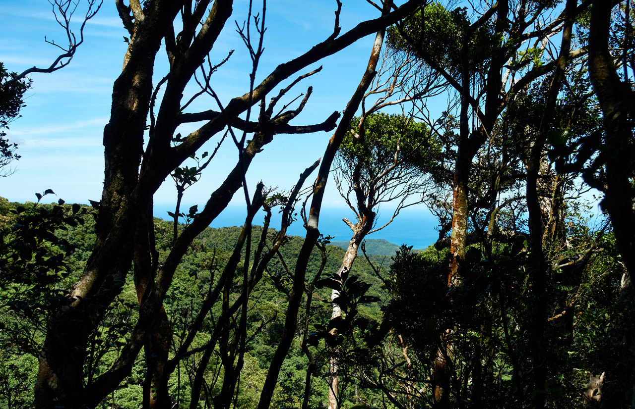
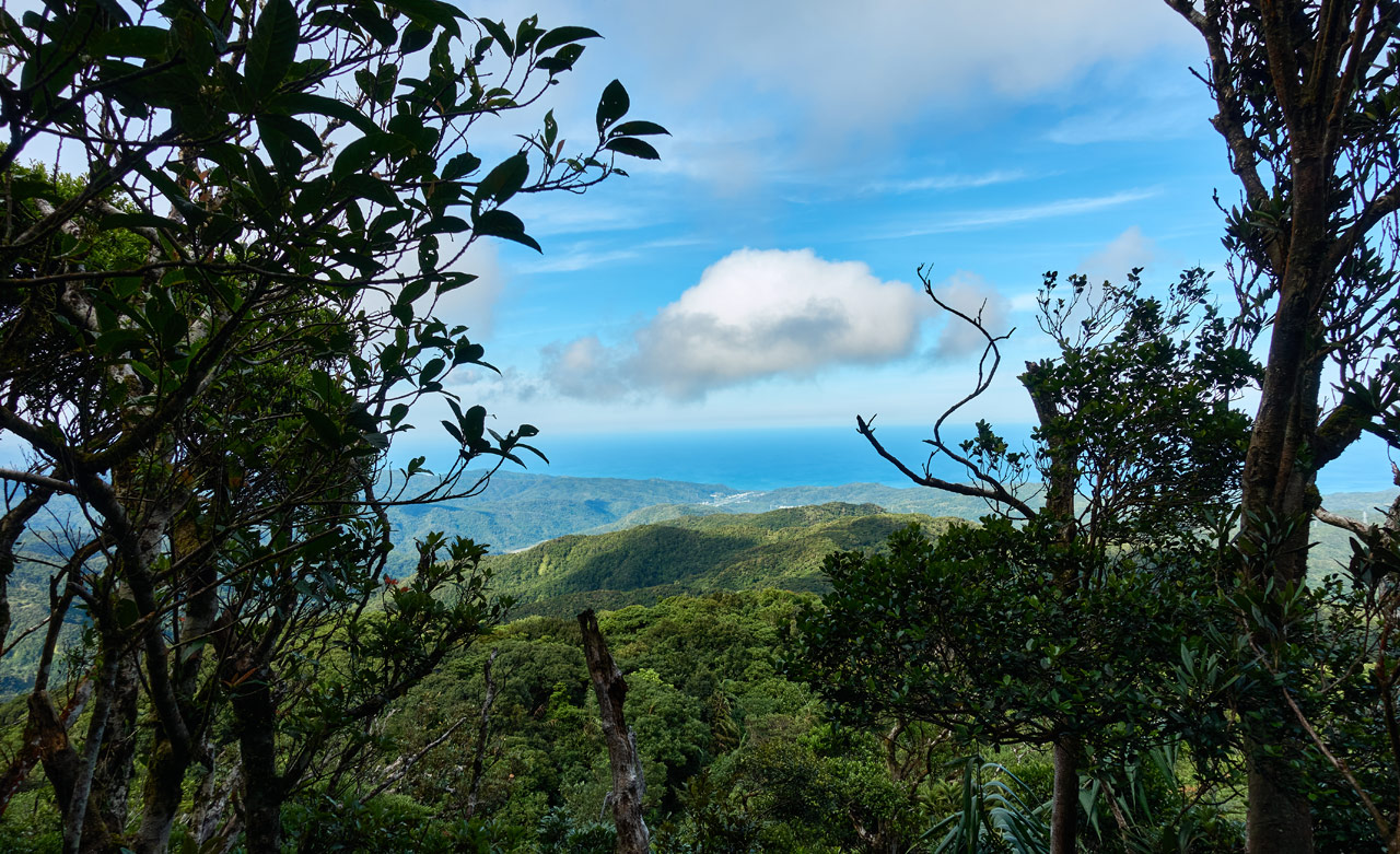
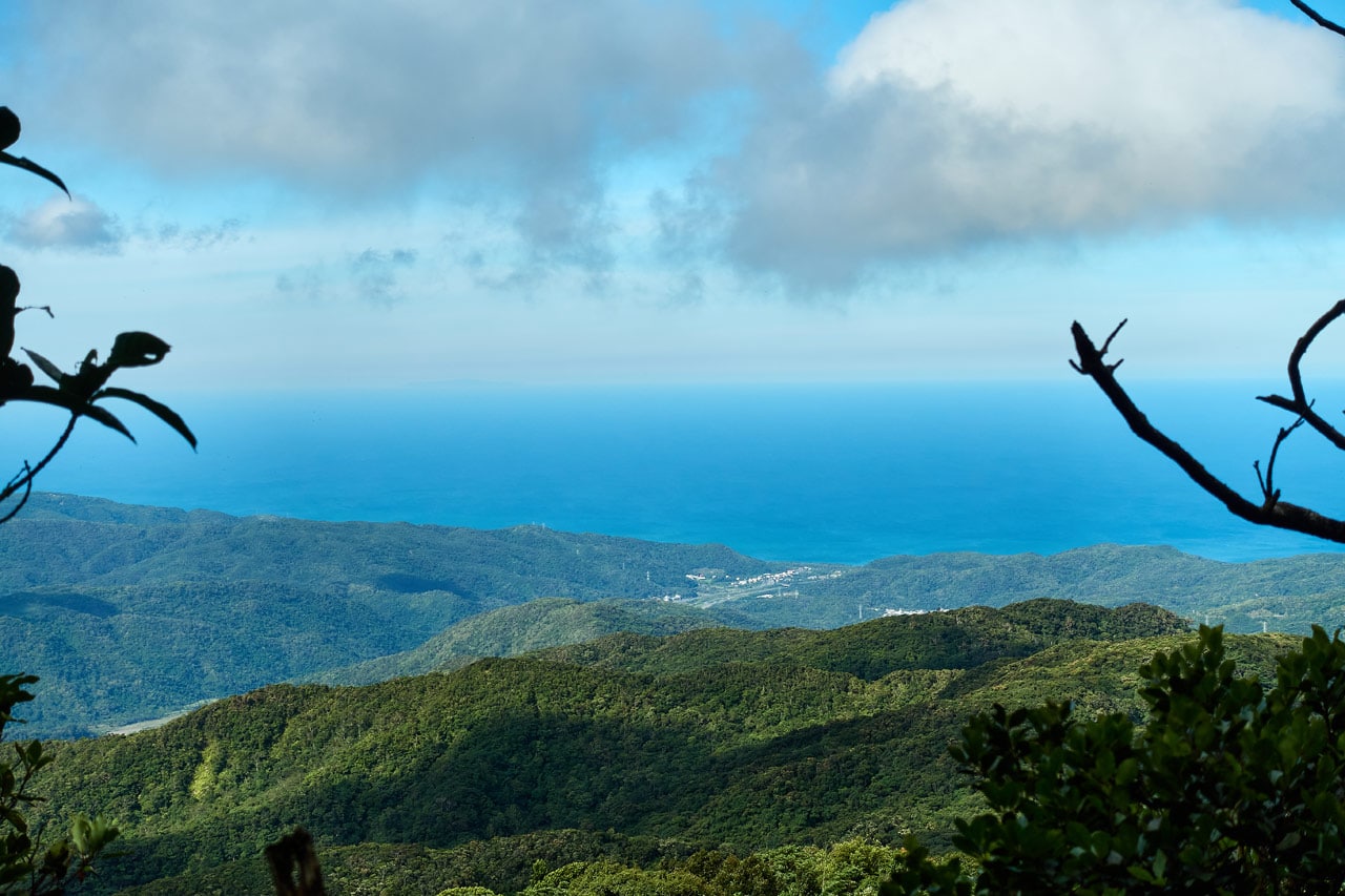
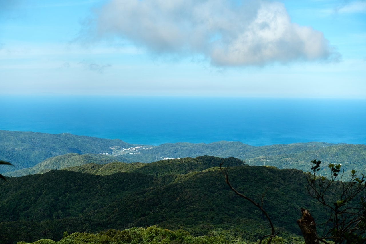
THE OCEAN!!!
I mean, it’s there. For real. The west coast ocean.
Don’t believe me? Have a closer look.
No? Still don’t see it? Fine…let’s make it painfully obvious for you.
See! There it is in all its glory!
Ok, ok it’s not all that great of a view. But it IS the ocean. And guess what? I promise you’ll see the east coast ocean soon enough. (weather permitting of course)
Ridge Walk
As you near the ridge, there’s this absolutely perfect spot. I can’t explain in words why it’s perfect. When you see the picture you’ll think “meh”. But honestly, the four times I’ve passed this spot I had to stop to just take it all in.

Anticlimactic, I know. Sorry, you just had to have been there to appreciate it. There’s something about the perfect weather…being at the top of the mountain…an open space…and most importantly, the wind blowing the tall grass this way and that. It all just comes together perfectly at this spot somehow.
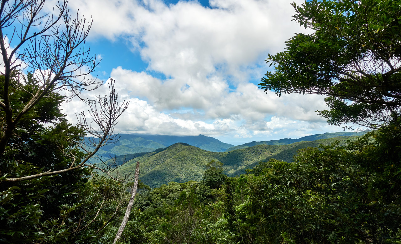
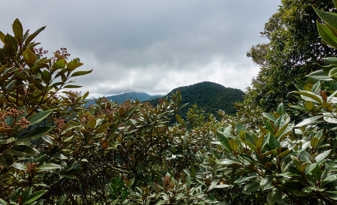
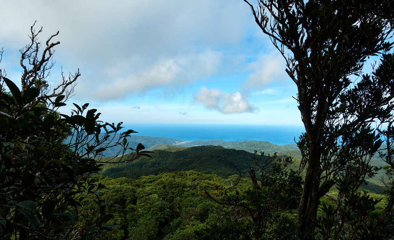
Once on the ridge the going is easy and relaxed. I got a clear view of that mountain I thought was QiLuZhiKeShan. I spent way too much time taking pictures of it.
Along the way I ran into a trap – a common theme for me.


Again, the ridge portion of this hike is nice. But there’s one thing about it that’s bad: It doesn’t last nearly long enough!

Before long you arrive at one last nice patch of grass with a view. I recommend you stop and enjoy it. There won’t be much more of this beyond this point.
From here it’s all tall grass again for a bit.


Wrong Turn and Animal Bones
The first time I was here I got all turned around. The GPX track I had been following seemed to go in the wrong direction. There just wasn’t any discernible trail for me to follow. I wasted some time, but eventually found my way. You have to go through a kind of tree/bush tunnel. There’s an old PVC pipe on the ground to help guide you. But honestly, once you find it, it’s easy to follow.
After I exited the tunnel the first time, I completely missed the turnoff. There was a ribbon marking it, but it wasn’t very obvious at the time. I kept following a trail, but the wrong trail. It was a hunter’s trail. Thankfully it didn’t go far. It ends at a trap.


As you can see, the hunter caught something and ate it right there. The second time I was there I wanted to see if he caught anything. I didn’t see the trap right away and ended up stepping in it. Oops! Sorry hunter…

You’ll need to look closely to find it.
Correct Trail…the Trail of Doom
Here’s a look at where I went wrong.

It really seems like you need to follow the trail up through those trees, right?
Nope! Not the case at all. The trail to QiLuZhiKeShan goes off to right and down. My second time here I wondered how I could have missed it.
From here it gets strange. The trail is more or less like any small trail I’ve been on before.


There’s even an old PVC pipe that shadows the trail for a good way.

The strange part is a sort of lack of life here. No birds, no animals, the sun can’t quite make it though the canopy…just a forlorn landscape so to speak. And to add to the “chorus of the dead” is an orchestra of cicadas laying down the stringed instrument soundtrack. It’s eerie. I briefly imagined this being a forest where people go to purposely become lost forever. Maybe something similar to that suicide forest in Japan.
Are you scared yet? Have you decided to ditch this hike for something more palatable? Hahahaha…don’t worry. It’s not that bad.
The Real Hike
If you managed to make it through the “Forlorn Forest” fully intact, then it gets (somewhat) better once you start your climb.

I stopped briefly and took this video. It might give you an idea of the loneliness I mentioned above.
This section takes your mind off the landscape for two reasons. First, it’s somewhat steep. The harder your body is working, the less you think, right? That’s how it works for me anyway.
Second, I was hounded the entire time by a series of horse flies! At first I thought it was just one, but after a time it would disappear. Then 5 minutes later it would be back. I can’t imagine a single horse fly would follow me for an hour. AN HOUR! It was madness.
The thing(s) bit me several times on my shoulders. I just couldn’t kill it. Eventually I stopped being attacked. But they resumed on my way back down later in the day. And guess what? I smacked the shit out of that mothertrucker! I had planned to take its body and do something triumphant with it, but I couldn’t find it on the forest floor. Oh well…
(sorry to spend so much space writing about this, but the damn thing(s) traumatized me!)
Ok, back to the hike.
The landscape was all very similar looking for a while…


Until I came to this tree. It seemed so out of place here.


Something about it felt very good. Like a ray of sunlight in a dark corner of unpleasantness. It wasn’t alone though; I crossed a few more later.
The Road From Nowhere
However that tree came to be planted there, for me it was some sort of foreshadowing of things to come. Not long after passing the tree I came to an old dirt road. It’s hard to imagine from where the road came given what I had just hiked through. But there it was, the road from nowhere.

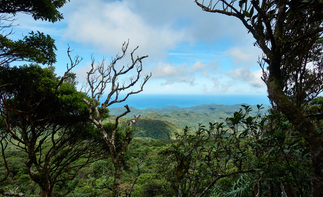
From that road I got my first glimmer of hope that the rest of the hike wouldn’t be like the past hour…
The east coast ocean!
It was false hope though. I still had plenty of the same crap as before to hike through…


…but at least I had the thought “things might open up soon” to help push me along.
As I neared the peak (yes, believe it or not, I’m actually almost there at this point) I came to this spot that was covered with trees, but had a sunny and open feeling to it.

It took me a second to realize that the sun was able to brighten the area because the trees had no leaves. They were all dead…


The ground felt hollow-ish as I walked through the trees. As nice as the sun felt, I didn’t want to linger. Forlorn forest indeed!
Almost There…But Where?
I was close. Just a little section of steepness and I would be on the ridge.


As I pulled myself up and onto the ridge, I was met with a small obstacle.

I had to push and hack my way through the edge of this tall grass to make it fully onto the ridge. According to my GPX track I was there! But…where was the triangulation stone?
I started chopping at the grass with my machete thinking I would need to clear the area to find it, but then…I looked down at my feet for some reason and…
QiLuZhiKeShan – 耆路知可山
There it was!


I’m not sure how I missed it, but whatever. At least I didn’t have nearly as much grass to cut.
And I DID cut a fair amount of that grass to create enough space for me to be comfortable.

And while I’m at it, here’s my peak picture and some others.


As you might have guessed from these pictures, there’s nothing to see at the peak. However, there was a great breeze and the sun was shining. It felt good to sit there and listen to music for a while.
An Unexpected Surprise
The above sequence is slightly out of order. I did cut all that grass and take those pictures, but that came AFTER a little bit of exploration.
The GPX track I had followed showed a line following the ridge to the south for about 50 meters. I thought this would lead to a spot with a view; or perhaps to a nicer place than this peak…a place I wouldn’t have to chop a bunch of tall grass.
I was wrong on both counts, but what I did find was quite a surprise! As I made my way over, this structure came into view.

I couldn’t begin to guess what it was other than maybe some old antenna or radar station or something. As I walked nearer, I got a better look.


This writing makes me think they were made outside of Taiwan, or perhaps built and installed by Americans when the US military was here? I can’t imagine them being built here locally by Taiwanese and for some reason they decided to use English for assembly instructions.


I’ve seen structures like this before in the south up on top of mountains. On the nearby peak of NuRengShan 女仍山 I passed a similar structure.

I posted these pictures on Facebook and a local hiker told me they are Passive Repeaters – or Passive Radio Link Deflection. That seems to be exactly what they are. And apparently they aren’t needed any longer. It’s too bad because there probably would have been a road that drove right up to this spot if they were still being used! But then again, that would have made this hike pretty boring.
There’s a spot on the concrete base that has a view to the west. It’s not much of a view, but better than nothing.
One Last Look and Then Chow Time!
I stupidly got it in my mind to try and climb up the broken repeater.

It seemed I would get a perfect view of the surrounding mountains if I could make it to the top. I managed to get about halfway up when I heard a loud “CRACK!!!!” and felt the rail under my feet move and something hit the ground. That was all that was needed to turn me around. I believe the words that came out of my mouth were, “Fuck this shit!”
I climbed down, grabbed my pack, and made my way back to the triangulation stone.
When I got back I cleared that grass, spent a decent amount of time eating and relaxing, and took my peak pictures. All was right in the world…


…except it wasn’t. I didn’t have a good shot of the surrounding mountains. Hmmm…
One Last Look
I couldn’t let it go. There HAD to be some place along the ridge with a decent look at the east coast. So I grabbed my camera and picked my way through a bunch of crap along the ridge to the north.


As you’ve probably noticed, there are a bunch of old trail marker ribbons! I have a couple guesses why they’re here. Maybe the trail I followed wasn’t the original. At some point it might have veered to the north and linked up here. Personally I don’t think that’s the case. So it’s possible there used to be a trail (or still is?) coming from the east coast. Following these ribbons might lead you there.
My only other thought is that there’s something further along the ridge worth seeing. A GPX track I found shows that person followed the ridge north a good ways for some reason. I wish I had time to explore, but I didn’t. Though I might have if I hadn’t reached this spot…
There it was again…the east coast!
I worked my way down a bit to try and get an unobstructed view. Here are a few shots.
That’s DaRen – 達仁 in the distance. It’s the first town you come to when reaching the east coast after heading across the 9. Here’s another shot of it.
I wanted to stay a while longer, but it’s not exactly a comfortable place to hang out. (I was standing off to the side of the ridge on a steep slope)
One last look before I leave…
There wasn’t much left to do when I got back to QiLuZhiKeShan – 耆路知可山 except pack up my things and say goodbye.

The Trip Back…or, To Conclude…
I don’t have much to say or ANY pictures to offer about the trip back. With the exception of that damn horsefly that found me again (and later I killed!!) nothing happened of note. I got back to my bike before dark and drove down without incident.
If that had been my first time hiking this peak, I probably would have had more feelings about it. But all I could think about was getting it over with. Despite that, I would recommend this hike because it’s somewhat different. You get to see both coasts, an old passive repeater, and several other oddities along the way. As for me…no way. I don’t want to go back a fourth time! Well, I AM curious where those ribbons lead to on the ridge. Who knows…
Date hiked: 2020 July 06
GPX Track Download Instructions: Click the track on the map to see the download link
This is the GPX track on my third, successful trip
There two tracks are from the first, failed trip.


![[Valid RSS]](https://outrecording.b-cdn.net/wp-content/uploads/2020/03/valid-rss-rogers.png.webp)
Leave a Reply