
If you’re looking for an interesting day hike and don’t mind a bit of a drive, then give WoDanShan East Peak – 我丹山東峰 a try. By my guess it’s not particularly popular, but it holds some features that make it somewhat unique in my opinion. So let me tell you about my experience hiking it.
A Peak with a Stupid Route
First I would like to get this off my chest. The route to this peak is dumb. Just stupid, stupid, stupid. Well, the route I took at least…which as far as I can tell, is the main route. Now, WHY is it dumb? You’ll have to read on to find out. Sorry, I can’t spill the beans right up front, now can I?
BUT…since I’m writing about the route, I’ll at least show it to you.
The Trailhead
The trailhead is near the parking lot of Changlong Falls – 長龍瀑布.

Let me quickly defend my crap pictures for this hike. I bought a new camera body and thought the kit lens would work well enough. It didn’t. The aperture wasn’t nearly wide enough for the low light conditions on this hike. And I neglected to bring my usual pocket camera, the RX100, so I got what I got: noisy pictures. *sigh*
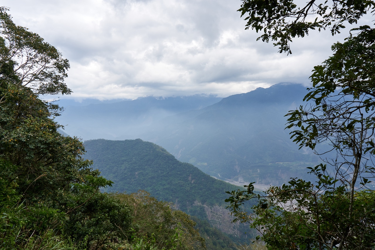
After a short drive from the bridge I took the above picture from, and a short “where exactly am I going???” drive through some farm fields, I had finally arrived at the trail head.


The trail head is here, up that little sorta-path next to those hanging pieces of cloth.

The Horrifying Beginning of the Hike
I’m being dramatic. It wasn’t horrifying. Just messy…and I wouldn’t have it any other way!


But things eventually cleared up a bit.

And then came the rocks…

First just naturally lying around like you would expect to see. Then they appeared to be stacking themselves.


This entire area was row after row of stacked rocks. Remnants connected to long ago farming no doubt. I felt the need to explore these stacks of rocks as I’m wont to do, but I wasn’t sure how long this hike would take. Maybe I would have time for exploration on the way down.
Unpleasant Discoveries
Nearby the rock stacks I found something that would be a common sight through the first half of the hike.
GARBAGE!


Plastic bottle after plastic bottle were littered usually in a small section here and there. Rather than show them in chronological order as I found them, I’ll post them all here now.


I took a video as well and posted it on Twitter.
I found their trash stash. 😠#taiwan #hiking #mountaingarbage #garbage pic.twitter.com/G87RVXqS7R
— OutRecording (@OutRecording) November 12, 2021
I’d bet strong money that the trash came from one or more hunters. There’s no other explanation. I found one of their shells not long after the garbage pit.

I’ve come across hunters’ garbage before, but never THIS much. And never so much on trail. Usually it’s concentrated at or near the trail head.
Back to the Rock Stacks
The area looked much the same after the stacks of rocks (and garbage!), just a bit ‘messier’ in a different way.


It did flatten out a bit, which was nice.

But that was just a tease for what was coming next.
The Climb


This is the part of a hike where you’re thinking “fuuuuuuuuuuuuuuuuuck….”
Not necessarily because of the steepness, but because of how long it lasts. The kind that never seems to end. I’m sure you’re well aware of that kind of climb, right?
Looking back at my GPX track’s elevation profile, this section isn’t much different from what came before it, but it just felt different for some reason.
This part of the hike all looks much the same. There were some rock stacks here and there.

But by and large, it was all the same looking.

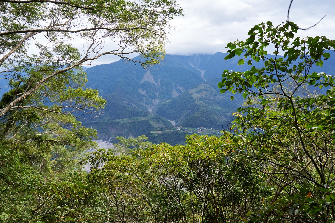
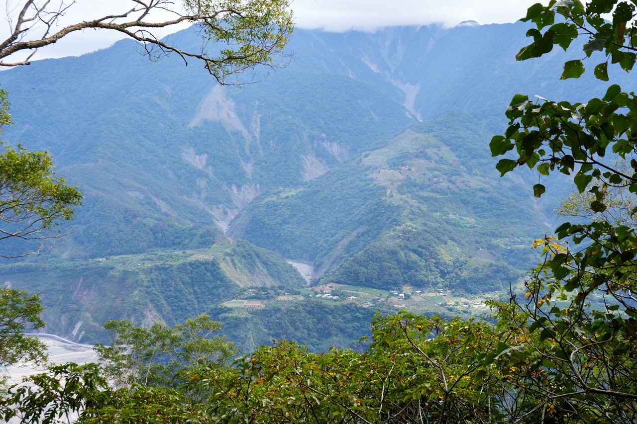
Along that stretch an opening allowed for a view across the Laonong river.
Somewhere not long after I took these pictures I encountered a wild boar. It was standing on the trail ahead and above me a bit. It stared at me for a bit, but not long enough for me to get a picture. Then it turned tail and trotted off, not to be seen or heard again.
Leveling Out
After roughly two and a half hours of steady climbing, I finally got a bit of a reprieve. The trail became somewhat flat.

Now this is where I first had a thought. Well, not here. But here:

This was the first part of the hike where the sun managed to break through the clouds and light up the area. This spot felt really nice at the time.
The trail went off to the left, but I thought I might have a chance to get a nice picture of the mountains if I climbed up to the ridge on the right.
Unfortunately there wasn’t a view to be had, but I did get an idea.
Could I follow this ridge up to the peak?
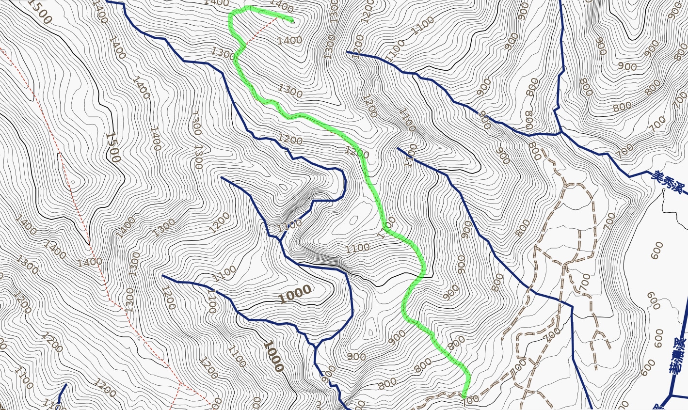
Take a look at this map.
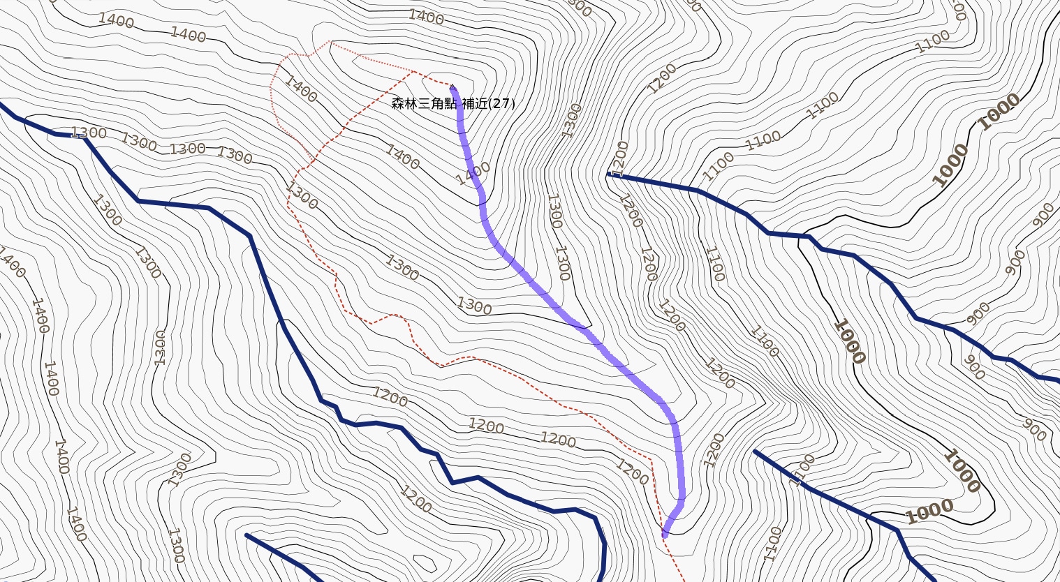
I was roughly at the bottom of the purple line, but a little over to the right on the ridge. Taking the ridge up seemed a much quicker and more direct path to the peak, right? Certainly better than that dotted red line.
As I stood there contemplating my next move, I received an unwanted visitor. Or more like, I was the unwanted visitor.
Any guesses what this #hornet thing is? I’m at a loss. #taiwan #hiking pic.twitter.com/PxuIr3SD0l
— OutRecording (@OutRecording) November 12, 2021
That thing didn’t want me around there for whatever reason, so I left. I made a little roundabout loop and connected back with the trail.

The “Who the Fuck Decided to Make THIS the Trail!?” Part
For this section of the hike I was happy I brought my machete. I often lost the trail and had to hack my way through various unpleasantries.

But for a lot of it, there were just a bunch of…stones…


I think I didn’t mind so much in the beginning because I had just come off a steep climb that lasted nearly three hours. So an hour of more or less flat-ish hiking was a nice change of pace. Until it wasn’t…


The last twenty percent of the hike just got…nasty.


There were a lot of “dirty climbs”.

And by dirty climbs I mean the ground wasn’t easy to get footholds and there were vines and whatnot impeding progress. It was quite exhausting for me to get through this section…not to mention dangerous!
I don’t have many pictures from this part because…I don’t know…would you stop and take a bunch of pictures when you feel like you wanna die??
The only redeeming quality of this part of the hike was the sound and slight view of a stream below. And that’s hardly redeeming.

This stream flows directly into Changlong Falls – 長龍瀑布.
There was also one spot where you could see the mountain on the other side of the stream. I think that was the only blue sky I saw the entire hike.
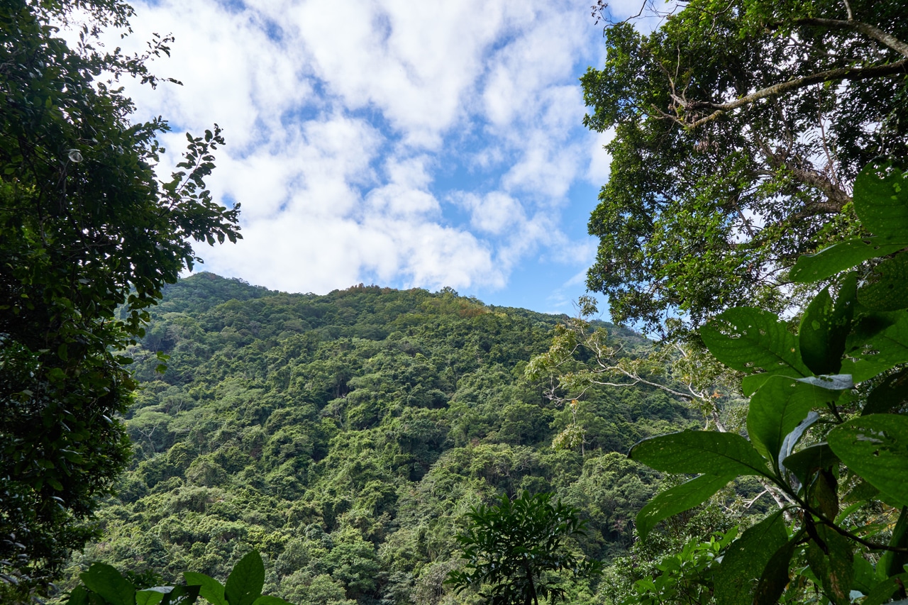
The Final Push that Sucked Majorly
Looking at the map again, you’ll notice there are two routes to the ridge near the end of the hike.
I climbed up roughly 70 meters and had a choice to make: continue straight up or cut across the mountain a bit and head up somewhat more gradually for a time before hiking straight up again. I chose the latter as it seemed easier. Honestly, I don’t think either would be easier at that point, but a short bit of flat-ish hiking seemed a nicer choice.
Well, things weren’t nice. In fact it was just as sucky as everything before. Maybe even worse.

I’m struggling to remember the details, but one thing jumps strongly from my mind. It didn’t feel like a safe place to be hiking. But I did make it up and near the ridge. There was an open area devoid of trees and most vegetation–just dirt and rocks–to climb through before reaching the ridge. I could see straight up to my goal. But getting there tired me out something terrible. When I neared the top I had to take a little rest on that moldy tree there.

After my rest I made my way along the ridge.


And ten minutes later, after nearly five hours of hiking, I had arrived!
WoDanShan East Peak – 我丹山東峰

It was pleasant at the peak, a feeling that contrasted greatly with the rest of the hike. I wished that I had brought a tent and extra water so I could stay the night. But as things were, I had about fifty minutes to spare. I wanted to get back to my bike before dark; I had a long drive home ahead of me.
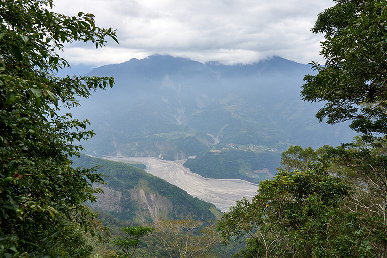
For anyone still considering this hike, let me throw in a little reward you’ll get at the peak. A picturesque window!
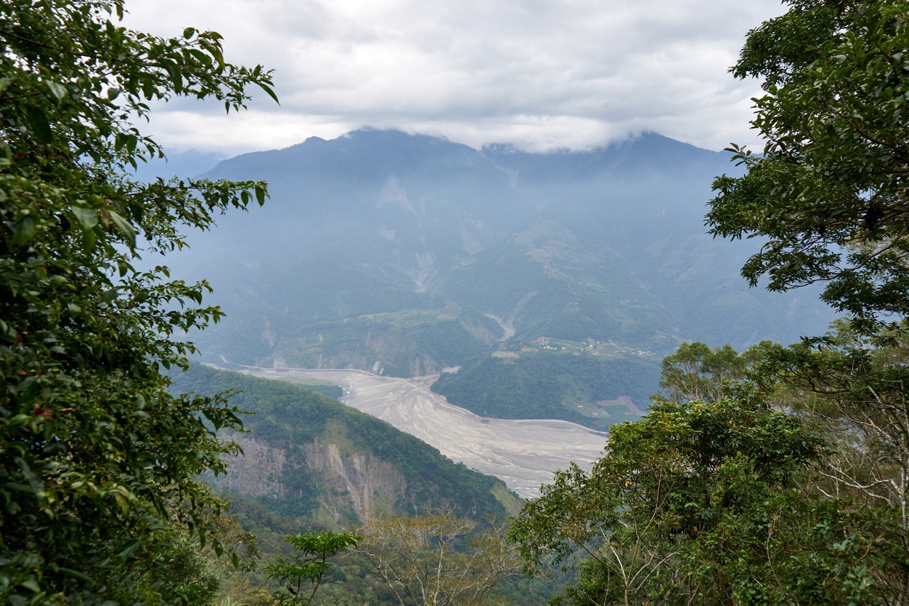
Ok, it wasn’t hugely picturesque when I was there, but I imagine on a sunny day it’s a great view!
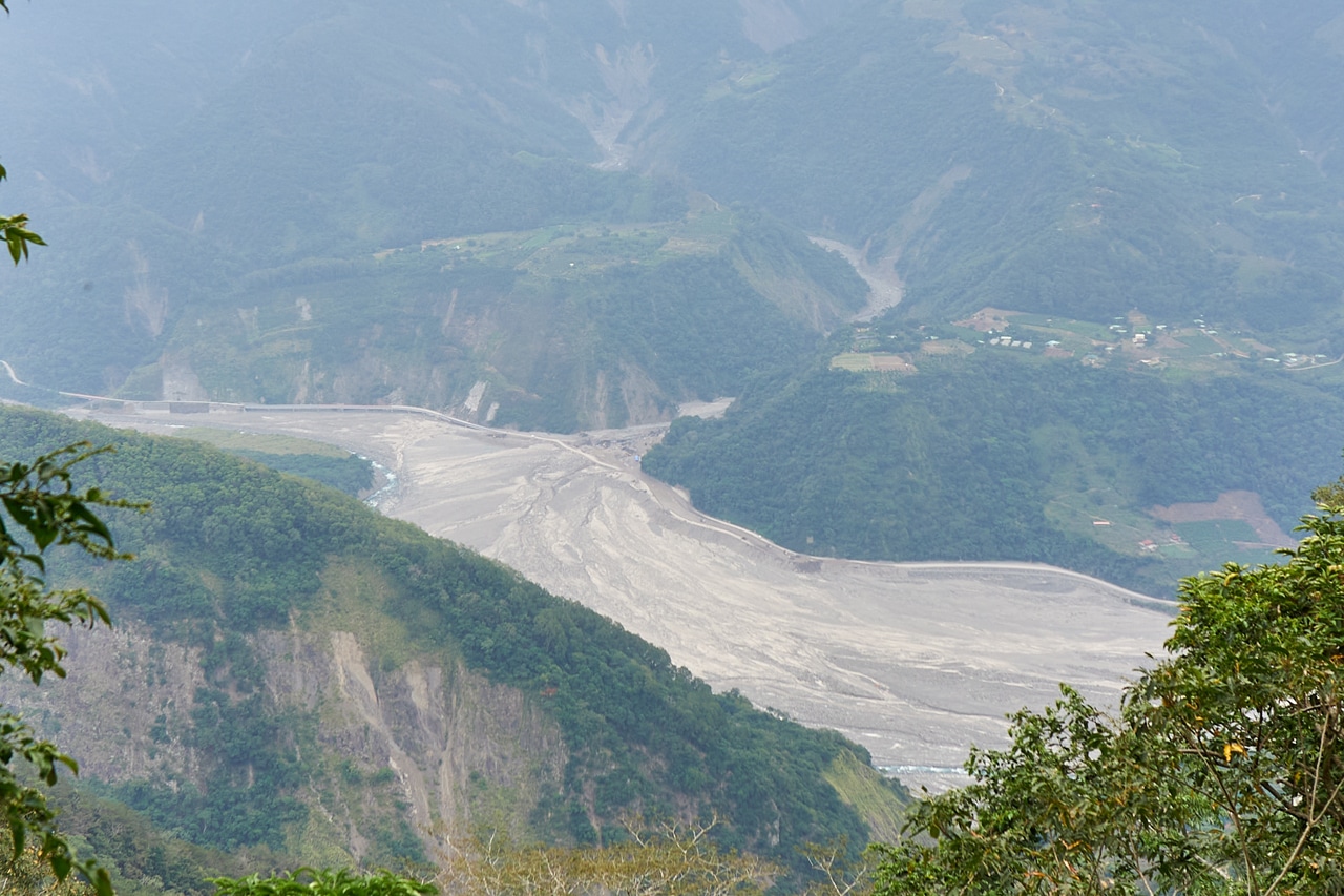
And if you notice down on the other side of the river, you’ll see a place where the road goes down into the riverbed. There used to be a bridge there. It was knocked over in a flood a few months earlier. Here’s a video to refresh your memory.
Well, after my meal and rest I shot my usual assortment of pictures…


The area as a whole…


At first I had thought someone tied their garbage to a tree. I see that sometimes and it pisses me off. But this time it was something different. Someone printed out a paper with the peak name, height, and other info and put it in that plastic bag to protect it. However, it didn’t work. Water had seeped in and it was falling apart.
Ok, now I can FINALLY get to the part that I’ve been waiting to tell you about.
Oh, but first my peak picture of course! I think I’ll go with this superman pose this time around.

And Now For Something Completely Different
While relaxing atop WoDanShan East Peak, I couldn’t help but wonder about that ridge I pointed out to you earlier. (in purple)
I was somewhat dreading the idea of going back the way I had come:

So I walked over to the other side to see how good/bad that ridge looked.

I hiked down a bit without my pack for a couple minutes and it seemed doable.

So why not give it a shot?
And I did!
About a minute in, I got another decent look through an opening in the trees.
It’s quite possible that’s ZhuoShuiXiShan – 濁水溪山 there in the foreground.
Soooooooo…how was the ridge, you wonder?
Not bad at all!!


I wouldn’t go as far as saying there was a trail, but I could easily work my way down this ridge no problem.
Thirty-seven minutes into my descent, roughly halfway until I connected up with the usual trail, I found this!

What…the…actual…Fuck!?
A trail ribbon!
It’s cloth, so it’s probably old. But it means this was a trail at one point. So why oh fucking WHY did people just STOP using this ridge??? It makes no sense to me. But wait…I’m only halfway down at this point…maybe there’s some insurmountable obstacle I’m about to run into like a landslide. So let me hold back my anger until I know for sure.
Down Into the Unknown
Let’s keep going and find out.

Some larger stones…no big deal.

And more and more…but OK, not a problem.

Well, yeah…this area wasn’t the easiest to get through.


There were a lot of boulders to pass over. You had to be careful where you stepped. If you tried stepping between them, your foot might break through to what’s beneath. So I took it slow and hopped boulder to boulder. But after that area, it was all good again!
I had made it back to the part of the ridge I walked up to on my way up (the area where that hornet was following me). I could have traced my old path down to the trail but I decided to follow the ridge instead.
Not long before connecting back to the trail I found this.

Seems a hunter would have done this with a machete?
Anyway, I made it back to the trail! In total, this route saves you 1.6 kilometers of hiking.
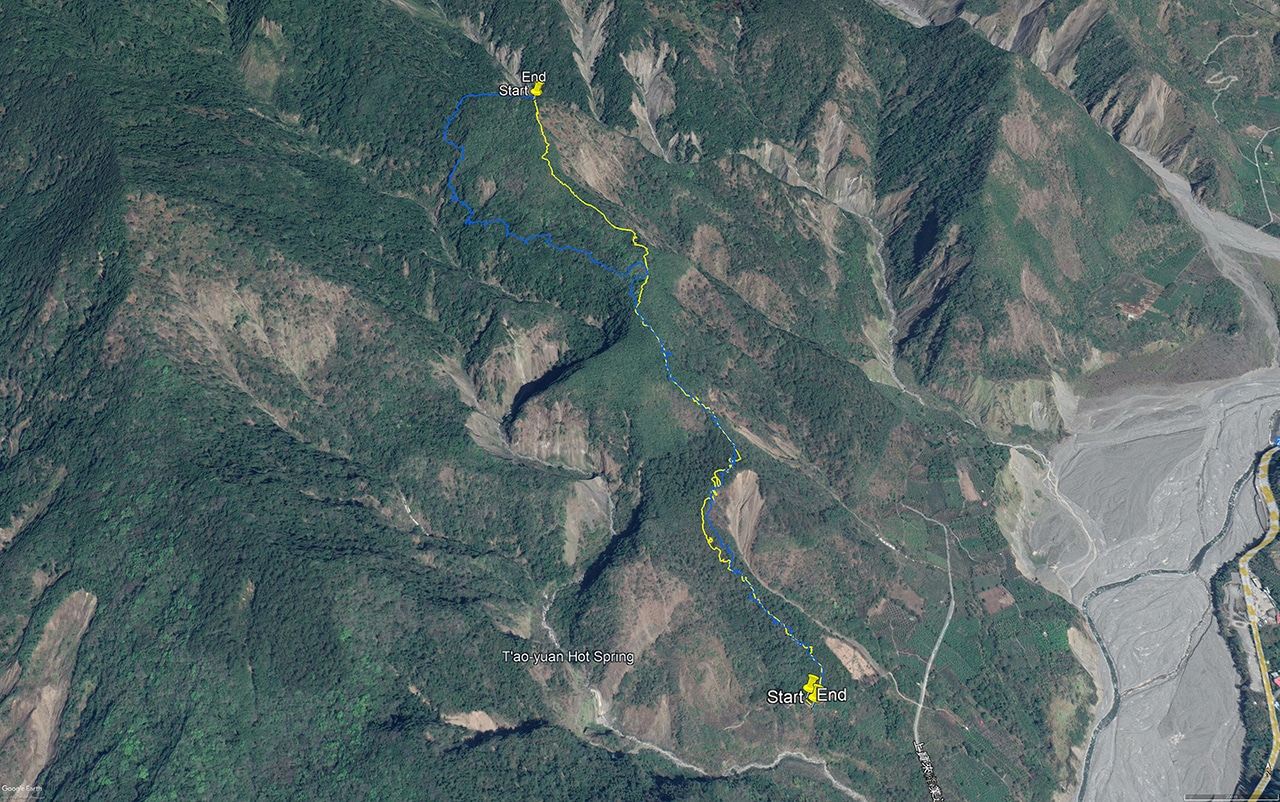
Here’s a look at my GPX tracks. The blue color was my path up. The yellow color was my path down.
So let me swing back to why on earth isn’t this ridge the main trail!? Why!!!??
It makes no sense to me at all why anyone would want to hike through all that crap “trail” through all those “hell spikes” and stupid dirty climbs and…sheesh…just stupid when you have this nice ridge to climb up. I mean, was there at one time some mad hunters who hid along that ridgeline and ambushed hikers and threw them over the ledge? I don’t get it.
Ok, enough ranting.
If you decide to hike this, please TAKE THE RIDGE. Seriously. Just do it.
The Rest of the Hike
Not much to say about the rest of the hike. It went steady and smoothly. I did notice some barbed wire that had been eaten by a tree that I hadn’t seen on the way up.


I can only guess it was placed here long ago for farming purposes. But who knows…it could have been put here for any number of reasons.
Here’s a video I posted on Twitter about it.
I found this old barbed wire being eaten by a tree out on a trail in an odd location. A nice drop-off to the front and nothing in particular behind. I can’t begin to guess why it was put there. Approx 1012m. This was back in November. #Taiwan #hiking pic.twitter.com/jhnfIwyENC
— OutRecording (@OutRecording) June 19, 2022
I only took one picture over the rest of the hike and it’s not very interesting; I’ll spare you the bandwidth.
So yeah, I made it back to my bike and all was good. I conquered another peak! Woohoo!
Should You Hike This?
I would say this is an interesting peak to hike. You get a long and pretty drive along the Laonong river on the 20 to reach the trailhead. Then a hike through a variety of terrains and land features. (as many as can be expected on a five hour hike anyway) Despite my rants about the stupid route to the peak, I DID enjoy myself. Probably more so because I trusted my instincts and found a better route down part of the mountain. Yeah, the garbage along the way spoiled those parts of the hike a bit, but all in all I would totally recommend this hike to you.
Oh! And on the way down near the bottom where all those stacked rocks are…near the garbage…I found a large roll of garbage bags! Hahaha…some irony there.
So yeah, go and hike WoDanShan East Peak – 我丹山東峰 if it suits your fancy.
Date hiked: 2021 November 12
GPX Track Download Instructions: Click the track on the map to see the download link
This is my route down the mountain. I took the ridge down instead of the usual trail. I recommend this route. You’ll save 1.6 kilometers of hiking. However, take it at your own risk.


![[Valid RSS]](https://outrecording.b-cdn.net/wp-content/uploads/2020/03/valid-rss-rogers.png.webp)
Leave a Reply