

It took me a while to write about this hike because the hiking portion of it wasn’t all that interesting; it was rather boring, truth be told.
That’s a great opening line, huh? It really engages you, the reader – encouraging you to read on!
But I cannot tell a lie; if you plan to hike to ZheKeYuShan – 著可芋山 I highly suggest you do it from another trail head. That is, unless you have an offroad capable motorcycle or are some sort of masochist and enjoy unnecessary pain.
Wait! There’s another trail head? Why didn’t you take that one, Glenn?
Hold your horses…I’ll get to that.
The Extra Long Ride Up
ZheKeYuShan isn’t the easiest of peaks to reach. Regardless of how you plan to get to the trail head (or the other one) you’ll have a bit of a mountain drive. On the map below (go ahead, click it), ZheKeYuShan is marked by that little orange circle. I had planned on taking the most direct route to reach the trail head, but I ran into a small problem.
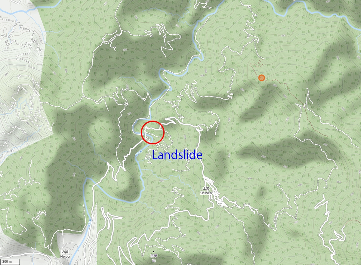
Yeah, there was a landslide.
This meant that I would have to backtrack and basically start all over again. Instead of a nice direct route, I’d have to drive up to ShiWen village (士文村) and come down the other side. As it happens, there was a nice direct route up to the village not far back from that landslide. Except…there was a landslide there a year or two ago that hasn’t been fixed yet. Doh!
So, I drove back to the beginning and made my way up an alternate route to the village…that was also broken by what I can only assume to be another landslide. *sigh*
There’s another route of course. It was clearly marked and paved the whole way, so not a big deal; I eventually reached the village and drove on to the trail head.
I had driven back there before and was familiar with what I’d encounter. I thought I would be able to drive quite a ways and be able to park pretty close to the peak. And I wasn’t wrong. But I would soon find out that it wasn’t going to be an easy drive.
The Dirt Portion of the Drive
It started off easy enough.

But it gradually became worse and worse.


I didn’t take pictures of the shit portions of that road. But I hope you get the idea. This “road” became so bad that my clutch plates swelled and I had to stop to let them cool down. Yeah, I was clutching it a LOT to help get my ass up some of that shit terrain. (I’ve switched from full knobby tires to 50/50 tires. They last much longer and feel much better on the pavement, but I pay for that on the trails. They don’t grip nearly as well.)
The road DID eventually get better. But I made the decision to stop because I figured there wouldn’t be much of a hike left if I kept driving!
So I stopped and prepared for the hike.

Let the Hike Begin!
The start of my hike was flat and simple. Well of course it was…it was a road after all.

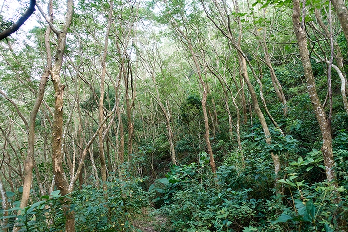
There was a lot of overgrowth, but you could clearly make out the trail/road.


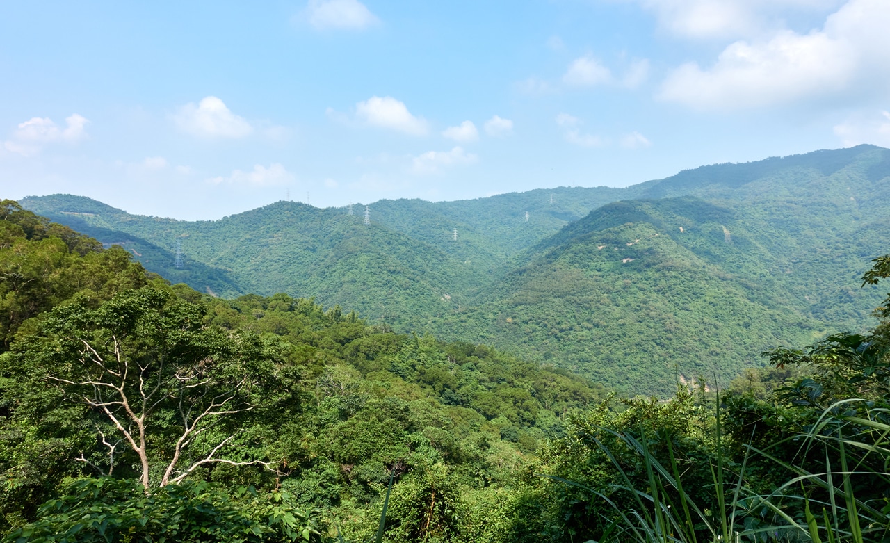
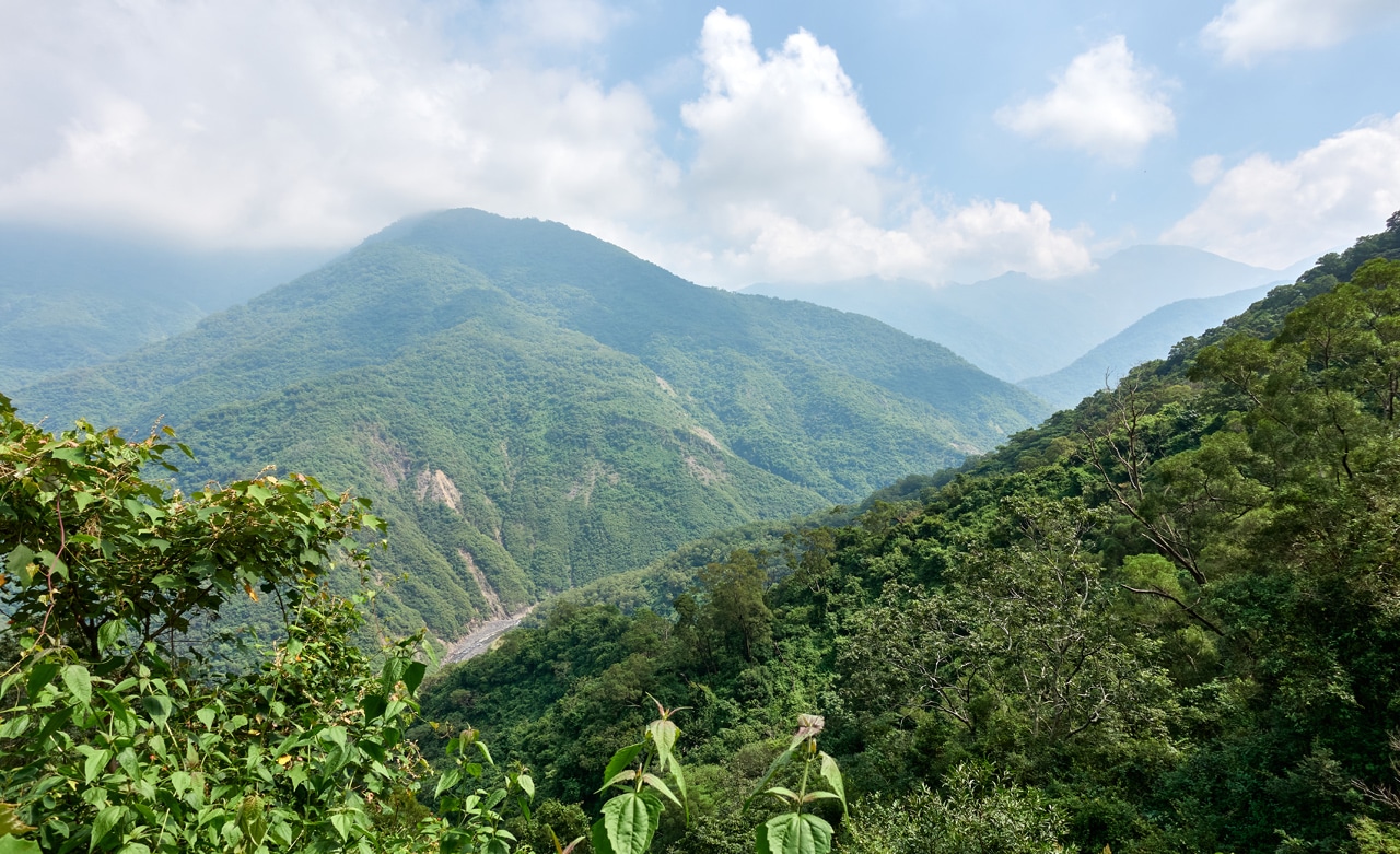
It went on like this for thirty minutes. There wasn’t much of a view for most of it…

…but in a couple spots it opened up for a “just OK” view.
This section of the hike had very little to write about…except for maybe these mushrooms and an old glass container.


This was the first time I had found this kind of glass container in that shape. I had planned on bringing it back with me, but I didn’t want to carry it up and back down the mountain. So I marked its location and…forgot to pick it up on my way back! hahaha…that’s SO me! Maybe I’ll go back for it someday.
The Ascent
A solid thirty minutes later and I had finally come to my turnoff point.


It was still rather flat, but soon I would be switchback-ing my way up the mountain. But not before finding some chili peppers!


It’s possible someone used to farm them here. That or someone dropped some seeds from a meal and they took root. I should have taken a couple, but like the glass jar, I said I’d get them on the way back. Of course I forgot.
Right before I started the real climb…


…I found one of the reasons why this trail still exists.


Snare trap-making materials!
I made a mental note to be careful of possible live traps, but I didn’t find any.
Onwards and upwards I went!


Several switchbacks later…and I had made it to the end of the line!

The “road” kind of disappeared. It was time to get down and dirty!
What Do You Do When There Is No Trail?
I found myself on the ridge that would take me up to ZheKeYuShan.

But there was no trail, ribbons, or anything other than my GPX track to tell me where to go. Speaking of ribbons, there were none the entire hike. What does that tell you? huh…
Well, it’s a ridge, right? Just follow it up and you’ll eventually reach the peak. It’s a pretty simple concept…so up I went.
Except…


It was pretty fucking overgrown! So much for a simple concept.
I had to bushwhack my way up all that mess. From the start of that ridge to the peak it was *ONLY* 300 meters. But it took me nearly an hour to traverse that shit-fuck of a ridge.
It wasn’t all overgrown like that though. At some point the messy plants thinned out.

When I got to this open section I thought, “Yeah, not so bad. The rest should be easier.” Hahahahahaha…
No, that’s not how things go for me, right?


I think I would have rather faced the overgrowth of thin, easy to push aside plants than all these little trees and vines. This section involved a lot of crawling and chopping to clear a path for my large ass to push through.
And per the usual way things work with me…it got worse right before I reached the peak. Why oh why!?

But…I did make it!
ZheKeYuShan – 著可芋山

I wasn’t expecting much, and there wasn’t much there. So that part of my plan worked out at least.
I hung out there for a bit doing my usual routine of eating, resting, and complaining to myself about choosing hikes like this, when I noticed something.
On the opposite side from where I came up there appeared to be a path!?
Well, this made sense. Someone had recently repainted the triangulation stone and there were fresh cuts on some of the trees here. I had wondered how this person could have recently hiked here without leaving so much as the tiniest broken twig on the way up. Yeah, that’s when I realized there had to be another, likely MAIN ROUTE to this peak. 🙁
So I grabbed the minimum amount of gear I felt comfortable with and followed the now clear-to-me trail.
Mini Side Adventure
Yep, no doubt about it, this was a trail!


It looked freshly groomed in places. Lots of small trees had been cut with a machete. And there were trail ribbons.

I followed it for about ten minutes before stopping here.

I checked my location on my GPS and decided that this trail must continue on to a road a little way up.
Looking at this map…the yellow is the part that I had driven. The red is the part that I had hiked. And the green is the main trail to ZheKeYuShan. (Can you feel me facepalming now? If not, please do it for me) Go ahead and click it for a larger image.
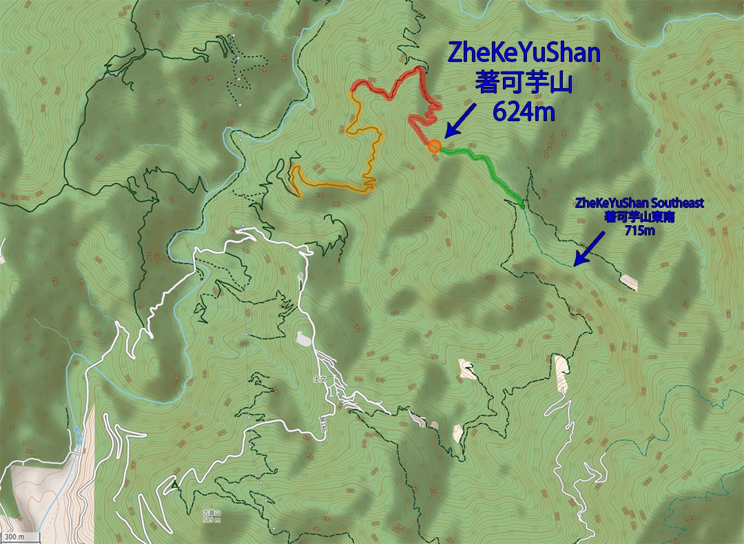
So yeah, you can drive (I’m presuming a much easier drive) to a trail head that will take you to both ZheKeYuShan and ZheKeYuShan Southeast Peak (著可芋山東南).
Back to the Peak
I hiked back to ZheKeYuShan and packed up my gear. Looking back, I had plenty of time to hike up to the southeast peak – it was only 1:30pm. But I didn’t know it was up there at that time. That’s something I discovered after the hike. Oh well…
Before leaving, it was time for my peak picture routine.


I was now ready to head back to my bike. But man I can’t tell you how much I did NOT want to hike back down that ridge. This was the start of that descent:

But I had little choice. So off I went.
An Alternate Route!
One thing I didn’t mention about the trip up was coming across what I had believed to be a road. It was roughly halfway up the ridge and well after all that overgrowth at the beginning of the ridge. When I reached the road I decided to take a chance and follow it down to see if it met up with the road below. I mean, it must, right?
I have no pics from this little experiment except for this part of a trap that I found and some bugs gorging themselves on likely monkey poop.


Thanks to Trevor Padgett for that ID.
Macaque!
Drinking (poo juice is delicious if you only give it a chance…A file once whispered) or laying eggs.
Try shaking the leaf next time and see how long it takes them to reassemble (just don’t shake *too* hard)
— Trevor Padgett (@TrevorCPadgett) October 4, 2021
So I followed the road, which was tough–it was overgrown far more than the rest of the roads out there–and guess what? It connected to the road I was trying to get to. I mean, it WAS that road. It was just so overgrown that it was hard for me to tell that it was a road at the time. Click that sucker too!
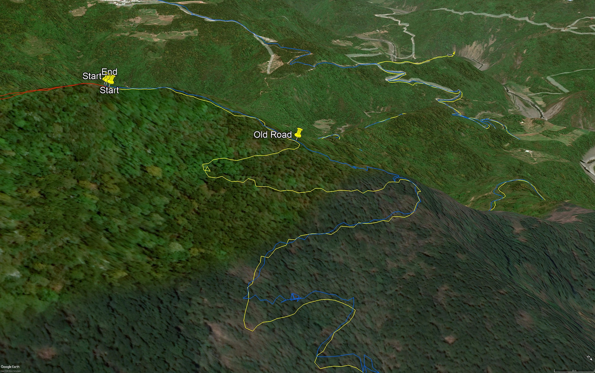
The blue line is the route I took up to the peak and the yellow down. The new route only took me fourteen minutes to connect from the “Old Road” back to the original trail.
So yeah, that was a bright moment in the hike.
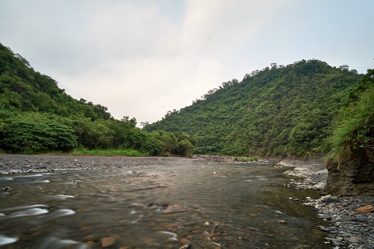
The rest of the hike down was unremarkable. I forgot the glass jar and those chili peppers. I took but one picture for some reason. Here it is:
I made it back to my bike in just over an hour without incident. For reference, it took me a bit over two hours to hike from my bike to the peak.
Peak #2
I had plenty of daylight ahead of me so I decided to hit a small peak on my way out of the mountains. It’s name is JiaLuKaEnShan – 加路卡恩山 or “Big Fish Mountain” – 大魚山 according to a couple older maps.
While I was leaving the trail to ZheKeYuShan I crossed paths with a farmer who was trimming the road where it went from an actual road to an overgrown mess. He looked shocked to see me. He asked what I was doing. I explained and he was like, “You DROVE up there!? It’s possible???”
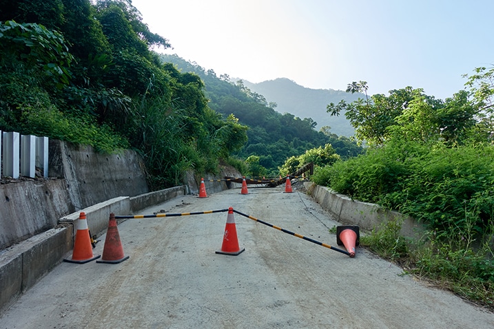
From that point on, it was an easy ride to the next trail head: a very, VERY short powerline road that ends at a transmission tower.
Here’s part of what it looks like and the trail head.

This is one of those peaks that, well…have no point? They’re beyond just not wanting to go to them. They stand at another level. A lower level. Sure, there’s a trail and a stone there to visit, but they really offer nothing. You wouldn’t purposely seek it out. The only reason you hike it is because you are nearby and you have the time. And even then, that’s not all that great of a reason to go.
Let me continue painting the picture with…pictures!


Does that give you an idea?
It only took nine minutes to hike this mess, and there was some semblance of a trail to follow, but it wasn’t at all nice. It’s listed at 239 meters, so you don’t get any winds like you would on a taller peak. It was quiet and lifeless – minus all the insects. Too many insects. This was the type of place in a movie where you’d expect a bunch of venomous snakes to fall from the trees on the poor unexpecting souls who took a wrong turn and became lost in a dead forest.
Anyway, I made it to the peak.


I mean, it’s not even a “proper” peak, right? Just a water boundary stone there. But whatever…
I didn’t linger any longer than necessary. I got the heck out of there and since I still had time, drove down to the riverbed access that was nearby. Looking at that little mountain to the right, I believe that’s JiaLuKaEnShan. You can see the powerlines behind it and to the right. I’m about 90% sure.
Looking at it from down here, I’m not sure how it got the name Big Fish Mountain. Maybe some dude found a huge fish up there after a typhoon or something. No idea.
Finally Done
I’m not sure if you picked up on it, but writing this has been something that I didn’t want to do. I’ve been putting if off over and over again. There’s just not much interesting about it and since discovering the main route (or should I say I discovered this alternate route and totally missed finding the main route?) there seems little point in posting about it. The only reason I’ve finally gone through with it is for some record that it exists. It’s entirely possible that the main route could become inaccessible at some point in the future. So this alternate route could be the only route someday.
If you want to try this route….well, ok then. Enjoy yourself and please do find that glass jar and bring it back to me. 🙂
Date hiked: 2021 September 30
GPX Track Download Instructions: Click the track on the map to see the download link
This GPX track has the alternate route I took to get down (part of the way) and the path to JiaLuKaEnShan 加路卡恩山 (大魚山)

![[Valid RSS]](https://outrecording.b-cdn.net/wp-content/uploads/2020/03/valid-rss-rogers.png.webp)
Leave a Reply