

Behind the village of Duona 多納, which is located at the end of road 132 in Maolin District 茂林區, is a peak hiding a secret: an abandoned fire watchtower. Ok, it’s not much of a secret really. But it’s something you can’t see from below. Unless you’re satisfied with looking at it from a satellite image or someone else’s pictures, you’ll need to complete a fairly tough hike to ZuMuShan – 足母山.
Duona Village 多納
Getting to Duona village is fairly easy. It’s paved the whole way; so long as you have transportation that can handle your typical mountain roads, all will be well. Here’s a little write-up on the village from the Foreigners in Taiwan blog: https://www.foreignersintaiwan.com/blog-370963385326684/maolin-duona-village
Also, here’s a video of Duona’s main drag.
To reach ZuMuShan 足母山 you’ll have to drive down to the riverbed where the old Duona Hot Springs used to be located before it was destroyed by a typhoon. There’s a relatively quick route that takes you through the village and down a steep set of switchbacks, or a longer route that has you drive around the village past farmland and some abandoned hotel/resort. I was starting quite early, so I opted for the longer route so as not to disturb the residents with my probably-too-loud motorcycle.
The Parking Lot
I arrived at a newly paved parking lot that I’ve been to several times before.


As you can see, they’ve made it wider and more accessible since my last visit a year and a half ago.

One point of interest is a sign off to the side.

It describes the Wanshan Rock Carving sites (萬山岩雕群遺址) which are located quite a ways up the river. There are several locations with rock carvings believed to be from 500 to 1000 years old. Together they are a national historic site and certainly considered to be a national treasure. I hope to hike there later this year. Here’s some more information if you’re interested.
http://heritage.khcc.gov.tw/english/Heritage.aspx?KeyID=f5dae71b-0214-4ad6-ad96-4e34325e525e
https://taiwantoday.tw/news.php?post=26403&unit=20
A second point of interest is this newly built area.

It had just been built the last time I was here.

But now it appears it has just been sitting here all this time.

I’m guessing this was supposed to be a replacement for the hot spring area that was destroyed. But why it has been left like this, I haven’t a clue.
Let the Hike Begin!
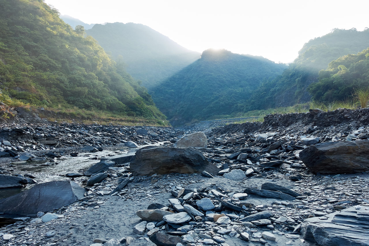
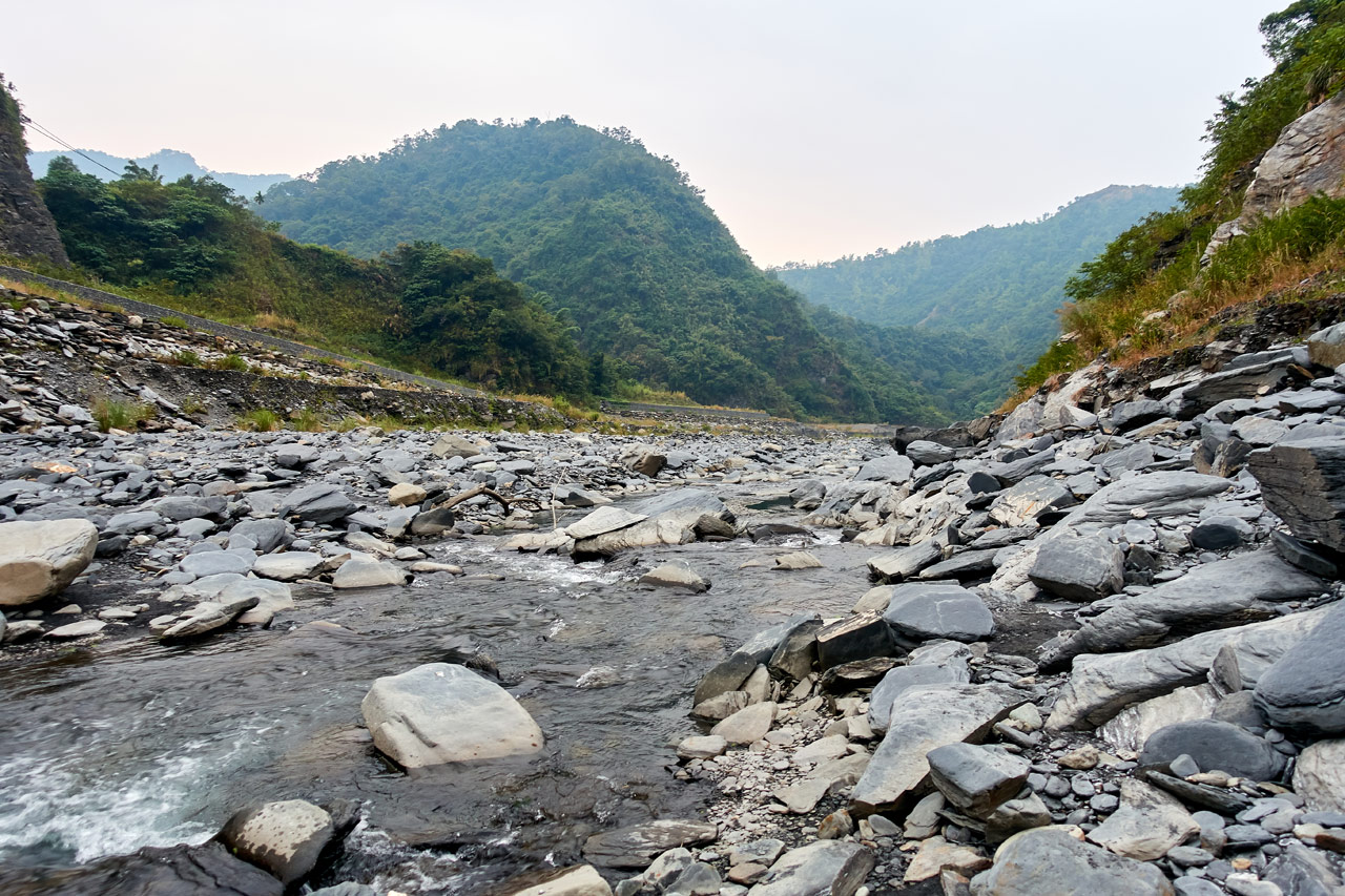
After securing my bike, I made my way down a dry stream-bed to reach the river.


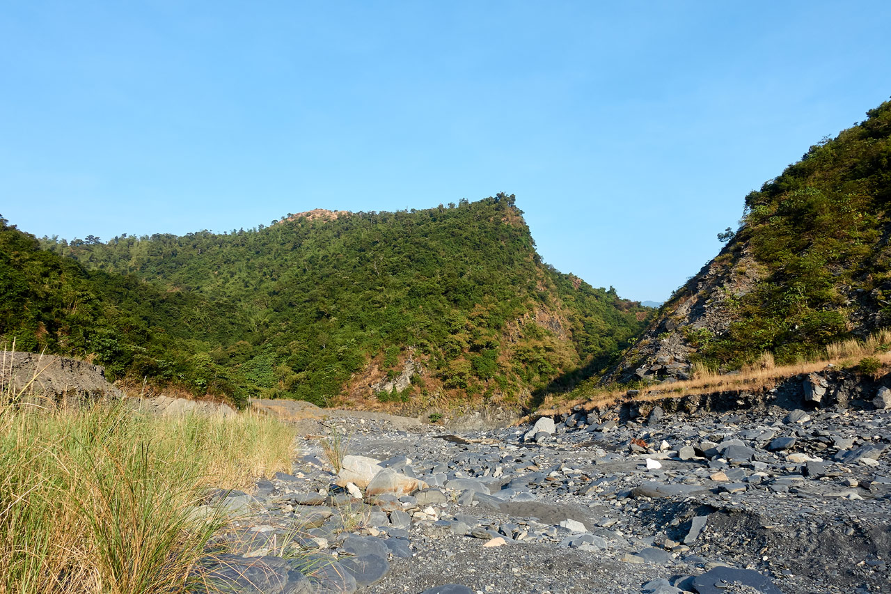
It’s a short hike up the riverbed before reaching the trail head. The water level was low, but not low enough to find a crossing point where I didn’t need to remove my boots. Oh well.

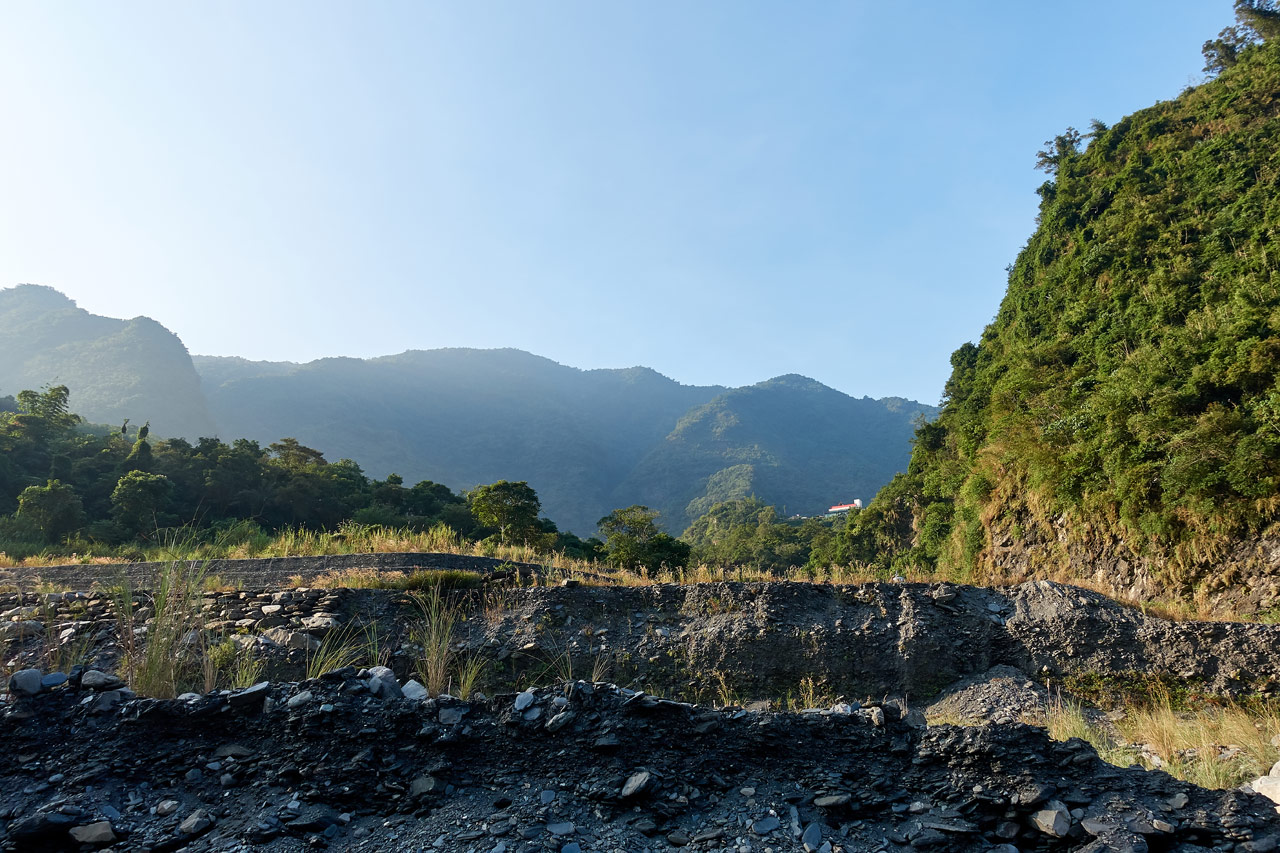
When I reached the other side I could see where the old Duona hot springs used to be located.
There was a footbridge that crossed the river that you could use to access the ZuMuShan trail head. The whole area was built up nicely.


This next pictures sums up how much the river has changed.

All of that is gone. Never to return. 😥
ZuMuShan Trail Head
The trail head can be difficult to find. The first time I was here a couple years ago I couldn’t find it right away. It seemed like all there was to find was a rock slide. In fact, that basically IS the trail head, a rock slide.

This was the third time I’ve been here to attempt the hike. The first time was in May 2017. It was a pretty hot day and I was hauling way too much gear. After about ten minutes I realized it would be too difficult; the hike is STEEP.
My second attempt was in October 2018. It was cooler and I brought far less gear. But I started the hike too late at about 10am. My progress was slow due to the steepness and my body not being in the best shape for it. But also, I ran into a section of overgrowth I had to hack my way through. Five hours into it, and pretty close to the last steep section up, I realized I wouldn’t have enough time to make it back before dark. The last thing I wanted to do was hike those steep sections in the dark. So I turned back.
I prayed this attempt would be different…and it was.
The First Steep Section
From the trail head it just goes pretty much straight up.


But it’s not long before it levels off a bit.

You’ll immediately notice different ‘artifacts’ as I’ll call them.

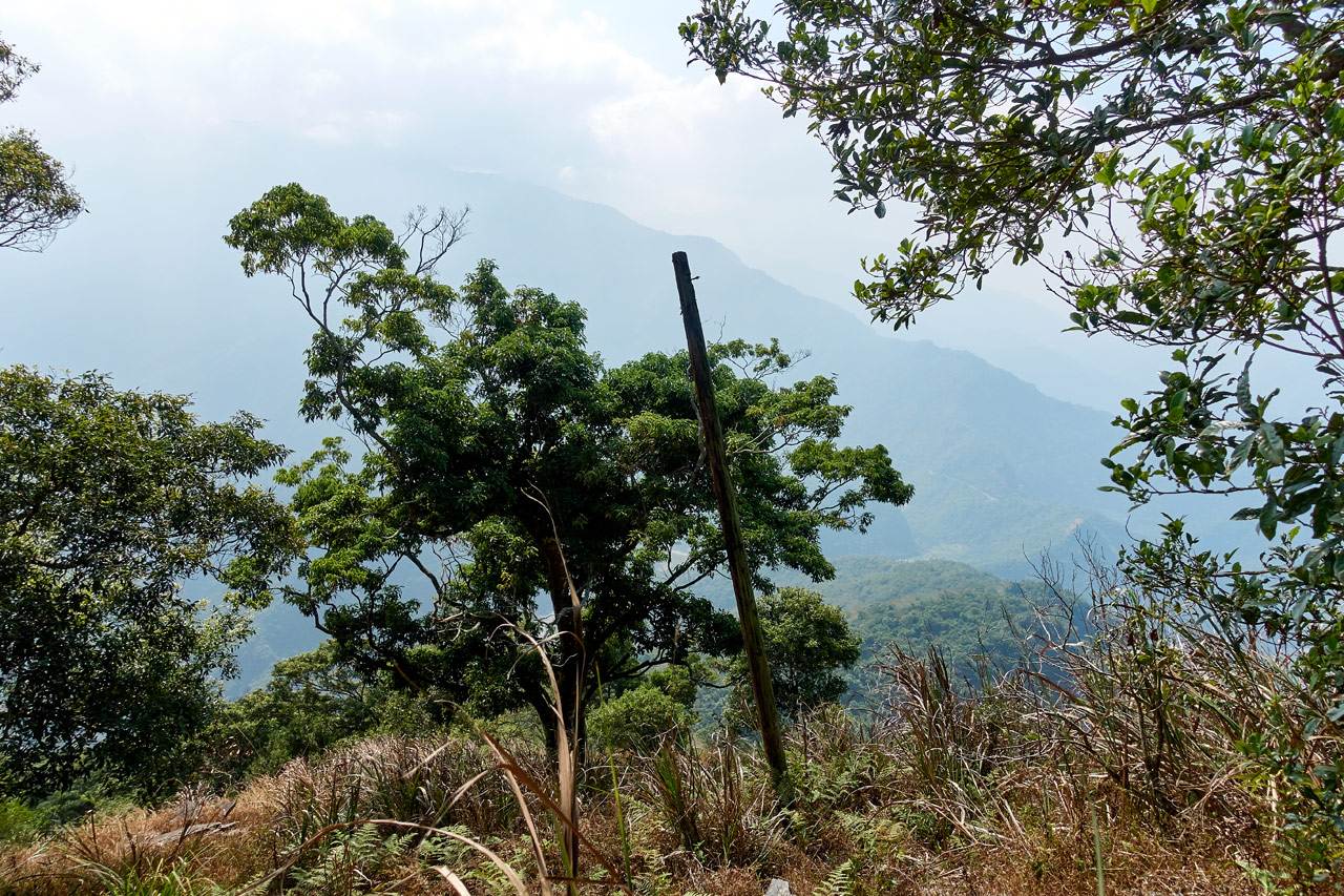
One of them is this object you’ll see at the top of telephone poles. It wouldn’t be the only one I would see that day.
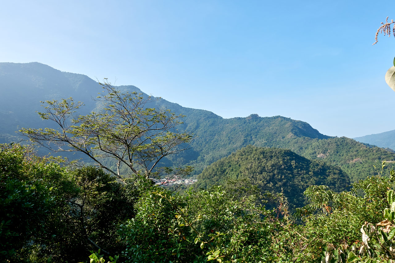
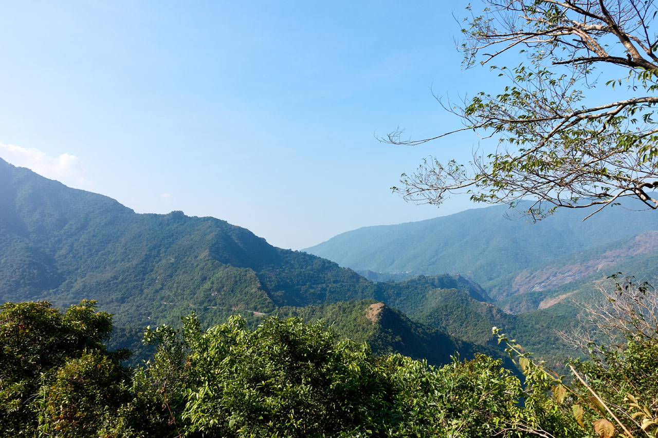
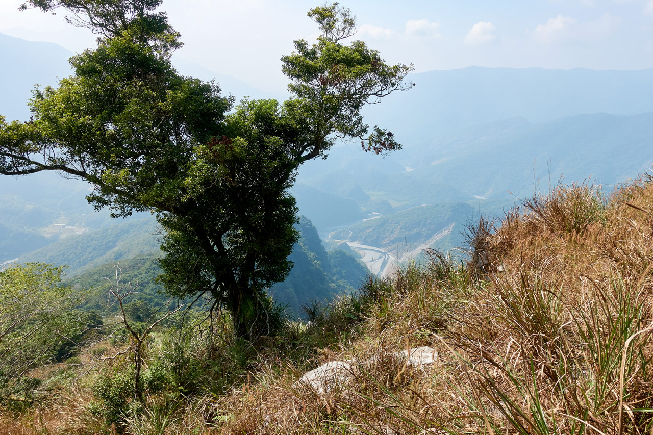
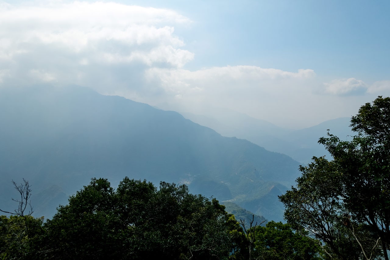
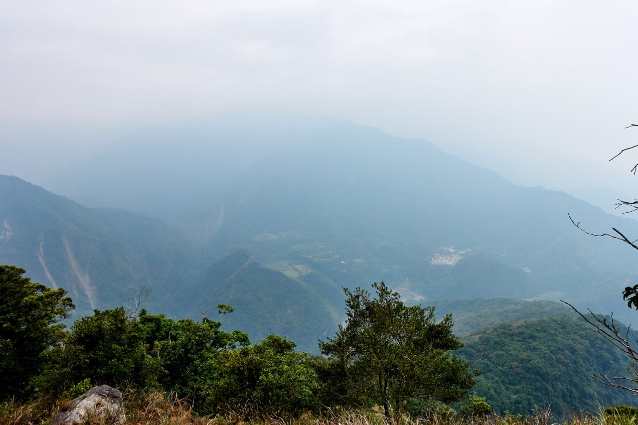
I continued up and finally got my first real view of things below.

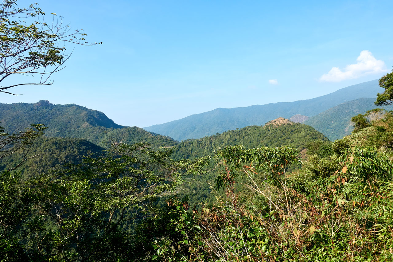
You can see Duona village in the distance. It will be a common theme of most of the panoramic shots from this hike.
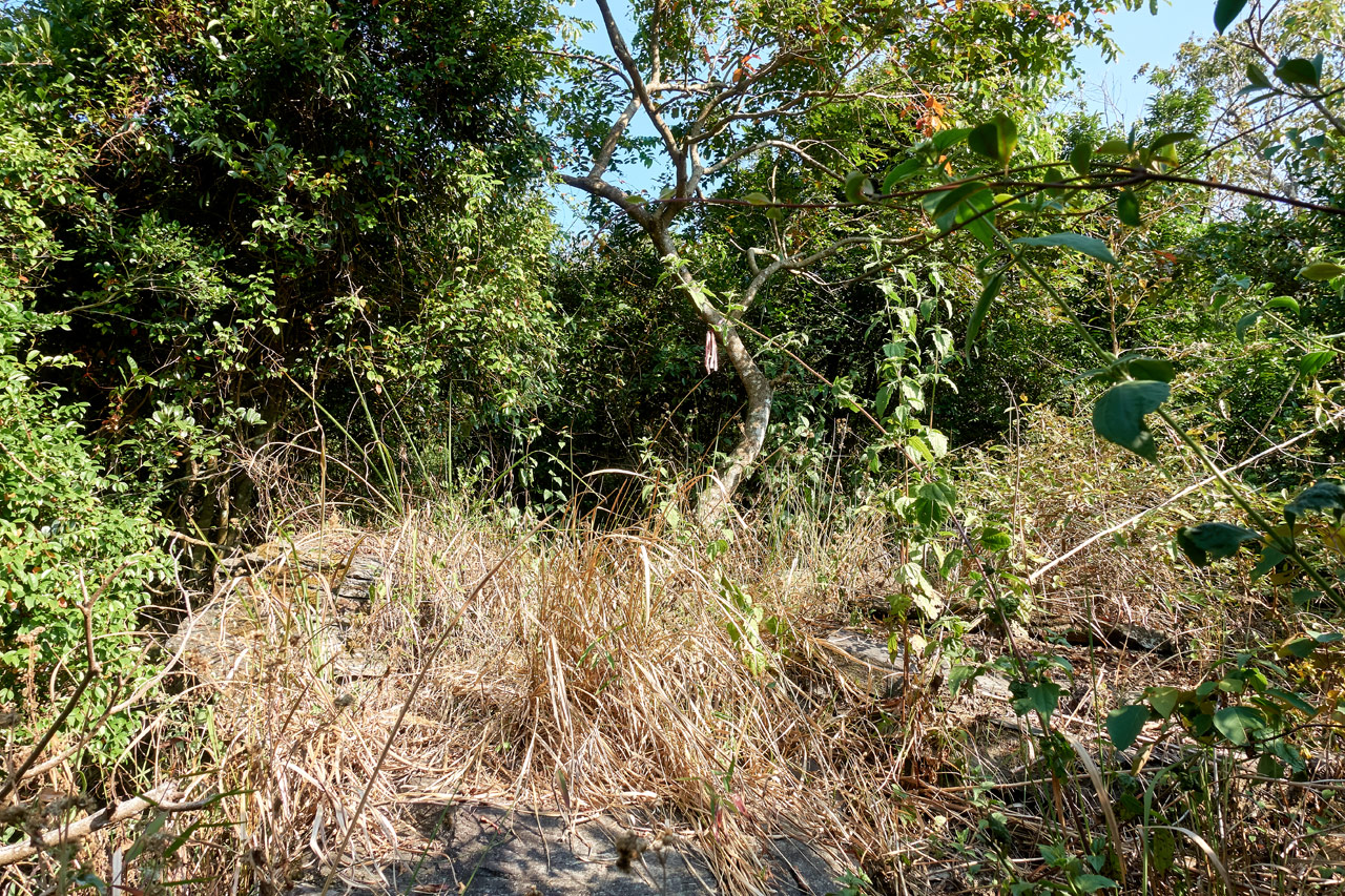
Things looked more or less the same in the beginning. I climbed and climbed; most of the time under tree cover, but occasionally I would come to an overgrown clearing.

Another interesting find along the way was this cable.

This was another common theme throughout the hike. You would see it nearby the trail or a ways off to the side – not too often, but enough to let you know you’re headed in the right direction.
While I’m on common themes, I should also bring up these rocky remnants.


I saw various stacks of rocks like these throughout most of the hike. At first you would assume they were built by the aboriginals–and maybe they were–but something about them makes me think they weren’t. They’re not stacked very ‘orderly’ like their houses in the abandoned villages I’ve visited. Also, I doubt any of these were houses. They were too small and the side of this particular mountain doesn’t look to be a good location in my opinion.
My best guess would be something to do with the fire watchtower at the top. There must have been some kind of supply line going to it and perhaps these structures were a part of it. But I’m spitballing here.
A Reprieve
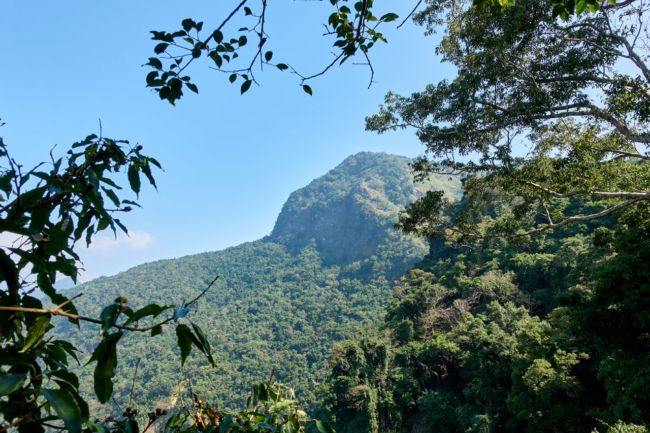
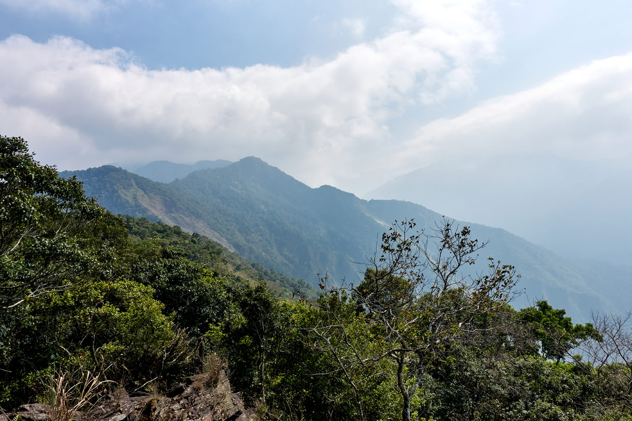
The steep grade never REALLY lets up. It’s pretty much constant. But there are a few places in the middle of the hike where it’s a lot less steep. I was nearly there when I came to this clearing that offered some nice views, including my first look at my objective.
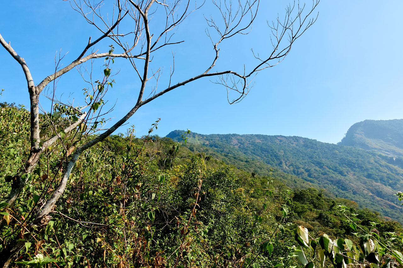
That little bump on the left is ZuMuShan 足母山. Thankfully I didn’t need to hike to that peak on the right!
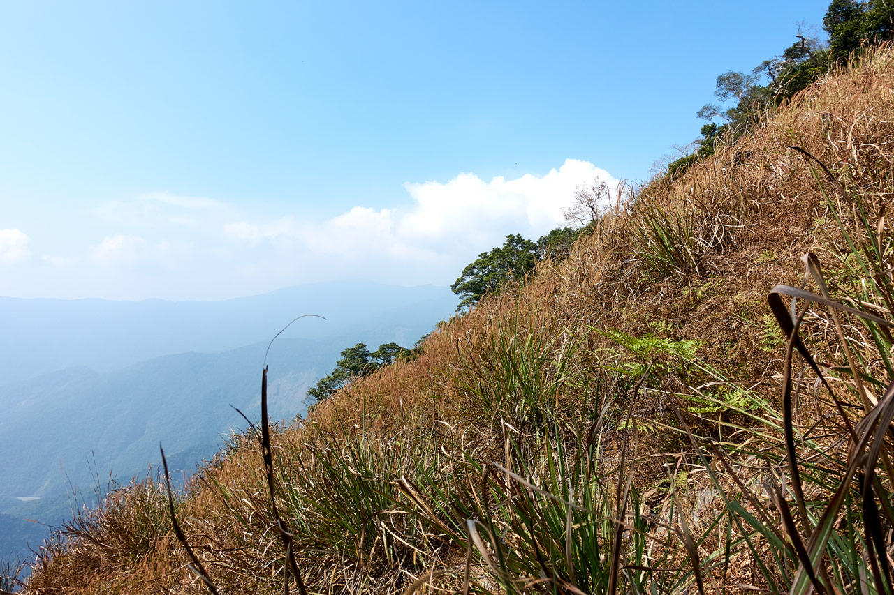
This thin ridge section is about where the steepness finally lessened. I can’t tell you how great it was to see flat ground!


A bit after this section were more stacks of rocks.


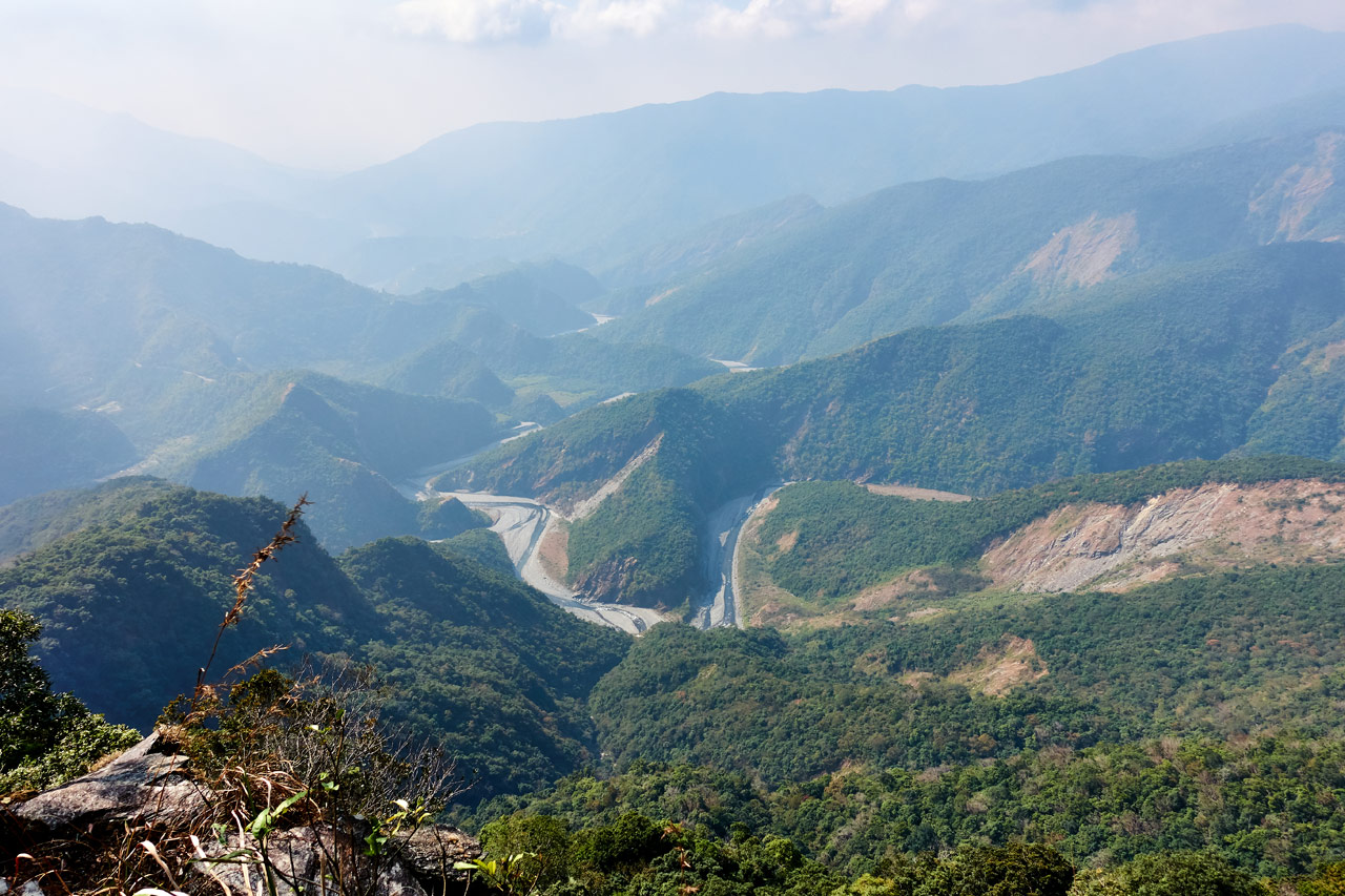
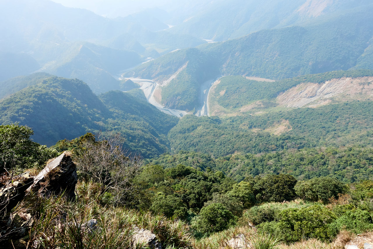
And then came a great place for a rest. There’s an opening off to the left of the trail that gives a great first look at the other side of the ridge. It’s easy to spot, so I won’t try to pinpoint it for you.
This next picture shows ZuMuShan. This is a common shot you’ll see in people’s trip reports to ZuMuShan.
BTW, be careful on this ledge. A fall will be the death of you. For real.
Another artifact. 😆

New Scenery
The first real change in scenery happens right after that excellent viewing ledge. The trail more or less follows the center of the wide ridge. However, the center dips down so you’re at the bottom of an imaginary “U”.


This is where I found my first old telephone pole.


They are a common sight from here until the peak. They’re interesting to me because they must have been made here. There’s no way they could be transported here by anything but a helicopter – and I can’t imagine they would spend the resources to do that. So they must have cut down a suitable tree, stripped it, added the hardware, and erected it on the spot. Pretty cool really.
This ridge section lasts about 45 minutes. I’d say it was the flattest part of the hike, but by no means was it flat.


There’s one part of this section that really sticks with me…the SILENCE. As the saying goes, silence is deafening. I mean, it was just plain eerie!
Have you every seen one of those movies where a group is hiking through the jungle or mountains or somewhere…and the group leader says, “Listen! Do you hear that?” And someone replies, “I don’t hear anything.” And then the leader says, “Exactly….” This exchange is followed by something bad happening.
Well, that’s exactly what it was like. There were no sounds at all really. It was just a ‘dead zone’ so to speak. On the way up there were birds and wind noises and stuff. But here…nothing. Even the bugs didn’t want to be here. Well, I’m lying. There was the occasional butterfly. But that was it.
Creepy.
Can You Say STEEP?
Needless to say I made it through that eerie ridge-line. Towards the end the trail dipped down into a saddle and started up the final climb of the hike. The scenery here was much the same as before.


But this is where things really changed. I know I’ve been going on and on about how steep this hike has been. I’ve had hikes before that had steeper sections, but this hike just never lets up with the steepness. It starts to wear you down, you know? But it wasn’t REALLY that bad up until this point. It was manageable. Hahaha…
Starting here…


…and for the next 600 meters, it got really steep.
Six hundred meters doesn’t sound like much, but it took me a good 45 minutes.
One problem I had was knowing exactly which way to go. The trees were thinning out and there were sections with just rocks and grass.

This picture doesn’t exactly represent what I just wrote – there were areas with a lot less trees and more rocks. I find that I take a fewer pictures when I’m tired. And this section sure as hell tired me out!
Anyway, locating the trail ribbons were difficult at times. I would have to guess which way to go. I don’t think it really matters which way you go though; you don’t really need to follow the ribbons here. You’re ultimate destination is “the top”. 😆
Almost there!
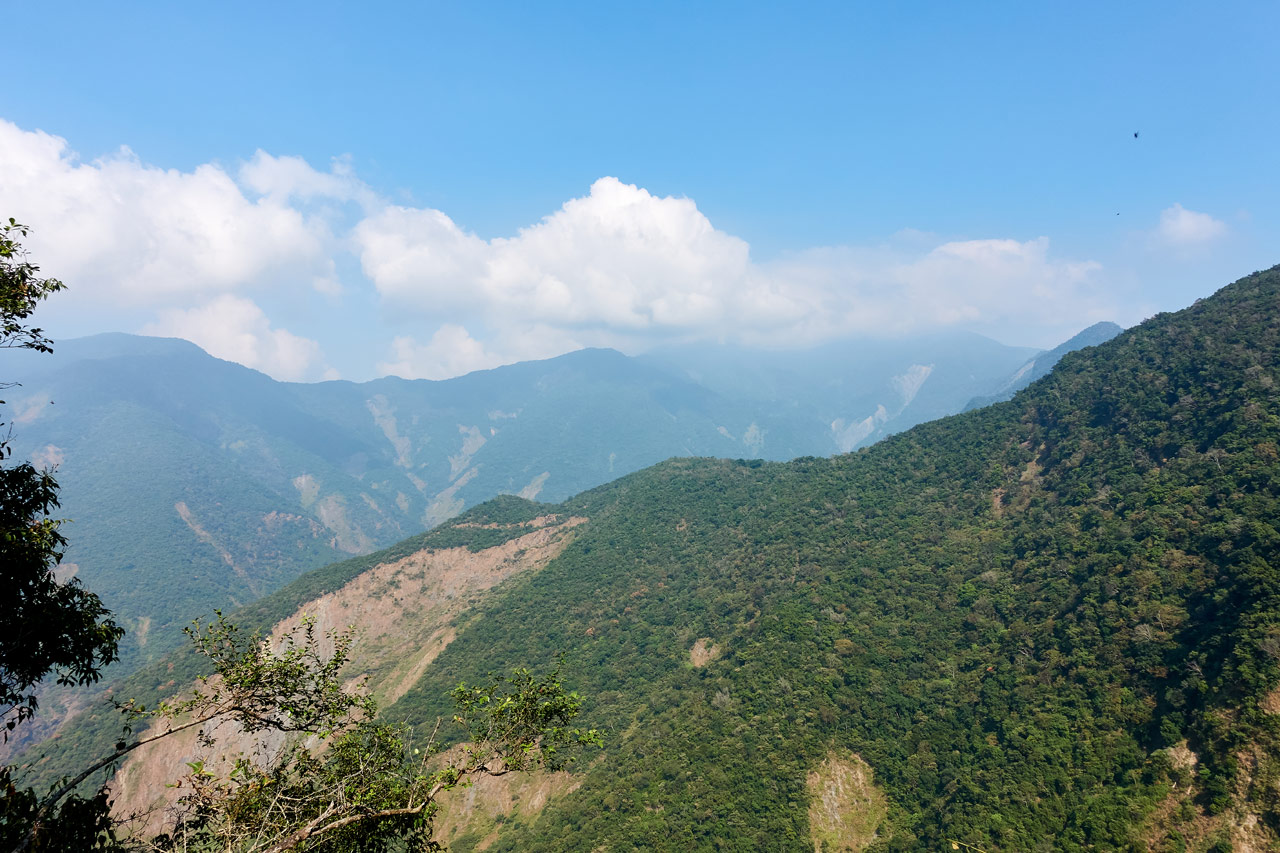
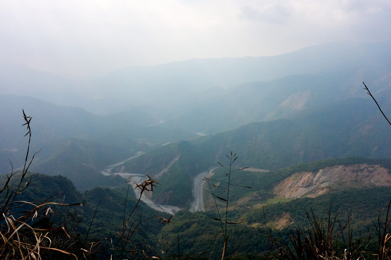
Roughly in the middle of this somewhat barren section yields one of the best views of the whole hike. To be honest, I might rank the views here BETTER than the views at the peak. But it’s subjective. And the weather at the time of these pictures was a bit better than when I got to the top.
I was about halfway up this section for those shots. You can see the ridge I came up at the bottom of both pictures. Just looking down at it fills you with a tiny sense of dread at the thought of having to go back down on the same day. I’ve seen blog posts of hikers who had spent the night at the top. I was beginning to regret my choice of “day hike” for this peak. I mean, look how steep it got!
Near the top I got to see another lonely telephone pole.
The last challenge to face was this clutter of rocks. And again, there was another telephone pole waiting for me at the top.

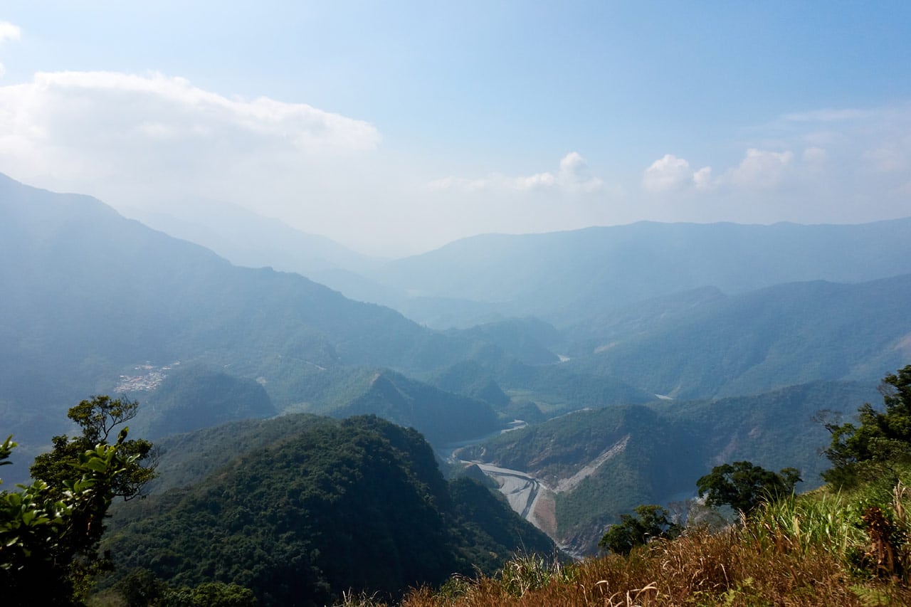
And I made it to the top! Whew! I rested a moment and took in the view. This next shot is looking south.
Final Leg of the Hike
I was so close now; just about a hundred meters away. I had hoped for a relaxed walk with little to no elevation, but this hike wasn’t about to let me relax.


Compered to what I had just climbed, this was nothing. But still, the last thing I wanted to do was climb a rope! And a rope that was down to it’s last threads (LITERALLY!) no less. 😕

But a few minutes later…

And I had made it!
ZuMuShan – 足母山
The first thing you notice (besides the abandoned fire watchtower) is the triangulation stone.

I was tired and wanted nothing more than to plop down on the ground in a vegetative state, but I HAD to see what views this peak had to offer.
Directly in front of the abandoned building is this halfway decent view.
This wasn’t the view I had seen in many pictures, so I searched for a better spot. Off past the watchtower, just past one of its anchoring cables was a small outlook.

It was perfect!
Unfortunately the weather wasn’t perfect. I could still see pretty far, but it was all just a bit hazy. Oh well.
I took a bunch of pictures from here, but they all look like this shot more or less.
And please remember, this is a ledge. A fall from here wouldn’t be nice.
Rest & Exploration
The first thing I did was find a place inside the fire watchtower to sit down. That wooden bench thing at the bottom right of this picture did the trick.

The place was a mess.

But the fact that any of this still remains is somewhat of an engineering feat in my book. Think about all the typhoons that have passed through here since it was abandoned; though I do think it’s on its last leg. Search for pictures of this place posted by other hikers and you’ll see how it once had walls and windows, etc.
After my rest and some food, I spent time walking around the structure.


Notice how some of the pictures have anchor cables attached to the corners of the structure? These must be the only reason this building is still standing.

There’s a ladder to the second floor of the building, but I didn’t bother going up. Actually, I had planned to have a quick look, but forgot. 🙁
I went back a couple times to the outlook to relax and take in the views again. But the weather was getting worse.
There wasn’t much left for me to do other than my usual peak pictures…


One thing I noticed while researching for this post was the triangulation stone’s location. See where I’m kneeling behind it in the picture above? Now compare it to the below picture from 2014.

It’s deeper and obviously in a different location. This might be on the ledge with the nice views. I can only guess that it was moved for fear of a landslide sending it to the bottom of the mountain? I can’t think of another reason.
It was 1:30pm and I was looking at a solid 3+ hours of hiking to reach the riverbed. I wasn’t ready to leave, but I had little choice if I wanted to avoid hiking at night. So I packed up and took one last look before heading out.

The Trip Down
There’s not a whole lot to say about the hike down. When I got to the top of the “steep ass part” I took a long look at what was to come.
These ribbons caught my attention not long after beginning my descent.

Something about those three ribbons hanging there just gave me a ‘lonely’ feeling. I’m not sure why.
Nothing of interest happened on the way down. Well, except a pain that started developing in what I thought was my right knee. It started hurting in the final steep section right before the riverbed. I tried to ignore it as best I could. Accidentally grabbing this tree certainly helped me forget about the pain in my knee for a bit. hahaha…

But before long I arrived at the riverbed and the pain in my leg just disappeared. I quickly forgot about it, but tune in for my next hike to WeiLiaoShan – 尾寮山 where it got much worse!
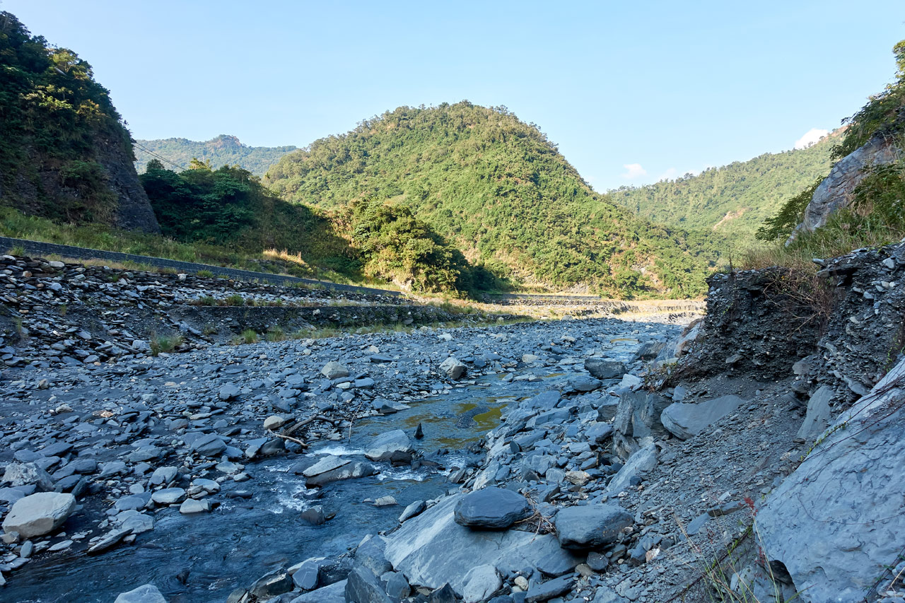
After that hike, the riverbed was a beautiful sight!
I had plenty of time to make it back to my bike, pack up and leave before dark. All in all it was a pretty darn good hike. But it’s a hike I never want to do again! 😆
Date hiked: 2019 November 15
GPX Track Download Instructions: Click the track on the map to see the download link


![[Valid RSS]](https://outrecording.b-cdn.net/wp-content/uploads/2020/03/valid-rss-rogers.png.webp)
1 Comment