


If you live in southern Taiwan, chances are you’ve heard of the popular RiTangZhenShan – 日湯真山 – everyone and their grandma has been there. Heck, I’ve even taken my son.

But its “little brother” RiTangZhenShan Southwest Peak – 日湯真山西南峰 on the other hand, I bet few know (or care for that matter) of its existence. Having been out there several times, I’d argue that it’s worth your time to head over for a look. But not for the reasons you might think.
Getting There Is Half The Fun
Take a look at the map. Go ahead…touch it. It gets bigger!
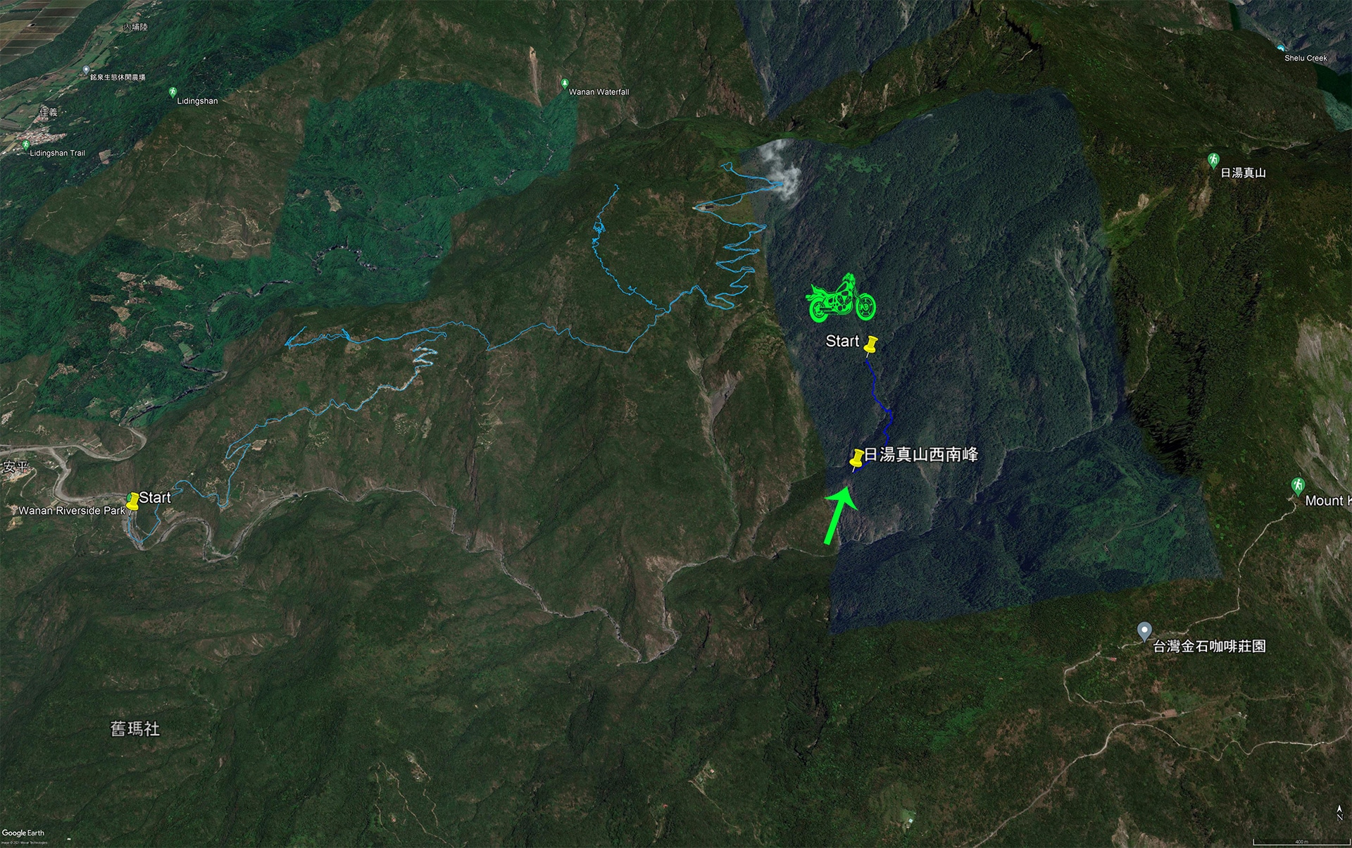
There’s a solid mountain drive to get to the trail head. The blue lines are from my hike to YaMaWanShan & YaMaWanShan West Peak – 亞麻灣山 & 亞麻灣山西峰. It doesn’t show you how to get to the trail head exactly, but should give you an idea.
Starting from Wan’an Riverside Park – 萬安親水公園, head up the concrete road. It eventually turns to dirt, but it’s suitable for most means of transportation. If you look where the blue lines end in a squiggly pattern going up the mountain, there’s an orchid nursery at the top.
They drive their blue trucks to that building. So unless there’s a recent landslide, there’s no reason you can’t drive at least as far at the bottom of that squiggly line. From there it kind of depends on what time of year you go, what you’re driving, and what level of comfort you have with less than ideal road conditions.
I was able to make it to the trail head on my dual sport motorcycle in the winter, but a few hundred meters short of it when I went in the summer. A normal motorcycle should be fine in the winter. I saw a hunter drive his motorcycle when I was there in the winter. If you take a car you might have to park around the bottom of the nursery road. And a scooter…well, just depends on you.
But don’t worry, regardless of where you stop, you won’t add a lot of distance to the hike. Plus, the actual hike is pretty short.
So…with all that said, let’s get to it!
Expected stop before the hike
I should mention here that I failed at my first attempt. In hindsight, it wasn’t the best idea to try this in August. I had the spare time and it wasn’t supposed to rain, so I figured “what the hell,” and went. Bad (though not a terrible) idea. More on that later.
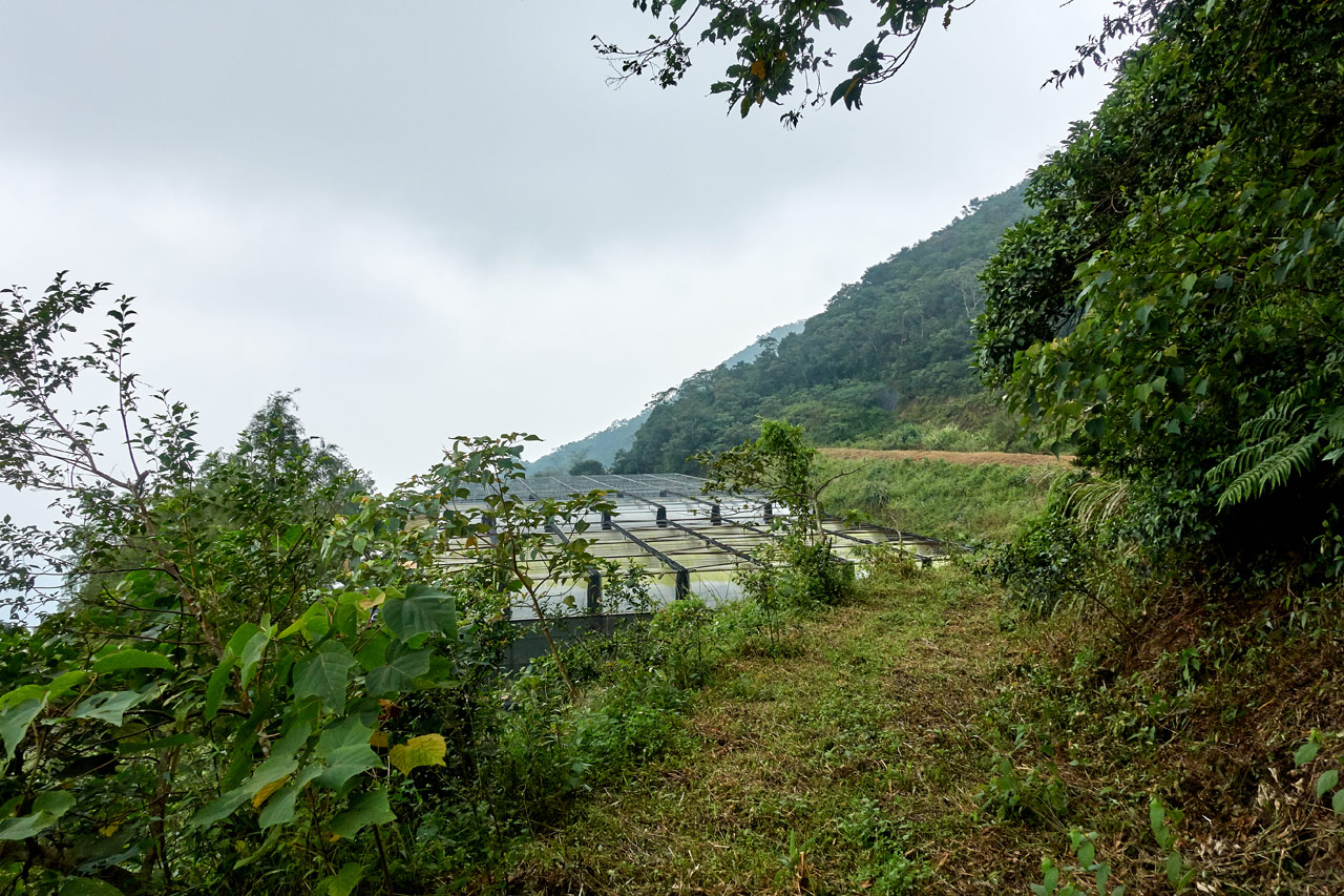
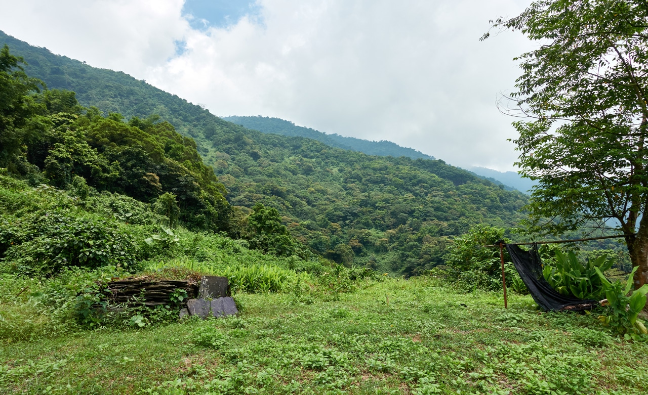
The drive up was easy and relaxing. It appeared this would be a short hike, so I thought I’d stop and look for the remains of a few abandoned villages in the area first. As much as I would like to write in detail about what I learned, this is a hiking post so I’ll just show you some pictures.

This marks the entrance to an abandoned village now turned farmland.


Target practice.

However, if you’re interested, I wrote a short Twitter thread about the tribes in that area.
**Short thread on Wanan Village 萬安村 in Pingtung, and the Paiwan tribes that live there.**
Have you ever been to Wanan Village in Taiwu Township? Maybe you’ve visited Wanan Riverside Park – 萬安親水公園?
(Pic Credit: https://t.co/fPfZYxDKMr) 1/x pic.twitter.com/UTgazLj8e9
— OutRecording (@OutRecording) August 2, 2020
Trail Head
As mentioned, the first time I attempted the hike, I stopped short of the trail head.

It got thick at times. So yeah, don’t try this hike in August unless this is the kind of thing you enjoy.


From here it wasn’t a long hike to get to the trail head.


And yeah, that’s my motorcycle tire in the corner of the picture. It’s from my second attempt.
If you’re a keen observer, you’d have noticed that there’s open sky behind those trees at the trail head. And maybe you know what that signifies? A downhill hike!!
That’s right. The entire hike is completely downhill.
In Search of Water
The first section of this hike isn’t particularly interesting. There aren’t really any views. So I have little to show you.


Yep! Even on this crappy little trail there are some trail ribbons…including this one from someone who must have been terribly lost. Taipei Skyline Trail!? Hahaha…


This might be the only “view” of the hike down.

Throughout the hike down, you’ll at first faintly hear the sound of running water. The further down you go, the louder it becomes. Eventually you’ll see the source of the sound.

This would be the highlight of the hike. Yeah, I’m not kidding. And it takes all of twenty minutes to get to if you stop for pictures. Otherwise fifteen minutes or less I bet.
Mountain Stream
This stream is kind of a double-edged sword. If you want to see it in all its glory (and it IS quite pleasant) then you should go in the summertime. But all that extra water that makes it nice to look at makes it a bitch to cross safely. So…go in the dry months! Yeah, but then it looks like shit. Almost no point in stopping. So…it’s up to you.
Here it is in the summer.


I had a heck of a time trying to figure out how to cross this thing with all that water flow. The main problem being that there was a sort of “water slide” I needed to cross. If you slipped into that, you’d slide down past a tiny waterfall into a swirling pool (that leads to what I believe is a much larger waterfall) where you’d spin around until you basically died. There seems to be no way to get out of that pool. So you can imagine I was being somewhat careful.
Here’s a pic of the pool.

And here’s a video of how everything looked.
If you watched til the end, I did follow the stream up and managed to find a place to cross. It wasn’t pretty, but it worked.
And speaking of “not pretty”…

To give you some comparison, here’s the same stream eight months later.
And sorry about the music. I used YouTube’s free music to cover my botched audio.
The Other Side
My first attempt crossing was a success, but I didn’t get far after that. The other side was wickedly overgrown and I had a hard time picking up the trail.


But I DID manage to find the trail (I think?) and followed it a short ways before hitting an obstacle.
I didn’t take a picture unfortunately. So I’ll try my best to explain. There was a rocky spot where you could go up or down. The trail seemed to go down, but the GPX track I had found clearly showed it going up. I followed it up several meters, but there didn’t appear to be anywhere to go. And following it down only led to this tangled mess:

It was too steep to go around and to the right of it and there was a rock face on the left…so my only choice was to remove the mess. I had my machete, but didn’t much feel like spending the time and energy hacking through that. Plus there was more behind it a little ways.
That was basically it for me. I called it a day and vowed to come back another day with a hand saw. I hiked back to the stream and spent some time lounging about. I won’t lie, it was nice to relax for a change.
Let’s Try This Again!
I came back in April of 2021 and found everything to be MUCH easier. Imagine that…*eye roll*
Yes, part of the reason it was easier was because a lot of the overgrowth had died…and because the stream’s water flow was next to nothing…and because I had hiked half of it already and knew where I was going and what to expect. Yeah, all of those things helped, but the MAIN reason it was easier was because someone had come sometime between this trip and the last trip and cleared paths that made it very obvious where to go.
Remember that obstacle I mentioned that I didn’t take a picture of? Well, I didn’t take a picture of it again. (That’s a total “Glenn” thing to do)
When I arrived at that obstacle, it wasn’t much of an obstacle anymore. There was a trail ribbon up high on that rock and that part of the trail had been cleared. Yep! Up is the way I was supposed to have gone. (Though had I gone down instead, I’m sure I would eventually have made it back to the trail. There are no hard rules when it comes to following the trails, right?)
Ok, that’s a lot of text and no pictures! So here come some pics!


There wasn’t a whole lot to look at after I passed “the obstacle that wasn’t really an obstacle”.
But then I found myself hiking down what I believe to be old farmland.


It’s not as neat as I’ve seen some old farmland, so it’s possible that it isn’t farmland. But I don’t know why else those rocks would be stacked up like that in rows if not for farmland. So I’m leaning strongly in that direction.
Now, I want you to brace yourself…cuz you’re about to get whiplash.
Ready?
RiTangZhenShan Southwest Peak – 日湯真山西南峰

Yeah…I made it to the peak…already!?
From the stream it took me thirty minutes. In total, fifty minutes. FIVE – OH…50…FIFTY MINUTES!
This is by far my shortest hike. I mean, I’ve hiked to a couple peaks that took less than fifty minutes, but those were in combination with other peaks. Combined they took most of the day. But this peak was all I had on my plate for that day. So…I had a nice long rest ahead of me. But this was hardly the place to do it.

It was 10:15am when I arrived. I stayed an hour exactly and got the heck out of there. Would you want to stay here any longer than necessary?
Here are some pics of the little peak as well as my uncharacteristic non-triumphant peak pose with the triangulation stone.


That’s It…Really
I haven’t had a post stop this short in forever. But it is what it is. As mentioned, it took me fifty minutes to hike down to the peak, and fifty-five minutes to hike back up to my bike. It would have taken less time if I hadn’t have stopped to take that video at the stream. I was hauling ass!
So what’s my conclusion about this hike? Is it worth it? For most people, probably not. The only redeeming quality of the whole thing is the stream. But you need to go in the summer to enjoy it. And you don’t want to go in the summer, so…
BUT…the road leading to the trail head wouldn’t be a bad hike. There’s plenty to see and I don’t think it would take all that long. Plus you have some remnants of a few aboriginal villages you could explore, or the main village that’s still somewhat intact. It’s easy to find (a short trail near an old house leads down), but there’s a gate.

You can see where people have walked around it. It’s up to you if you want to see what’s beyond. I’m not sure if the descendants care or not if people visit. So enter at your own risk.
But at the very least, you can have a look at the old house that I mentioned. There’s no gate or anything barring you from taking a look.


So yeah, maybe this hike does have some redeeming qualities. Why not give it a shot?
Date hiked: 2020 August 01 & 2021 April 23
GPX Track Download Instructions: Click the track on the map to see the download link
This is the track going up. Remember, the ridge has no trail or markings of any kind. Hike it at your own risk.


![[Valid RSS]](https://outrecording.b-cdn.net/wp-content/uploads/2020/03/valid-rss-rogers.png.webp)
Leave a Reply