

ZhenLiShan 真笠山 and its Northeast peak 真笠山東北峰 are hikes suitable for most anyone. If you’re game, you can rather easily add two other nearby peaks, LiDingShan & ZhenLiShan Southwest Peak (笠頂山 & 真笠山西南峰) to your hike. Since I have already hiked to those two peaks, I skipped them to give me plenty of time to visit the new ones.
Trail Head
This area, located in Majia 瑪家, is quite popular. You’ll find many hikers all throughout the week. I’ve never been there on a weekend, but I have to imagine it’s quite hectic. However, over the weekdays it’s not so bad.
There are several ways to get up to the peaks. There’s a road just off to the side of the ridge, so you could drive up. But what fun would that be? As for me, I opted for the parking lot just a short drive up from Jiayi village 佳義村 and took trail number 4.


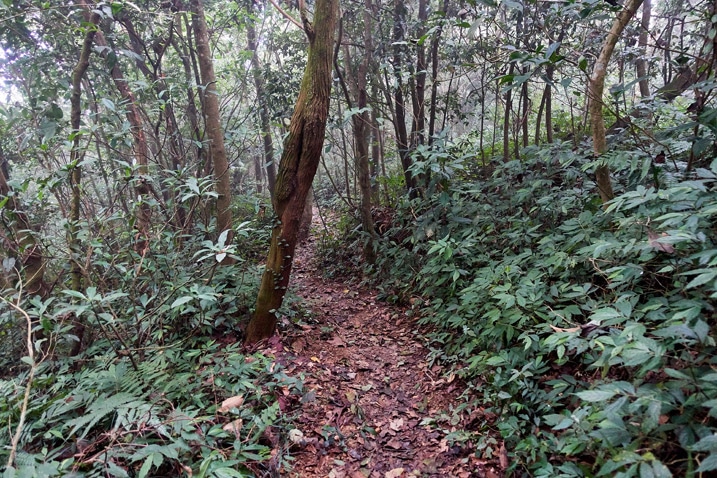
The trail was well hiked and relatively easy in the beginning.


About twenty minutes into the hike it opened up onto an old farm.
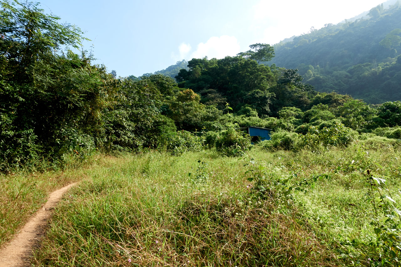
This part of the hike linked up with a dirt road and weaved in and out of a farm or two.


The trail would follow the road a bit and then cut up through the trees rather than follow the road to its switchbacks.

It did this several times…


…before finally leveling off at a little ‘rest area’.

The Ridge
From the ridge I could have followed a nice and easy trail that would link up with the main trail. But I’m weird and like to make things more difficult than they need to be. So instead, I followed a different trail up the ridge to see where it led. (Hint: I knew where it would take me)

As you can see, there were several permanent tarp/chairs/table areas anywhere with ground flat enough to accommodate them.

I passed a group eating and drinking at one of them. They asked if I would like to sit with them, but it felt like I had just gotten started, so I declined.
I continued up a bit before the trail split.


This is where I needed to exit the ridge trail and head down to link up somewhere with the trail I should have taken. It took all of four minutes. 😆

It was only about another ten minutes from here before I reached the main trail to ZhenLiShan.


Trail to ZhenLiShan 真笠山
I took a short break when I reached the dirt road. Yeah, it was a road.

I tried not to think about how I could have saved myself a lot of energy driving to this spot. My bike would have made short work of the distance. But whatever, it only took an hour and forty minutes to get here and I had plenty of energy!
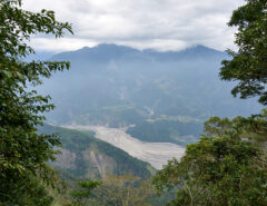
The hike up from here was a lot of the same scenery.


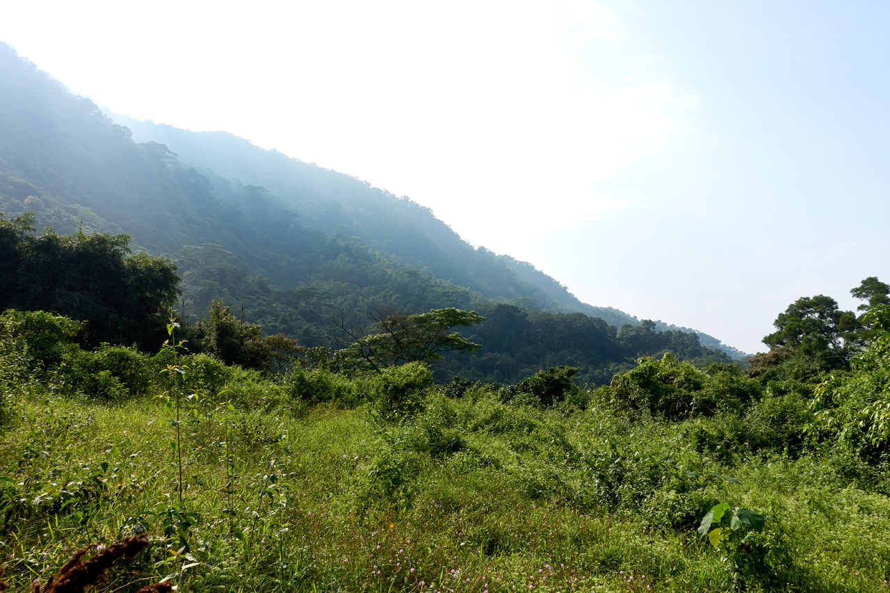
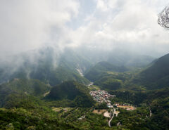
But after about an hour the trees opened up and I found myself in mixed trees and taller grass.

This part of the hike would probably be the place to get some decent mountain views. But I wasn’t so lucky that day. All I could see was white.

Somewhere up here was an open area with some makeshift benches. (tree trunks) I met a man up there who was coming down from the peak. Strangely I didn’t take a picture with my good camera, just this one with my cellphone that I sent to my wife for some reason. And yes, there was cell coverage for most of the hike.

Small Mystery
From this spot, after a short section of easy hiking…


…until near the peak, there were several more of those “claimed areas”.


I could hear people loudly talking wherever the above trail leads to.
If you notice in the above two pictures the “claimed areas” are roped off. The one place had punji sticks stuck into the ground. I was very confused about the sticks and reasoning for roping off all of these areas. I initially thought people were being pricks and not wanting other hikers to use “their” areas. But later one of the signs said something about being careful to not leave the gate open or the wild oxes (or cows or buffalo or something like that) would get in and mess things up.

Ok, mystery solved!
The Final Leg
The last bit of hiking to the peak was relatively easy.

And for some reason this fan was in a tree.

About twenty minutes from the peak was this intersection.

Obviously “up” was the way to go. But I was very curious about the other trail. More on that later.
The trail continued on…

…and led to a series of stairs…sponsored by Yakima apparently. 😆


I thought Yakima made products like roof racks and such. This was my first time seeing something like this.
One final push through the forest and some wild bamboo…


…and I arrived!

But…
ZhenLiShan – 真笠山
Was this someone telling me I couldn’t go to the peak!? That was my first thought. But yeah, I had forgotten about the wild cows. This was for them, not me. So I opened it and walked in to reap my rewards!

Well…it wasn’t much, was it? 😐
It didn’t matter though. There were some plastic stools for me to sit on and I had plenty of daylight ahead of me. I would take a nice long rest and move on to the next peak that was located nearby.
I took my usual peak pictures…


Nearby the triangulation stone was another stone.


I’m guessing it’s one of those water boundary or protection markers I’ve often seen. One of these days I’ll look into the reason why they were put all over the mountains.
So where was I? My resting, right? Not much else to say about that. I listened to my music, ate, drank and left. I would have to come back through this way again, but I took a departing shot regardless.

A MUCH Easier Way to Reach the Peaks
If effortless peak bagging is your thing, then let me quickly tell you how to get to these two peaks another way. I don’t know the exact details, but for the most part it seems all you need to do is find a road around the back of the mountain that will take you up really close. Take a look at the map below. (click it for a larger image)
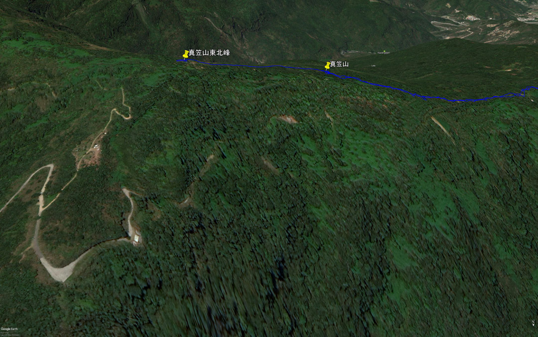
Before I arrived at ZhenLiShan (真笠山) I mentioned the trail I saw that went off to the left. Well, just past ZhenLiShan is another trail (two actually) that I believe links up with that trail. From another map that’s a bit clearer, you can see that it connects up with the road above.
So yeah, it’s really that simple if you want it to be.
A Quick Hike to the Next Peak
The hike from the main peak to the northeast peak takes less than twenty minutes. There isn’t much to write about. I only took these two pictures.

When I arrived at the peak I found a small group of hikers preparing a meal. I didn’t get them all in a picture, but here’s what the area looks like when you first walk in.


This is a rather large area when it comes to lower mountain peaks. There must be a lot of people that come here on weekends judging by all the miscellaneous “stuff” lying around. Also, there’s obvious upkeep of the surrounding area.


It wasn’t obvious where the peak marker was, so I asked the hikers. They pointed me in the right direction. As I walked by them, their dog came out of nowhere and bit me! Well, it bit the back of my boot. So it wasn’t really a big deal. They scolded it and tied him/her up.

ZhenLiShan Northeast Peak – 真笠山東北峰
The peak was about 40 meters or so from the picnic area.

It’s too bad the weather wasn’t cooperating. I bet the view here is decent.
Since there wasn’t anything to do here, I took a quick set of pictures…


…and left.
My plan was to head straight back but the hikers asked me if I would like to join them. Normally I would decline, but they offered coffee. It’s VERY hard for me to turn down coffee…especially at the midway point of a hike! So I accepted.

They were nice people. Turns out they hiked a whole lot today. I believe they mentioned bagging four or five peaks. For whatever reason they weren’t counting this northeast peak. So technically they bagged one more.
After the coffee we set off together. But with me being slow and always taking pictures, they quickly disappeared ahead of me.


The Hike Back
I’m only mentioning the hike back because of two things. The first being this oddity I found at the side of a trail.

My first thought was “bathroom” mainly because I saw something that resembled poop towards the top of the bucket. But upon further inspection, I think it was a rotten banana peel. Also, the location would be really strange for a bathroom; anyone and everyone could see as they walked by.
I posted this on twitter but didn’t get any solid answers.
I can't figure out what this is being used for. It's off to the side of a relatively popular trail. There are several permanent table/chairs/tarp areas nearby where regulars spend the day. This bucket is plastic (so nothing being burned) but it's quite black inside 1/2 pic.twitter.com/tFHVgf05rG
— OutRecording (@OutRecording) November 13, 2019
Feel free to post your guesses in the comments.
Lastly, (or is it supposed to be ‘second’?) I took a different route back to my bike. This is the trail that takes you by that NCC building and all the little “claimed” areas very near LiDingShan. Since I’ve already written on that, I’ll only post these two pictures of that section.


Conclusion
I don’t have anything really to say about this hike. It’s straightforward and relatively easy if you’re in halfway decent shape. It’s not dangerous; at least no more dangerous than any other mountain hike in Taiwan. I would even take my son on this hike when he gets a little older.
Date hiked: 2019 October 30
GPX Track Download Instructions: Click the track on the map to see the download link
This is the hike from the parking lot to Hike to ZhenLiShan 真笠山
This is the return hike from ZhenLiShan Northeast Peak 真笠山東北峰 and ZhenLiShan 真笠山 to the parking lot

![[Valid RSS]](https://outrecording.b-cdn.net/wp-content/uploads/2020/03/valid-rss-rogers.png.webp)
Leave a Reply