

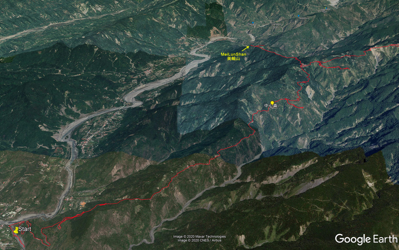
It’s not often I tell you that a trail isn’t worth your time. But I might have to make an exception for MeiLunShan 美輪山.
MeiLunShan, located in Liugui District, Kaohsiung (高雄市六龜區) likely hasn’t ever been at the top of anyone’s list of peaks to hike. And in its current state, I doubt it will ever be given the chance.
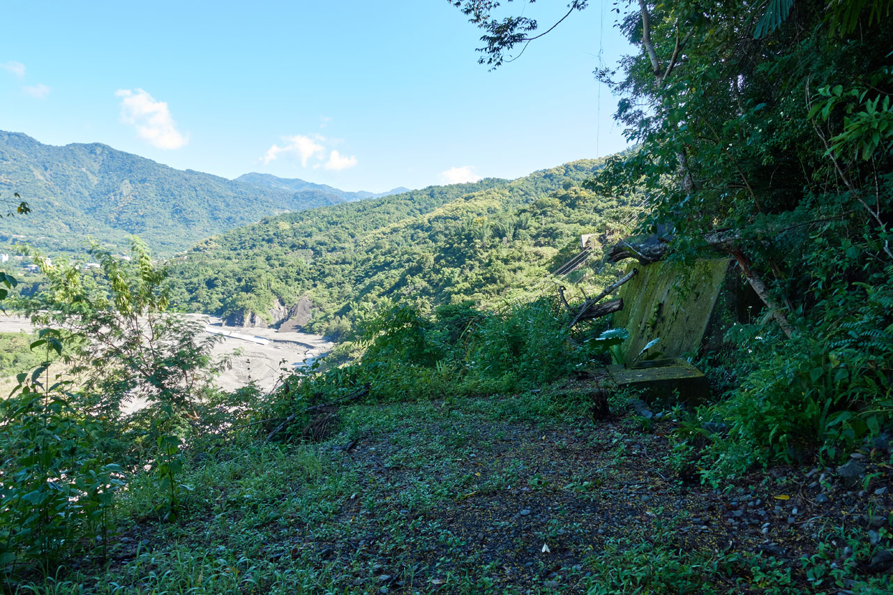
About six years ago I drove the first section of the trail, which is basically a farmer’s road. The area was in reasonable shape back then. Here are some “then & now” pictures.


The trees now cover most of the view.


Signs are now moldy, but still in decent shape.
And I can’t show a picture of this, but there’s one section of road that’s completely gone. I remember driving it up to meet with the trail at some point, and have the GPX track to prove I’m not going crazy, but now it’s just gone. I looked for it on my way down and couldn’t find a single trace of it.
My First Peak
As it turns out, I had unwittingly been to the MeiLunShan peak not long after that first trip. It was the very first peak I had “hiked” to. I don’t count it as my first peak because the “hike” lasted all of a minute or two. See, you can drive up from the south and take a short trail up to the peak.
As I remember, I could nearly drive right up to the peak. I got off my bike and followed a trail. I had no clue where I was going. Imagine my surprise when I found myself at a triangulation stone.

It must have been easy, cuz I was still wearing all my offroad armor.
Things have changed a bit, but you can still get pretty close by vehicle. It’s an easy peak to bag if that’s your goal.
Round 2
So if I’ve already been there, then why go again?
Two reasons. For one, I wanted to properly hike to the peak from the trail head. Second, I had read about a missing hiker that was last seen near the road that takes you to the trail head. I contacted his daughter who told me she didn’t think he would go to MeiLunShan, but I figured I’d first have a look around the area and then hike up to MeiLunShan later. She mentioned that the police had conducted a mid-level search (whatever that is) on the trail, but didn’t find anything. I didn’t think I would find anything either, but I had hoped I could be of some help…and at the very least I could hike a trail I doubt I would have ever gotten around to otherwise.
So off to LiuGui I drove!
After a bit of looking around for the missing hiker on an abandoned section of road…

…I went back to the MeiLunShan trail head.


There are some hotel/B&B/spa places in the area. They look dated, but are still in reasonable shape. I would have to guess that the MeiLunShan trail and these places used to have a symbiotic relationship. They probably still do to some small degree.
The Drive Up
As I had mentioned, it used to be in decent shape. I’m not sure why hikers/government/locals? have given up on it, but it certainly appears that way.
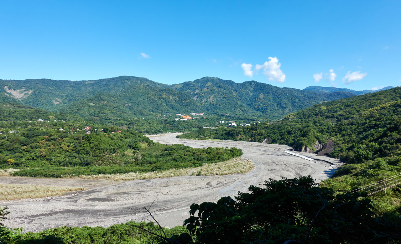
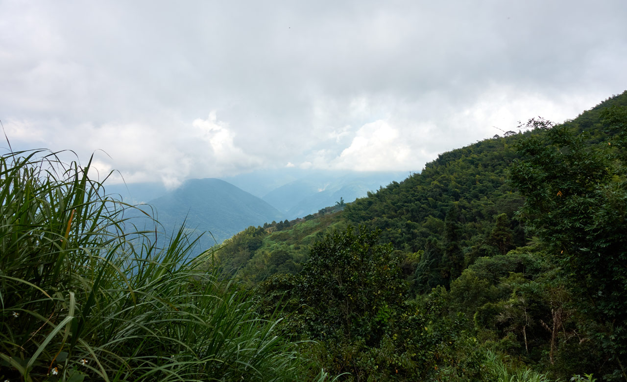
The drive starts off in reasonable shape. The tarmac turn into dirt eventually. But it’s easy enough if you have a capable vehicle. Along the way are two viewing platforms and a bunch of signs.


Second viewing area.

As you can see, the views aren’t great from the viewing platforms anymore. The road to get to them is fine, but you’ll probably want to park around here or a bit beyond and start your hike.
There are various signs that tell you which way to go, as there are some side trails–though I can’t imagine you would think to veer off the main road–as well as some other old signs.


I could have driven a lot further, but I felt I should park after a particularly rough patch of single-track. The road opened up again right after that rough part and I found a suitable place to park under the trees.

I was surprised to see this tourist sign so far up.

I continued up to the where the tea farm was supposed to be located according to the signs.

A muntjac could be heard nearby–first barking, then making that horrible sound they make–and I stopped to make noises back at it. It didn’t seem amused, but I was.
After that I arrived at the actual trail head!
MeiLunShan 美輪山 Trail Head
The trail head is marked by a shit-ton of ribbons.

Nearby sits these old decaying signs. Who knows what information they once shared.

The road continues on to the old tea farm.

I remember driving the full length of the road. It used to connect up with the trail further up, but it no longer does. I believe there’s a structure or two over there, but I could be wrong.
I wasn’t in the mood for exploring, so I turned and started the real portion of the hike.
Let the Real Hike BEGIN!!!
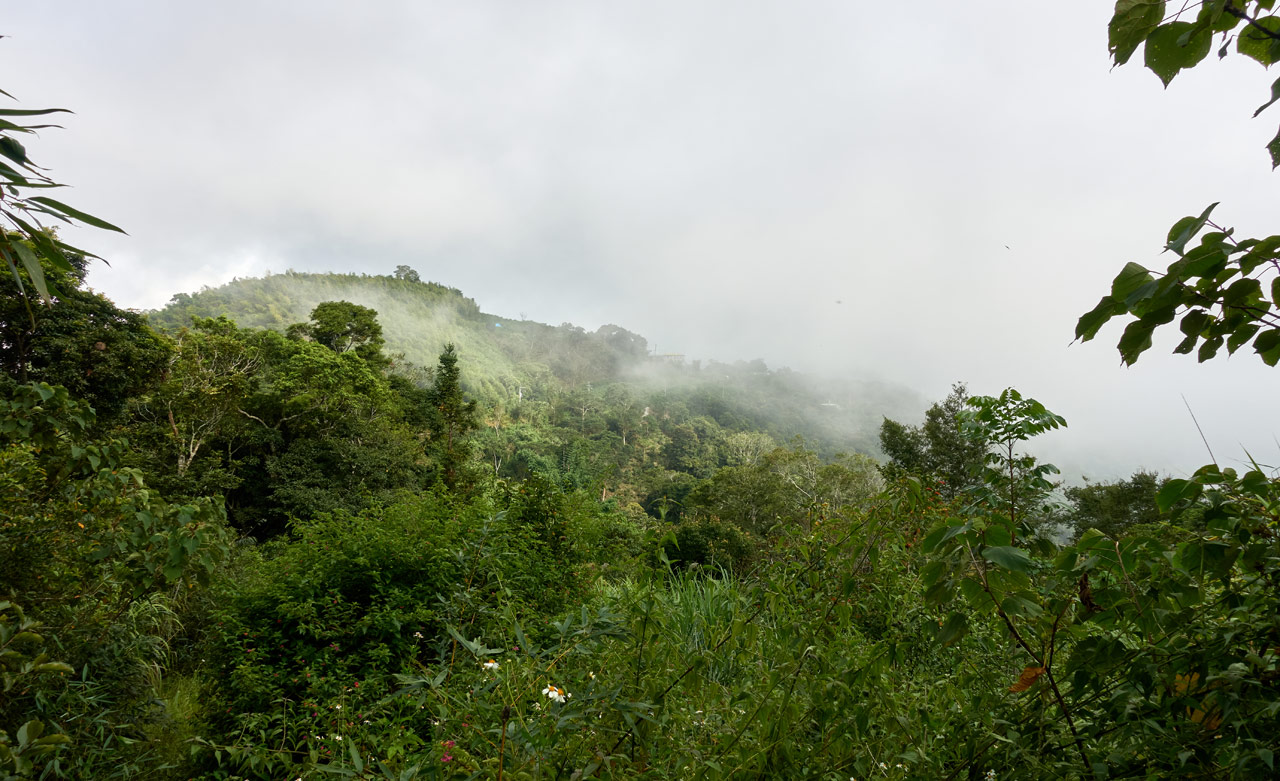
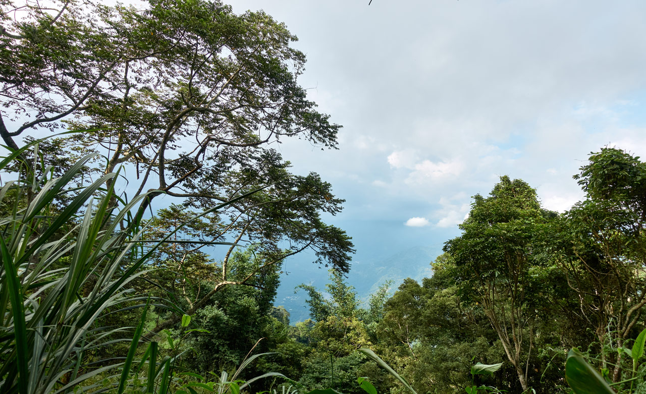
I hope that heading got you excited. Because that’s about as exciting as it’s going to get. I’m not purposely trying to undersell this hike – but it didn’t have a whole lot of redeeming qualities. I would usually show some pictures of the beautiful landscapes on the way up, but this hike had ZERO.

Most of the hike looked like these pictures.

It wasn’t a bad thing though. The sun was shining quite brightly that day, and being under the trees was a good thing.
And despite it being a so-so hike, there were a few things to see along the way.


One interesting find was this vine that was apparently holding up a fallen tree.


You have no idea how bad I wanted to take a chop at that vine with my machete! Maybe I would have in my younger days, but something told me to leave it be.
The Rest of the Hike to the Peak
From the trail head (where the road ends at the tea farm) it took me about an hour and a half to reach the peak. I would allot about 2.5 ~ 3 hours if you’re planning to park earlier than I did. According to the sign at the entrance, it would take 6 hours if you started your hike at the main road.
The hike did get a bit more interesting towards the top. There were more ropes–and I say this lightly–spots with a bit more danger to them.


But honestly, for the most part it was just simple up-mountain hiking.


As I neared the top everything became brighter.

I was almost there! (Imagine me sounding happy because this not-so-difficult hike is almost over)
And a few twists and turns later and I had arrived…
MeiLunShan 美輪山

I wasn’t very tired, but took some time to eat, rest, and take pictures of the stuff people hang up at the peaks.


And of course the triangulation stone(s) and my peak pic!


Exploration!
I think a part of my brain was restless. This hike left me unfulfilled. So what better way to fill that void than with some exploration!?
There is/was a road that goes around the side of the mountain and back down to an old house just below where I parked my bike. It’s in red color and changes to black on the map below.

From what I gathered, it was either gone or in really bad shape. It used to be hikeable, but I had my doubts if I could currently make it down that way. But why not try? So off I went!
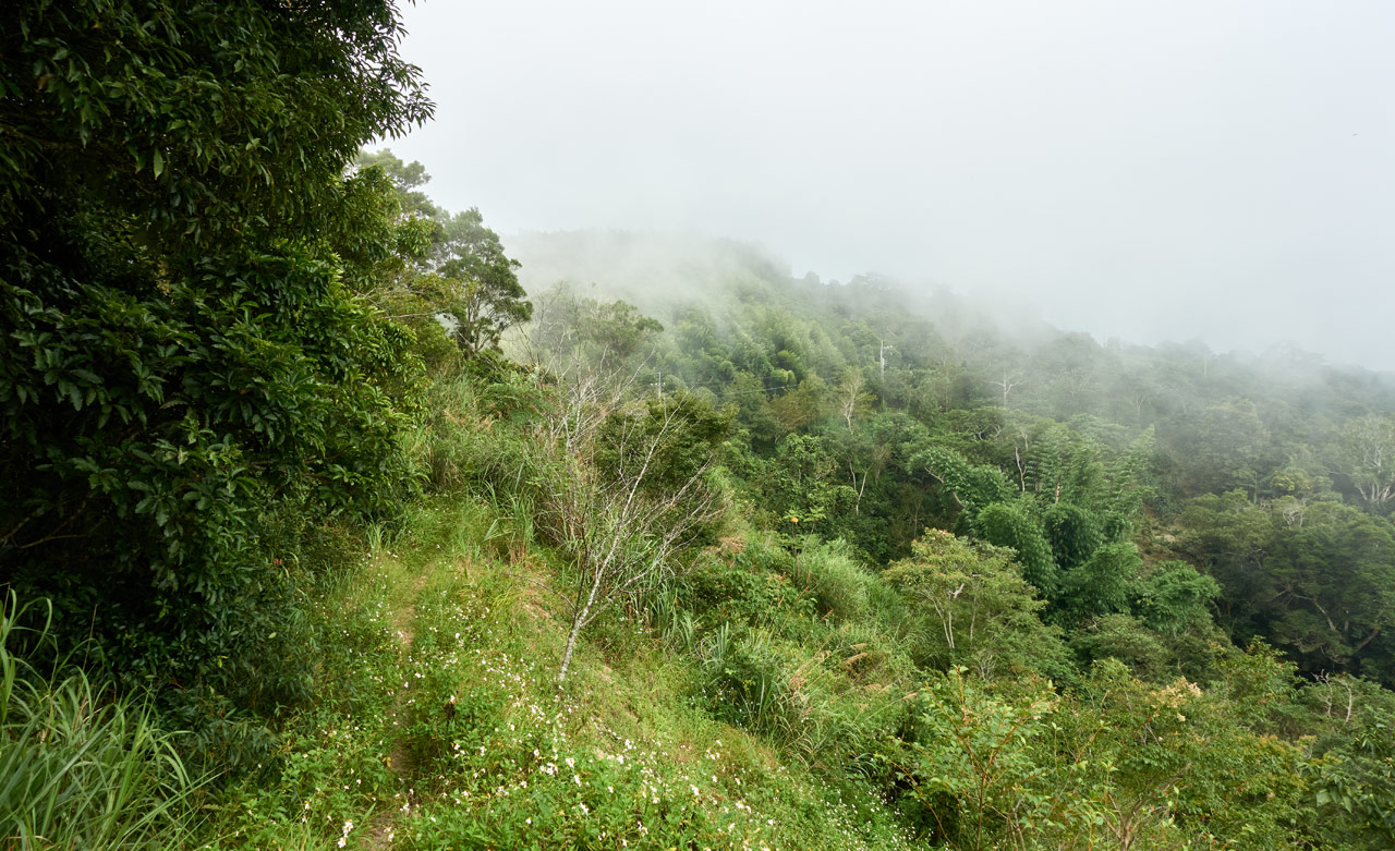
I was immediately happy that I made this decision. The ridge was nice and full of flowers.


It was cloudy/foggy by then, but it felt good to be out in the open.

I walked along the ridge and down until I reached the road.

It felt strange being on a road that soon after leaving the peak. Some part of my wanted to magically transport my bike up here so I could go home. haha…but nah, let’s keep going…
As you can see in the above picture, there’s some space to park a car there where the road curves. The trail to MeiLunShan is going up to the left. But over there by the parking area was my destination…
The “Road” Down
And as expected, it wasn’t in great shape.

But it did offer some views from time to time.
Along the way I found this orange ‘tub’ presumably for holding water. Now abandoned, the frogs have taken over.

The road slowly became worse and worse.

I had the foresight to bring a machete, but not my brain.

At one point the overgrowth became so bad I had to crawl a good ways under it. It was like a giant blanket covering the entire area.

From there it was spotty. Sometimes halfway decent…

…and other times not.

There was one place where I even had to take off my pack and drag myself under a low-growing tree. There was just no way around it.
But I had hope (really, I did!) because there always appeared to be a path to follow. It wasn’t a great path but it seemed like someone came through here at least semi-regularly.
Why the Path?
The road started getting extra crappy. So crappy that I didn’t think to take pictures. BUT…that path was still there to follow. And then I found the reason for its existence.

At the time I had no idea what it was. It was obviously collecting some kind of information and sending it somewhere. But what info?
I posted it on Twitter and one Internet sleuth found the answer!
Here! At this, uh solar powered blue light bulb. No clue of its purpose. All I know is that whatever semblance of a trail there was to get me here disappeared at this spot. I had 2km of bushwhacking ahead of me. It started raining. I had 2 hrs of sunlight left. Nope! I went back. pic.twitter.com/1ASX3YB7hU
— OutRecording (@OutRecording) September 26, 2020
In short, a monitoring station for landslides. I saw what appeared to be something similar up at the MeiLunShan peak. It was off to the side and half destroyed from what I remember. Unfortunately I didn’t think to take a picture.
One Problem & Then Another
The trail ended at this solar-powered station. What was left of the road was possible to hike, but it would be a long hike. I estimated a couple hours of hacking my way through whatever was between me and the end of this road…but whatever, “Let’s do it!” I thought.
I probably could have made it…if not for the rain. DOH!
Just as I had started my first few chops with the machete, rain came down…lightly at first…then moderately a couple minutes later.

All that overgrowth was good for something: it kept most of the rain off me. Luckily it didn’t last long, but long enough to make everything good and wet. As I sat there, my adventurism slowly disappeared. It’s one thing to hack, crawl, slide, and push your way through a jungle…but a completely different thing to do it in a WET jungle.
I had my poncho, but it would get ripped to shreds in no time. I would be wet regardless of which way I chose to go. But one direction meant a little wet and the other direction meant a complete soaking wet. I chose the former.
Back Up to Go Down
I went back the way I came and got wet as predicted.


But once I got back to the MeiLunShan trail, I slowly dried out.
It was getting late as I made my way down the mountain.

I was eventually hiking in the dark.


I’m not sure which was more boring, the hike up or the hike down. hahaha…
There’s not much else to say. I made it to my bike and safely drove out. Though there was a small rockfall that came crashing down RIGHT BEFORE me while driving down. Had I been a couple seconds faster it would have hit me. You just never know what will happen out there.
The End
Do I really need to wrap this up? My feelings about this hike should be very clear to you by now. All I’ll say is this: If you’ve hiked everything down south and need something to fill up your time that’s not difficult, then go to the gym and walk the treadmill! hahaha…No…go to MeiLunShan. It’s not terrible. Oh, and I’ve read that mountain bikers will ride down this trail since they can be dropped off at the top. I guess it’s possible, though I would’t want to do it.
Date hiked: 2020 Sept 21
GPX Track Download Instructions: Click the track on the map to see the download link


![[Valid RSS]](https://outrecording.b-cdn.net/wp-content/uploads/2020/03/valid-rss-rogers.png.webp)
Leave a Reply