

This post is difficult for me to write. I’m trying to find the words to make the hike to PenMaoLiShan & PenMaoLiShan South Peak – 盆貿里山 & 盆貿里山南峰 sound at least somewhat interesting, but I can’t. It was not fun. Not in the least. It has no redeeming qualities at all; easily one of my worst hikes. Ok, I’m lying. If you enjoy a challenge, then maybe that’s one good thing and this might be the hike for you.
The Beginning of Misery
PenMaoLiShan & PenMaoLiShan South Peak are located in Laiyi Township (來義鄉) near Wangjia Old Village (望嘉舊社). There are two possible ways to reach them. The first is most likely the easier trail. You head up the mountains just as if you were going to Wangjia Old Village. A trail breaks off from the main road and you follow that up. It connects almost exactly between the two peaks.

That route was my original plan. But nearby there are a couple lower peaks that I thought I could easily reach along the way. So I chose–what I would later learn to be–a more difficult route. In short, drive up a different road a little further south and make a quick side hike to XiLeGeLangShan – 溪樂格朗山. Then drive up as far as I can go and hike to PenMaoLiShan, PenMaoLiShan South Peak, AND…if time, hike down the trail in the picture above to PenMaoLiShan West Peak – 盆貿里山西峰. Sounds ambitious, huh? Well, how about this: I had thought, if I have time I can ALSO drive down to the other side of the mountain and quickly go to BaoHeYiShan – 保和以山. (It’s near a road; it should be easy)
I was obviously mislead about how easy all this would be.
The Ride Up – First Half
This was the beginning of my misery. The road started off fine.

But soon became a mess.

It was wet/moist and sometimes muddy with plenty of leaves. I was worried that my tires might lose traction and I’d fall. To make matters worse, there were plenty of pretty steep sections. My rear tire started spinning on one particular steep uphill. I almost lost it but managed to recover.
It doesn’t look like much, but this road was slippery.

When I arrived at the XiLeGeLangShan trail head there was a hunter parked there. He passed me on the way up. I thought he must be checking his traps on or near the trail to XiLeGeLangShan, so I didn’t stop as I didn’t want to bother him. I could always stop on my way down later in the day.
This road must have been used often a long time ago to warrant road signs. You usually won’t see them on roads like this. But now they are moldy and unneeded.


There were also a couple places where all these people must have stopped to spend the day talking with their friends.


Thankfully the slick road eventually ended and the much safer dirt road began.

The Ride Up – Second Half
The dirt made me feel much better. I could drive faster. It wasn’t always in the best of shape, but offroad is where my bike shines. And speaking of that, the sun was out and it was a nice day.
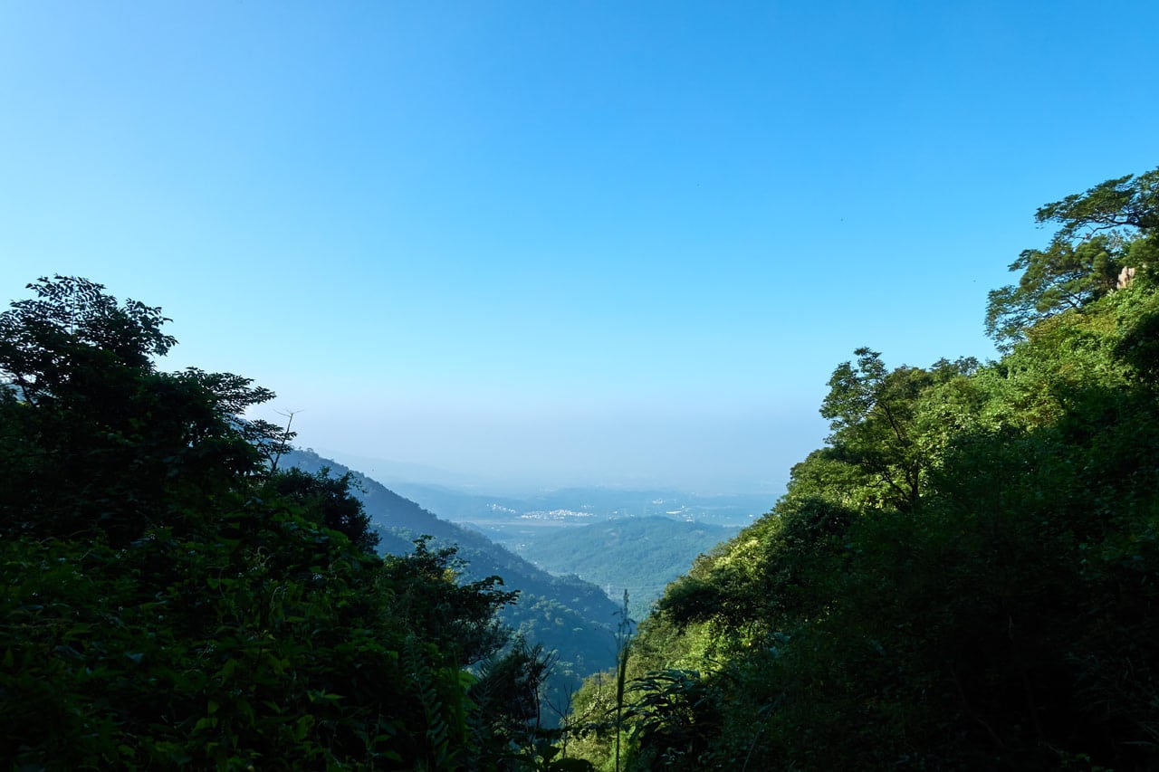
Had I known what was ahead of me, I would have stayed here a little longer to enjoy the view. There were no more views after this. There might have been some in a couple places if the weather was better, but I’ll get to that later.
I continued up and up…

(ok, there was ONE more place with somewhat of a view)
…and finally I made it to the trail head….which was ummmm….
A GARBAGE PILE!!!
PenMaoLiShan Trail Head


If I had to guess, I would say this is from a hunter. I don’t think many hikers pass through here; at least not enough to leave THIS much garbage.
But who knows. And what could/can I do about it? Maybe it’s all an extension of this odd “shrine” that’s off to the side:

I didn’t want to hang around here any longer than needed. So I got my stuff ready and started the hike a lot quicker than usual.
The Trail to PenMaoLiShan South Peak
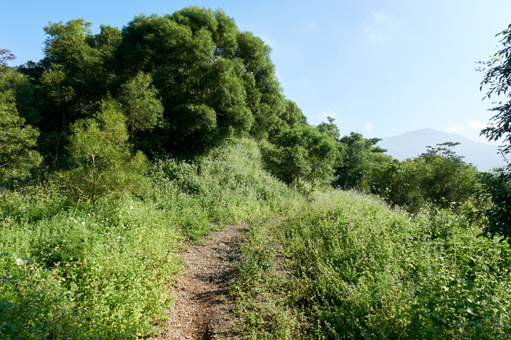
The hike starts on what used to be an old road.

There was always a trail to follow, more or less. But it got nasty in places.


This is where I should mention the bugs. There were mosquitoes. They weren’t bad, but they were pretty much constant. And then there’s the OTHER bugs. I’m still trying to figure out exactly what they are. At first I thought they were biting midges. (known here as xiaoheiwen – 小黑蚊) But I think that’s wrong. Xiaoheiwen appear to be really tiny and attach to your body, sucking your blood, and often aren’t noticed until it’s too late.
But THESE bugs…I’ve encountered them often on my hikes, but usually just one or two here and there. They’re about the size of a large gnat, but look more like a tiny fly – and SO friggen’ annoying! They will hover around your head and dive-bomb your ears and eyes constantly. Seriously! JUST your ears and eyes. And their accuracy! Oh my god…they are SO ACCURATE! I’ll cover my ears with my head wrap (they’ll STILL ram my ears!) and then most of them will move to my eyes. Some will crash into one of my open eyes and get stuck. I’ll pick it out and that’s it. It’s dead. I really don’t understand these bugs.
So…my point is…these bugs didn’t leave me alone for most of the hike. 🙁
The Stream – The Climb
The old road only lasted about 900 meters but took me a solid hour to hike. There was a small rocky stream bed that cut through the road.

I mistakenly followed the road a bit and realized I must have made a mistake because there wasn’t much of a trail to follow. I backtracked a bit and returned to the stream. After a some searching, I found the “trail” that went up the mountain.

No, there was no trail. I had a route to follow on my GPS, but it didn’t correspond to anything I saw. In short, it was basically “You are here. You need to be up there. Good luck dude!”
I did find a couple ribbons on the way up, but they looked ancient. In fact, I barely saw any ribbons at all the entire hike.


The climb up to the ridge was the worst part of the hike. It was only 300 or 400 meters but took me 45 minutes. Let me try to paint a picture for you.
It was dense. Pretty much like this:

Try to imagine climbing up through this mess. There were all these little tree branch-like vines grabbing you, tripping you up, scraping you…just making life miserable. The whole time being assaulted by those little bugs bombing your ears and eyes. It doesn’t matter if you’re consulting your GPS or hanging on for dear life to a tree branch to avoid falling to your death, those bugs won’t stop.
Ugh…
It was slow going but I made it to the ridge and to my delight there was another old road to follow. Ten minutes later and I was at the turn-off to PenMaoLiShan south peak. A few minutes after that and I arrived.
PenMaoLiShan South Peak – 盆貿里山南峰
Unsurprisingly the peak was overgrown. I had to play “lawnmower man” and cut all the overgrowth around the peak marker.

I would have loved to have rested here for a while and eat an early lunch but the bugs wouldn’t have it. It was miserable sitting there so I packed my stuff to leave. Here’s my usual peak pic and the lone sign I found off to the side.
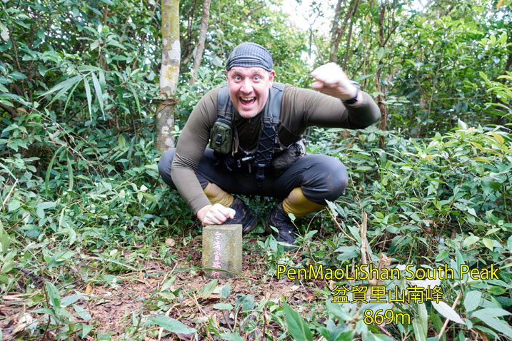


If you notice in my picture above, I’m wearing gaiters. Yeah, it was a bit wet out there. Just thought I’d mention that – another little detail to make things slightly shittier.
Trail to PenMaoLiShan – 盆貿里山
As mentioned, there was an old dirt road to follow. Well, minus the dirt.

I’m not complaining. It was nice to not have to weave and duck, hack and slash…trip and fall. But it didn’t last. The road went east and the trail cut up west to the ridge. It wasn’t long before I was “back in the shit” again.


Oh, I almost forgot about the trap I found not long after leaving the last peak. A hike with me wouldn’t be complete without finding a trap.

It’s pretty pathetic as traps go; at least compared to most that I find. But whatever. I’m sure it works.
And for every negative (a trap is a negative, right? I mean, something will die because of it. I suppose that’s a positive if you’re starving. But for now let’s call it a negative so my story makes sense)…And for every negative there should be a positive. Here’s a nice flower I found.

And another one of those awesome smelling plant/flower I found recently at the CaoBuHouShan – 草埔後山 peak.

For real, they smell great!
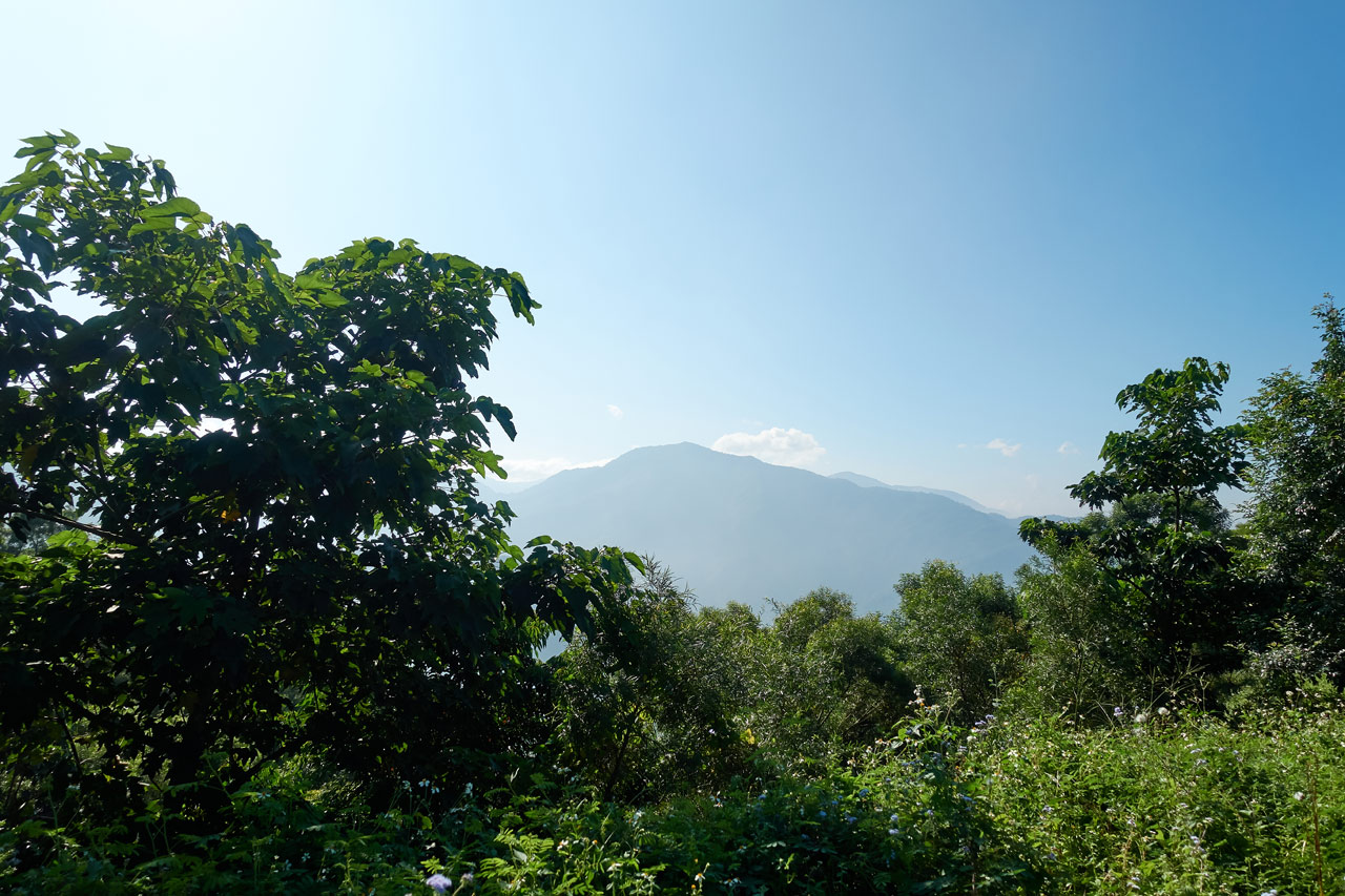
I don’t have many pictures from here to the next peak. All I could think about was getting to my destination. There were some exposed areas on the ridge which was good and bad. Most of the bugs avoid these sunny spots. The downside is all the overgrowth.

It’s slow going trying to pick your way through all that. You have no idea what’s underneath and you have to carefully push your way through. It’s not worth wasting your time and energy using a machete to clear a trail. Just push through and hope for the best.
Peak to peak is a mere one-thousand meters distance with an elevation gain of about 70 meters. That sounds like a piece of cake, but still took me and hour and fifteen minutes. But I made it!
PenMaoLiShan – 盆貿里山
There was one little problem when I arrived. I couldn’t find the triangulation stone!

There was this completely overgrown open area surrounded by trees. You can see signs attached to the tree indicating this is the peak. But there was no triangulation stone to be found. I searched and searched and found nothing. So I took pics of all the signs and admitted defeat.


There was no place for me to sit. So I found a couple large rocks and stacked them as a makeshift stool. And yeah, I needed to cut the overgrowth to open up a spot.

At this point I HAD to eat and rest, bugs or no bugs. And there WERE bugs. They were worse here than anywhere. Probably because I was just sitting in one place for a long period of time.
I always carry a head net with me. And it paid for itself that day. Notice the mosquito on my nose.

I rested as long as I could, but at some point I couldn’t stand it. I quickly ate as much as I could and packed up my gear. Since I couldn’t find the peak marker, I thought I’d take a picture with the sign on the tree. Better than nothing, right?

Triangulation Marker Search
One thing I failed to mention was when I first arrived at the peak I came across these signs off to the side out in the open.


I also looked here for the peak marker and was unsuccessful. I felt kind of bad because I couldn’t find it, so I spent another 20 minutes or so searching. Heck, I hiked beyond the peak area because there was a trail going out the back (kind of a trail…well, maybe not). But nothing. 🙁
Forget it. I gave up and hiked back to the peak. As a last ditch effort, I searched across from the area with the signs above. I had no expectations. But guess what? Yeah, I found it!

It was buried in a lot of tall grass about waist high. I was kicking through it and found it. Just like the last peak, I cut the grass. The next hikers who come through better say thank you!
This peak marker had a little plaque below it.


I was too lazy to take my normal peak picture. But I had to take one. So…

Here’s how the area looks from afar. I really should have known it would be hidden there in the grass.

The Hike Back
Not a whole lot to say here. The hike down was just as depressing as the trip up. I mean, when this is what you have to wade through to start the next leg of your journey, how could you feel happy?

The bugs somehow seemed worse, if that’s even possible. But whatever. I tried my best to ignore them.
The clouds/fog had already arrived earlier, but it was getting thicker.

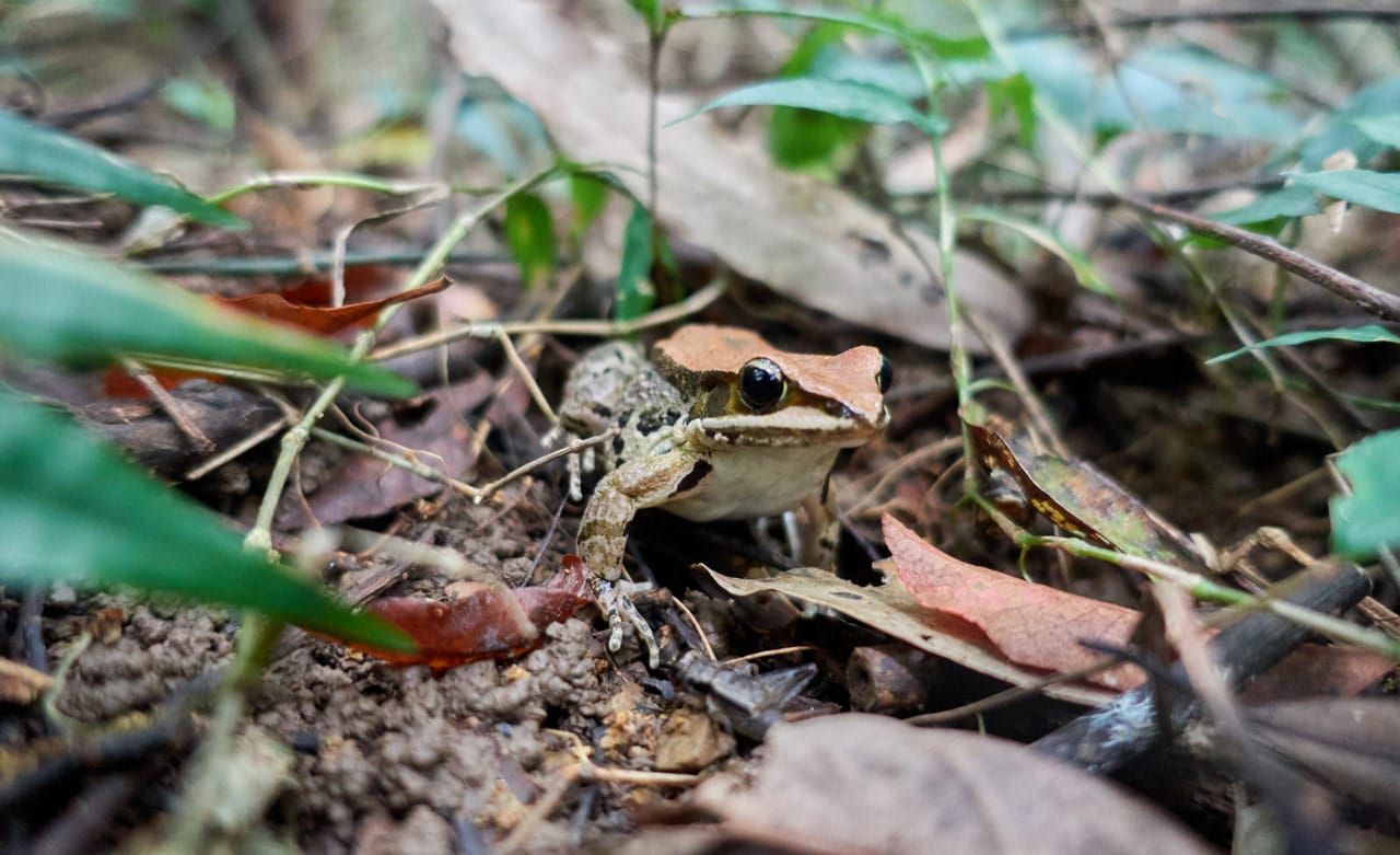
I don’t have much else to say about the hike down. I did it and didn’t get hurt. Going through the thick tree area was just as bad going down as it was up. While I was in there I crossed paths with this toad doing its best to mimic a dead leaf.
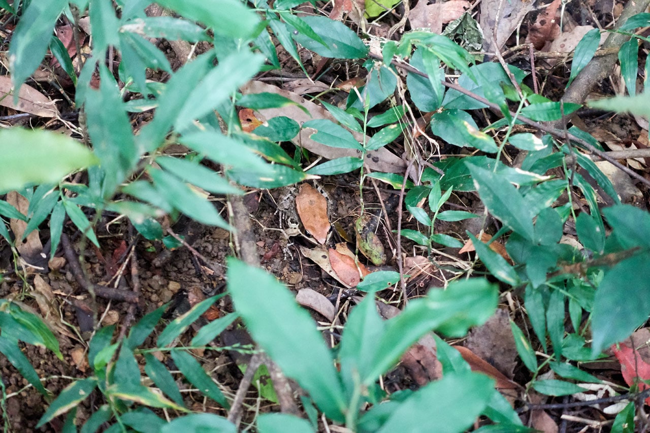
It’s probably easy for you to see because it’s centered in the picture. But for real, it was camouflaged pretty well. I only noticed it because it jumped when I almost stepped on it.
It took me about two and a half hours but I made it to my bike and drove down without incident. I was in no mood to stop at XiLeGeLangShan (the one I passed driving up). Perhaps another day if I’m ever in the area.
Final Thoughts
To sum it all up, it was a wet and slippery drive up; the trail head was a garbage heap; nearly the whole trail was overgrown; the ground and plants were somewhat wet; there were no views; the bugs were HORRENDOUS; I had to search and search for the triangulation stone (my fault kinda); and…did I mention the bugs!? 😆
In conclusion, I do not recommend this hike. Don’t do it unless you are some type of hiking masochist. Ok, it wasn’t AWFUL. But I felt little joy while hiking it. And you should at least kind of enjoy your hike, right?
Date hiked: 2019 October 07
GPX Track Download Instructions: Click the track on the map to see the download link


![[Valid RSS]](https://outrecording.b-cdn.net/wp-content/uploads/2020/03/valid-rss-rogers.png.webp)
發佈留言