

This was a two-part hike that I have dubbed my “Dr Jekyll and Mr Hyde” hike. One part yielded enjoyment and views a plenty, while the other…*shudders* yielded pain, misery, and no views to speak of. The choice is clear of which path to choose, but maybe you’re like me and enjoy beating yourself up. If that’s the case, please read on!
Easy Hike Made Difficult
Honestly, I had planned for this hike–like so many others–to be easy. I didn’t want to do anything that would put stress on my knee, so when I found this simple hike, I knew it would be perfect. It follows an old dirt farm road most of the way and then there would maybe be a little bushwhacking the last several hundred meters. But nothing can be simple or perfect for me for very long. Nope! I have to see or find something that will make a mess of the whole thing.
And I did…
While researching this hike I noticed a little “line” going off to the side.

Why was it there? Where does it go? I had to know, but there was almost no info about it.
One blog post mentioned a trail going to 425岩峰, or Rock Peak 425 – 425 being the elevation. But they ran out of time on their hike and didn’t expand on what it might be. It was a mystery that needed solving! And I think I mostly did solve the puzzle before heading off. A quick look at google Earth told me that line *must* go to this rock…
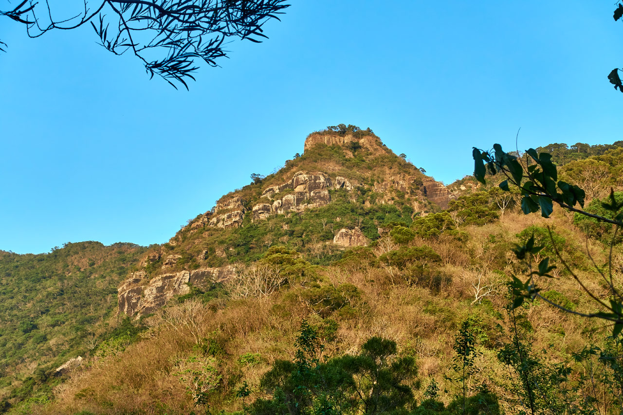
If you’ve ever been to KaYouFeng Waterfall, then you’ve surely seen that prominent rock peak. What’s not to love about possibly climbing THAT !?
But that’s not all! No, I felt the urge to further complicate my hike after seeing this GPX track:

The uploader labeled it “枋野具山500峰” and mentioned something about Garmin saying this was the actual peak. It was only a few hundred meters away, so why not!? (famous last words…)
The Choice is Yours

Maybe one or two of you will get the above reference.
So your options are to hike to FangYeJuShan or Rock Peak 425…or maybe to that other mystery peak…or try them all!? Personally, I would recommend only hiking to Rock Peak 425 followed by a relaxing swim at the nearby Kayoufeng Waterall – 卡悠峯瀑布 to end your day. The choice is yours.
But don’t take my suggestion and run. Have a look at what’s in store for you first and then decide.
FangYeJuShan – a.k.a “Mr Hyde”
My original plan was to hike everything I laid out above. But that didn’t happen. Here’s what did happen…
I arrived at the old farm road around 10am. That’s a pretty late time to be starting a hike for me, but there isn’t much I can do about it at the moment. My wife has taken an early morning job, which leaves me with the responsibility of getting our son to school in the mornings. So starting my hikes early won’t be possible for a while. (another reason I’ve been doing shorter hikes recently)
The road up was pretty bad for the most part, definitely not possible for a car, but it eventually got better as I drove up. As it turns out, I could have driven pretty much all the way up to the trail head(s) minus one stop to clear some fallen bamboo. But I wanted this to be a hike, so I stopped early and parked.

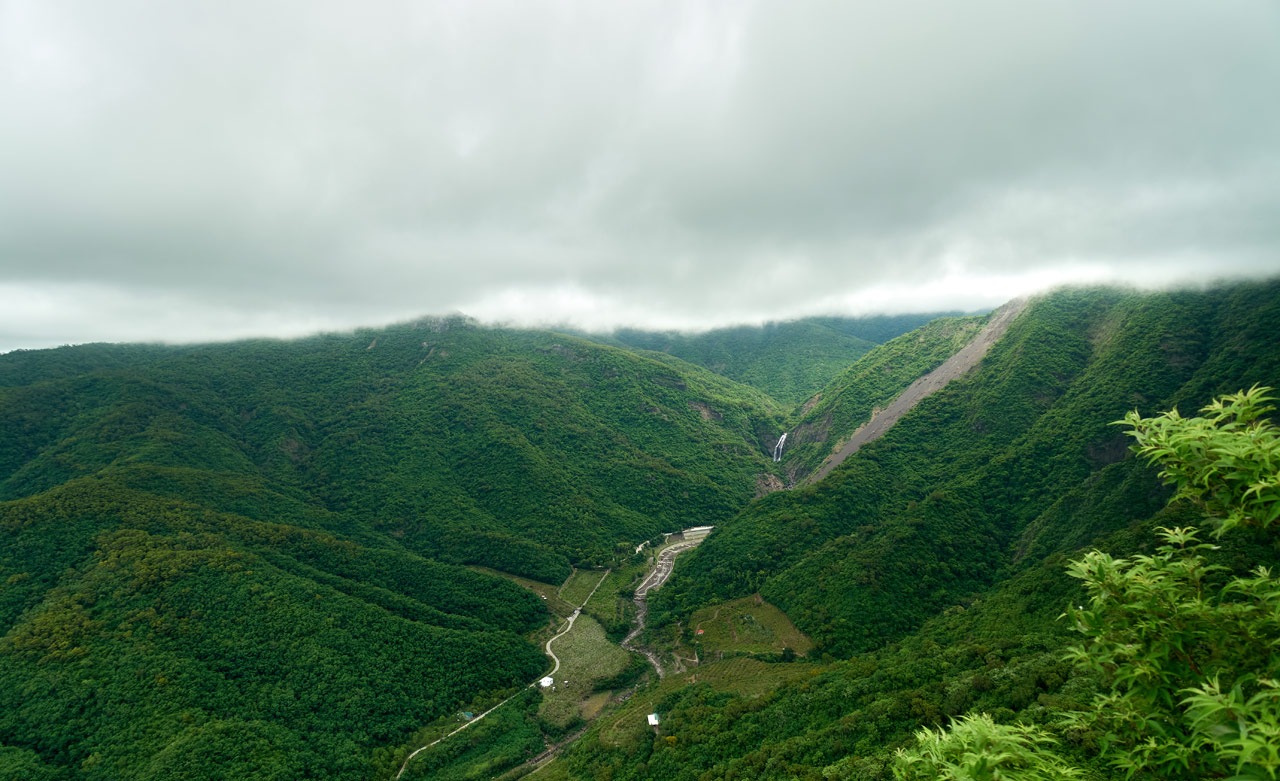
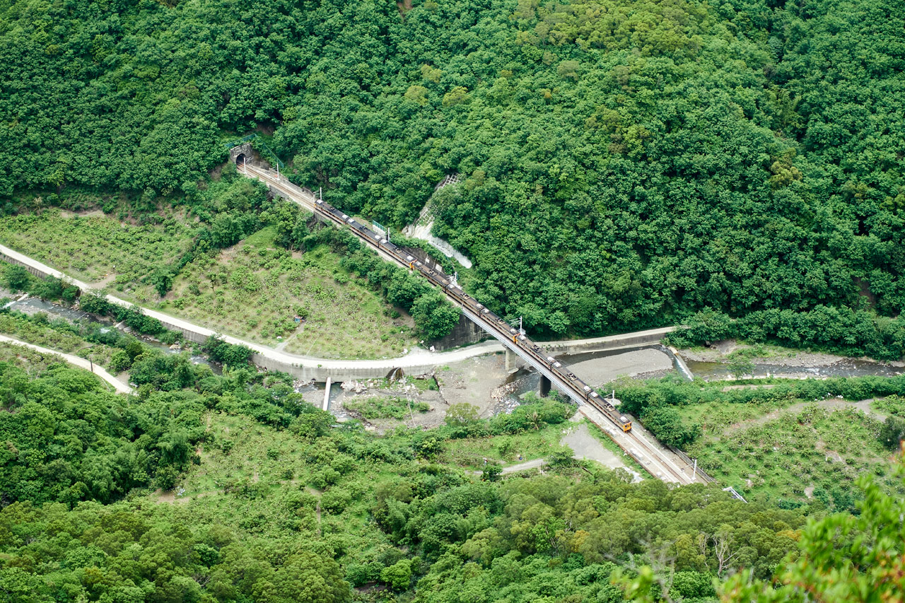
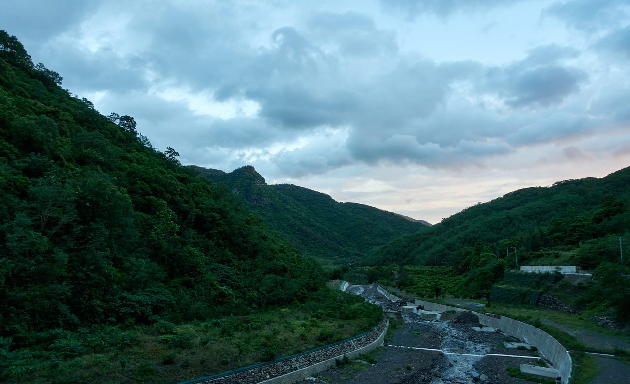
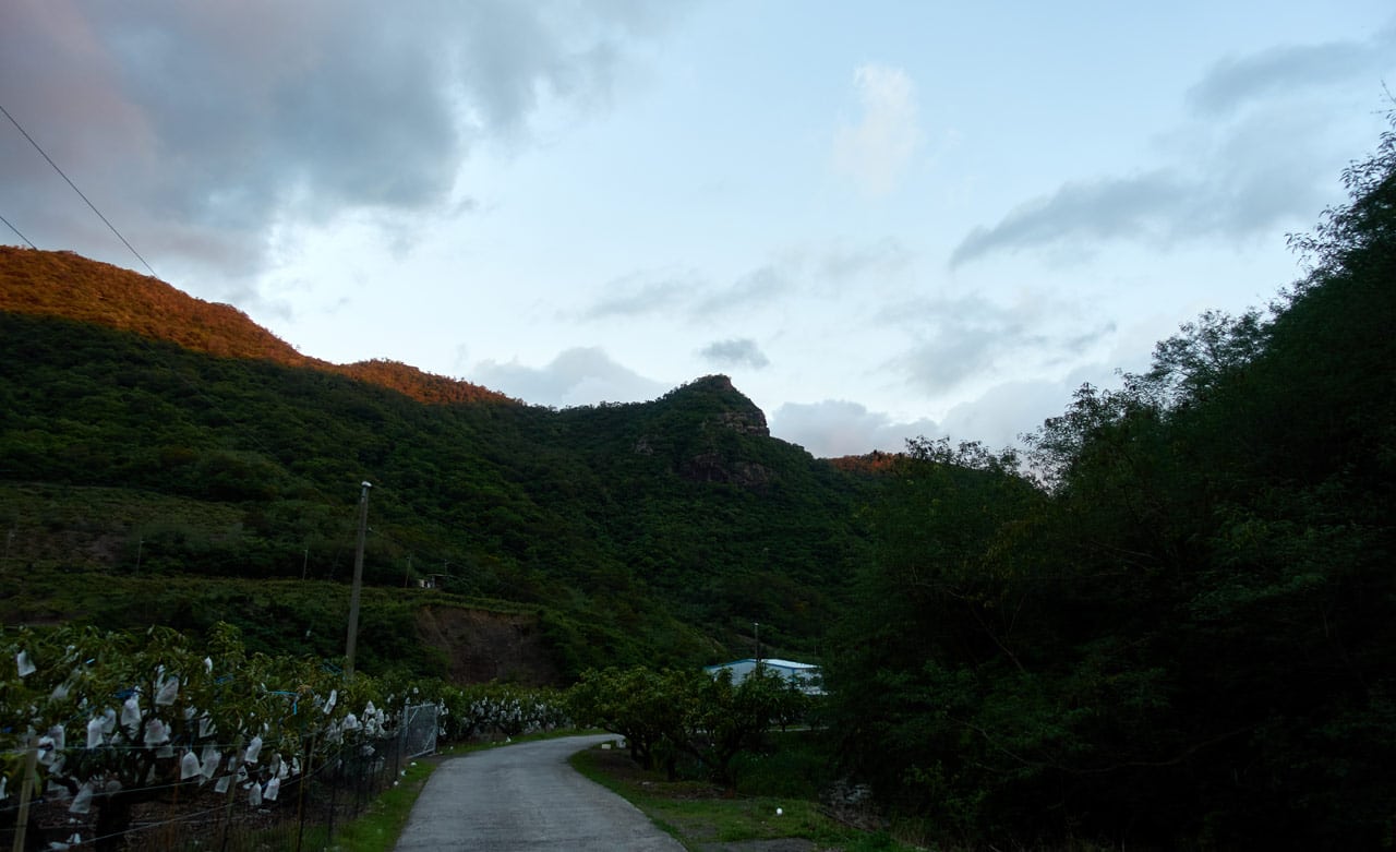
The road up, to be frank, is quite boring. It’s like any other old farm road you’ve probably been on, except there isn’t a whole lot to see – a view here and there…but really, not much to excite you.
I’m going to do you a favor and just post several pictures of what to expect from the beginning of the farm road until the first trail head.


See what I mean? Boring… 😛
It took me about an hour and a half to hike up to the trail head of Rock Peak 425.

At the back of all those trees is this stone marker. Some kind of survey marker is my best guess.

I took a brief rest here and then walked the short distance up the road to the FangYeJuShan trail head.


Trail to FangYeJuShan
It looks pretty simple so far, right? And it was! Granted, it was HOT. Really hot! So hot that I regretted leaving my spare two liters of water back at my bike. That bad decision would play out later in the day. But at that point in time, I was feeling great about the whole hike.
I started up the trail and quickly ran into some sort of trap.

It looks rather simple and non-functioning. I asked around and some people thought it was for catching pangolin. That’s possible I guess, but I wonder if that’s correct? I read that some pangolin sleep in burrows during the day – so yes, this could be a trap for one. But if you knew a pangolin was in there sleeping, wouldn’t there be some easier method than this to catch it? Or maybe they’re trying to catch it coming back? I don’t know… Again, maybe it’s for something else entirely.
Back to the hike.
Going up was messy.

But it quickly became apparent that there used to be a road network up here.


The hike was still pretty easy up until this last overgrown dirt road. But after it…that’s when things took a twist.
There was plenty of overgrowth.


And there was no trail at all. Whatever GPX track I was following might as well have been drawn by hand. I had to chop my way, crawl my way, curse my way, to the top. From the main road I took up, it was roughly 400 meters to the peak. It took me about 50 minutes to “hike” that.
Unwanted Guests
The biggest problems (aside from the sun and ummmm…NO TRAIL) were the damn ants and thorns! There were ants EVERYWHERE. And I’m not talking about the cute little ants you find roaming about your house. No, these are the big black type. The ones that just want to bite the f*ck out of you!
Here are a few pictures of them.


The plant with the berry-like things those ants are going crazy over…those plants were all over. Did you notice the thorns as well? It seemed half the plants out there had thorns. I kept getting stuck by them seemingly every minute. And not just the plants, but the trees too!

Honestly, half the time I wasn’t sure if I was being bitten by ants or stuck by a thorn. It was a lot of fun I tell you!
FangYeJuShan – 枋野具山
But yeah, after a final chop, chop, chop and crawling on my belly under god-knows-what…I made it to the peak!

Which…and I’m sorry to put it like this…sucked balls!
I don’t usually describe things as crudely as that in my posts, but I can’t put it any other way. It was hot…sun directly overhead. There was no shade…nowhere to sit. I was punctured full of holes and still getting bites on my back, which I later found were a bunch of pissed off ants getting their revenge. There was no view of any sort…and no wind to cool me down. Yeah, it sucked balls. 😥
I found a downed tree a short distance away and tried to rest there, but without any shade, it was torture. So I quickly ate and took some pictures before getting out of there.


See…that’s all I took. And I couldn’t even be bothered to focus the second shot. That’s how bad I wanted to get out of there.
“Short” Trip to the Mystery Peak
It took me some time to get my bearings and to choose a suitable path to that other peak I had mentioned. There was no GPX track to follow, just a little flag on my phone that I had to navigate toward.
The total distance is around 300 meters as the crow flies. But to get there you first have to go down to a little saddle and then back up. Actual hiked distance is about 600 meters. It didn’t seem like it would be a big deal…until I saw what I was up against.

It was just as bad as what I had hacked through earlier. In fact, it was far worse in some places. I don’t think anyone has ever tried hiking from the main peak to this peak – not in the last fifty years at least.
I made my way down, slowly and painfully…constantly getting caught up on all of that tangled mess. And as before, the ants were doing their thing along with the thorns. Good times!
I have no more pictures from the descent. I guess documenting that horror show wasn’t on my mind. But thankfully, when I got to the bottom it was somewhat open.


That is…it was open until the point where you needed to start climbing up the other side.


Bamboo…oh bamboo…. 😥
It took me some time but I managed to carve a path through all that fallen bamboo. But even then, it wasn’t much better beyond.


The ‘Other’ Peak
Peak to peak, it took me 70 minutes to blast my way through all that. I was drenched with sweat…I was hungry…tired…beat up basically. But I made it. And I’m happy of that accomplishment. I can’t tell you how many times I thought, “Frack this…just turn around and go back. It’s not worth it.” These are the kind of wins I enjoy most. When there’s nobody there to push you forward…where you could easily quit and nobody would be the wiser. (No, instead I’m bragging about it on my blog – yeah, we both see what I’m doing here.)
I mean, it sounds kind of stupid, I realize that. Beating yourself up for what? Nothing! haha…
And that’s exactly what I got at that other peak…nothing.
I just now realized that I have no pictures of that other peak. Can you believe that? I fully blame it on a pigeon. Here’s its story…
Fugitive Racing Pigeon
When I first arrived at that other peak I searched around for…anything. I wasn’t expecting to find anything, like some kind of marker or something…and I didn’t. I wandered around searching for a few minutes until I gave up. When I found what I believed to be the highest point of this peak, I dropped my gear and got to eating and resting.
This peak was MUCH nicer than the last. There was shade and a breeze. It was actually somewhat pleasant. I just wish I had brought my little chair.
So, the pigeon.
I was sitting there (or maybe I was standing?) listening to music when I heard some noise from above. I looked up and saw this pigeon.

And a closeup…

Close Encounter
Literally a second after I looked up, a saw some kind of eagle–wings spread, claws out–coming in for the kill!
It was a few meters from the pigeon, which by the way was oblivious to the entire encounter, when it locked eyes with me and quickly changed directions, and flew away. It never came back.
At first I thought my presence saved the pigeon, but now I realize it was precisely there because of me. Being a racing pigeon means it has been in captivity its whole life. I have to bet that it heard my music, which it probably associates with humans, and came looking for some food.
So yeah, I kind of almost got this pigeon killed.
After taking a bunch of pictures, I turned my head and heard it flapping its wings. When I looked up, it was gone. 🙁
I figured that was that…then got a startle when I looked slightly up and to my left and saw it staring at me once again!

I figured it was looking for food, so I threw down some completely unsuitable food for a pigeon – corn chips. Really, I had nothing but jerky, chips, and candy. Sorry fella!
The pigeon flew down and spent the next ten minutes picking at the ground for food.


I’m fairly certain I could have picked it up and hiked out of there with it, but, well…I didn’t really feel like doing that. 😳 Also, I had nowhere to put it.
I mention that because I was pretty sure it wouldn’t last long out there. It obviously had few survival skills!
Back to the Rock Peak 425 Trail Head!
I only took a thirty minute rest before deciding I shouldn’t waste anymore daylight. It was already 3:30pm.
I bid my new little friend farewell and got back to the nightmare that awaited me. This was the last shot I took of it as I left.

Going down wasn’t as bad as I had thought it would be. I stuck to my original trail for the most part, which made things easier.
About halfway up the other side, I changed directions to make a loop around the main peak rather than have to crawl through all that crap again. And it payed off! I connected up with one of the old roads!

I followed it around until it intersected with my original path up to FangYeJuShan. This is where I should have counted myself lucky and simply FOLLOWED THE ORIGINAL TRAIL BACK DOWN. But oh no, that’s what normal people do…not me.
Somewhere along the way I saw another road down the mountain a short ways, so I cut down to follow it. It didn’t help. It took me out of the way but eventually connected back up with the main trail…which I missed…and ended up on the other side of the ridge. Great…
I managed to find another old road that, thank God, brought me back pretty close to the Rock Peak 425 trail head. This portion of the hike complete!
A Quick Word
One bit of advice. If you DO, for some ungodly reason, want to hike to FangYeJuShan (and seriously…why in the hell would you do that!?) don’t use my return path. Use the GPX track I made going up, except, the last 100 meters or so, cut to the left and go AROUND the peak. And then come up the other side. So instead of coming in from the northwest, you’ll come in from the east of the peak. Hope that makes sense. If you look at all of my GPX tracks together in this screenshot, you should get a sense of what I’m saying.

The yellow line is roughly the route you should try taking.
Finished!? Yes and No…
I had enough time to reach the mysterious Rock Peak 425, but water was another story. I had less than half a liter left. 😕 Since I didn’t know what to expect, I didn’t want to chance it. Plus, I was ready to call it quits. What do you think?

I managed to get some of the best shots of the day on my hike down. (and yes, I did quickly run out of water.)
That was the end of that hike…but not the end of this story. A month later I felt the urge to return to once and for all learn what this Rock Peak 425 was about. I thought it would be a good idea to see if anyone wanted to hike with me this time around. So I reached out to see if anyone was interested and Richard, who I hiked with last year, answered the call.
Rock Peak 425 – a.k.a “Dr Jekyll”
We met up near the old dirt road entrance late morning and got to hiking up. There was quite a bit of stopping and talking so it took a good deal longer to make it up to the trail head. After a good rest, we got to the hike.
The trail head is right behind that stone marker I mentioned earlier.

I was really happy to see that there was some semblance of a trail. It wasn’t great, but it was something.

There was also the occasional trail marker ribbon. By then I knew this *should* be an easy hike.

It was steep, but it wasn’t all that bad.

It took all of 15 minutes to reach the bottom of the little ‘valley’. There we found this interesting tree in some sort of relationship with a vine.


From there we took a couple minutes to figure out which line would be the best way up the other side. Once we found it, we started the equally steep climb. This section was a bit more technical than the first part.


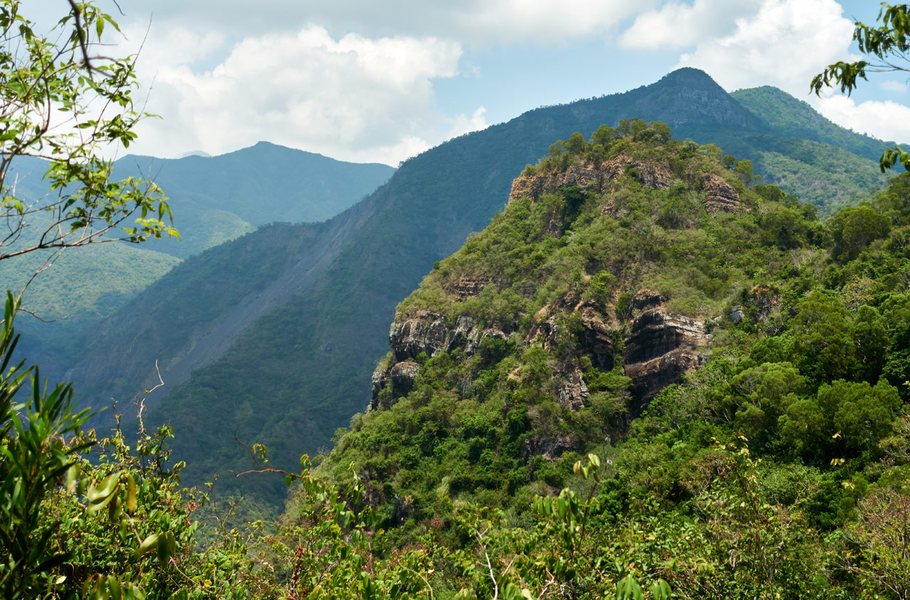
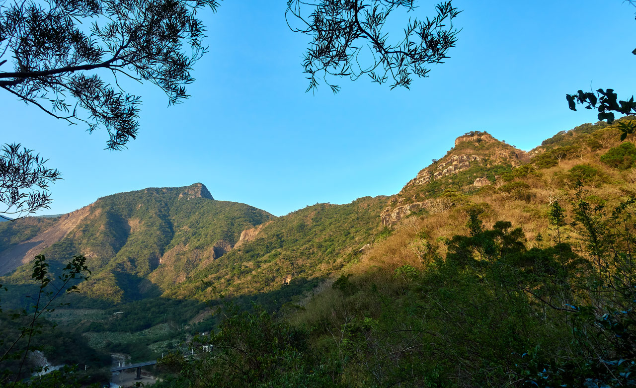
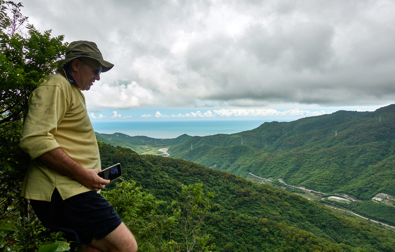
On a side note, from over on this side I could see FangYeJuShan (right) and the other peak (left).

For all the pain they put me through, they sure don’t look like much. 👿
Anyway, we continued up until…
Rock Peak 425!
Would you believe it only took 30 minutes to reach the top of Rock Peak 425? And this…this is it…

I guess this is what I had been expecting…basically nothing. But for the record, I took a “peak picture” for my proof of climb.

Let’s count this shot as Richard’s peak picture.

Ok, I’m kinda lying about there being nothing up there. Off to one side there’s a small path that leads to an outlook.

It offers a pretty nice view, but it’s not exactly what I had been expecting.
Fortunately, this wasn’t our last stop. The GPX track I had been following showed they continued on for another 50 meters or so before stopping. There must be something there. So we pushed our way through the tangled mess of Rock Peak 425 to see what it was.


A few short minutes later we found it.

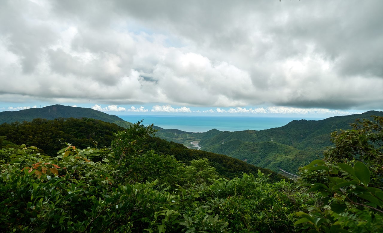
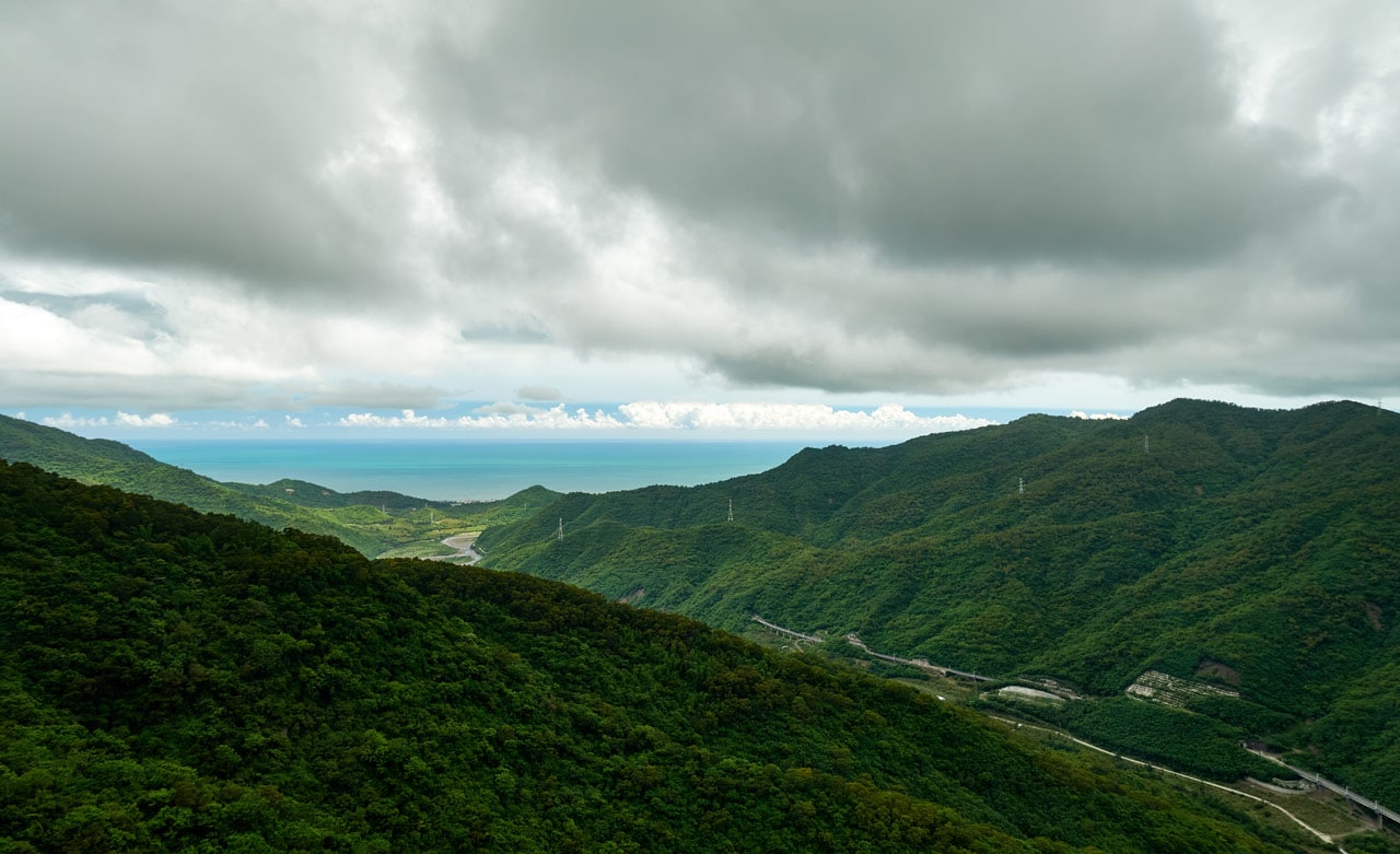
There was this perfect little ledge on the north side of the the peak that was free of trees and anything else to obstruct the view.

Here’s what you get for the effort. Mind you, the weather wasn’t the best for pictures. But trust me, it’s worth the hike.

It was quite windy at the time, so I’ll caution you to be careful. I’d say there’s enough room up there for two or three people no problem. But any more than that would be a bit tight.
A Little More Exploration
Well, here we go again! I had a pretty damn perfect hike up until this point…so why not go and try to mess it up. 😆
After we hiked back to the dirt road, I suggested we follow it a bit to see where it leads. I mean, it’s in too good of shape for it to just go nowhere. It MUST lead to something interesting, right?
So we got to it…

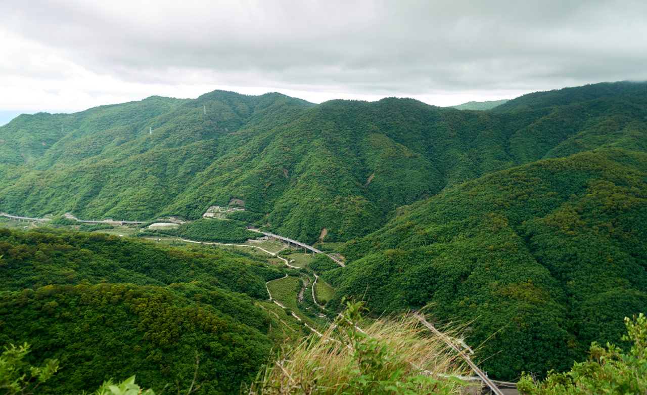
We hiked about 10 minutes. The road was still looking good for the most part.

We came to a messier area where the road all but disappeared. We decided to end the exploration there, but Richard found some butterflies to take pictures of, so I took the time to hike a bit more up the road. I hiked a little ways up until I figured I had been gone long enough. I turned back, and as I neared where Richard was waiting, that’s when it happened.
My Punishment
Out of nowhere a wasp or something flew out of the trees and bit me on the ear. On the damn EAR!! Remember Brad Pitt’s reaction when Edward Norton punched him in the ear in Fight Club? That’s how I felt! (BTW, I read that was Brad Pitt’s honest reaction because he wasn’t expecting an ear punch.)

You can’t see much. But f*ck did it hurt…for a good 10 minutes at least. Seriously though…why the ear!?
I guess that was my punishment for not just ending the hike on a good note. *sigh*
Oh, one last thing. We did find a pretty cool stick bug on the way back.


We also found this Robber Fly that was nice enough to pose for us.

And that pretty much ends the hike. We slowly made our way down and back to our vehicles.

But that’s not all folks!
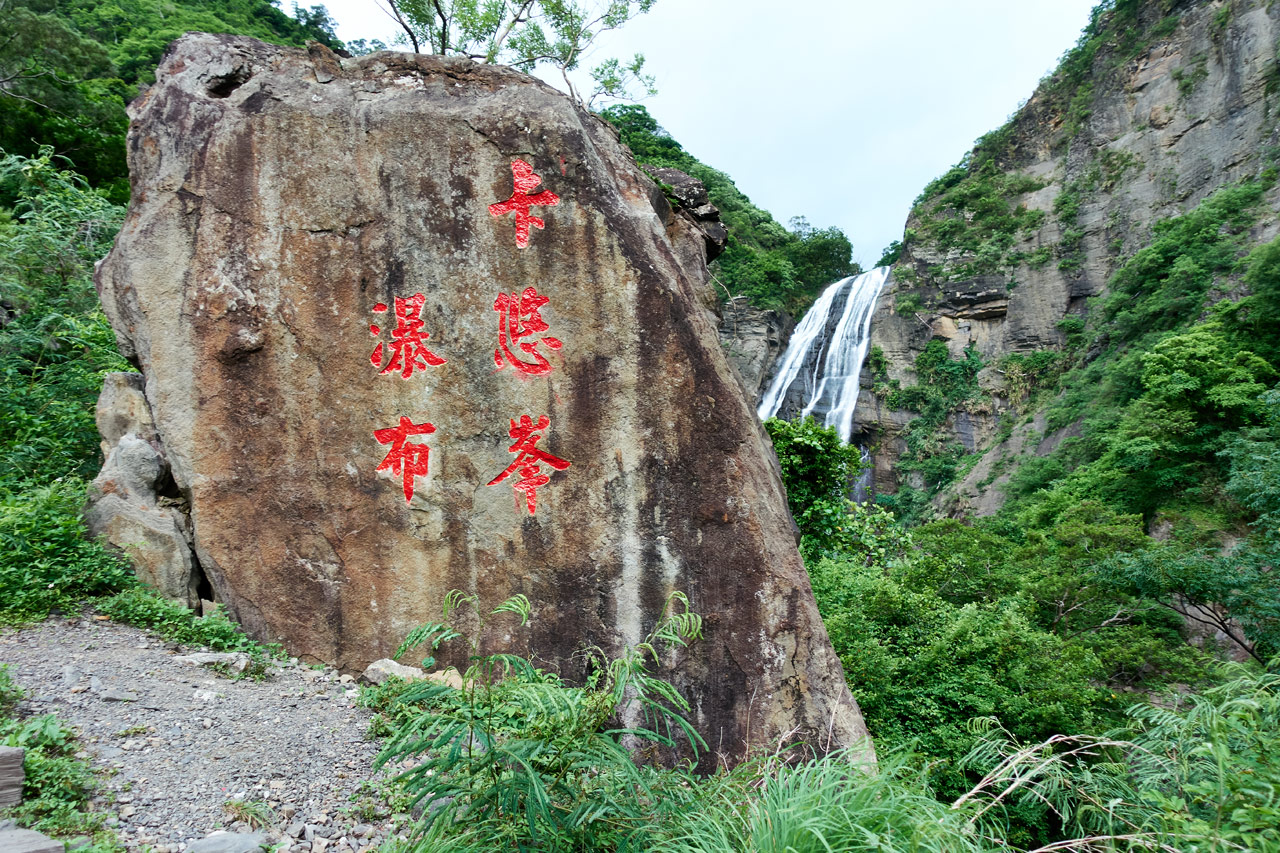
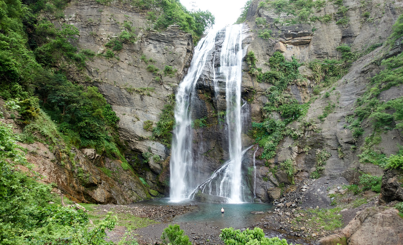
KaYouFeng Waterfall – 卡悠峯瀑布
If you decide to hike up to Rock Peak 425, I highly recommend you allot some time for a visit to KaYouFeng Waterfall. It’s a few minutes’ drive from where you parked and is totally worth it!
Getting there is simple, so I won’t go into that. I’ll just leave a few pictures to try and convince you.


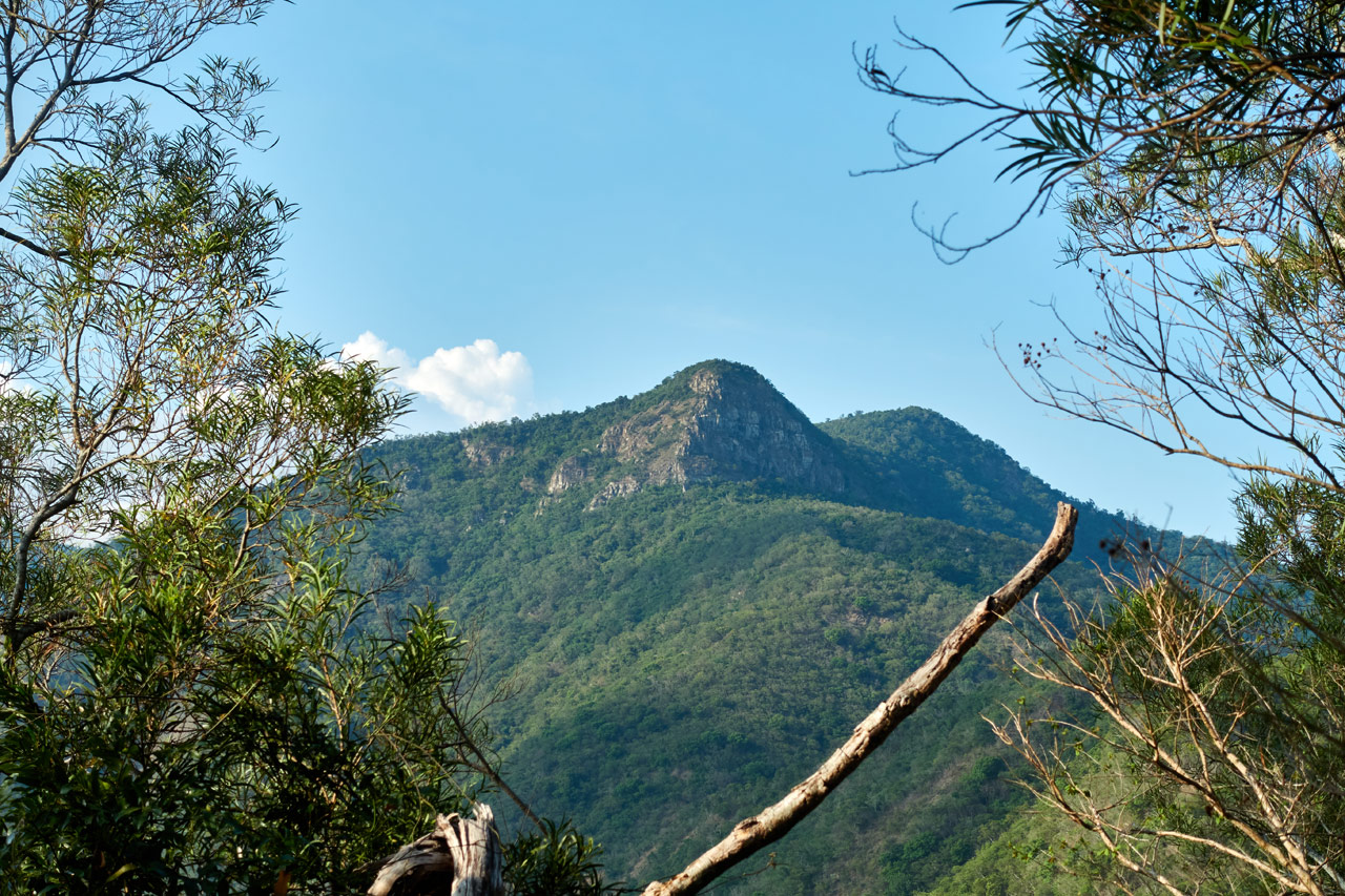
Looking back toward Rock Peak 425.
Date hiked: 2020 May 14
GPX Track Download Instructions: Click the track on the map to see the download link
Hike to FangYeJuShan – 枋野具山
FangYeJuShan – 枋野具山 to “Other Peak” (Really, you don’t want to do this.)
“Other Peak” to Parking Area (Use this at your own risk – I got off course a lot)
Date hiked: 2020 June 16
GPX Track Download Instructions: Click the track on the map to see the download link
Hike to Rock Peak 425 – 425岩峰
Return hike from Rock Peak 425 – 425岩峰 (I made a mistake and didn’t record the track all the way to the end, where the best view is. This track will start from that end point.)


![[Valid RSS]](https://outrecording.b-cdn.net/wp-content/uploads/2020/03/valid-rss-rogers.png.webp)
Very interesting hike, thanks for your time and effort to give us very details and funny stories of your hike. 😊
Thank you! Your comment is much appreciated!