

Continuing with the theme of ‘easy hikes’ due to my knee injury, I chose to make an attempt to hike to an abandoned Paiwan village named Tjakuvukuvulj. While there, my secondary plan was to hike to NeiWenShan – 內文山, a nearby mountain peak that doesn’t appear on any newer maps.
Why Tjakuvukuvulj?
My interest in Tjakuvukuvulj stems from a hike back in May 2019 to WuLiYiShan Northeast peak – 霧里乙山東北峰. After driving to the trail head, instead of dismounting, I followed the main trail a bit more to see where it led. The trail narrowed to single track and I stopped for fear of traps – I’ve had bad luck with them in the past.

I had often thought about that trail and wanted to go back. I had a suspicion that it may lead to Tjakuvukuvulj, but it was just as much possible that it didn’t. At the very least I figured it would cut some of the distance and I could bushwhack the rest of the way. The important thing was, there was very little elevation gain as far as I could tell from topographic maps.
Tjakuvukuvulj
Tjakuvukuvulj, known as 內文部落 (NeiWen Tribe) in Chinese, was previously located in Laiyi township (來義鄉) and was later moved to its current location deep in the mountains at the headwaters of the Fangshan river (枋山溪) late in the Ming Dynasty. The village’s name “Tjakuvukuvulj” is also the name of an alliance of 23 tribes during the height of its power. It’s known in Chinese as 大龜文王國 – literally “The Great Turtle Kingdom”.
I could easily get deep into the very interesting history of this tribal kingdom, but that’s not the focus of this post unfortunately. If you’re interested in learning more (and your Chinese is up to snuff) here’s a copy of a paper on “The Kingdom of Tjaquvuquvulj in the Dutch Period” written by 蔡宜靜: LINK
The original was uploaded to http://www.tips.url.tw/publication/6-07蔡宜靜.pdf but the site appears to be dead. I found this copy on The Internet Archive.
The residents of Tjakuvukuvulj were forced to move in the mid to late 1940’s; most of them to Shizitou 獅子頭, but many were scattered about the area. According to records, there were 46 households registered in the village in 1942.
Here’s a website dedicated to the tribe and a page with some wonderful black and white historic pictures of the village: https://caqovoqovolj-project.tw/image/tid/53/ – which also includes a couple shots of their altar of skulls.

There are also some current pictures from some of the descendants of the village who took a trip there: https://caqovoqovolj-project.tw/image/tid/129/. I’ve had the pleasure of personally meeting one of the three chiefs of Tjakuvukuvulj – seen below.


The Drive Up
Getting to the trail head isn’t too difficult, but there are a couple sections that may give you difficulties depending how the weather has been.


This section was fine when I was there for this trip. However, an earlier section was pretty bad. It’s doable if going slow though. Just keep in mind that you may need to stop earlier and your hike will be longer. More info on the drive up, as well as a few easy peaks you can bag along the way here: WuLiYiShan Northeast peak – 霧里乙山東北峰.
I drove up as far as I did the last time and kept going. I took it slow and looked for traps, but found none. Honestly, I should have stopped earlier, but I tend to keep going until it’s physically impossible for my bike to keep going. For example, I should have stopped before this landslide….but instead kept driving. 😐

It was worse than it looks. Your rear tire wants to slide down the mountain. I don’t recommend trying it.
I pushed on and finally told myself I needed to stop. With no idea of what was ahead of me, it seemed wise not to push my luck. Also, I would have to drive back over all those bad sections of trail when leaving. Try doing that after a full day of exhausting hiking! So I parked.

The Hike
The start of the trail was fine for the most part. There were some sections here and there that weren’t great…

…but it has obviously been taken care of to some degree.

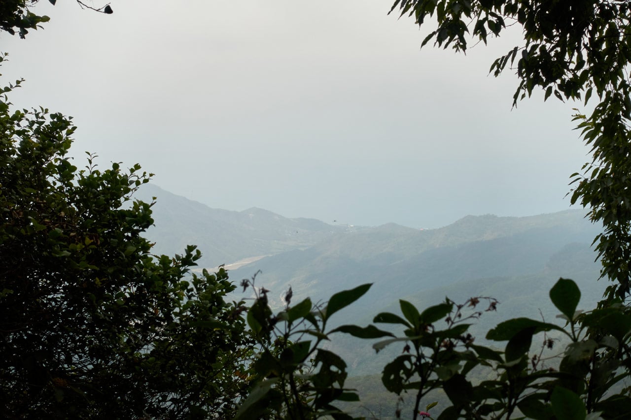
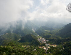
The bad part is that there aren’t many views. At best you’ll get a small window with a bit of a view. This picture is zoomed. That’s Fangshan (枋山) down there and the ocean. Can’t see much, huh?
Maybe someone knew the views are crap here and wanted to help make up for it. Because there were a lot of these ‘flowers’ along the way.

I’m told they’re Curcuma Aeruginosa, a cousin of Tumeric.
Here’s one for @TrevorCPadgett. I’ve only seen these down here on a particular mountain behind Neishi (內獅) this time of year. They’re sometimes in patches, sometimes alone…here, there, everywhere. Beyond that mountain, nothing. Before it, nothing. I’m guessing not endemic? pic.twitter.com/gWsYHW3nzD
— OutRecording (@OutRecording) May 10, 2020
About twenty minutes after I started there was what I thought to be a fork in the trail.

But I was wrong. The bottom trail was the original, but was taken out by a landslide. The new trail goes up and over it.
My first ‘way-point’ was the crossover point of the ridge. This trail starts on the western side of the mountain and gradually (and I mean gradually) climbs to the ridge and continues down the eastern side. It took me about fifty minutes to reach the ridge. Along the way I found these feathers and bones.


The Ridge
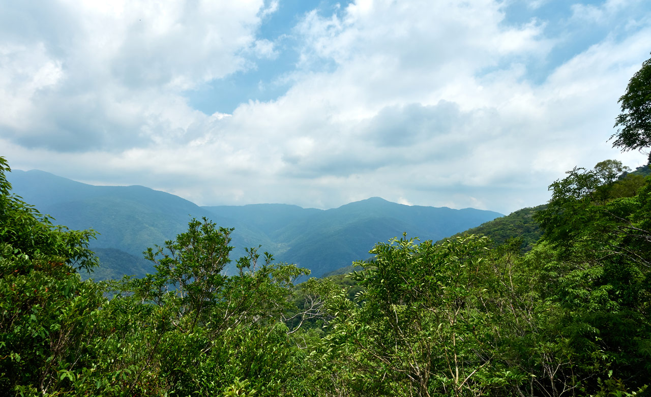
When I got to the ridge I was happy to get a bit of a view of the western side of the mountain. In particular, there was a nice view of what I’m 95% sure is BaCengBaMoShan 巴層巴墨山 – a spectacular hike btw!
I didn’t linger long, and continued on…

…and quickly encountered this skull.

I’m guessing it’s a Formosan Serow skull. I found it off to the side of the main trail. There’s this open area that could be for camping or “hunter’s work”.

A smaller trail breaks off down the side of the mountain from here. I was curious, so I followed it for a few minutes. I turned around when it started getting too steep. If I had to guess, I bet it’s a water trail. It appears to follow a line down to what eventually turns into a re-entrant. Hunters stay out there for several days at a time; they’ll need a resupply of water eventually. They probably made it. Keep that in mind if you ever find yourself short of water with a long ways to go. It has happened to me before. It’s not a pleasant experience.
Unfortunate Findings
Not long after starting down the other side of the mountain I looked over and saw this scene:


This poor muntjac got caught in a snare. It appears that the hunter never came back to claim his prize; it probably died of thirst. 😥
I contacted a friend who lives in a nearby village to let him know about this in the hopes that someone might know who the hunter is. Perhaps the hunter died himself or was hurt and couldn’t check his traps. Whatever the case, I knew there must be more traps out there that needed checking or dismantling. I didn’t hear back about it.
Onward to the Village!
By this point in the hike I knew the trail must go all the way to Tjakuvukuvulj. Now, how is it that I’m so darn smart? Am I a map reading expert? Did I consult my horoscope and it told me so? Or perhaps I’ve become some sort of wilderness tracker and can just sense it. Nah…it was probably this ribbon I found tied to a tree.

But who can be sure? 😆
It took me about an hour and a half to hike to the village from the ridge. Most of the trail was fine, but there were a few areas that were a bit “iffy”. For example, spots where you need to cross a stream (or where a stream would be had it rained anytime in the last month). You have to climb up or down to connect up to the trail on the other side. Fortunately, one spot had a rope to help.

Here’s looking down to where I needed to be.

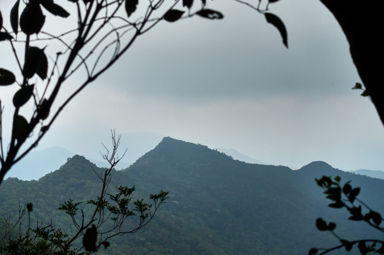
Somewhere along the way there was a nice opening in the trees to get a good look at the other side of the mountain.
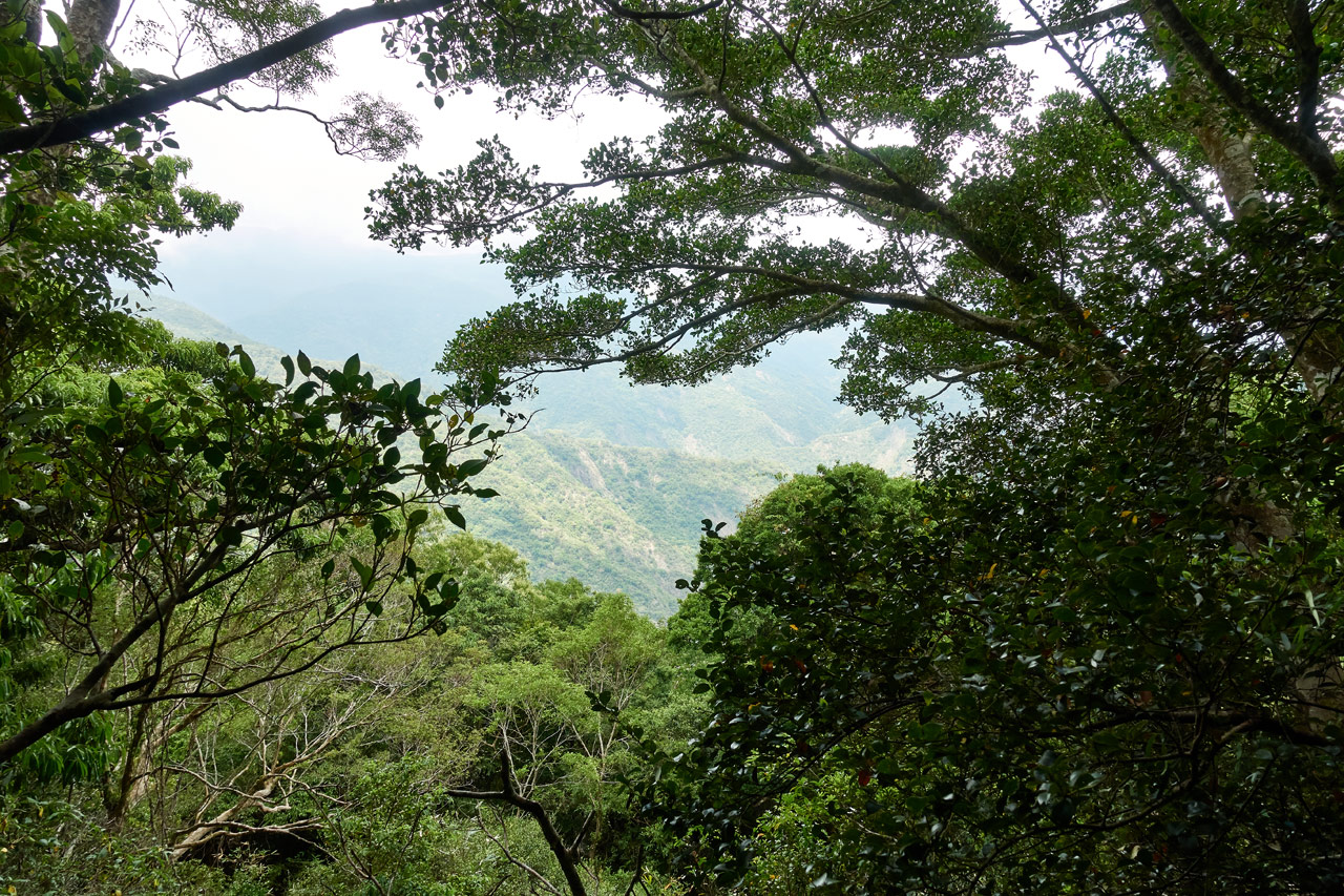
But for the most part, the hike looked like this:


As I approached the village I came to another fork in the trail. I didn’t take a picture. Just know that the trail going down the mountain will take you to the lower part of the village – where the houses are located. Of course, I didn’t know this at the time. So I stuck with the main trail; it headed up a bit and I followed.

That’s when I got my first glimpse of Tjakuvukuvulj.

Entrance to Tjakuvukuvulj
I knew right away that this wasn’t a house – that is what I had been expecting to find. Upon closer inspection, I think this might have been some kind of…I can’t think of an appropriate word…but an “entrance to the village monument” or something. For example, you’ll often see arch gateways over the road before entering modern-day villages.

And sometimes, like the above picture, a statue of an aboriginal hunter or warrior or similar. Perhaps that’s what this structure was about. Notice the metal bolts?


Something used to sit on top of this structure.
Another interesting thing to note is the use of concrete in the structure to help hold the stones together. From what I’ve been told, aboriginals back then didn’t use concrete.

I walked around to the other side and got a better view of the structure.

This sign tells the story of a group trip to find their roots – descendants of those villagers who once lived here no doubt.

I stepped back a bit more to get a full look of the entire area.

Over to the left of the above picture were all these bamboo trees clumsily stacked.

Who brought them here and for what purpose?
Leaving that question behind, I followed another set of stairs down…

…and followed a path along an old wall.

Upper Part of Tjakuvukuvulj
The path ended in this open area with not much to look at.

There were some branches lined up next to each other and a garbage bag. Someone had been working on something here.

It can be a little confusing navigating an old village like this if you have no idea what the layout is. Luckily for me, there were red ribbons to help guide my way.

I followed them and found this…whatever it is.

And they led me down to the next level, which was far more interesting than that last.

There were all of these concrete foundations running the entire length of this flat area. Upon closer inspection, you can see a lot of stones mixed in with the concrete.

Here are some pictures from my walk around this level of the village.


The below structure intrigues me. I would really like to know what its purpose was.


I have asked a Paiwan friend of mine what these structures might have been. He believes they were likely put there by the Japanese, as aboriginals didn’t use concrete back then. He said they possibly could have built a school or something similar. If I can find out for sure, I’ll update this post.
The Next Level
Sometimes it can be difficult to find the path to the next level of an abandoned village – oftentimes overgrowth hides it. But this time it was simple.


I followed these stairs down and took a path off to the right which led me to the first layer of the village’s houses.


Many, Many Levels of Houses
From here it was just level upon level of houses. Some levels were smaller than others, but they were all quite interesting to explore. It’s difficult for me to remember which pictures were taken on which levels, so I’m just going to drop some of the more interesting pictures with the occasional comment below in the order I took them.


I’m very curious what this stone was used for. Any ideas?


At the link to the website with all of the old pictures from this village I linked above, there’s this old picture:

And in case you’re wondering, that peak is NanHuLuShan – 南湖呂山. At one time you could stand in the village and clearly see all of the mountains beyond. But now, with all of the trees growing unchecked, the best you can see is through the occasional tiny window.


Notice the notches in the stones? These stones would be used as braces. Here’s an example of how they would look.


Another mystery…a stone-lined hole.


Right around here is where I reached what I thought was the bottom-most part of the village. But honestly, I’m not entirely sure. There could have been more below, but I didn’t see anything that was obviously part of the village or any safe way to climb down lower. So I headed back up.


Back to the Top
When I reached near the top I found this little fire pit area – perhaps used by hunters or the descendants of the former villagers when they visited.

Another interesting find was this concrete “box” that’s slowly creeping down the mountain.

I would guess it had something to do with holding water. The concrete appears much newer and of better quality than the concrete foundations I saw in the other part of the village.
I peered inside to see if any unlucky animal had fallen inside…thankfully nothing was there.

Instead of retracing my steps, I followed a larger trail/road that went off toward the entrance. There was this old banner with faded words crumbled up on the road.

It’s likely a banner from when descendants come back for a visit. I’ve seen such banners used before in this manner. But I could be wrong.
When I arrived back at that entrance structure, I took a picture sitting on the steps, but somehow I feel it’s inappropriate to include it here. I’m not sure why…just a gut feeling. But anyway, that’s where I stopped for a bit to eat lunch and to take a break.
On to NeiWenShan 內文山!
I was excited about this part of the trip. NeiWenShan doesn’t have a triangulation stone, nor is it listed on newer maps. I first noticed it while looking at an older map for the location of the original road(s) that used to connect to the Tjakuvukuvulj.
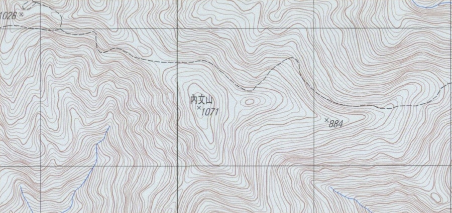
On another map I found a couple dots drawn about where the peak is located.
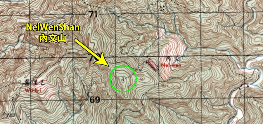
I can’t tell you what they mean. The map’s legend didn’t help. This map has a lot of dots drawn in various places. My only guess would be to denote a structure or object of some sort. At any rate, I’d find out soon enough.
My plan was to hike back to the ridge, as that seemed the most logical starting point to the top. But I kept an eye open for any possible routes along the way. Notice the dashed black lines going to NeiWenShan from the village on the map above? I thought that might be a way up. Let me tell you…it’s possible, but would be a somewhat steep and tiring climb. Best head back to the ridge.
Along the way I found these parts of a snare trap lying off to the side on one of the dry streams.

I would get the chance to see another one “in action” soon.
Up the Ridge
It took me about an hour to hike back to the ridge. I found an ever-so-faint trail and followed it up. It was pretty easy going, though I needed to use my machete from time to time.

Later I found the occasional trail marker.


About three quarters of the way there I nearly stepped on this trap. Can you see it?


I tied an orange ribbon on the tree above it to mark the trap. I doubt many people, if any, come through here. But you never know…
Near the top there was this somewhat open and flat area.

It appears an animal likes to hang out next to this tree – it smelled like it too.

NeiWenShan – 內文山
It took about thirty minutes for me to reach what I believe was the peak of NeiWenShan. There were a few…objects to see; three of them from what I could find.

One slab of concrete…

And a couple short “pillars” made from concrete.


I can only guess what they were used for. From the closeups below, obviously the taller one held something.


I searched the area, but didn’t find anything else. Though I’m sure there must be more to find.
Oh, and when I first reached the top, there was a Serow hiding off to the side in a sort of ditch. It let me get really close (unbeknownst to me) and scared the crap out of me when it suddenly darted off down the mountain. Good times!
I took a short rest here and then my peak picture.

I also followed the trail for a few minutes for no particular reason at all. Later I found reference to some hikers who took this route to reach BaCengBaMoShan 巴層巴墨山. Their trip would have been before the current trail to BaCengBaMoShan was rebuilt. To be honest, taking THIS route might be easier in many ways. I may attempt it some day.
Let’s Wrap Things Up
It was 4:30pm and I didn’t want to linger. Driving that trail at night wasn’t something I wanted to attempt, so I headed back.

I noticed this macaque skull that I somehow missed seeing on the trip up. What is it with hanging skulls all over??

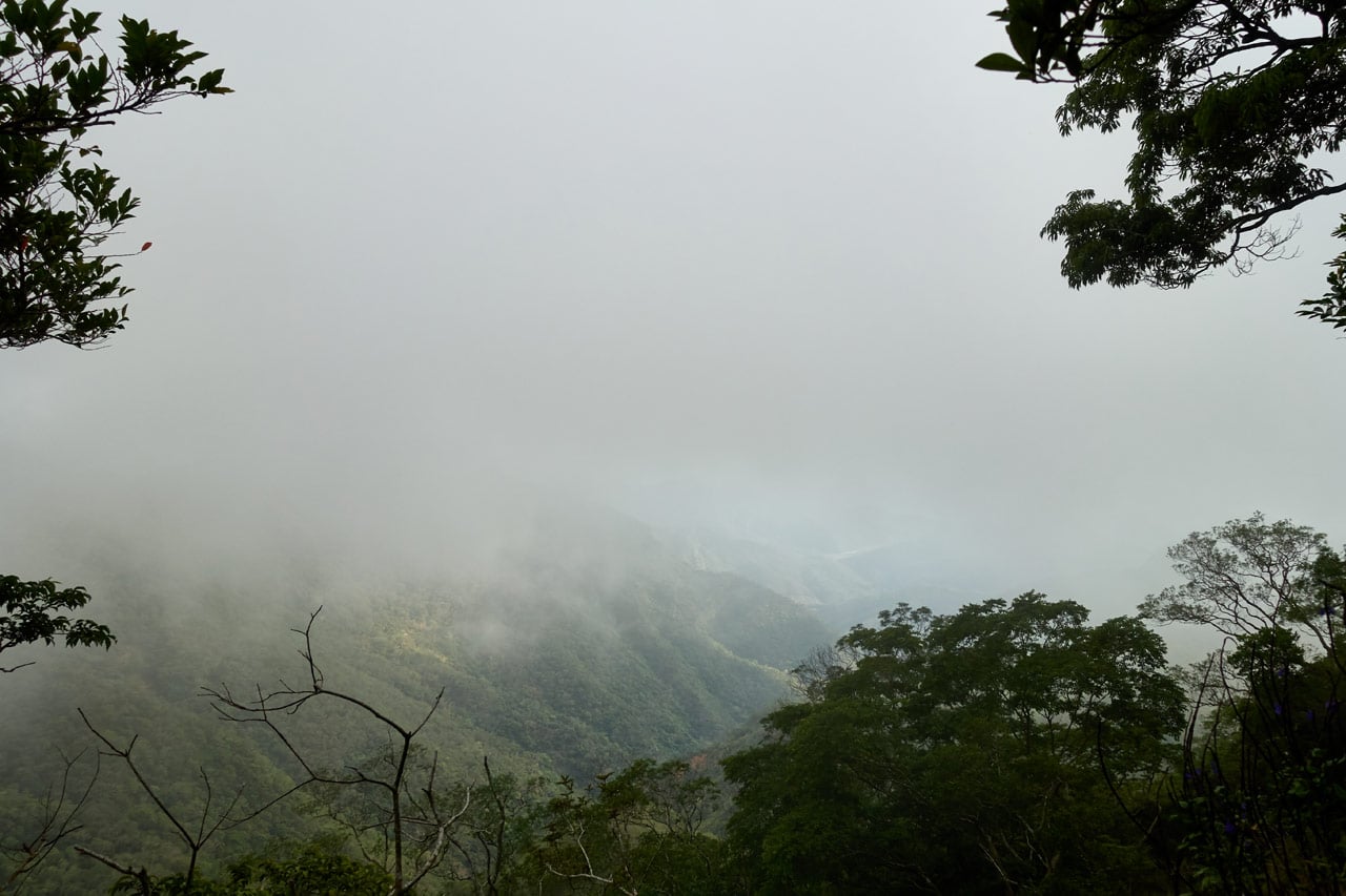
The rest of the hike was unremarkable, which is a good thing in my book. It started getting a bit foggy, but nothing else to note.
In case anyone cares, I drove out without a problem. And I got lucky with the time. I caught the sunset right when I rounded a corner.
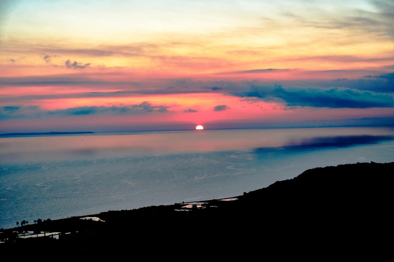
This mountain is great for sunset pictures. Just wish I had a better camera for it!
Date hiked: 2020 May 08
GPX Track Download Instructions: Click the track on the map to see the download link

![[Valid RSS]](https://outrecording.b-cdn.net/wp-content/uploads/2020/03/valid-rss-rogers.png.webp)
發佈留言