

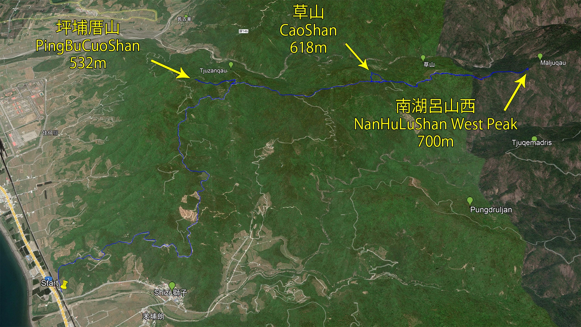
“Three peaks to rule them all,” they said. No, they didn’t say that. I said it. Because this hike features three peaks, two of which aren’t terribly difficult to reach. One of them has a view that will make you not want to visit the other two. But you’ll have to read on to know which one! PingBuCuoShan, CaoShan, and NanHuLuShan West Peak – 坪埔厝山, 草山, & 南湖呂山西 are on the menu for this post!
The Long Road
As mentioned, there are three peaks that are all connected by one long road.
The question you should be asking now is what kind of condition is that road in? I’ve driven it several times on my motorcycle over the years. In the past it was in pretty good shape–and most of it still is–but now some of it is nearly un-drivable. I would say you can safely make it as far as CaoShan, even by car. But there’s no way you can make it to NanHuLuShan West Peak unless you have an offroad motorcycle or want to hike some of the old dirt road.
Here’s how the worst of it looks…

CARS used to be able to drive this section if you can believe that. I’d say maybe six or seven years ago, no problem. But no longer.
For your information, this road goes to the NanHuLuShan – 南湖呂山 trail head. There was a small, sort of parking lot at the end. But maybe a hundred meters before the parking lot there was a major landslide. Aside from that old parking lot, there weren’t many places to park. That obviously made it difficult for people, so they stopped taking cars altogether. Hence, the road slowly disappeared. It’s too bad because that’s a pretty damn nice hike (that I need to do again).
If that managed to bum you out, then let me tell you something cool about this road. A few years ago, I had my first and only sighting of a Taiwan rabbit! Or “Chinese Hare” is what I believe it’s called. I had no idea that rabbits lived in Taiwan. It was quite an exciting moment; especially since it was running away from me while I was on my bike, as if I was chasing it.
Anyway, I thought it was cool.
And since we’re on the subject of animals on this road, I found this little fella the day of this hike.


This was the second time I’ve found a land turtle here.
Ok, you’ve got an idea of the hike layout and what animals you may or may not see. So what’s next?
Let’s drive up and hike to these mofo’s!
Peak #1
For this hike I decided to visit the three peaks in this order: PingBuCuoShan, NanHuLuShan West Peak, and CaoShan. I saved CaoShan for last because I thought it would be the toughest to reach. So onward to PingBuCuoShan!
Getting to the trail head was simple: A nice and easy ride up the mountain until I made a turn and stopped when the road became overgrown.

I parked here and took in the view while I prepped my hiking gear.
The old road kind of got thick…

…but it didn’t last long. Ten minutes later I had arrived at my turning point.

I needed to go up to the left of that old wall.
The good news after passing the wall was that I was out of the hot sun. The bad news…

Yeah, it was hardly a walk in the park. But there was something to see.

An old farming water container perhaps? I didn’t bother to take a look. Snap a picture and keep going for this one.
From Bad To Worse
The “trail” became worse and worse. It wasn’t hard to push through, but definitely appeared that nobody had been here in some time.

Now one thing I should mention is that I hadn’t done a whole lot of research on this particular peak. I snagged a GPX track off the Internet, verified that it was legit, and that was it. So, imagine my surprise when I found concrete stairs!

This discovery really got my mind going! If there are stairs, then the stairs must go to somewhere worthwhile! Was the peak so cool that this was a tourist hotspot at one time? Did there used to be a temple up here? Maybe something military related? The possibilities are endless!
So I continued up…while bending down a lot. There was a lot of bending down and some crawling.


And then I saw it!
A Building!

Mystery solved! Or so I thought…
I took a quick look inside this part of the building.


I couldn’t guess what this room was used for or why it was cut off from the rest of the building, but whatever it was, it used to house some type of machinery.
So off I went to see the rest of the building.
BTW, this is what it looks like staring out from the entrance:

There’s a path on the side of the building if you can see it. There’s also a window to give you your first peak into the other side of the building.

I’m not sure what I was expecting to be in there. But I’ll tell you that I wasn’t expecting…a bathroom.

I continued along the left side of the building and found a door at the opposite end.


Here’s some more pictures of what little there is to see inside.

Some equipment definitely used to be here. And judging from the channels in the ground, I bet their wires/cables used to go in there.


I’m not sure what those outlets in the ceiling were about.
And the bathroom again.


And a similar wood block attached to the door frame like on the other side.

I asked around what this building might have been used for and someone said it housed communication equipment. That would make sense given its location. There was probably an antenna somewhere up there at one time (or maybe it’s still here, somewhere on the ground).
To the Peak!
There’s a wall across from the building. You can see a bit of it in the above picture. I needed to climb up some “sort of” stairs to get above it.

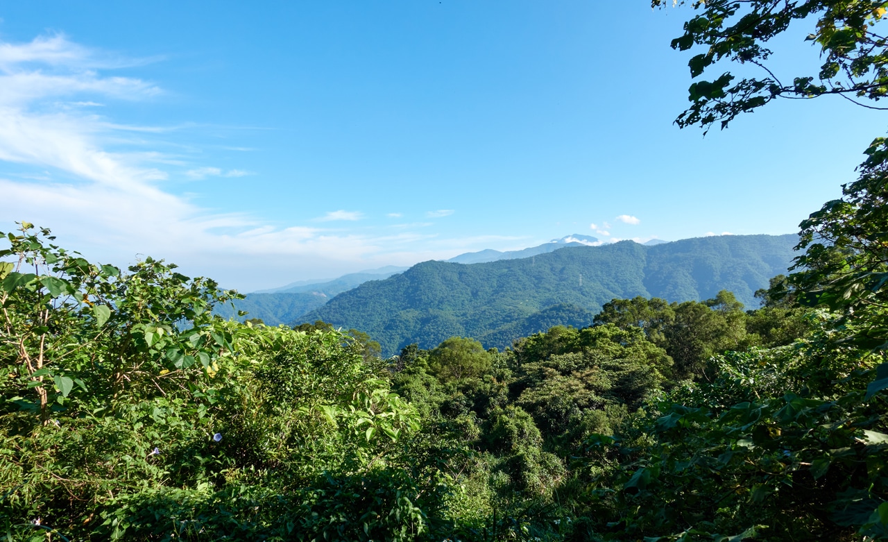
Yeah, it was sketchy. But, there’s a view.
That distinctive peak in the distance is LiLongShan – 里龍山.
If I remember correctly, the stairs got sketchy to the point of me saying ‘fuck it’ and leaving the stairs to make my own path up the mountain.

You might be wondering where those stairs were going. No one in their right mind would build stairs that went nowhere, right? Fortunately these builders weren’t insane. They do go somewhere. And I found out where after a bit of bushwhacking in the intense Taiwan sun. See it?

A brick building!

From the side you can see a tree growing out of it!

And the inside…


I’m not certain what used to be in those sacks. Just looks like dirt now.

There wasn’t much else to see inside this building. I can only guess that it was used for storage.
And outside behind it was this sort of basin.

To the Peak Yet? Nope…
So…next to this little abandoned building was ANOTHER abandoned building. Except this one looked far more interesting.

There’s a door on the side facing the other building. I had a choice to enter through that door or walk over to the main side of the building to enter there. I went with option two.

The first thing I noticed was a ladder.

Would I dare climb this old thing, you ask? Hell yeah I would! But not right then and there. Just in case I fell and hurt myself, I thought it would be better to first go to the peak and then climb it on the way back. More on that climb later.
As I approached the door at the side of the building I could see a bit of stone wall across from it.

I must have forgotten to go over there to investigate because what I saw next captured my complete attention.


This building had a similar function as the first building by the look of the channels dug into the ground. But that’s not what caught my eye. All the scat on the ground is what I immediately noticed.
And you know what that means, right…?
BATS!!!
I’ve come across vert few bats in my years exploring the mountains. (Though of course there are plenty to see in the city at night) Well, this encounter would make up for the lack of ‘mountain bats’.


I took far more pictures here than I’ve ever taken of anything I believe. I’ll spare you the pain of viewing them all and add this one more that I took from a side window on my trip down the mountain.

I didn’t want to go inside for fear of spooking the bats. They definitely seemed agitated by my presence. So here’s some pics I captured from the doorway.


Apparently this is where the former workers slept.

And a video if you’re interested.
I remember as I stood in the doorway taking pictures I felt a bat fly right by my head. Its wing flicked my ear as it passed. I don’t recall seeing it at all; that’s how fast it was flying. Or perhaps some crazy mountain jokester snuck up behind me and flicked my ear without me noticing…who knows…?
But getting back to the building, I left and went around back.

There were two “mystery boxes” next to the building.


And to quote Forrest Gump: That’s about all I got to say bout that.
Seriously, are we ever going to make it to the peak??
The answer is, YES! However, we first must hike a LITTLE bit more.
Starting with this:

And then this…

A little bit of this…

And finally this!

Almost there!

And Boom-Shaka-Laka! We’re there!

Can you see the peak stone? Yep, there it is!

And that large metal post…perhaps that was part of an antenna? This would be a great location for sure.
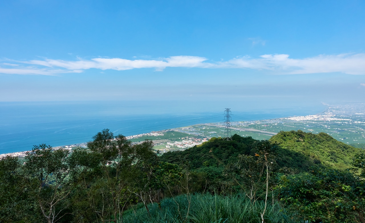
So what’s the payoff for all your hard work? What’s the reward for braving the ‘bat cave’?
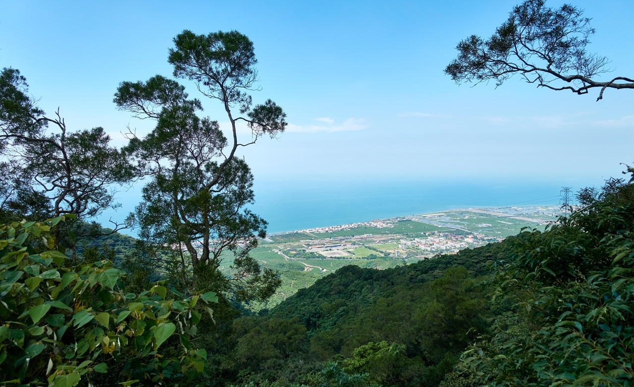
A pretty darn good view!
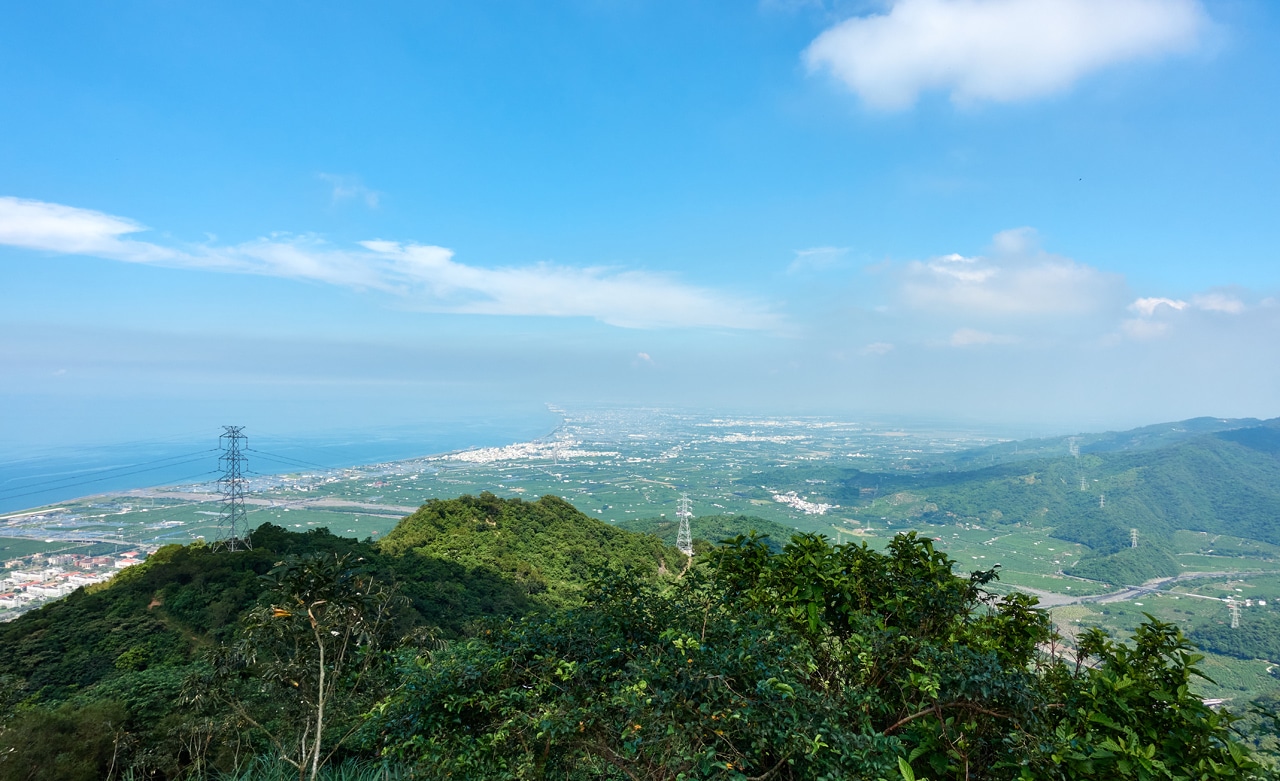
Except it was a bit hazy in the direction of Kaohsiung City. What a surprise…haha. (click any of these images for a larger, clearer picture)
I tried taking a large panoramic picture made from several shots. It worked, but didn’t turn out how I had hoped. But it should give you a good idea what to expect when you go.
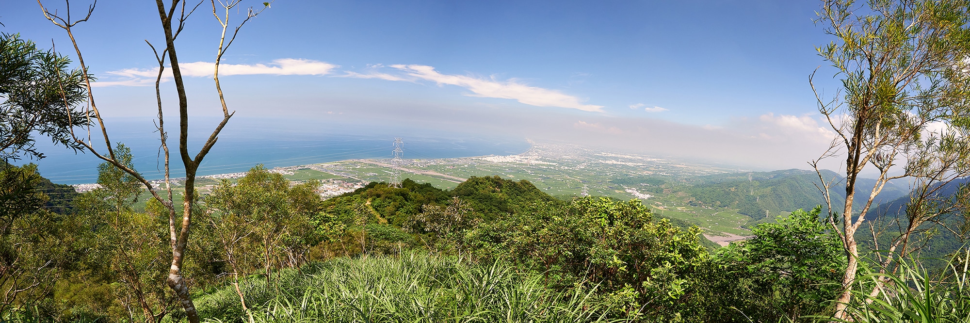
Honestly, you could find worse mountains to relax atop!
Oh, almost forgot my peak and trig stone pics!


Back to Building #3
I told you I would circle back to the third building and the climb to reach its roof. So here we go.
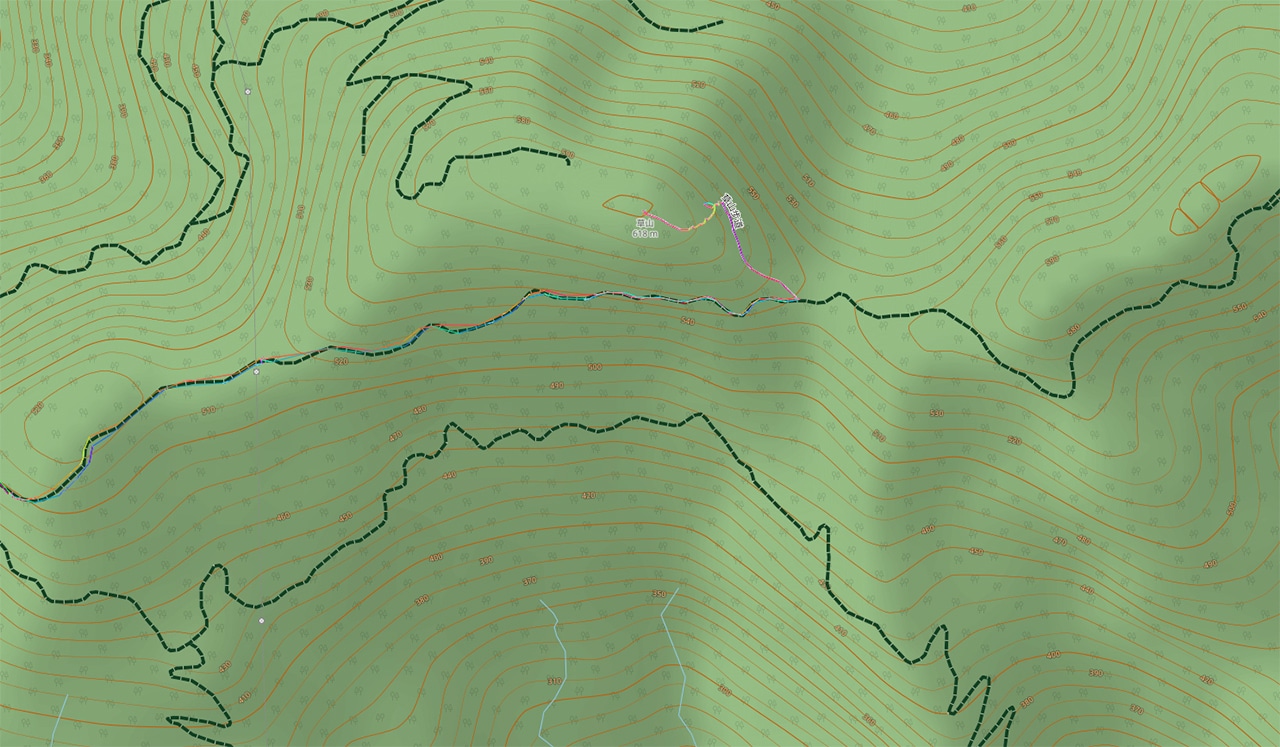
But first, I thought this would be a good chance to give you a quick look at the area in map form.
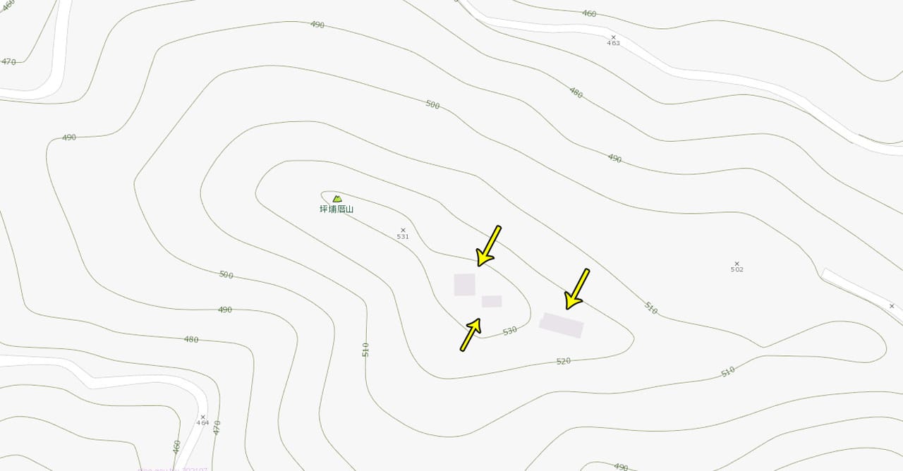
The three buildings have the arrows pointed at them. Notice a road to the left of the map ending not too far from where it says “502”? That roughly where the hike begins. There really isn’t much to this hike. It would be ridiculously quick if there was a clear path the entire way.
You can see the three buildings quite clearly on Google Maps HERE.
Ok, so back to the roof.
I climbed the ladder–which wasn’t simple due to the tree branches–and none of the rungs broke under my 120kg weight. And what did I find on the roof?


Well, it’s a roof. What exactly were you expecting??
But…there was a view up there!
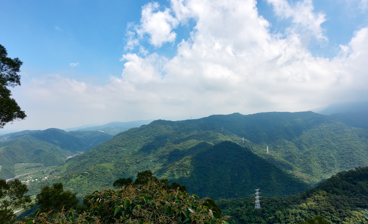
That’s a military base down there in the middle. And on the other side of the roof you could once again see LiLongShan.
And for those interested, here’s a video of the roof.
I left the roof behind and hiked safely back to my bike ready to drive to the next trail head.
Which Peak is Next?
With PingBuCuoShan safely behind me, it was time to tackle the next peak. But which one? CaoShan was close and seemingly the logical choice, but I had a feeling it wouldn’t be simple. NanHuLuShan West Peak, on the other hand, was much further but looked to be really simple. Well, I know how I am with multiple peaks…whenever I leave the easy ones for last, I NEVER get back to them. Seriously! I can’t tell you how many minor peaks I’ve missed because I was too tired or ran out of time.
So NanHuLuShan West Peak it is!
I already mentioned about the road conditions that far down the road. But here’s a quick reminder:


These were taken near the trail head, (all the ribbons on the left) which wasn’t all that bad of a stretch to drive. But I DID manage to swell up my clutch plates on the trip up, which definitely complicated the drive. There were a couple bad sections where my tires weren’t hooking up too well. My fault for using 50/50 tires. Full knobbies wouldn’t have had any problems.
Looking up from the trail head you immediately notice the ridgeline above.

Yep! This really isn’t going to be a difficult hike. It’s so easy in fact, that I have nothing to write about the actual hike. It took maybe five minutes. I somehow remembered to take a couple pictures along the way.


NanHuLuShan West Peak – 南湖呂山西
And just like that…I was standing atop the infamous west peak of NanHuLuShan!

Except it’s not infamous…and it’s exactly the opposite of exciting. But hey, it wasn’t difficult to reach really, so I’m not complaining.
I decided it was time to eat lunch and this place was decent enough for it. Remember, it was hot and sunny. The shade was welcome.
After lunch I took my peak pics and got the heck out of there.


And of course, me again.

The only issue here is whether it’s 700 meters or 710 meters. OpenStreetMaps puts it at 700, but a sign there attached to a tree reads 710 meters. My GPS puts it closer to 710, but I tend to defer to OSM.
One More Peak To Go!!!
I arrived at the trail head after a nice twenty minute ride down the mountain. And right off the bat things didn’t look promising.


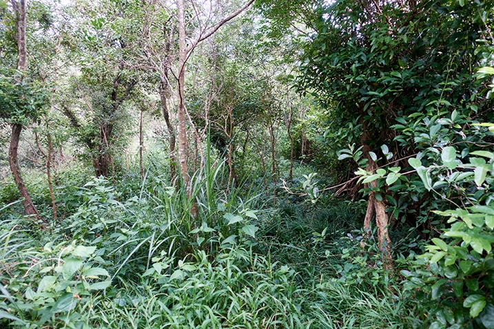
There were signs that this trail head has been used, but not used much. This hike would definitely require some bushwhacking.

Ok, so there are some trail ribbons…nice.
But as you can see, the terrain and overgrowth made it slow going for me.


I don’t remember this next part at all, but apparently it flattened out and opened up at some point.

It didn’t last long though; I was right back to the uphill bushwhacking probably not long after that shot.

At this point I bet you’re thinking, “WHY, GLENN!? WHY!?” Well, I can’t exactly answer that. But sometimes little things will pop up to help make the hike worth it. In this case, something that literally popped up…out of a stick.


That’s a Cookeina tricholoma, aka Bristly Tropical Cup or Red Hairy Cup. A really neat looking fungi.
After that brief photo shoot, it was time to get moving again. And oh boy did things NOT improve. Things were messy and slow going up until this point, but it wasn’t terribly difficult. That is, not until I reached this next spot.

Here’s a video to give you a better look.
Things couldn’t possibly get worse though, could they?
Hahahaha…if you’ve read any of my other posts, then you know the answer.
Of course they can!!
The Ridge Almost From Hell
The overgrowth got worse and worse the closer I got to the ridge.

That section took some time to overcome. And then I reached this…


Again I took a video to give you a better idea of how it all looked.
Chop by chop, I made it through all that mess. The other side look FAR better. So much better, in fact, that I decided I wasn’t going back down the same way. I would follow the ridge down as far as I could go and see what happens.

But first…let’s find the peak stone!
Caoshan – 草山
It took a little bit of searching, but I eventually found the triangulation stone.

Well, sorta…

Yeah, it has been some time since anyone has been here.
So I played mountain landscaping man and cleaned it up some.

It took my about fifty minutes to hike to this peak. If after reading all this, you DO decide that you want to visit this peak…(seriously, why would you do that!?)…the stone marker is hidden in the back there. Bring a machete is all I can tell you.

I hung out there about thirty minutes before heading out. But one last small thing to take care of…


Looks like I’m about to have a heart attack or I’m going to shit myself, huh? Sadly, I wouldn’t doubt both as possibilities.
New Route
Something that I had overlooked or perhaps saw and chose not to try because I couldn’t find a GPX route was this apparent back trail to the peak.
I came up from the road below the peak to the south (black dotted line). But there’s another road that comes up from the east. It’s overgrown, but surely looks like a much easier route, right?
Of course I didn’t know that at the time. All I knew was that I didn’t want to bushwhack my way down a mountain. That really sucks. Getting your foot caught on a vine and falling straight down isn’t pleasant. Don’t ask me how I know!
So I made my way down the ridge, innocently thinking it would take me to the road in a nice straight line.
And it did for a few minutes…until it turned north.
“IT turned north, Glenn? You mean there was a trail?”
Yes! I found a trail ribbon and a trail! I didn’t take a picture of it, but I took a picture of this caterpillar and common butterfly. Reasonable trade?


The trail went straight down the mountain and there was no bushwhacking involved. But it was somewhat dangerous as I remember. Maybe it was the danger, or the excitement of finding a trail, or maybe I was losing my mind…whatever the reason, I didn’t take any pictures of this part of the hike. Sorry.
But I did take pictures again once I reached the old road.

If you are beyond an eagle-eyed observer, you would have noticed this configuration of…something odd attached to that tree in the distance.


They remind me of lawn mower blades, but that’s not what they are. I really haven’t a clue what they were or why someone would hang them there. But there ya go!
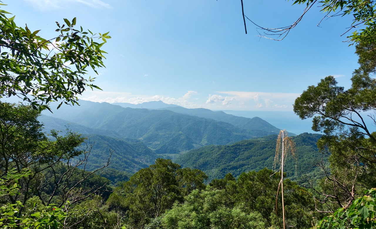
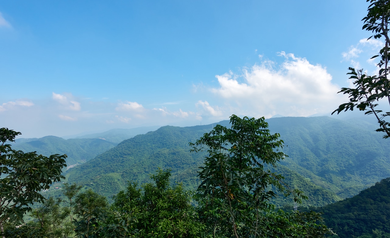
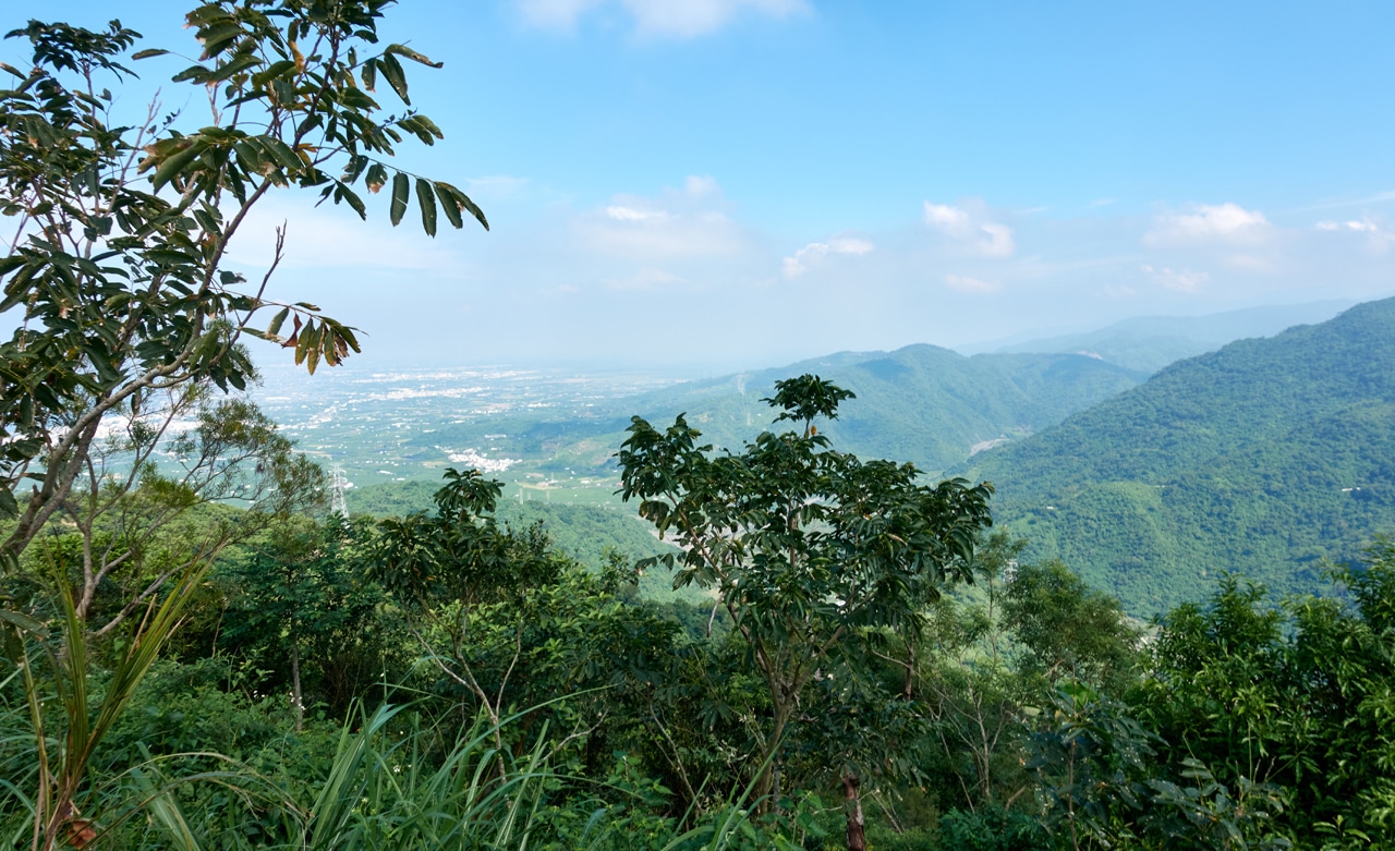
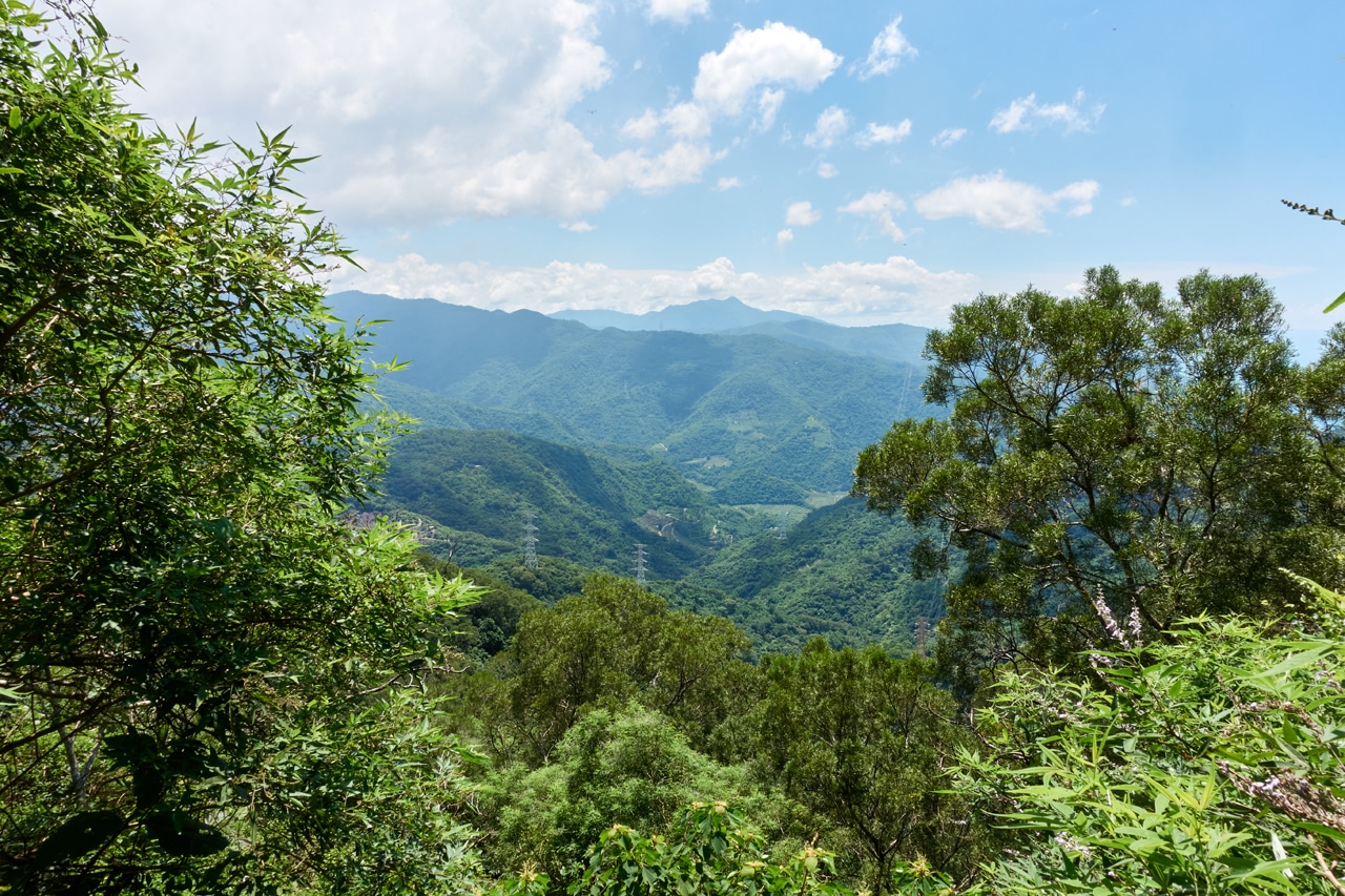
One nice “feature” of this abandoned road is the view! There are several places to look out at the mountains to the east.
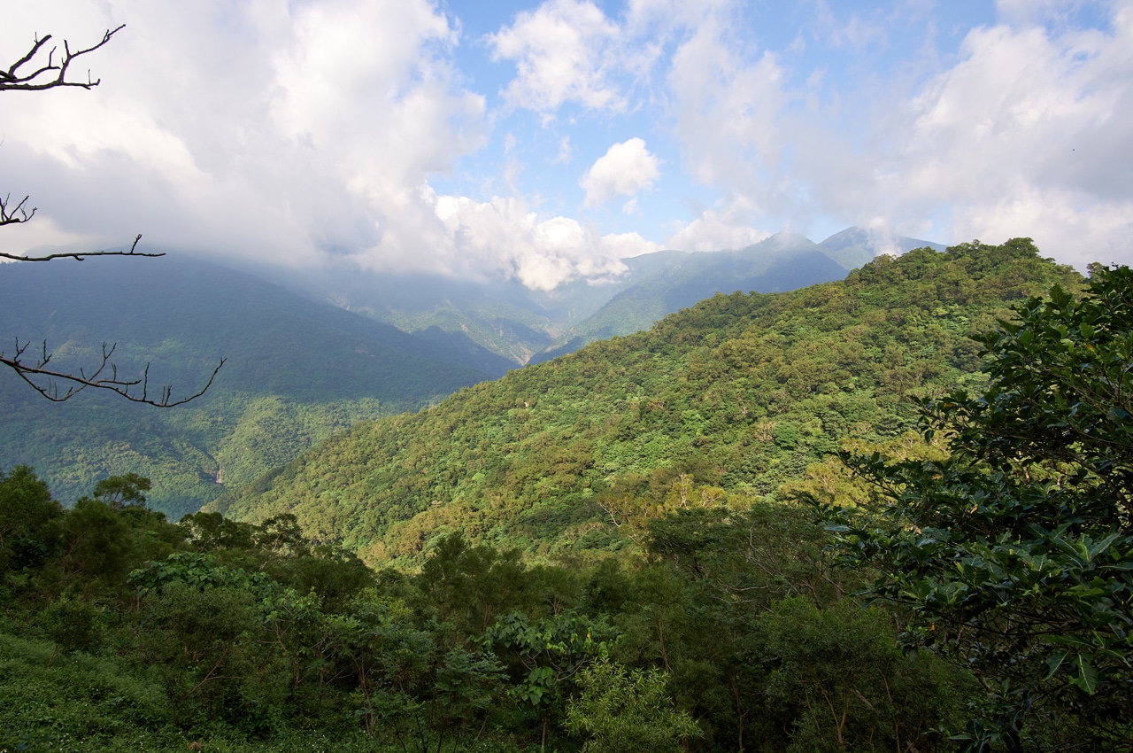
Hidden behind those clouds on the left is BeiHuLuShan – 北湖呂山. I stopped to do a quick time-lapse of the clouds. I’m new to this, so it didn’t turn out so great. And eight minutes isn’t a suitable length. But it is what it is.
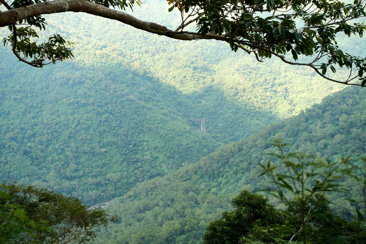
Oh yeah, and there’s a waterfall out there!
The rest of the hike was very easy. There was a path to follow on the abandoned road which took my right down to the main road. In total I spent just under an hour to get back. And that was with a twenty minutes stop for pictures! So yeah, I would advise taking this route up and back instead of the bushwhacking nightmare I took on the way up. Though I’m not trying to complain. I enjoyed it all.
Trio, Duo, or Solo?
The big question is, should you hike all three of these? Or two? Or just one?
Well, for the average hiker, probably none! hahaha But for real, I think a hike to the first peak, PingBuCuoShan would be worth it. NanHuLuShan West Peak isn’t worth your time unless you want to make a quick stop on your way up/down from the main peak, NanHuLuShan. And CaoShan? That’s a toss up. The views from the back road are nice. But there doesn’t seem to be any reason to continue past the road, unless you’re looking to bag another peak.
That’s my take on it.
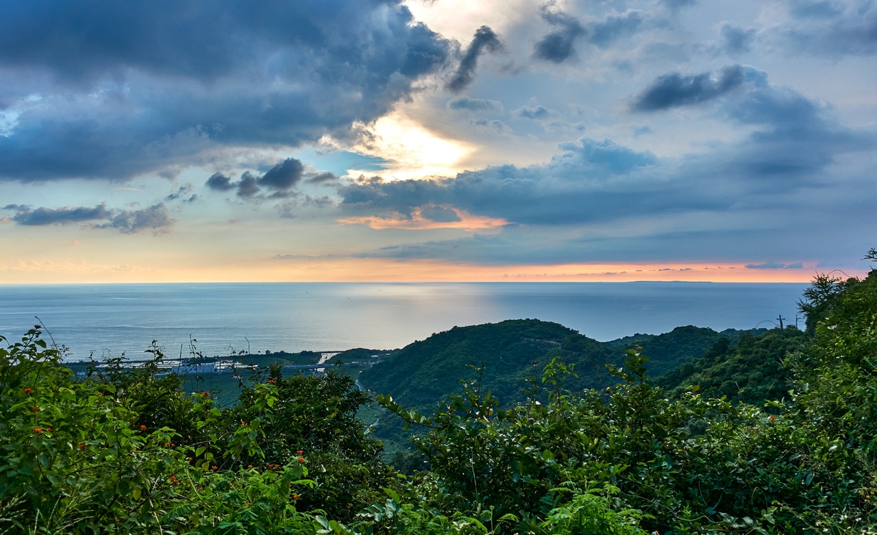
And for no reason at all, here’s a picture I took on my way down the mountain.
Date hiked: 2021 September 24
GPX Track Download Instructions: Click the track on the map to see the download link
This is the track going up. Remember, the ridge has no trail or markings of any kind. Hike it at your own risk.


![[Valid RSS]](https://outrecording.b-cdn.net/wp-content/uploads/2020/03/valid-rss-rogers.png.webp)
That woolly yellowish caterpillar is the larva of Locharna strigipennis, a moth common in low mountains in southeast Asia. Nice record!
Thanks for that ID Allen!