
Ride Info
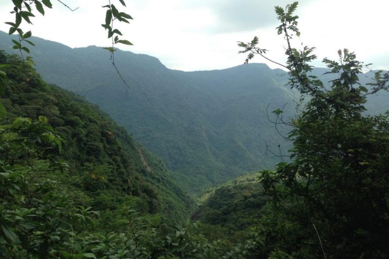
This ride starts at Wan’an Riverside Park. It’s basically just farmer dirt roads, but has some single-track hiking trails at the end you can navigate. There wasn’t much to see on this ride until the very end. A waterfall rewards your efforts, but requires a possibly dangerous walk to get there. I wouldn’t do it in riding boots. There are two trails to take you to two different parts of the waterfall. You’ll end up here: 22.6261,120.6869333 and here 22.6281604,120.6863789.
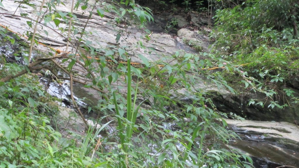
The waterfall is more of a “water sliding from rock to rock” and not your traditional free-falling water. From what I could see there were pools of water you could enjoy a nice soak in. As for the dangerous part, from what I could see you need to walk down a short steep slope and then back up just as steep. After that, you cross the water and then walk down some to the pool. There’s a rope across the water. Looks like the below picture. That’s the southern entry point. I don’t know what the northern spot looks like.
One of the trails ends in a rock slide, approximately here: 22.632086 120.665397. You could hike beyond it, but it’ll probably only take you to an old, now cut-off farm.
The last point of interest is a little creek crossing that takes you to another adventure. I haven’t rode it yet. But a little ways upstream from the bridge is a nice little swimming hole. It’s an alternative to Wan’an Riverside Park. Location: 22.622886 120.657050
Ride Start:
Date:
2015 Jun 09
Notes
- I came across a couple local aborigine’s. One had a rifle strapped to his back. They were probably hunting out there, so be careful. It’s something to be mindful of anytime out in the mountains.
- If you want to see the waterfall, park your bikes further back. There is no place to turn around once you get there. If you can see the water, it’s already too late.
- Wan’an Riverside Park would be a nice place to relax at the end of this ride. I haven’t swam there, but the few times I’ve driven by it seems somewhat popular.
- There’s a man-made clearing approximately here: 22.628344 120.681922 I’m not entirely sure what it’s used for. It didn’t appear to be related to farming. There was a burned out campfire under a tree.You can find the beginning of the trails to the waterfall at this point. One you’ll need to look for.
- For some reason the “Start” graphic is showing up in the wrong spot. I started and ended at the same spot, the bridge near Wan’an Riverside Park.
Videos
Video Location (approx): 22.6271221,120.6836165
Video Location: 22.6226877,120.6570848
GPX Track Download Instructions: Click the track on the map to see the download link
Gallery


![[Valid RSS]](https://outrecording.b-cdn.net/wp-content/uploads/2020/03/valid-rss-rogers.png.webp)
發佈留言