

I bought a new camera a couple weeks ago and have been anxious to try it out in the mountains. With the recent plum rains, only the mountains to the south of Kaohsiung looked to be a safe bet. WuLiYi Northeast Peak – 霧里乙山東北峰 (1026m) was low on my list. But I knew there would be some great ocean views and likely a blue sky in the morning. So that was my pick.
In addition to the Northeast peak, there are three lower peaks to visit along the way: WuLiYi South Peak – 霧里乙南山 747m, WuLiYi Main Peak – 霧里乙山主峰 867m, and Lion Head Mountain – 獅子頭山 454m. All four peaks are easy to reach if you have the appropriate transportation.
This was my first time to drive in the Shizi 獅子 area behind the Neishi train station – 內獅火車站. To my surprise, it was filled with mango trees nearly ready for harvest.

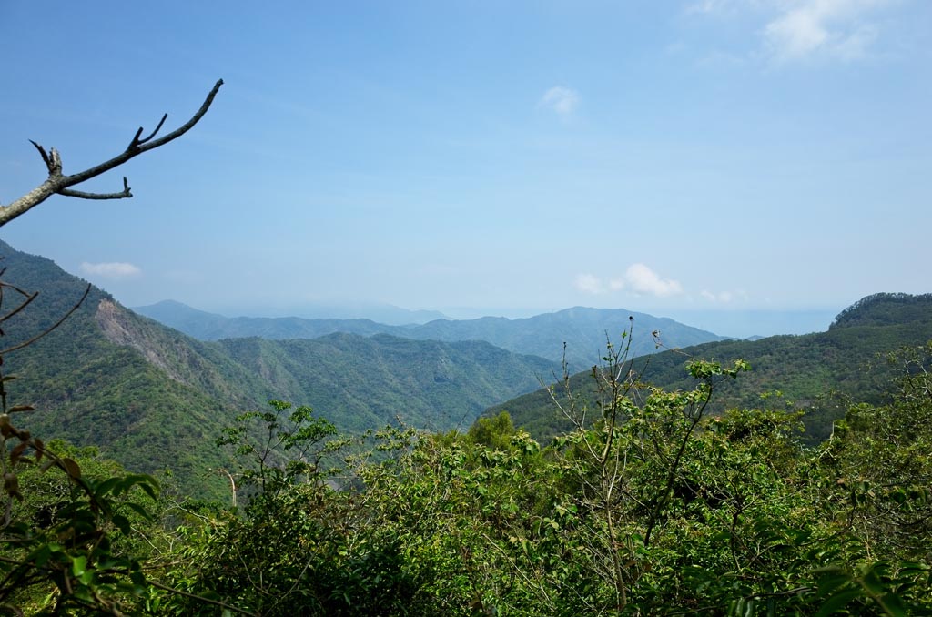
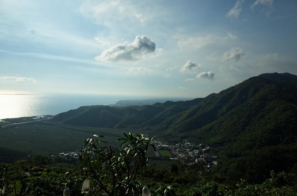
As I drove higher, I was treated to a spectacular view of the trees and ocean below.
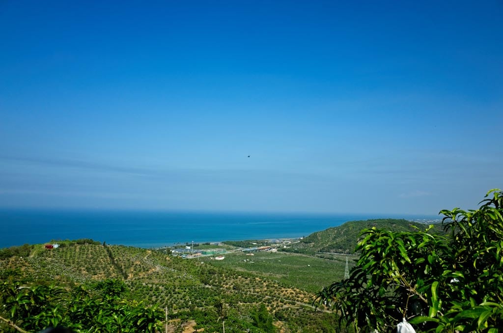
If you zoom in on the center of the picture, you’ll see an Apache helicopter flying by. It was circling the area for a few minutes before flying off.
Before arriving here, I had followed google maps (I know, I know…) up a different way. It took me through someone’s farm. I heard someone yelling at me but I pushed ahead. It seemed clear that the terrible dirt road would link up to where I was going. But when I got to within fifty meters of the connection, there was a gate blocking the way. So yeah, be careful following google. You shouldn’t have to drive on any dirt until towards the end of this hike.
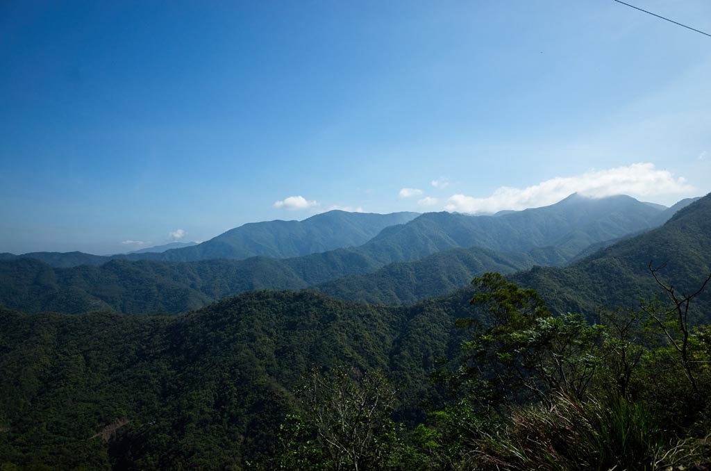
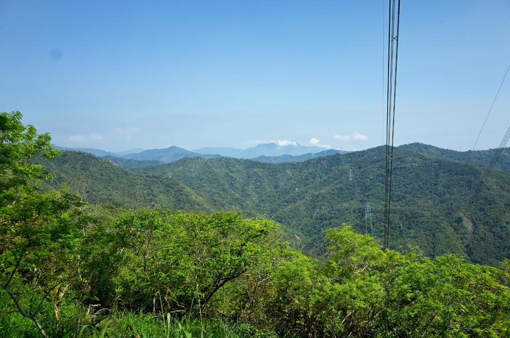
As I drove higher I got some mountain views, but it was starting to get a little hazy.
I didn’t know what to expect for this hiking trip. From what I researched, I could drive to an open clearing that appeared to be farmland; it was next to WuLiYi South Peak. But beyond that I had no idea if I had to dismount and hike it or if I could continue by motorcycle.
As I approached the clearing, I found my first sign that I wasn’t alone out there.

The Abandoned Cap Cult strikes again! I won’t get into it in this post. I find a lot of caps…
By this point the road had turned into a trail. You’ll probably want to stop and hike it if you are in a car. A motorcycle or scooter can still continue.

Not long past this point is a side trail heading down the mountain. Don’t take that trail…yet. There is something very cool down there. More on that later.
Just before you reach the clearing, there are two potentially dangerous spots to cross if you’re driving.


I’ve driven on worse trails, but the potential to fall is there. I’ll leave it to you if you want to try. Be careful.
Beyond that little obstacle was the trail to the top.

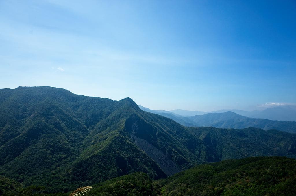
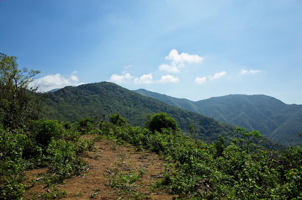
And of course, the top has some nice views.
The open area up there does look like it could have been used for farmland. Nothing now though.

There’s a short trail ride up to the very top…
If you can’t tell from the picture…it was HOT! I was really feeling the sun in this open area.
This is where WuLiYi South Peak is supposed to be. I poked around for a couple minutes and found it about ten meters from where I parked.


As you can see, I didn’t feel like spending the time to put myself in the usual peak picture. For one, it was too hot and I wanted to get out of there. But mainly, I thought it was just too easy – no work involved. I’ll count it though. 🙂
I quickly left that hot open area and was happy to see that the trail continued…and into the trees. I didn’t need to drive far to reach the next trail head to WuLiYi Main Peak.

A few minutes ride before this trail head I saw a side trail that looked to follow the ridgeline to the WuLiYi main peak. Assuming that’s where it went, I think it would take longer to follow the ridge. This trail head is just below the peak and all you need to do is walk straight up.
It took about 10 minutes to reach the peak from here. And when I arrived…well…I kinda regretted coming up.


There wasn’t much to see. Someone had put a rock on the ground to mark the peak. The whole thing was very anticlimactic. And sorry for the blurry pic. I’m still getting the hang of using a real camera.
I made it down rather quickly and continued up the mountain by motorcycle. The trail was ‘iffy’ in places but doable.
Along the way I found several places with fishing net tied up to the sides of the trail.


It’s not being used to stop rocks from falling, it’s far too weak. Aside from that, I really don’t know its purpose. I saw several pheasants in the area. I thought it’s possible the netting is used by hunters to trap them. For example, the birds couldn’t pass over the nets so they follow them to go around. Somewhere along the net they would have a trap. This could also work for wild boar. But to be honest, I don’t think that’s what they are used for. I didn’t see any traps. These things are a mystery to me.
Pushing forward…I almost ran over this dead…squirrel?

It was larger than any squirrel I’ve seen before. It had a bunch of these red headed beetles crawling all over it. As I got closer those beetles slowly scattered. Oh yeah, and it didn’t smell too good.
I drove around it and a couple minutes later arrived at the WuLiYi Northeast Peak trail head.

I was disappointed to be here. I guessed I was 300 meters from the peak. There was very little hiking ahead of me. Rather than stop, I continued down the main trail to see where it led.
It was narrow single-track for a bit and opened up to what I believe was a hunter’s camp, or storage area. Beyond that the trail narrowed a bit and I saw signs that there might be traps in the area. Given my luck with traps, I decided to turn around.

I got back to the trail head and left my bike.

The first 250 meters had an easy trail to follow.


Along the way I found more of that fishing netting.


The last 50 meters were a little steeper and was slightly more difficult to navigate…but all in all not a problem.


And then the peak!


I got in my usual peak pose…

And that was that.
I arrived at about 11:15am and didn’t know what to do with myself. I wasn’t really hungry and didn’t feel like resting. I had one peak left, Lion Head Mountain. It was back towards the beginning of the drive up the mountains, near a power line transmission tower. It would be another easy one I felt. This trip was looking to be all but memorable. But what else was there to do? So I hiked back to my bike and rode towards Lion Head Mountain.
One thing I saw periodically near WuLiYi Northeast Peak were these flowers.

I couldn’t tell you what they are, other than pretty.
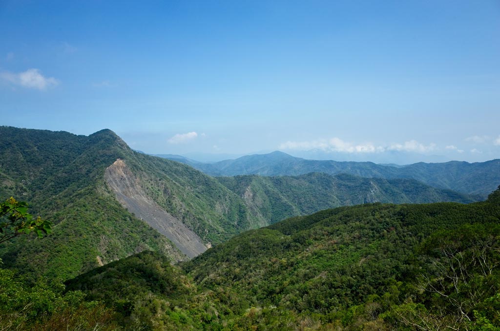
I took my time driving down the mountain. And snapped a few pics along the way.


Just before arriving to the (HOT!) open area, I noticed what I thought was a destroyed house down the mountain. Since I had a lot of time left, I tried to find it. My best guess was that it was located along that side trail I mentioned earlier.
I drove to the trail and followed it for several minutes. The trail was a bit soft and wet, but in good shape. I twisted my way down until reaching a gate. I forgot to take a picture. But it consisted of two poles driven into the ground connected by three lengths of chain – each with its own lock.
With three locks like that, I thought it was unlikely that anyone would live in there. To have to unlock three locks every time you enter and exit your property didn’t sound like local behavior to me. With that line of thinking, I chose to duck under a chain and walk a ways to see what was in there. And hey, there wasn’t a sign telling me not to enter. 🙂
From just beyond the gate I could see the “house”.

I could tell right away this wasn’t a house. It was some sort of structure that had been destroyed probably by a typhoon.


I would have stopped here, but my curiosity always gets the better of me. And a good thing too.
I walked for several minutes and saw the first sign that this trip might be far more interesting that I had thought.

These were definitely stacked by aborigines, most likely long ago.
As I walked, I saw more…

and more…


and more…and more…


I was pretty excited. I was at the edge of an abandoned village. And shortly, I arrived at the main part of the village.

I walked down and spent some time exploring.

There were a whole lot of old house foundations made of stacked rocks.


This rock has some faded Japanese written on it. I can only wonder what it says.


I found three bunches of flowers like this on the ground. Perhaps something religious related to the dead?


There were A LOT of these butterflies around the area.


These rocks above seemed the most interesting to me.


Towards the back of the village I found an old trail leading off to somewhere. It was fully overgrown, but judging by the time they took to stack rocks along the path, it must have led to something important.
Even though abandoned, it was obvious that people still cared for the village. Most of these places I find look terrible. This one is in great shape.
So the big question (for me anyway) is what was the name of this village and what happened to its occupants?
I come across a lot of old stone foundations like these in the mountains. Some are villages and some appear to be just a few houses or structures with nothing else around. I always wonder about them but have rarely taken the time to investigate. But this time was different.
After some research, I strongly believe this is WuLiYi Village – 霧里乙社. It’s pronounced Vuri’ilj in what should be the Paiwan language – or プリイツ in Japanese if anyone cares to know. Census data collected by the Japanese in March of 1889 says there were 11 households of 95 people at the time. 54 males and 41 females.

The villagers were relocated in 1944 – 1945 to NeiShiTou 內獅頭. From the records it appears several other local villages were also relocated there. I would have to make a large assumption that the Japanese wanted to consolidate the aborigines for whatever reason. This was right at the end of WWII; perhaps that had something to do with it. It’s not something I really want to investigate further at this time though.
My excitement from stumbling upon this village was still high. I went back to the main trail and followed it deeper into the mountains. There were one or two more stone foundations being swallowed by the overgrowth along the way, but for the most part it was just a normal mountain trail with the occasional view.
The GPX track I was following showed a trail head to what I thought was another small peak. Later I found I was wrong. It was the old trail to WuLiYi Northeast Peak. It looked to be a short hike, so instead of taking that trail I continued down the main trail.
I hiked down a couple switchbacks and realized it must go all the way down to the riverbed. It would take quite a bit of time to go down and back up, so I changed my mind and turned around. It’s too bad I didn’t have my motorcycle; it would have made quick work of that trail.
On a side note, if that trail does go down to the riverbed, it would be a little ways upstream from Kayoufeng Waterfall – 卡悠峯瀑布. I’d like to go back and see. It would be cool to see the falls from the top.
So…back to the trail. I hiked back to the trail head I mentioned and slowly made my way through a bit of overgrowth. The trail ended at a very old landslide, but appeared to cut up and around it. As I took a few steps up, I noticed some rope, a chain, and a metal hook attached to a tree. TRAP!!!

That’s what I thought. It must be a trap. But I didn’t see a trap anywhere. Until I found it I wasn’t about to move. I grabbed the rope, pulled it up, and followed it. It went up the trail and disappeared into the ground. I found a stick to move the leaves and debris, but didn’t find it. So I tugged on the rope hard enough and just like that, the trap popped out of the ground.


I flipped it over…

…and sprung the trap.

It broke the stick in half that I used to spring it. Normally I don’t touch the traps I find, but this one was right on the trail. I’m 100% positive I would have stepped in it. There’s no way I could have left it there.
That pretty much killed my excitement. I counted myself lucky and turned back; destination: my motorcycle.
I went real slow until I got to the main trail. I feared there may be more traps. And sure enough there was!

This one was at the side of the trail where no hiker would be, so I left it how I found it. And to be clear, I really doubt many hikers ever come out here. And those who do make it to the village, only a scant handful like me would want to come to this spot. So I’m not angry about the trap’s location. I just wish it was properly marked.
When I got back to my bike it was just after 2pm. I was hungry and the time was right for a little break. My plan was to drive to Lion Head Mountain to rest there.
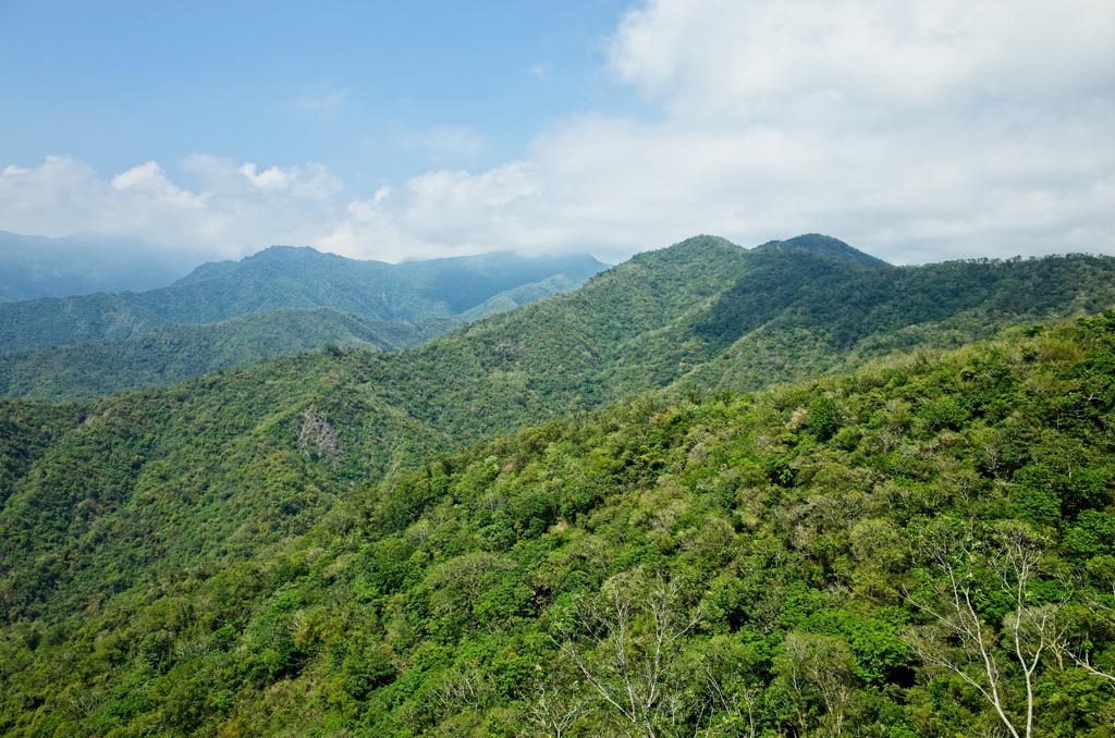
Again I took my time driving down, and snapped more pictures.
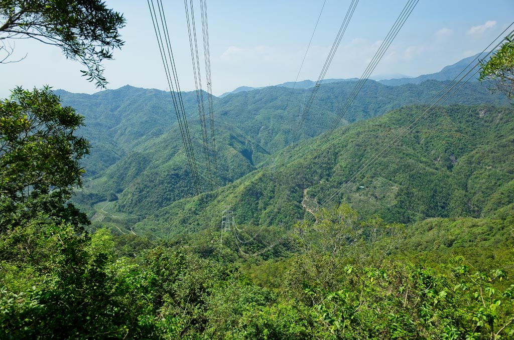
As mentioned, Lion Head Mountain is near a power line transmission tower.


Next to it is an old tower foundation.

This would be the perfect spot to relax. But since I still had all my gear on, I thought I’d quickly hike to the peak first. I mean, it’s downhill and nearby. It couldn’t possibly be difficult, could it?
Hahaha…turns out this peak was the most difficult of the bunch. Ok, not THAT bad. But I did need to use my machete a bit. And no, I didn’t get any pics of that part. Just this area beyond the towers.

But it wasn’t long before I made it to the peak.

There was old farmland all around the area. I could see an old, currently unused road that I believe in theory you could use to get here. But really, there isn’t much of a reason to come here. There’s no view and there are mosquitoes constantly on the attack. But I did find one redeeming quality.

It’s number 100! Woohoo!

I don’t know why that excites me. I guess since there are thousands of these markers all over Taiwan, it’s kind of cool to find number 100.


With that out of the way, I headed back to the tower to eat. I found a nice spot under a tree and relaxed for a good hour or so. 🙂

(I was testing out the camera’s delay function. Lame, I know)

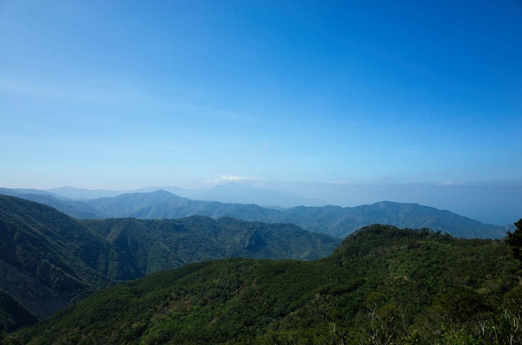
The views from here are decent. Definitely a nice place to take a break.
And that was the end of the trip. I drove down and headed home.
If it wasn’t for the abandoned village, I wouldn’t recommend this hike. But with the village I would say definitely take a look if that sort of thing interests you.
Date hiked: 2019 May 14
GPX Track Download Instructions: Click the track on the map to see the download link
This track for WuLiYi Northeast Peak – 霧里乙山東北峰, WuLiYi South Peak – 霧里乙南山, and WuLiYi main peak – 霧里乙山主峰
This track begins in the abandoned village near where I found the traps, and goes to Lion Head Mountain – 獅子頭山


![[Valid RSS]](https://outrecording.b-cdn.net/wp-content/uploads/2020/03/valid-rss-rogers.png.webp)
2 Comments