
First and foremost, let me tell you that this route to WeiLiaoShan North Peak – 尾寮山北峰 is one that I created myself. You won’t find this hike anywhere else…probably. So take that as a warning. Having said that, it was a damn fun hike! And it had a little surprise along the way.
New Versus Old Route
So how is this route different?
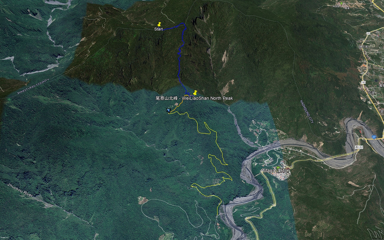
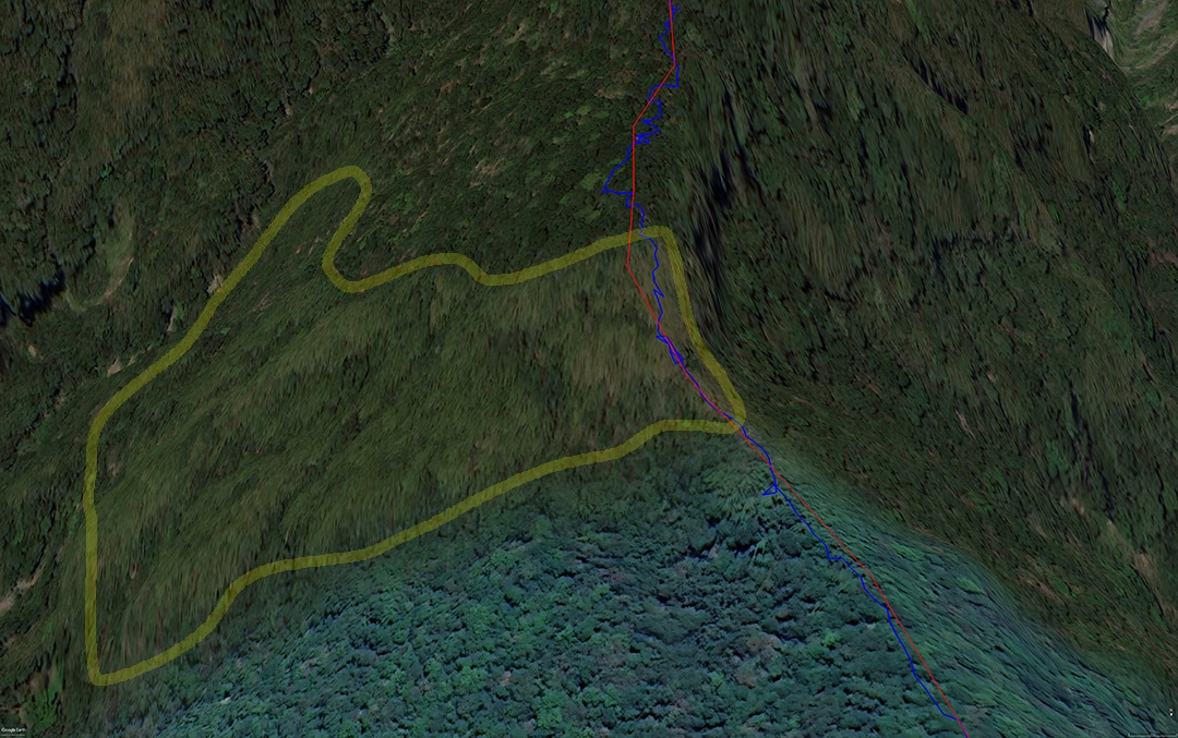
Looking at the map you can see the usual route colored in yellow and orange. The yellow color is the drive up to the trail head; the orange color is the hike. I drove up there about six years ago. It wasn’t too difficult of a drive as I remember. And I can’t imagine the hike is all that difficult either…or all that interesting! I suppose if you’re looking for a quick and easy hike while in the Maolin (茂林) area, then sure, go for it.
My route is in blue. It’s obviously not as easy. You first have to drive the Shaxi Lindau road (沙溪林道) to the WeiLiaoShan (尾寮山) back entrance. I have a cobbled together GPX track on this page and another on this page that might be useful. Once you get on the dirt section of the Shaxi Lindau, you can’t get lost. Just keep going until you reach the WeiLiaoShan back entrance. There used to be a nice sign letting you know where it is, but someone used it as firewood. But no worries, the GPX track I’m attaching to the end of this post begins at that very spot. So you’re good.
To the Trailhead!
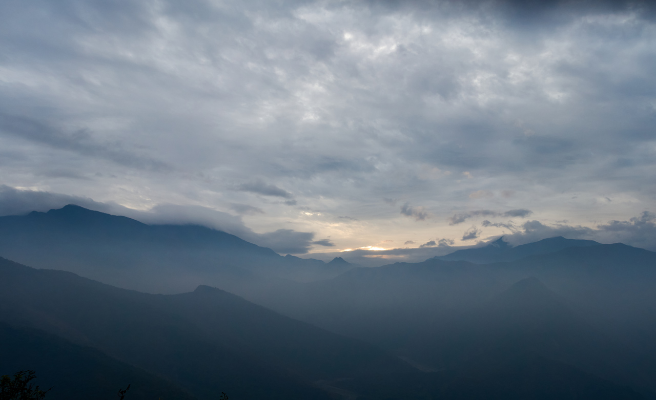
If you start out early enough, you might get lucky with some great views along the road. I was semi-lucky.
I would suggest driving a two-wheeled vehicle to get to the trailhead. There’s always a solid chance for a downed tree to mess up your plans.

When I got to the trail head I drove up a ways to see how close I could get to my proposed starting point. For whatever reason I kept driving up further until I happened upon what I think must have been a hunter’s storage cache. I couldn’t drive further than that. So I turned around and parked down near where I wanted to start hiking.
I was happy to note that it didn’t appear that anyone had entered the forest in that particular spot. It was all overgrown and had plenty of spiderwebs that had never seemed to stop getting caught up in my face.
A Messy Beginning
The start of this exploratory hike was about how you might expect it to be: A lot of plants and trees growing all over the place and no trail to follow.


I had a very rough GPX trace to follow that I had made at home.
It kept me more or less on the ridgeline and pretty much on track, but of course reality is always going to be different – there’s no accounting for what obstacles you’re going to encounter.
The first hour was relatively easy. It was a gradual downhill. Lots of spiderwebs and lots of vegetation, but easy to navigate. It all looked like the pictures I posted above. There were some different looking spots, like these below.


But the rest was just typical Taiwan lower-mountain forest.
An Ever-So-Slight Detour
Then I hit my first obstacle. The terrain became steeper along my proposed route, so I had to follow a different route to the east a bit.

Coming down, it looked like this.


Then I reached a flat-ish area that felt honesty quite nice to just stand there and look around.


This route was definitely easier than trying to stay on the ridge, however, I took it as far as it would go and I needed to find a way back up to the ridge. It took a little detour, but I managed to find a safe way up.
Back on Track
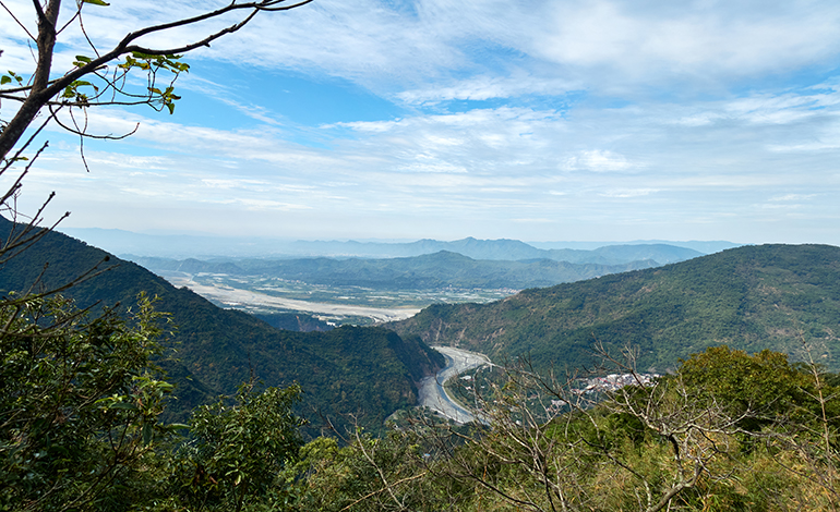
Once atop the ridge again, I got my first glimpse of the scenery beyond.

It wasn’t much, but certainly a preview of what was to come.
So I continued down the ridge…


I need to mention that the entire hike up until this point showed no signs that anyone had been there. There was no trail, garbage, markers, or anything that would suggest people had ever been through there. Now I’m sure people HAD been through there at probably many points in history. But it appeared that nobody had been there in very recent history.
I figured the whole way down would be mini struggle after mini struggle. So imagine my surprise when I found these.


I had immediately assumed those were cut by hunters. Not far from those I noticed this:


I’m not sure if you can see it in the second picture, but you can probably see the trail in the first picture, right!?
Yes, there was a kinda-sorta trail!
I found a lot more cut trees and various paths going in various directions.


And then I found my ‘proof’ so to speak. An old campfire.

At this point I was about 75% of the way to my destination. I forged most of the way myself and was content to hike the rest of the way via a hunter’s trail. And honestly, I was extremely grateful for their trail after learning what was to come.
BAMBOO!!!!

Yes, there was lots and lots of bamboo!
Bamboo absolutely sucks ass to hike through. And this particular part of the hike was the steepest. Bamboo and steep mountainside isn’t something I want to try and create a new trail through. This possibly could have been the end of my hike had there not been a very clear trail through all of it. Thank you mystery hunters for this gift!
Had I thought about it, I would have noticed on Google Earth that I was going to run into bamboo. All that area inside the yellow is bamboo.
Well, the bamboo area still sucked, even with the trail. This section was definitely dangerous. You might want to consider bringing a rope. I made it up and back OK. But I’m stupid. And I think the gods favor us idiots to some degree.


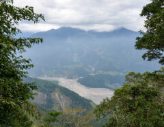
But this bamboo-ridden shit part of the mountain offered one feature the rest of the ridge kept hidden…
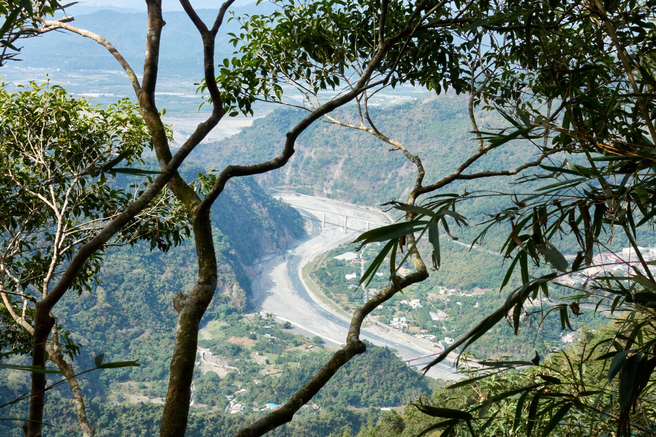
Oh no, it got better than that!
BOOM!

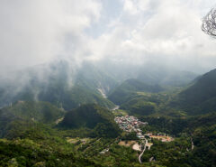
From here I could see all of this part of Maolin.

The downside to this view was the danger posed in trying to capture these pictures. There wasn’t any real decent place to stop and enjoy the view for any length of time.
An Unexpected Find
I continued on and to my delight the bamboo area was invaded by trees. Or perhaps it’s the other way around.

And this is where I found something I can’t quite account for.

At first I thought I had linked up with the usual trail to WeiLiaoShan North Peak. But given the location, that doesn’t make sense to me. This is too far north to be from that trail. Had there been another, now defunct trail? Or had there been an old trail starting from the top of the mountain the way I had come? It seems plausible. Maybe there was a trail and I had just missed all of the ribbons along the way? I don’t know. Seems I would have seen at least ONE other ribbon somewhere along the way, right?
Or heck, maybe one of the hunters snagged that ribbon from down the mountain and tied it up to help him find his way up the mountain? I guess anything is possible.
Almost to the Finish Line
The bamboo finally disappeared and I was in easier-to-navigate terrain once again.

I had lost my phone somewhere in this section of mountain. Thankfully I had a bright blue phone case that stuck out like a sore thumb. I thought I took a picture of how much it stuck out, but I guess not. Anyway, if you’re planning on hiking…well, hiking anywhere, I suggest you keep your phone in something that will stick out in the terrain you’re hiking.
Not long after finding my phone, I found a road.

Well, it used to be a road anyway. And considering there are farms not far from here, I’m not surprised to have found it.
The road didn’t go in the direction I was headed, so I sadly left it behind. No easy ride here.
And I can’t remember where exactly, but I stumbled onto another ribbon.

And another…

And another…

These were definitely part of the usual trail. It only took a few minutes from finding the first one to arriving at…
WeiLiaoShan North Peak – 尾寮山北峰

I wasn’t expecting much and yeah, there wasn’t much there. Just a triangulation stone and several ribbons tied around the nearby trees.


Although one of them is an oddity. I believe this is the third or fourth Taipei Skyline Trail (台北天際線) ribbon I’ve found way down south. hahaha.

BTW, if you’re interested in hiking the actual Taipei Skyline Trail, and not this fake southern part, all the information you could possibly want is located at my friend’s website Taiwan Trails and Tales. For real, go check it out! She put a lot of work into hiking the whole thing.
So that’s basically it. That’s the hike.
Ok, you twisted my arm. Here’s my peak picture.

The Trip Back
I wanted to add a little about my trip back up the mountain since I’ll be linking both the up and down GPX tracks.
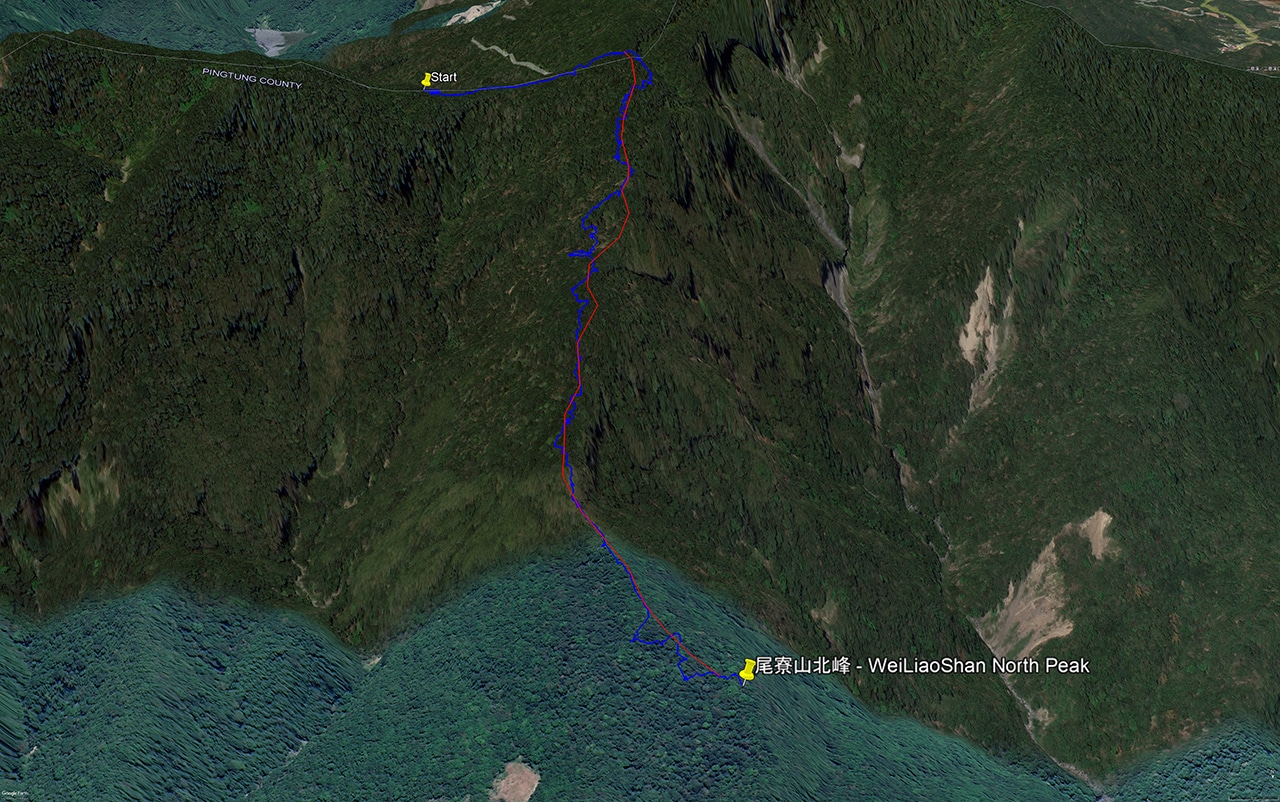
For the most part I hiked along the same route I took to come down…


…with one notable exception.
I chose to try and stay on the ridge instead of dropping down into that little ‘valley’ that I had detoured through at the beginning of the hike.
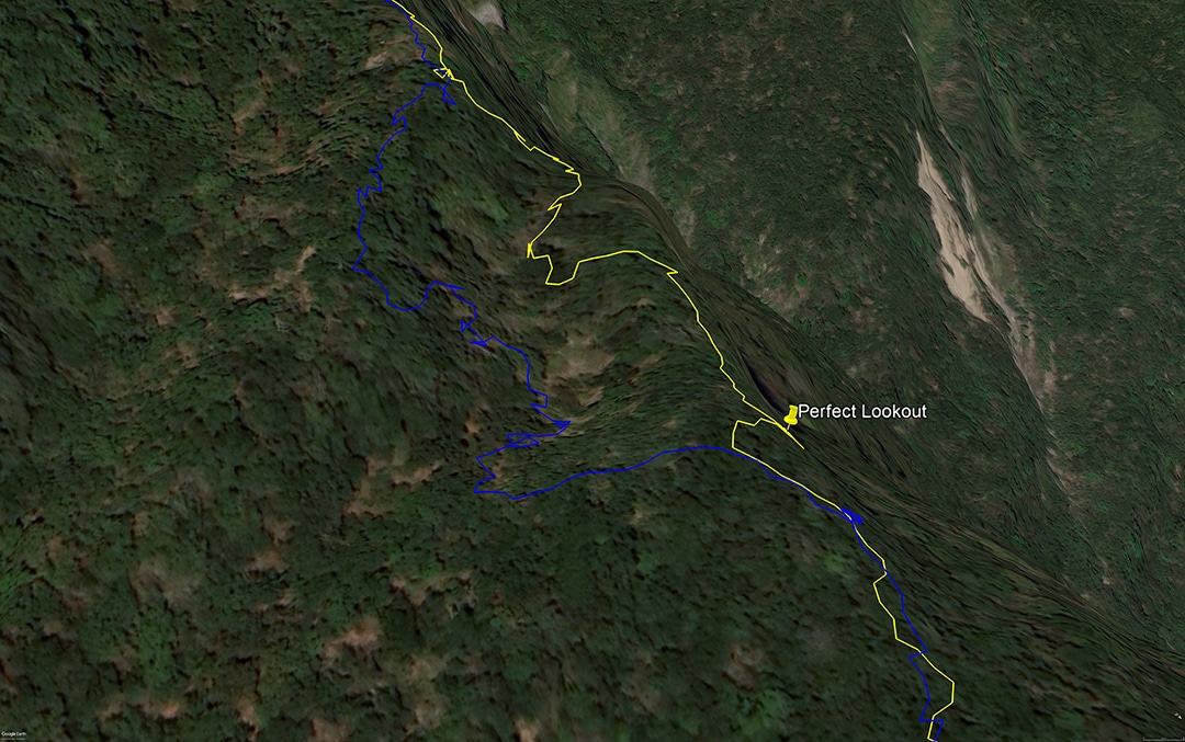
The blue was my route down, and the yellow my route up.
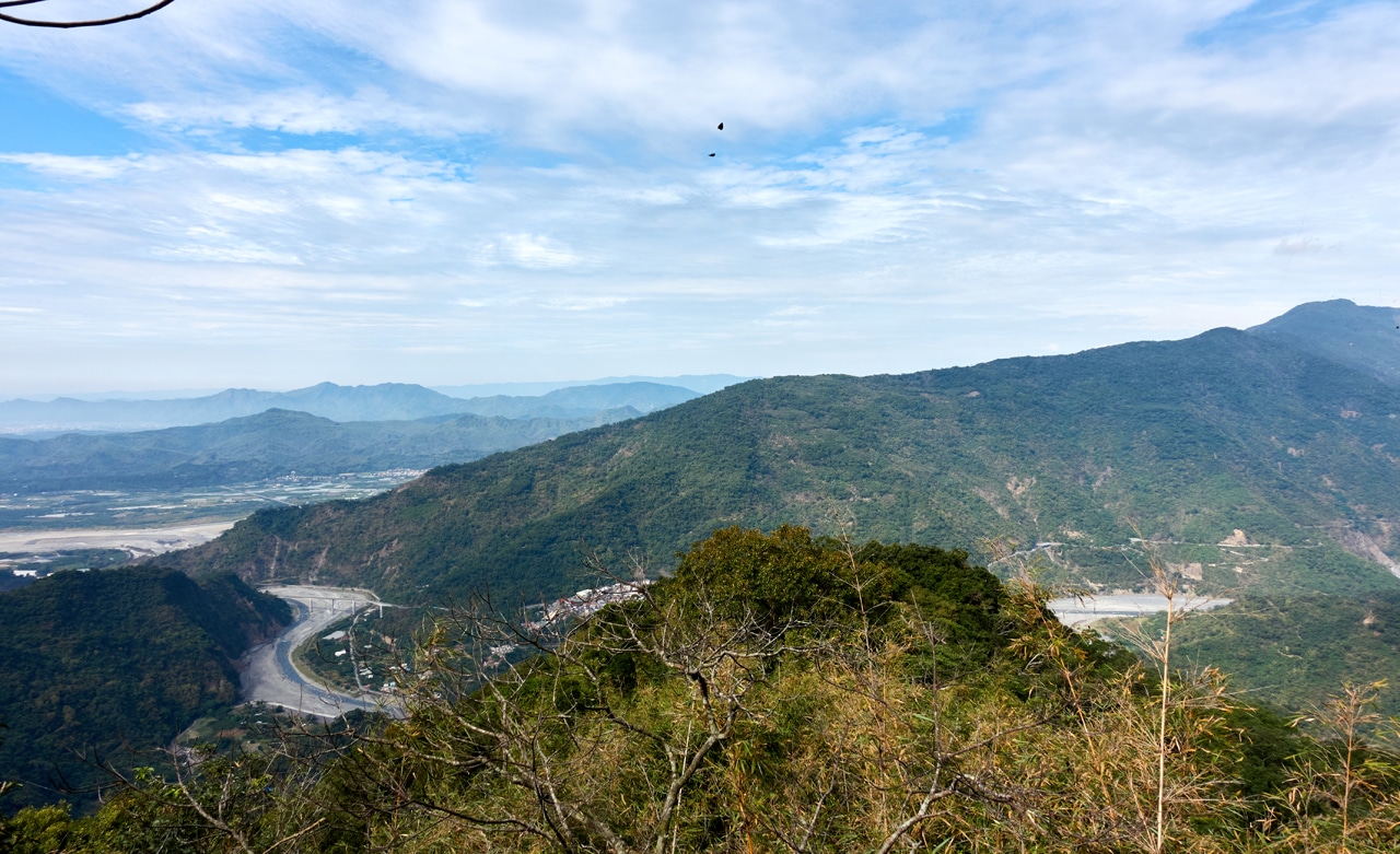
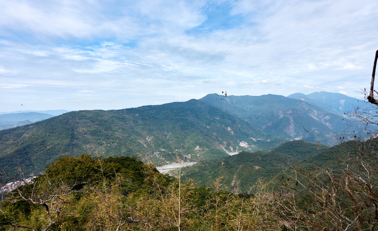
It started off easy enough. And as you might have noticed, I found the PERFECT lookout.
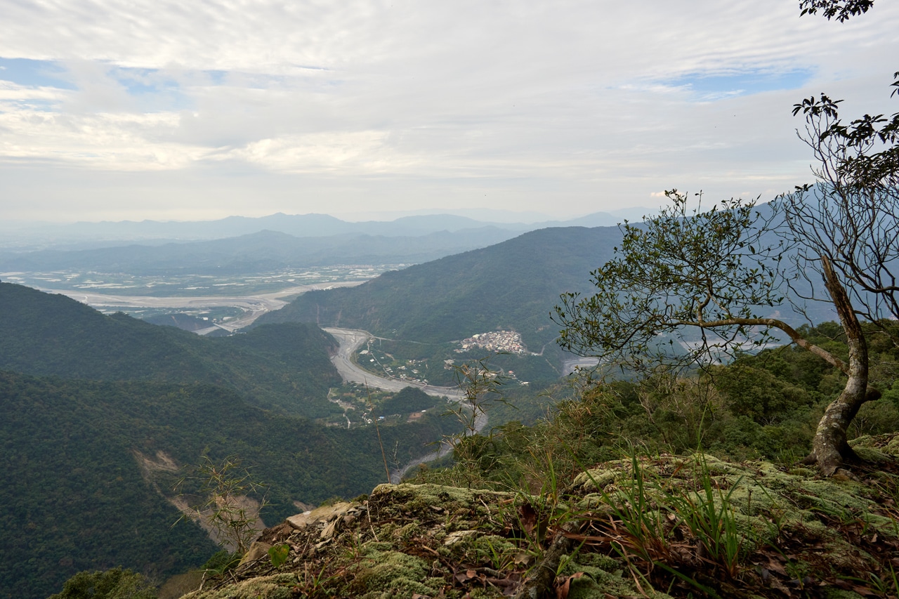
Unfortunately the weather wasn’t as nice as it was when I had a nice lookout in that bamboo section. But being able to sit down and enjoy the view more than made up for it!
If you look back at the map, you’ll see I was able to stay on the ridge for a bit, but eventually needed to go back down into that little valley. I could have easily linked back up with my original route, but I stupidly thought I’d follow what I had thought was a trail.

That kind of DOES look like a trail, right? Except it slowly turned into messy, overgrown forest and I was forced to head back up to the ridge. After some machete work, I made my way to an easier rocky uphill.


I followed the ridge again until it turned into bamboo. I think this is why I chose not to go that route on the way down. 🙁


So yeah, I found myself in a very steep section filled with bamboo. It sucked.

I highly, HIGHLY recommend that you do not follow that part of my hike if you download the second GPX track. It’s not worth the trouble.
That Ending Paragraph
So here we are once again at that ending paragraph of mine. This is where I give my opinion on whether or not you should hike the hike I just spent the last couple hours or more (probably more) writing about.
I think this one’s an easy recommendation. You already know if you want to do it or not. Since 99.99% of you wouldn’t want to hike the easy trail to WeiLiaoShan North Peak, and 99% of the remaining 00.01% who do want to go there sure as heck won’t want to take my route. So that leaves that one random weirdo like me who might be interested in this hike. I guess I wrote this for you, you lovely weirdo!
But seriously, I really enjoyed myself and think this is a pretty fun hike.
Oh, and I feel it necessary to mention that I did not mark my route in any way…aside from whatever plants my machete cleared. If you go, maybe bring some trail ribbons?
Date hiked: 2022 January 05
GPX Track Download Instructions: Click the track on the map to see the download link
I recommend that you use this map. The other map has a route that goes through a somewhat dangerous area.
Use the other map…seriously. This one has a dangerous section. I’m only including it so you know where that “Perfect outlook” is located. Download at your own risk.

![[Valid RSS]](https://outrecording.b-cdn.net/wp-content/uploads/2020/03/valid-rss-rogers.png.webp)
Leave a Reply