

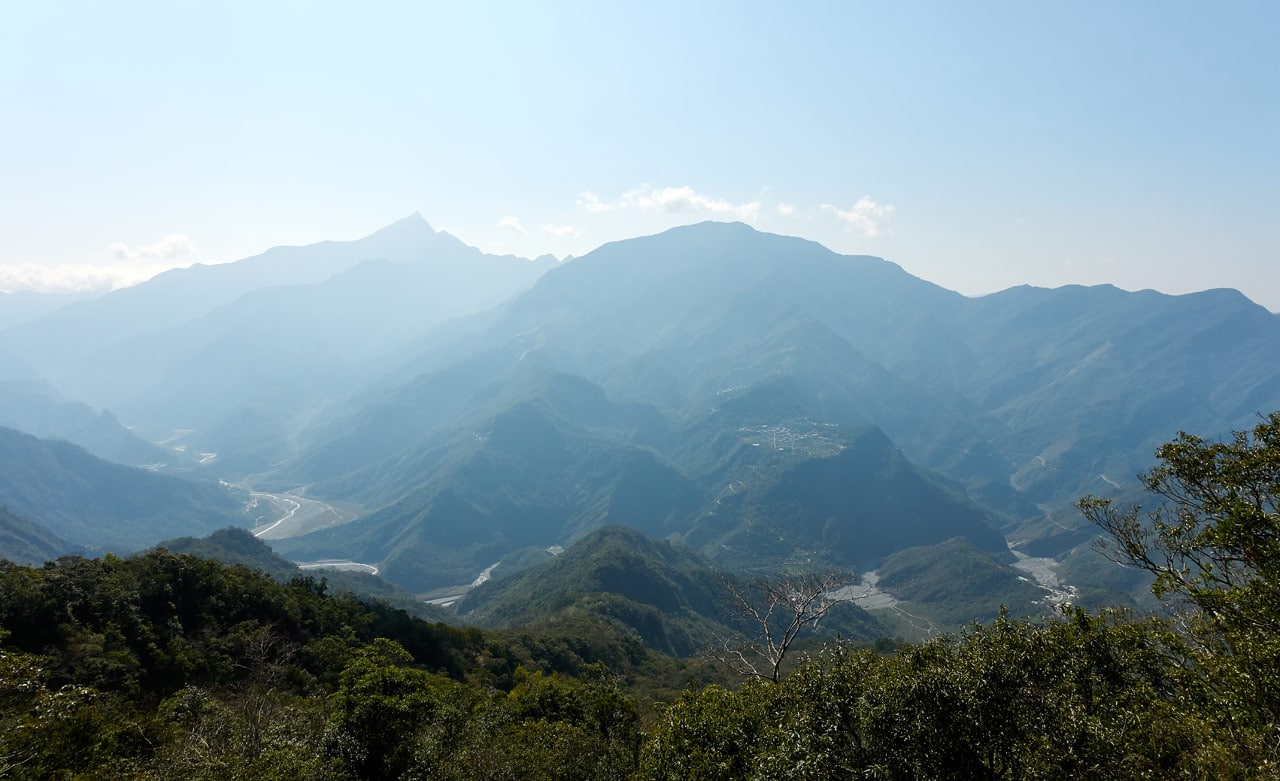
On a clear day standing in Kaohsiung city you might notice a volcano-shaped mountain peak in the distance. That’s DaMuMuShan – 大母母山. It has been on my list of peaks to climb for a while now, and I finally got around to it.
You can see DaMuMuShan in the below picture on the left side.
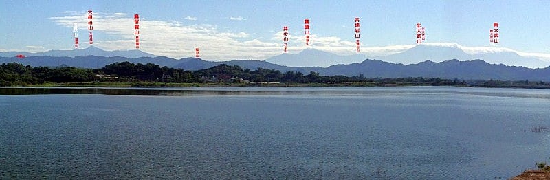
It’s located in Sandimen Township near the Wutai Township border and is number 66 on the “Taiwan Marvelous 100” list of mountains. Having now hiked it, I’m not sure I agree with it being on that list. But maybe I’m missing something. Here’s how my hike went.
Getting to the Trail Head
My plan was to arrive as early as possible at the trail head, but there was one problem. There’s a police checkpoint in Sandimen that won’t allow you to pass until 6am. This means you either have to spend the night somewhere after the checkpoint or arrive at six in the morning. I chose the latter.
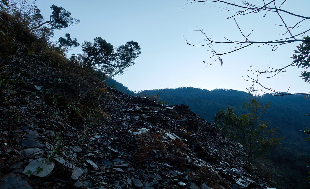
After signing in at the checkpoint I drove nearly an hour to reach a landslide I had driven to in 2015. Here’s a picture from that day.

Things have changed A LOT since then. Everything you see in this picture is gone. But I’m getting ahead of myself. Let’s jump back a little earlier than this location – 1.3 kilometers earlier to be precise.
HuYaLuoShan Trail Head – 戶亞羅山 (托庫棚山)
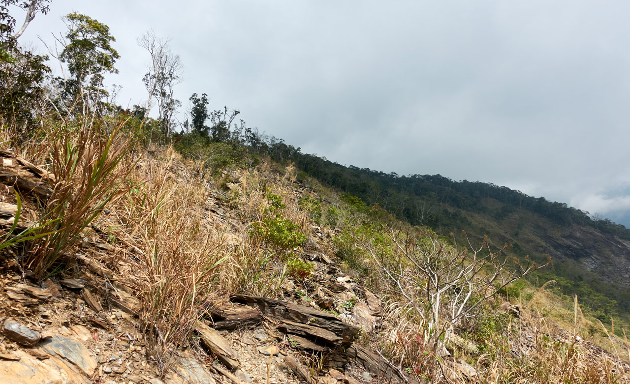
Along the way to the DaMuMuShan trail head is HuYaLuoShan. It’s about a 30 minute hike from the dirt road. I wasn’t sure if I wanted to hike it on my way up or on my way down the next day. My plan was to decide as I drove by. After taking a look at the trail head…

…I chose to hike it first. And I’m really glad that I did, because I would have skipped it the next day for sure, as I was in no condition to want to hike any more!
I left my backpack with my bike since it would be a short trip. I just brought a bottle of water and my trekking pole. The hike up was mostly under a canopy of trees, but towards the end it opens up as you follow the ridge up.


HuYaLuoShan/TuoKuPengShan – 戶亞羅山 (托庫棚山)
In about thirty minutes I arrived at the peak.

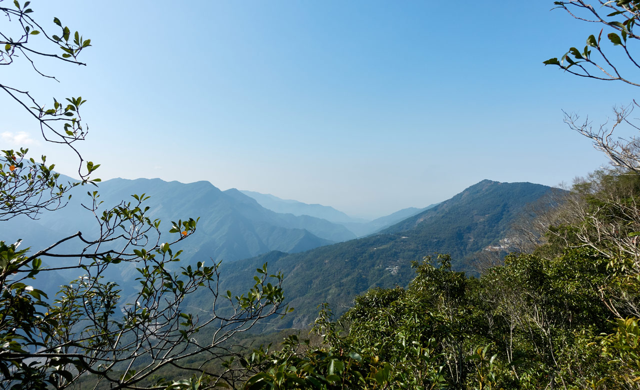
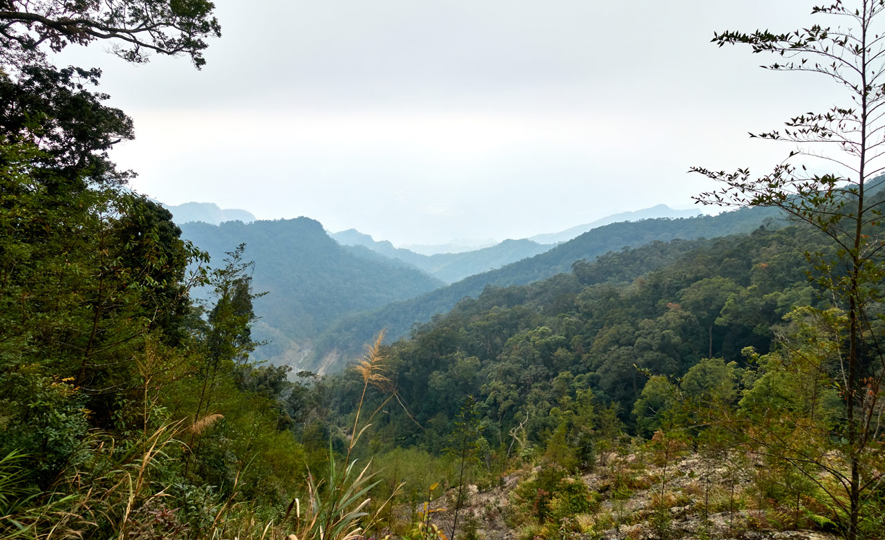
The view from here was pretty good. You can see the second peak just off to the side.
I’m not sure if you can hike to it, but I don’t see why not.
Here’s how the dual peaks look from the DaMuMuShan trial.
That was from the second day on my way back.
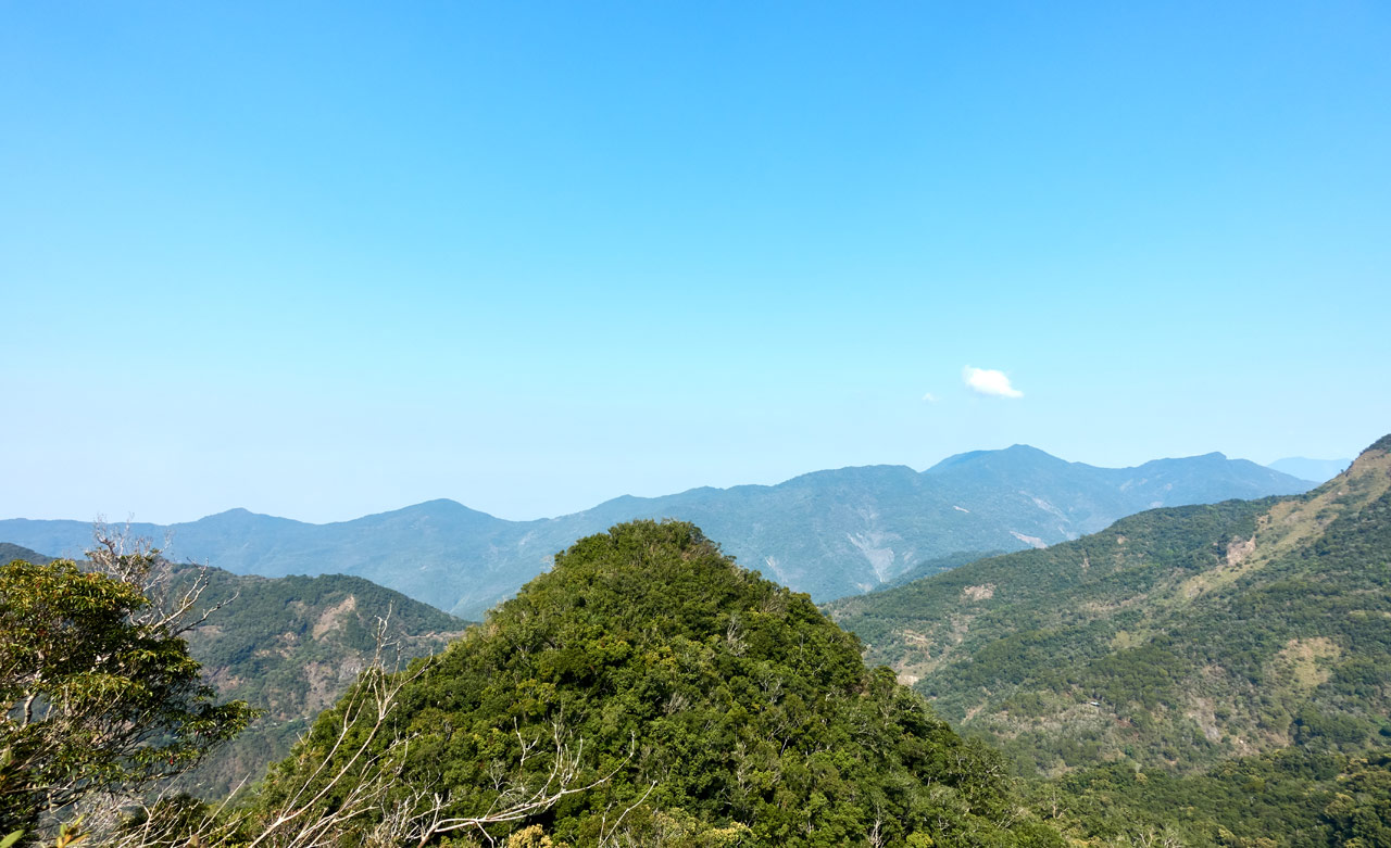
Back to HuYaLuoShan – Here’s the view looking straight out.


Move the slider to see the names of the two peaks. DaMuMuShan doesn’t look as impressive from this angle, does it?
I didn’t want to spend much time up here so I quickly snapped some pics and left.


Oh…and you might have noticed that there’s another name for this peak on those signs: 托庫棚山 – TuoKuPengShan. I’m not sure why two names, but I did find an older map with only “托庫棚山” listed as the name. It would appear that name was first. Perhaps it was an aboriginal name made into Chinese. Just a guess.

There’s also a smaller stone butted up against the triangulation stone.

If something was written on it, it’s long gone.
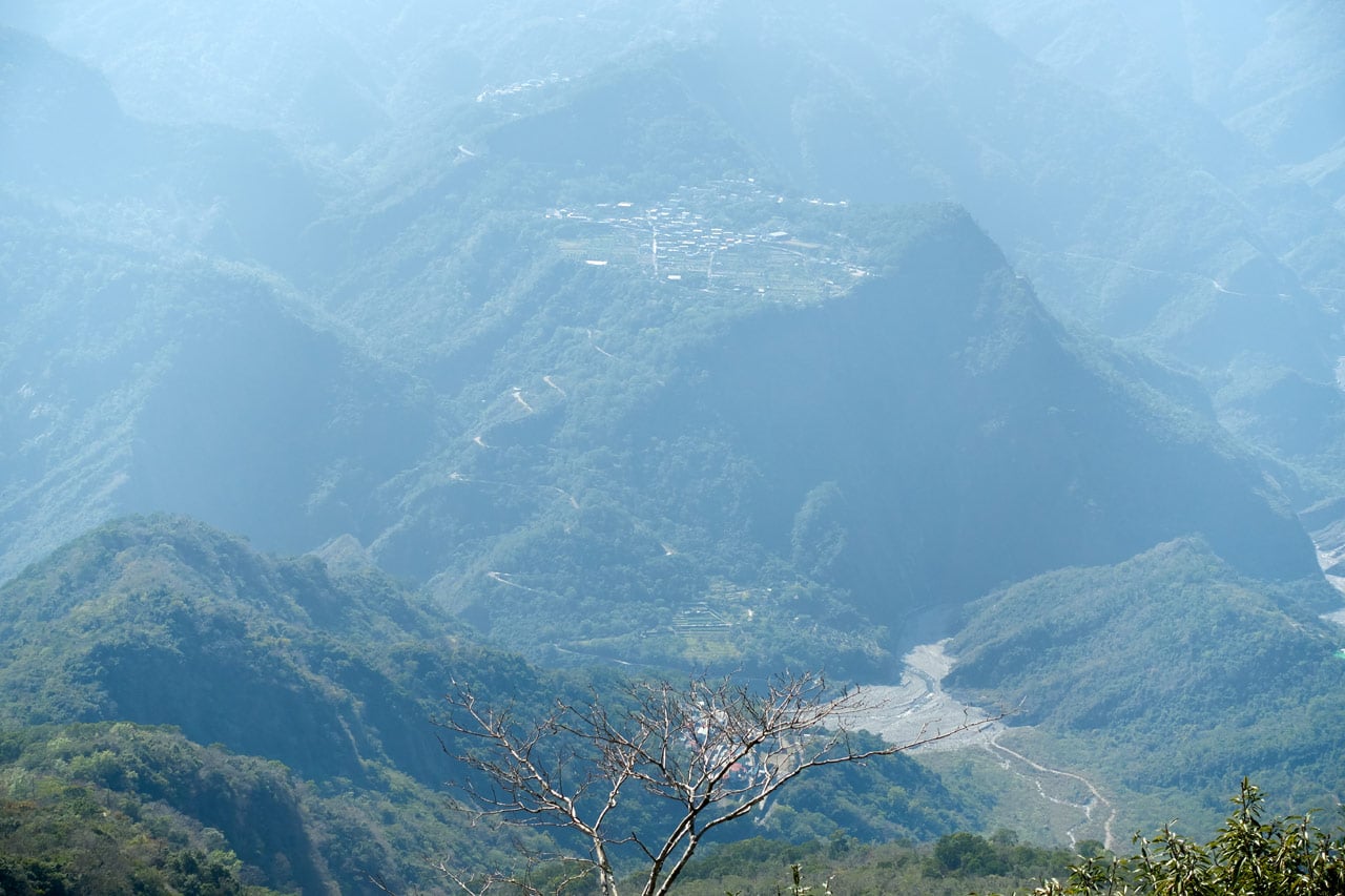
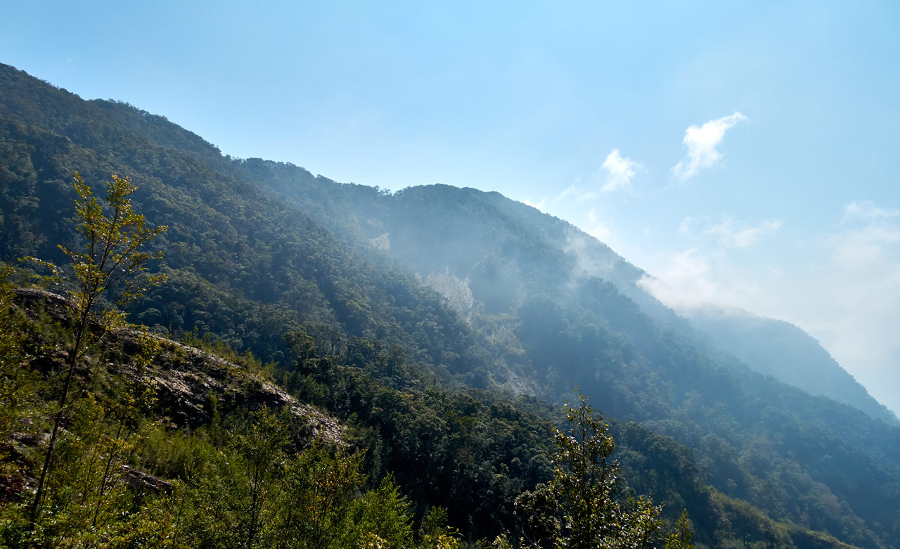
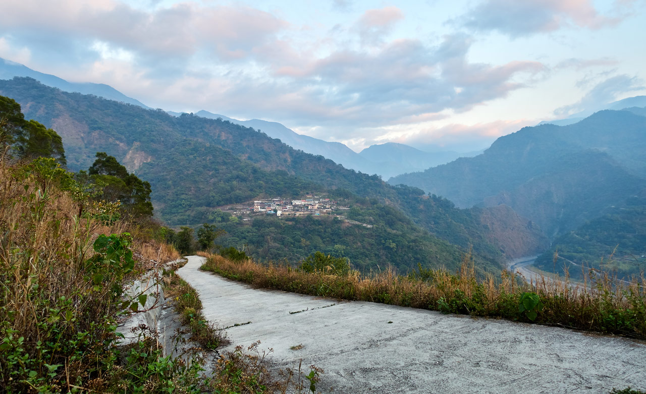
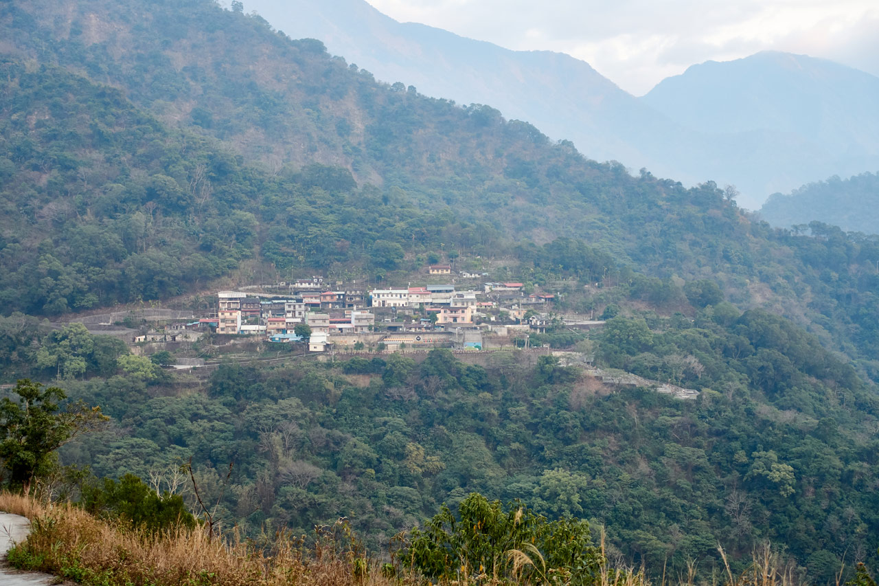
On the way back to my bike I snapped these pictures of Wutai village 霧臺 across the river. It’s too bad it was hazy out. These could have been a great shots.
I think HuYaLuoShan would be a decent half-day trip on its own. The drive to the trail head is nice. The hike is easy and the scenery beautiful. You could also stop by one of the small villages you pass through on your way back.
DaMuMuShan Trail Head
A short drive after finding my bike…

…and I arrived at the DaMuMuShan trail head.

BTW, this was my first time using my new Six Moon Designs backpack. Let me quickly say that it worked quite well and I’m really happy with it. I’m using the FKT version that utilizes a vest yoke over a traditional shoulder yoke. In short, the backpack doesn’t move around while hiking, but rather, moves with you.
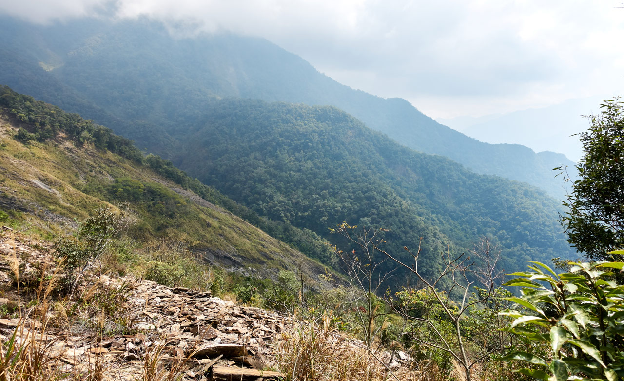
As I mentioned earlier, this area has changed a lot since my last visit. I could drive further before, but now it looks like there has been another landslide or two.

Let the Hike Begin!
The hike starts out messy. You have to hike over a couple hundred meters of landslide – some parts exposed and some with a lot of overgrowth. But before you know it you exit the landslide and come to the old dirt road.
I was immediately greeted with, by all appearances, an abandoned house.

Seeing how there’s no convenient way to get here, I’m assuming the owner(s) had to abandon their land.
Nearby there was some type of “grotto” as I first called it.

I went down for a closer look.


And no, the TV didn’t work. 😆
I hit the road again and was hit with another landslide…

…followed by this sketchy ladder-thingy.

It was surprisingly a lot stronger than it looks.
First Hunter’s Camp
Roughly thirty minutes into the hike I reached my first checkpoint: a hunter’s camp.

There’s a water source nearby: a PVC pipe valve that shoots out what seems to be clean water. (I would still use a filter just in case) It shouldn’t really be necessary at this point, but could prove useful on the way back.
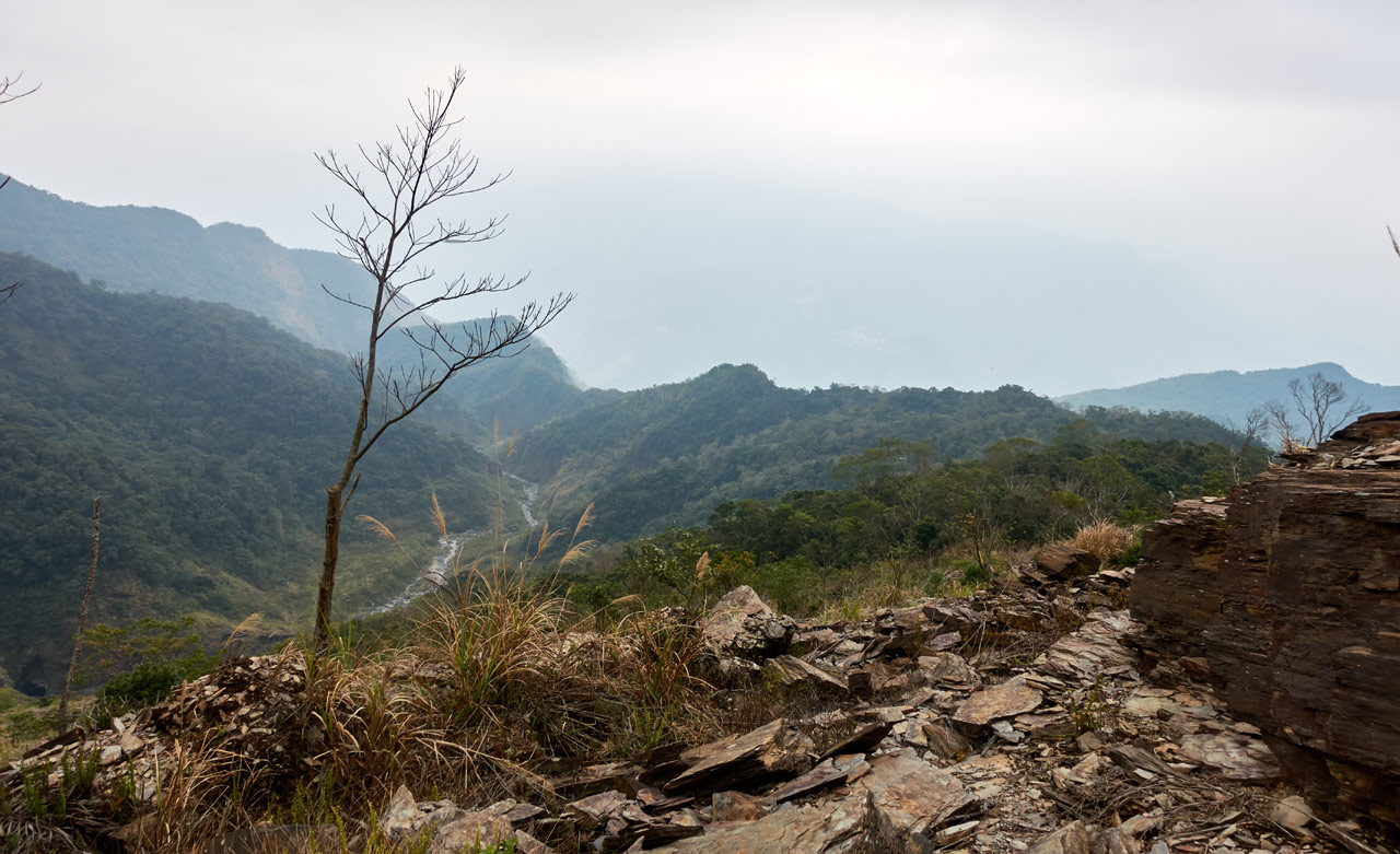
The old dirt road continued on for nearly a kilometer. The elevation gain was gradual, which was nice. You can even see a (likely) unnamed waterfall in the distance.
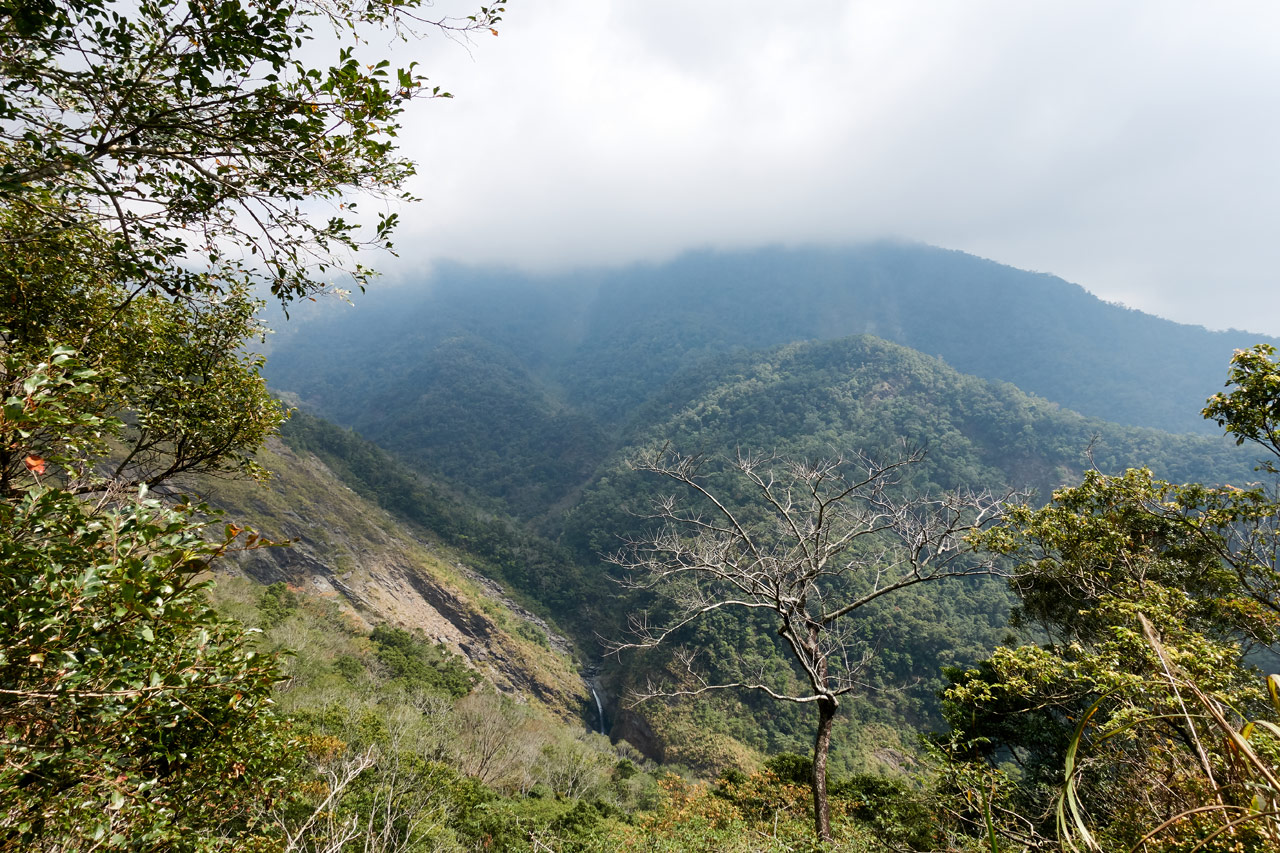
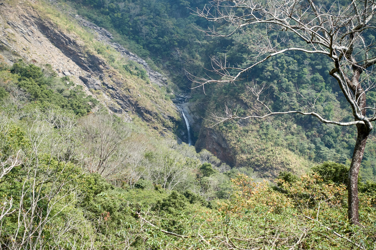
It feeds into FeiLong Waterfall (飛龍瀑布) further down the line. It appeared that there MAY be a way to get down there, but I’m thinking probably not. I’m not a waterfall chaser, so I’ll leave it to those guys to figure it out.
Burning Legs
Before long the dirt road came to an end.

And the leg-burning uphill began.


It connected up with a rather large landslide.

There were arrows painted on the rocks periodically, but the trail was obvious.

And someone felt the need to paint “mountain – 山” on a rock.

Despite it looking overcast and cool, the weather was kind of hot. I couldn’t wait to get under the trees again. But first, a couple pictures.
And then I got my wish. I made it to the trees!
Halfway Point
I was roughly halfway to the campsite I had planned to sleep at for the night. But somehow it felt like I had much further to go. At any rate, this section of the hike wasn’t so bad. There was a solid trail to follow and it was quiet.


There were some trees with little green signs on them, as well as more trees with those mysterious carvings.


I mentioned it being quiet. That’s one defining quality of this trail – at least on the day I hiked it. It was so damn quiet. I didn’t see or hear a single animal the entire hike. Sure, there were some birds here and there, but for the majority of the hike it was soundless. It was kind of creepy.
Someone mentioned that “bad things” had happened there in the past. Something about aboriginals and Japanese fighting…which means people died around there. Whether or not that’s true, I don’t think that has anything to do with it. But who knows…
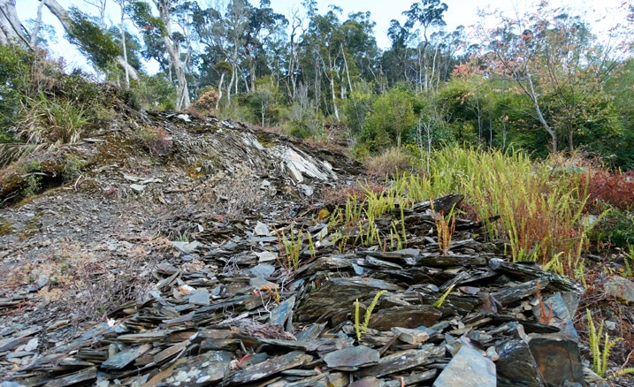
Another Landslide
Yep! There was another landslide to cross. But it wasn’t so bad.

And as landslides have proven so far, this one offered a view…though, well…it could have been better.
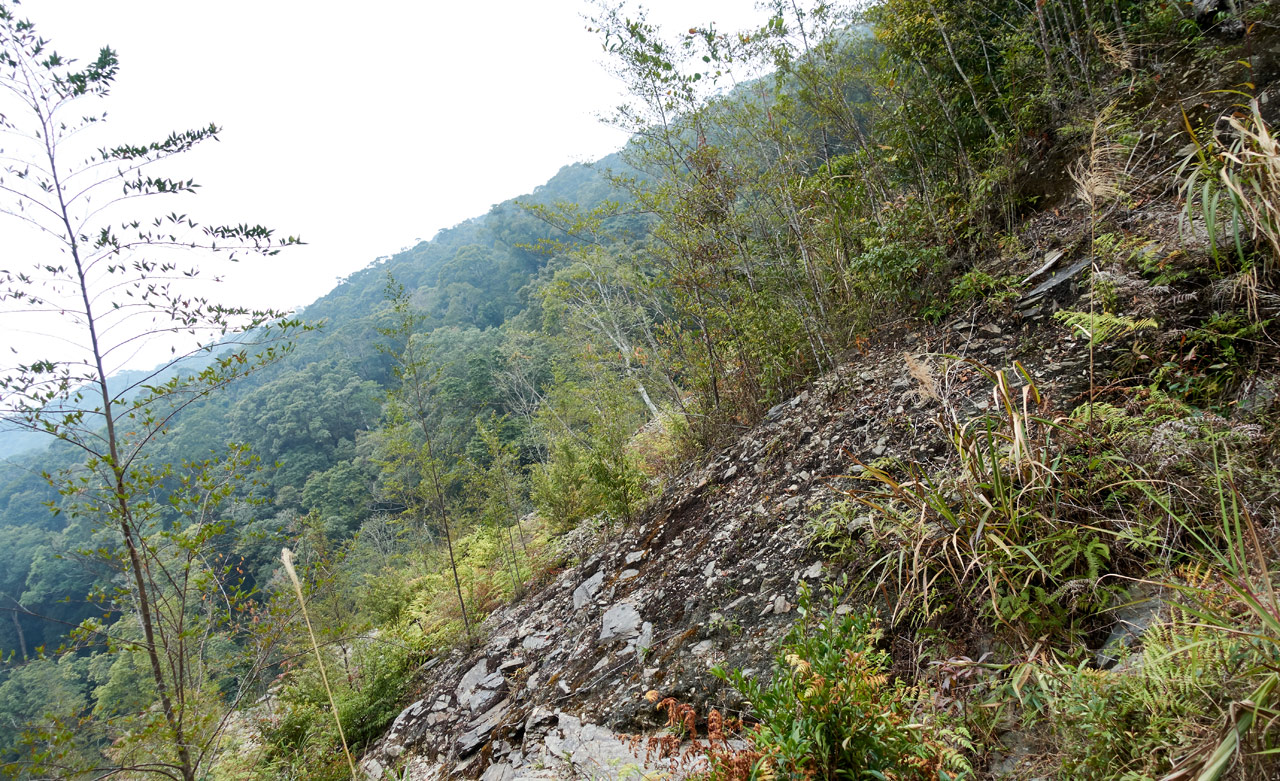
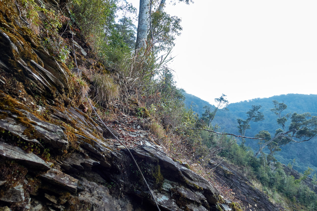
Now this is where things started getting a little more dangerous. Not terribly dangerous, but enough to keep you on your toes.
I hiked the increasingly more difficult trail…

…and came to a small ravine that offered a little challenge.


Coming up the other side I slipped on the muddy trail (just under where I took the below picture) and fell pretty much on my face. At least it happened on the way up. I was extra careful on the way down the next day. A rope here is really needed.

Here’s the other side of the ravine I started on. It’s steeper than it looks.

First Campsite & Hunter’s Camp
When I got back up to level ground I found myself at the first main campsite.

There are one or two possible places you could camp before this campsite, but they are small. This one had an old fire ready to spark up, enough space for several tents, and a nearby water source. But I wouldn’t recommend this campsite unless you had a really late start or a larger group. It’s only about an hour and a half hike (plus time to gather water) to the second campsite.
Since I had plenty of time, I continued on. Ten minutes later I arrived at the next hunter’s camp.


This was the largest one yet. It’s in a pretty good location to camp, but I wouldn’t. This place gives me a “this is our place, not yours” vibe. I took my pictures and moved on.
From here things were fine for about fifteen minutes…


But I knew I had quite a large ‘dip’ coming up to negotiate. My GPS showed about a 100 meter drop to a stream and then back up the other side. I always hate those dips. It makes you feel like all the progress you made climbing up til that point has been negated. 😥
Down & Up
When I arrived at the start of the downhill…

…I didn’t like what I saw. First, there were loose rocks and it was steep.

And later there were plenty of obstacles to climb over, around, and under.


Here’s how part of it looked from the other side.

But I made it without incident. Unless you call grabbing this thing as an incident.

In fact, I grabbed it a SECOND time the next day. Doh! It’s located in the perfect spot when you need to grab for something for support on your way up or down. Dumb me…
The landslide immediately spilled into a small untouched patch of trees.

During the rainy season there’s probably a tiny stream that runs through this section. The main stream is a little further. But between them is a small campsite.

You might be able to get a tent in there. Or try and set up on all that bamboo lined up on the ground. This wouldn’t be a terrible place to camp I guess. But I personally would just keep going.
As mentioned, the main stream is on the other side, but it was dry.


After the stream bed I started the hike up the other side…

…but only for a short distance. I had arrived at my water source!
Water and Steep Climbs
I wasn’t in desperate need of water, but I wasn’t sure if it was easily accessible past this new stream. So I stopped and filled up.


Now here’s where the ‘fun’ begins. I was fully loaded with my gear and plenty of extra water. Being the lazy guy I am, I opted to carry the 2 liter water filter bag by hand instead of trying to jam it into my backpack. That was a mistake.
The trail started off innocent-looking enough. But quickly became really steep and really dangerous.


The problem is, I don’t have many pictures of this section. In one hand I had that water bag and the other a trekking pole. I was worried if I put either down, it might fall out of reach. That, and I wasn’t feeling all that good; I just wanted to get it over with.
Other than those two pictures, I have this one. This is looking down I believe. There’s a trail in there somewhere snaking its way down.

I wish I had a picture that shows the entire side of the mountain. It’s like a wall going straight up that you need to twist and turn your way up…like something only a mountain goat could negotiate…roughly a 100 meter ascent over a short distance. The best I can do is show this messed up Google Earth image.
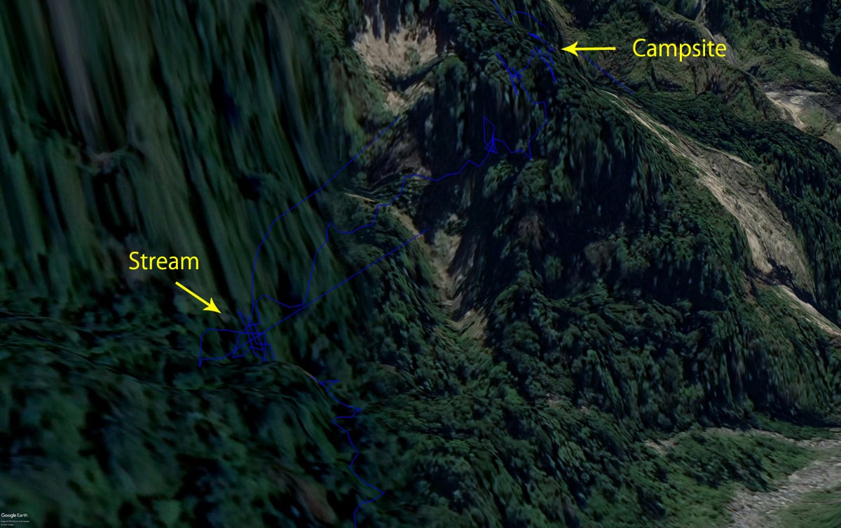
My GPS was messing up in this section as you can see.
There were a few places with ropes – and believe me, they were needed! It took me about thirty minutes to get through that dangerous section. I was happy to have it behind me.

A few minutes later I arrived at my destination for the day.
Home for the Night
I had arrived and I was ready to relax. But I was feeling kind of bad. Not exactly sick, but not exactly NOT sick. It’s hard to explain. I would almost say it was something similar to altitude sickness, but at only 1850 meters I don’t think that was it – perhaps I was just sick. Whatever the problem was, I needed to sit for a bit. And I did…and eventually felt good enough to set up my new tent.
As you can see, it’s not too large of an area. You can fit two tents here for sure; three would be tight.

This was my first time using this tent. At only 790 grams, it’s a heckuva light tent. I’ve been trying to lighten my load recently. A lightweight tent (as well as sleeping pad, quilt/sleeping bag, etc) really helps to cut the weight. For this one you must use trekking poles to set it up. I only carry one, so I found some spare poles for the other side. That adds to the weight a bit, but not so much. In short, I’m liking this tent so far.
It was getting pretty foggy out and the temp was dropping. Though I didn’t feel all that cold – there was zero wind.

Sounds in the Night
Later I ate and settled in for the night. I brought a bluetooth speaker with me and listened while I tried to sleep. That speaker also serves as a powerbank, so at some point I turned it off to save battery juice. That’s when something odd happened. I turned it off and I could still hear music! So I stuck my ear to the speaker and nothing. I put my phone to my ear…nothing. Huh!? It was some type of older sounding Taiwanese music, and it sounded not too far away!
I wasn’t anywhere near any houses. Music would have to be blaring to make it this far from Wutai or nearby – and this didn’t sound like it was loud. That only meant someone else was out there with me…and not so far away. I could only guess hunters. There were two motorcycles parked where I parked. It must have been them. But I have no clue where they were located. Anyway…
I also kept hearing some animal walking around the outskirts of the campsite. It sounded small, but kept growling in a menacing manner. It circled several times throughout the night. And it must have been looking for a fight because it found one. I think it won by all the screams!
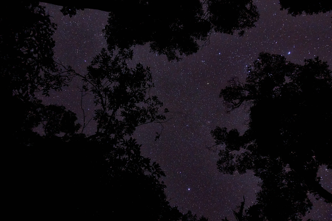
Sometime in the middle of the night I awoke to use the bathroom. When I saw the sky, I had to spend some time taking pictures! The trees blocked a good deal of it, but it was still something to see!
Morning
I woke up early and started breakfast.

If my thermometer was correct, it was nearly zero Celsius. But I didn’t feel cold at all. So I’m questioning that reading.

But despite waking up early, my ass was dragging big time! I didn’t leave until 7:15am. Oh well…I had plenty of time to reach the peak and get back to my bike. So no rush really.
The good part about this next section of the hike was that I could leave most of my gear at the campsite! I took the bare minimum and headed out.
Day 2 – Start!

The beginning of this section was pretty easy. It was a little slippery but not dangerous.


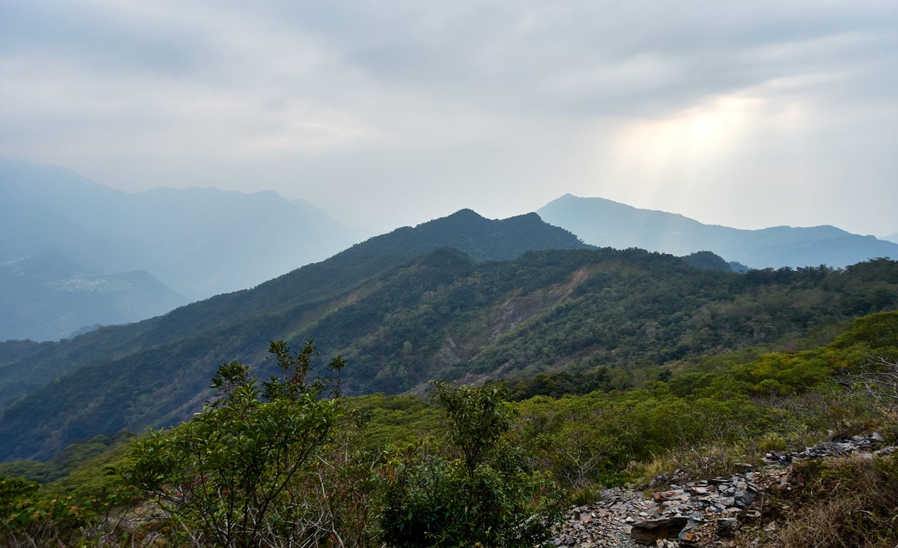
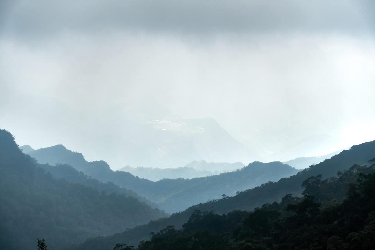
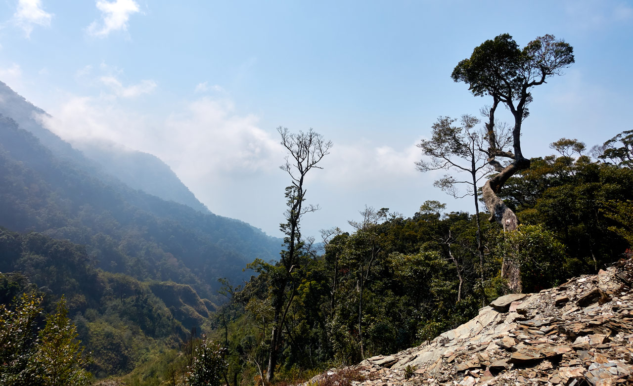
It went on like this for almost twenty minutes until opening up onto a large landslide.

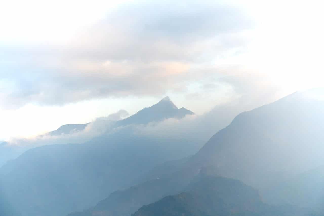
The views were nice from here, but not this early – at least not with my camera. Here are some shots from the trip down. Still not so good…sorry.
After I pulled myself out of the landslide it was a short walk to the turnoff.

This is where a decision needs to be made. There are two routes up to the DaMuMuShan peak. I was told the easier way is to turn left here and follow the ridge up. The harder route is to go straight and follow a landslide up. I should mention that there’s possibly a water source if you go straight.
What did I choose? The easier route of course! So I turned left and headed up.

The ‘Easier’ Route
Obviously ‘easier’ didn’t mean EASY. It was relatively steep most of the way, especially in the beginning and end.


Toward the top it started getting messy.


X marks the spot!

There was this pretty cool looking tree that reminds me a lot of Yoda’s swamp house. What do you think?


After two hours of hiking I was nearly to the peak. The constant uphill dragged on and should have made me tired, but my body seemed to handle it well. I think part of it was the excitement of reaching the peak and seeing the spectacular view I knew it must offer.
I climbed up the last bit…


And could just start seeing the top!

And then I arrived…
DaMuMuShan – 大母母山
At a tree covered peak… 😥

There was no view at all – not unless I had a ten foot ladder with me. Damn…
I really should have researched this part of the hike a little more, but whatever…I made it!

As per my usual routine, I took a decent break, ate, and photographed whatever I could find up there.


Oh! And it was cold up there! The temp was only 10°C but with the wind it felt a lot colder.

I look cold, right? 😆
The Trip Down
There’s not much to say other than I did the hike backwards. (Not literally backwards. That would have been funny!)
I made it down to the campsite safely and packed up my gear. I wasn’t looking forward to the steep section between the campsite and the water source, but I managed to get through it without killing myself. Then I filled up at the water supply again and hiked back to my bike.
Again, I didn’t see anyone or anything the entire way back save one ground bird that waited until the last possible second to fly away and scared the crap out of me. That was it.
When I neared the abandoned house at the beginning of the hike I found some old structure made of stones and this wall of rocks.

Right behind the house was this multi-tiered stone…something that I missed seeing on the way up. I would have to guess it had something to do with farming a long time ago.

And there are a good deal of flowers near the house.


And that’s it!
The Drive Down
I got back to my bike (the other two motorcycles were gone) and started the long drive back home.
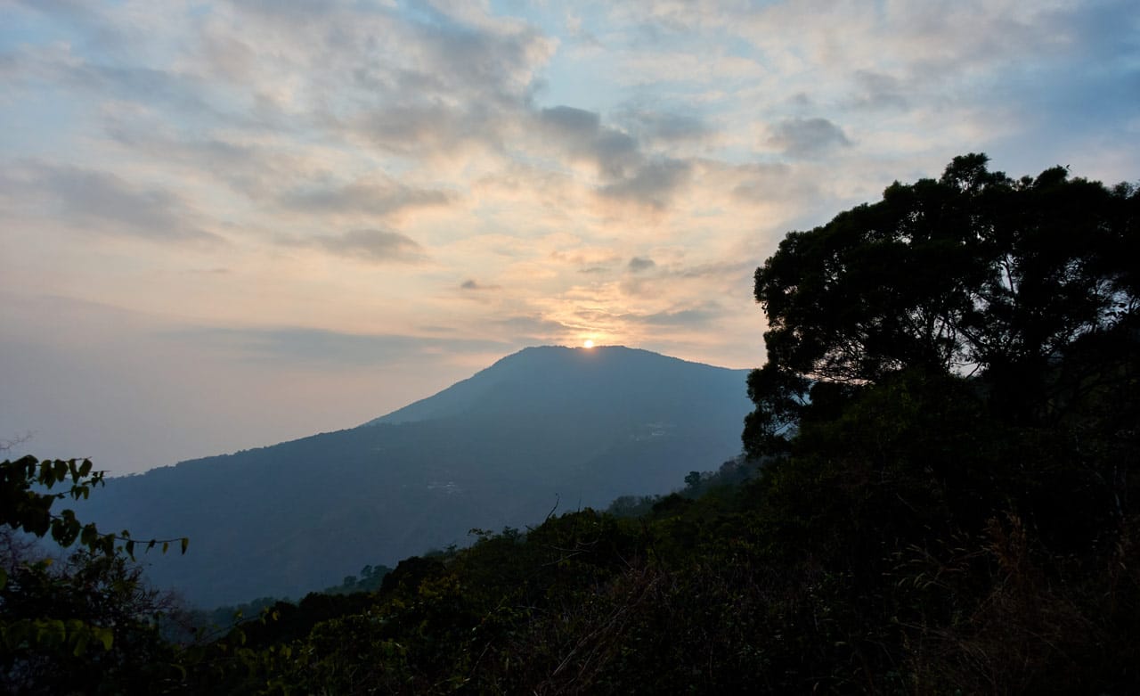
Along the way I snapped these pictures.
Final Thoughts
Ok, I was disappointed in this hike. But I won’t say it’s a bad hike. It was nice overall. I just expected a lot more from it, especially with it being listed as one of the “Taiwan Marvelous 100”. I probably shouldn’t put too much stock into that list though.
About the wildlife. I usually see some wildlife other than birds on my hikes. A muntjac, serow, goat…something. But I saw and heard nothing. Not even a monkey! I ALWAYS at least hear a monkey screaming at me. I think that quietness was part of it. Yes, I did hear that weird animal when I was in my tent, but I’m talking about the hike itself.
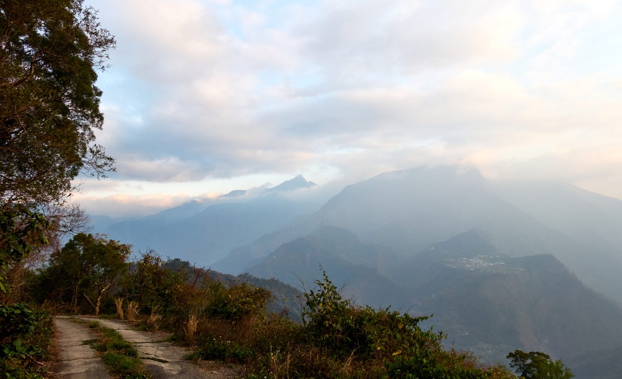
So I’ll say that I would recommend this hike, but with the caveat that you should hike others on your list before choosing this one. That is, unless if you luck out and get a perfectly clear day; then the views might be worth it. Otherwise the best views are on the drive up.
**About an hour after I finished writing this post a friend sent me some news about a pair of hikers who were lost hiking to this mountain. Link1 As of this morning, it seems they were found. They were on their way to a nearby peak, 麻留賀山. Link2 Be careful out there!**
Date hiked: 2020 February 19~20
GPX Track Download Instructions: Click the track on the map to see the download link


![[Valid RSS]](https://outrecording.b-cdn.net/wp-content/uploads/2020/03/valid-rss-rogers.png.webp)
發佈留言