Sorry, this entry is only available in 美式英文 https://youtu.be/Dz2tHsyRe_A?si=17N_LxMJ8MetX-vP While exploring Google Earth I found what appeared to be an old road network that split off the Shaxi Forest Road (沙溪林道), which is located in Pingtung county, Taiwan. It appeared to be an old farmer road that possibly wound...
Sorry, this entry is only available in 美式英文 https://youtu.be/ukDGLugOcOw?si=7V435cctUv9ZbjXs
Sorry, this entry is only available in 美式英文 This was originally going to be a combo post of two hikes I did a couple weeks apart. But I realized halfway through writing this that it would be quite a long post; so now they get their own posts! The...
Sorry, this entry is only available in 美式英文 It has taken me a while to get around to writing about this hike. It’s not that QiLuZhiKeShan – 耆路知可山 was particularly difficult, but because I attempted it three times. Writing about it feels like I’m going back for a fourth...
Sorry, this entry is only available in 美式英文 After last hike’s battle with what I thought were shin splints, I decided I needed some rest. But two weeks of rest was all I could take; I was itching to get back out in the mountains. I didn’t know for...
Sorry, this entry is only available in 美式英文 WeiLiaoShan 尾寮山 is a popular hike in southern Taiwan. It’s listed as one of the “Top 100 Lower Mountains” (小百岳). Expect a fair amount of hikers if you’re planning a weekend hike. The WeiliaoShan peak is located on the border of...
Sorry, this entry is only available in 美式英文 September was a month of backup plans and failed hikes for me it seems. First I couldn’t make it to MuDanLuShan 牡丹路山 and went to ShiMenShan 虱母山 instead. Then the following week I had a problem with my hike to QiLuZhiKeShan...
Sorry, this entry is only available in 美式英文 ShiMenShan (Also known as ShiMuShan – 虱母山 or 蝨母山) is located in Mudan township 牡丹鄉 in Pingtung County. Despite only being 384 meters in height and taking about one hour to hike, I highly recommend you consider this interesting little peak....
Sorry, this entry is only available in 美式英文 After a failed attempt that resulted in me being violently pulled down by a snare, motorcycle on top of me for about 40 minutes, I felt it was time to head back to HuYaYuShan 戶亞宇山 for one more try. HuYaYuShan is located...
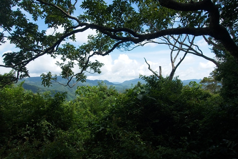
在大量的土石流區域頂端,你可以看見大武藏山。它不是怎麼有名的高峰,甚至沒有標記點。大部分的人都直接路過,前往其他著名的山。但上週我選它當作這次挑戰的目標! 大武藏山,海拔1630米,大致在卡山和久保山之間。奇怪的是,在我的幾個地圖集裡都沒有看到大武藏山,甚至連個“山“的名稱都不給,讓我懷疑這是否真的是座山? 算了, 管它是不是,估算後,其實來回距離的時間,也剛好消磨一天的路程! 路徑的開頭就在山上老七家和力力溪河的對面。如果你曾經看過這座雕像,你大概就知道路徑開頭在哪裡了! 幾乎整個上去的路段,風景都好美! 我大約早上八點半到達路徑開頭,接著騎著稍微可以看得出是路的路,能騎多少遠算多遠。在這之前,我已經來探路幾次,之前去南久保山的時候,徒步大約走了全路程的百分之二十。 只要有像樣的路徑,爬行的開始都蠻簡單的 (圖片有點糟,抱歉) 沿途也可以欣賞南久保山的美麗景色。 過不久,你會來到一個小坍方處。 可以看見幾個黃色箭頭的噴漆圖樣,指引方向。 From where I parked it took me just under an hour to reach what I call “the crossroads”. 從我停車的地方走到圖中的這個“十字路口”不到一小時。 這是大武藏山、久保山和南久保山的交會處,是個很棒的休憩點。週邊還有更多的指示,引導想上山的人們。看到那眼鏡了沒? 是好心人士所設置的失物招領呢! 休息一下後繼續前進大武藏山。 這一個小時還算平安渡過,路好走, 方向也清楚, 雖然一路上沒什麼有趣的可看,但就在不久的某處,我終於看見大武藏的身影! 越走,植物分布越來越茂密,但還是很好分辨路在哪裡。 後來,我還是被植物包圍了。接著我來到比較空曠的區域,旁邊都是高高的草。GPX 顯示的路線都是沿著山脊線,但當我走到山脊,雜草長得滿滿滿,所以我沿著另一條路徑來到這比較寬闊的區域。 雖然草地上混著很多石頭,看起來像是幾條路線分別前往不同的方向。這部分拖慢了我的速度,但值得一提的是,景色真的很讚! 連續兩週,我站在河床上抬頭看著大武藏山,如今,我正站在大武藏山上向下看著! 這就是我提到的高草群,遠處看還蠻美的,但當你靠近而整個脖子都被包圍的時候,根本只想逃走。 當我走到草群盡頭,我發現一件事: 有一堆石頭被整齊堆疊起來。其實要不是因為它們的形狀,我應該不會注意到它們。標準的方形,規格就像我之前看過很多次的原住民老屋一樣。 再往這條路徑向上走幾小時,我不覺得會有個“古老“被廢棄的原住民村落。但這石頭結構絕對跟以前的村落有關,可能是休息站…也或許是跟想像完全不一樣的東西。我不確定是否還有原住民住在這裡,與村落隔離,因為在這區域,我只發現這堆整齊的石頭結構,實在有趣! 我在這裡又休息了一下,然後繼續往峰頂前去。 經過雜草叢生的區域,來到一條有比較多樹木比較容易走的路徑。 不知道你們從上面的照片有沒有發現這是條舊路?...