

Ride Start:
Date:
Many times during the dry months (Winter)
Ride Info
This is one of my favorite riverbeds to ride. There’s always a trail to follow and plenty of markers (stacked rocks or spray paint) to guide your way. There are several sections where you can put down some decent speed, and towards the end will challenge your technical riding skills.
A trail bike isn’t a must for this ride, but I highly encourage it. A mid to large-size adventure bike can make it halfway no problem, but only the best of the best could navigate those bikes to the end. Having said that, I believe these trails exist in part by local farmers riding their “old man” motorcycles up the river to do whatever they do. So any motorcycle with decent suspension could handle it. But with the amount of river crossings you’ll encounter, I would advise having a smaller bike. Easier to pick up and de-water from a failed river crossing attempt!
Take this GPS track as a general guide; it won’t be accurate. The riverbeds change from year to year because of Typhoons and heavy rain, and so do the trails. I’ve gotten pretty deep one year, and the next just over half as far.
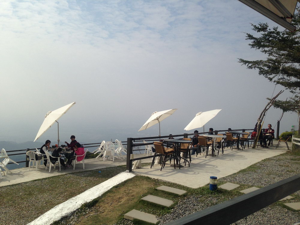
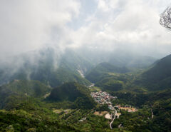
There are several ways to get to the starting point. The easiest way is to go to Laiyi township and follow the river until you get to the bridge. If you have more time, you can go to Taiwu 泰武 and go up and over the mountain to reach the bridge. There are several coffee shops with nice views along the way if you choose the Taiwu route. Life in the sky 宿天空 is a favorite of mine. It’s a nice place to relax after your ride. Unfortunately it wasn’t a clear day in this picture.
However you get there, the bridge is here: 22.562303, 120.662724
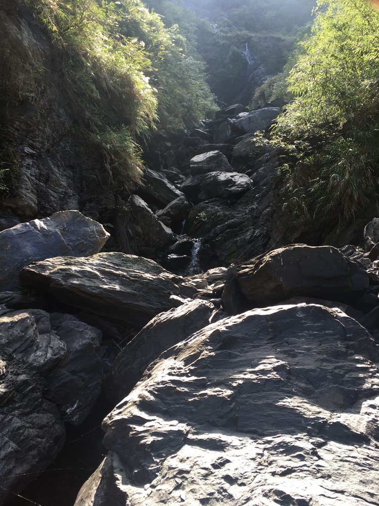
From the bridge, there are a few places to enter the riverbed. Slightly upriver from the bridge is the spot I’ll usually enter. Despite what google maps might show, there hasn’t been a “river road” there since I’ve been riding this river. Though one could pop up at any time. Taking this route is more technical in the beginning. It could easily take you 40+ minutes to get to the next easier section. Though last year it only took 10 min. From here it’s about 1.5km’s until the river splits. That is where the second entrance is located and is a much easier beginning.
The second, easier entrance is here: 22.562281, 120.679439. From the bridge head upriver until you reach 南太武山莊. This is some type of camping place or B&B. Drive like you’re going into the place and on your left will be a dirt road that takes you down to the river. If you find yourself going UP the mountain, you’ve gone too far.
A third entrance is further up river. I’ll sometimes use this as my exit if it’s getting late or I’m too darn tired. Located here: 22.574880, 120.678173. (IMPORTANT NEW INFO: As of 2019, the farmer who owns the land has put a locked gate blocking the road. You can still drive up there in an emergency, but you will be stuck there. Also, do not attempt to start your trip here unless you plan on hiking the whole way. I couldn’t see any way for a motorcycle to get around it. Maybe you could drag your motorcycle under it.) From the bridge you would go the opposite direction up the mountain on the 106. Go through the village at the top and make your way around until you reach the location.
There are other entrances further downriver. I haven’t tried them because there are usually a lot of gravel trucks and excavators working. I doubt they’d care if you’re there, but I’d just assume bypass them.
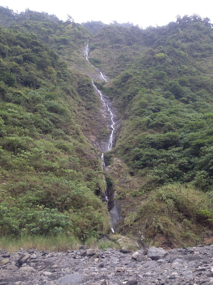
There are a few waterfalls to see along the way. The below picture is my favorite. It’s a thin little thing, but I’d bet it looks great in the rainy season. It starts up pretty high and ends in a small pool. I don’t think it’s deep enough to swim. But good enough to cool off.
There’s another waterfall just slightly upriver. But not much of any pool at the bottom when I went.
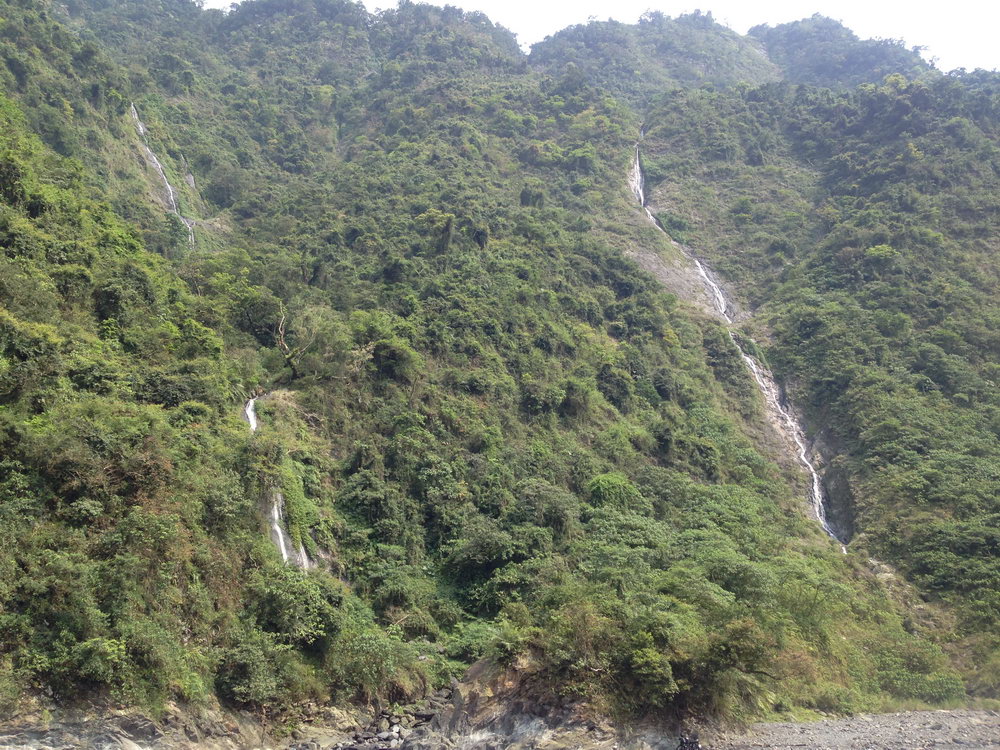
There’s a third waterfall a little ways downriver from here. It doesn’t pool much, but might be worth your look.
Look in the Notes section for all of their exact locations
If you can make it to the end of my GPS track, keep going a little further and you’ll come to another nice waterfall. I wasn’t aware of it the couple times I made it that far. The going was tough and I didn’t continue further. Had I known, I would have hiked the rest of the way. *Here is an account of my trip in March of 2019 where I rode and hiked the rest of the way to the last waterfall: http://outrecording.com/trip-to-walusixi-%e7%93%a6%e9%ad%af%e6%96%af%e6%ba%aa/
Have fun with this ride! I always do!
**As of 2019, you will no longer be able to reach the final waterfall. Every year since typhoon Morakot the river has been turning back into its original shape. At best, expect only to reach slightly beyond the 3rd waterfall listed below. I’ve seen motorcycle tracks beyond it, but you would need to have a great offroad motorcycle and the experience to use it to really do much.***
Notes
- Have a Plan B ready in case you can’t get far. Riverbeds in Taiwan are hit or miss.
- It’s a good idea to track a riverbed ride with any GPS tracking device you have available. You can’t technically get lost on a riverbed…just head down-river…but there will be times when you lose the trail and drive around aimlessly looking for it. Yes, it’s part of the fun, but it will save your butt when it’s nearly dark and you’re still out there. Believe me, I know!
- Unless you plan on putt, putt, putting around, you MUST wear full protection on this riverbed if you plan on going any further than the third waterfall. You will fall and trust me, those rocks aren’t forgiving
- You’re likely to encounter farmers on the riverbed. Some will be nice and smile/wave while others will give you a dirty look. I’ve encountered people out on riverbeds doing things they’re not supposed to be doing (poaching/illegal hunting). I doubt you’ll find trouble, but still, be aware of your situation.
- 1st waterfall: 22.577294 120.696258
- 2nd waterfall: 22.581325 120.699792
- 3rd waterfall: 22.582297 120.699722
- 4th waterfall: 22.592639, 120.717210 (approx here)
Gallery


![[Valid RSS]](https://outrecording.b-cdn.net/wp-content/uploads/2020/03/valid-rss-rogers.png.webp)
發佈留言